Big Lagoon State Park | Likes Dislikes

big lagoon state park boardwalk

Review: RV Camping, Hiking & Recreation Pensacola’s Big Lagoon State Park

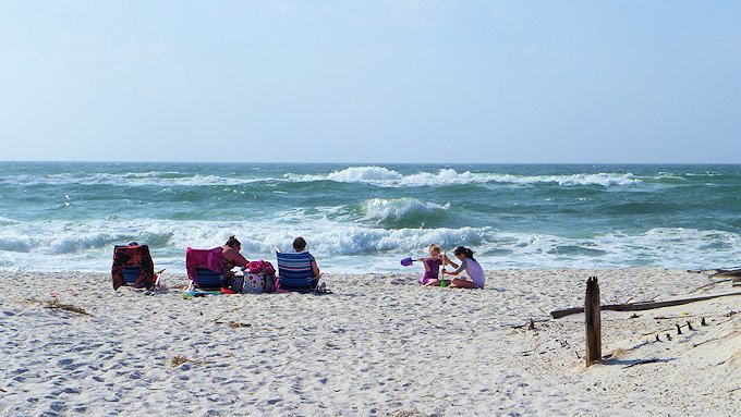
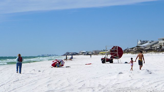
Big Lagoon State Park is located along the Gulf Beach Highway that connects Fort Morgan and Gulf Shores at the western end to Pensacola and then east to Destin, Panama City Beach and beyond. Technically it is not on the Gulf but on the mainland side of the “big lagoon” formed by Perdido Key which forms a barrier island between it and the Gulf of Mexico. The park does offer some sand beach swimming areas on the lagoon but they don’t compare to what you find in nearby Pensacola Beach.

boardwalk big lagoon state park
A view from the park tower of one of the many boardwalks that are part of the hiking trail system at Big Lagoon State Park near Pensacola Florida

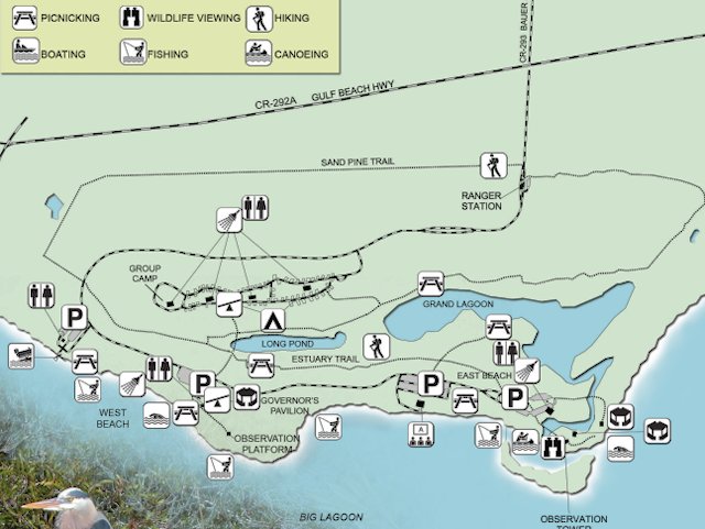
Big Lagoon Amenities and Activities

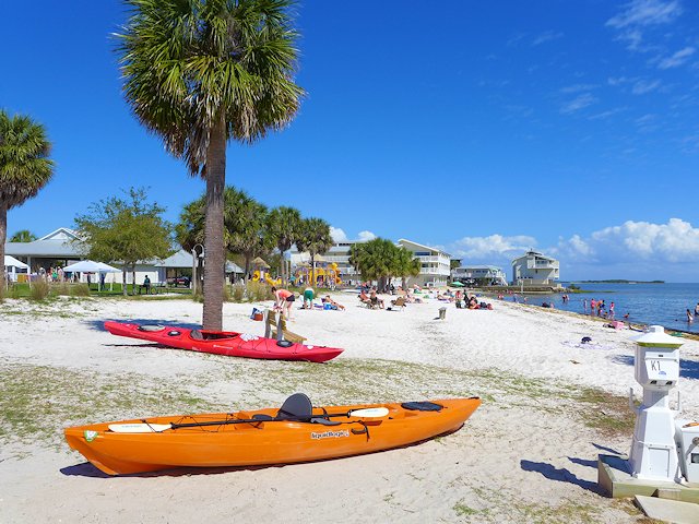
The lagoon and the interior lakes within the park offer lots of protected-water paddling territory for canoeing and kayaking. If you don’t have your own watercraft, kayak, canoe, and stand-up paddleboard rentals are available from the Ranger Station.

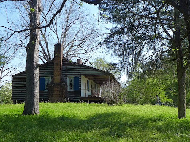
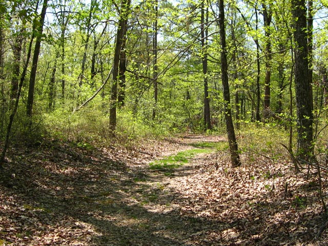
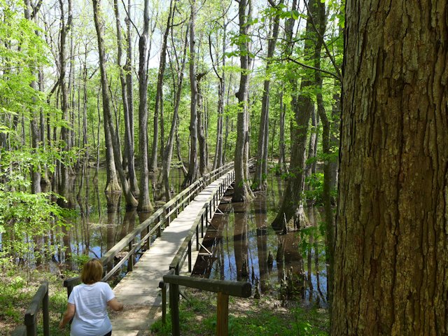
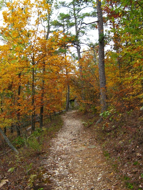
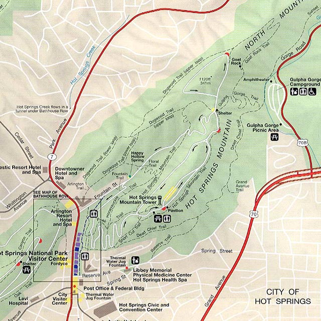
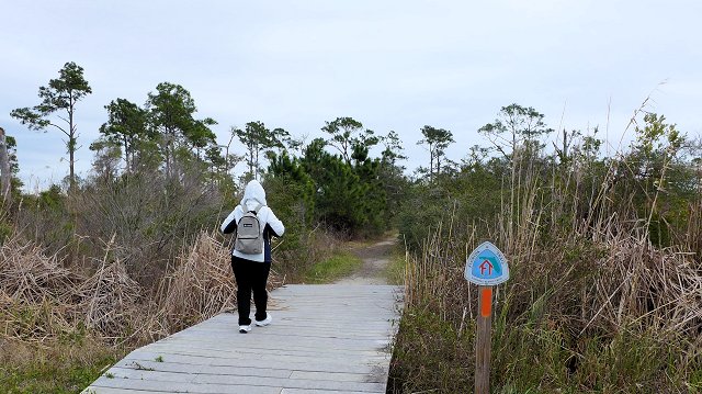
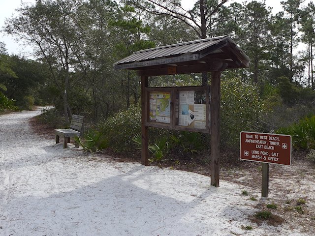
The hiking trails through the coastal forest and boardwalks along the shoreline plus a three-story observation tower provide lots of bird-watching and excellent wildlife viewing opportunities. There are over 5 miles of varied hiking and nature trails plus several boardwalks.

big lagoon state park
If you stand just outside the little camp store, you can get free Wi-Fi
big lagoon state park hiking
The hiking trails are wide and sandy or are wooden boardwalks.
big lagoon state park boardwalk
One of the Boardwalk/Nature Trails in the park

The park offers a full-boat launch area giving access to the lagoon and gulf for fishing and boating.

Biking is another popular recreational activity along over 3 miles of lightly traveled paved park roads. Gulf Beach Highway borders the North edge of the park. It provides additional biking opportunities as there’s a sidewalk running adjacent to the highway. That sidewal allowed us to safely bike to Shopping Plaza a mile or two West of the park entrance to do some shopping. If you are ambitious enough, you might also be able to bike across the Theo Baers Bridge all the way to Rosamond Johnson Beach along the gulf on Perdido Key. There you can enjoy a day on the outstanding several mile long white sand gulf side beach that is part of the National Gulf Island Seashore Park.

big lagoon state park
Lots of trails for biking and hiking plus several picnic areas

March 2023 Note: On our recent visit to Big Lagoon, we found, due to storm damage, the East Beach area and the central pavilion section of the park was closed. So some of the swimming, hiking, biking, and boardwalk area was off-limits. Unsure how long it will be before repairs are completed.

Review: Big Lagoon RV Campground Facilities

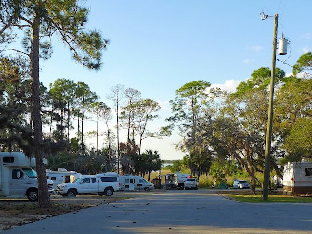
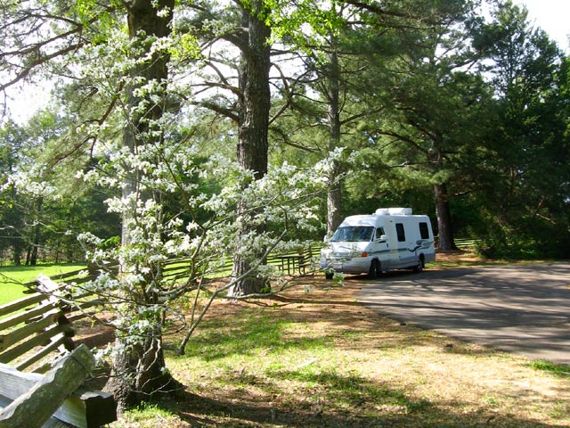
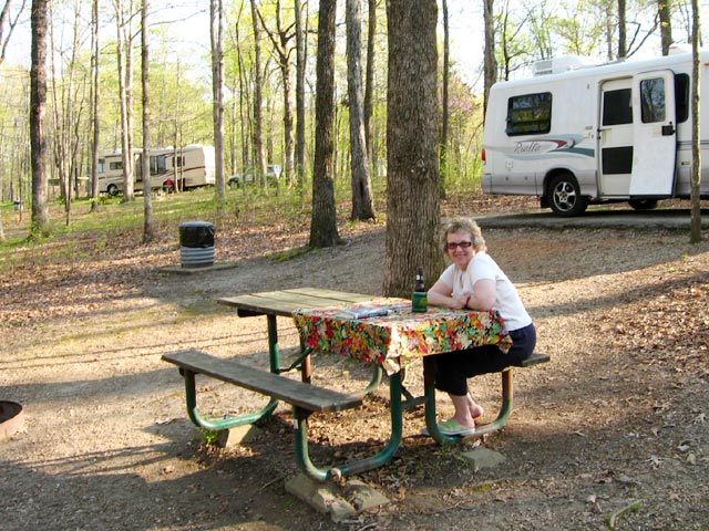
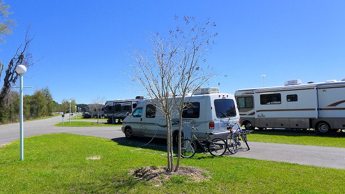
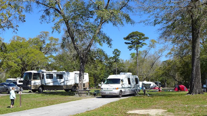
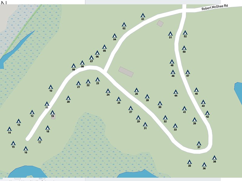
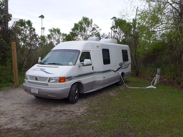
The campground has 75 campsites with 30 & 50 amp service and is served by 3 full-service restrooms. The main park roads are paved but the campsites themselves are sand with some gravel. Most of the sites have good plant screening providing some privacy separation. Some of the sites along the edge of marsh are subject to flooding in heavier rains. The maximum RV length is 40 feet. Several areas of the park, including the washrooms, are wheelchair accessible and there are a few designated accessible camp sites that are paved.

big lagoon state park
Typical Big Lagoon Campsite

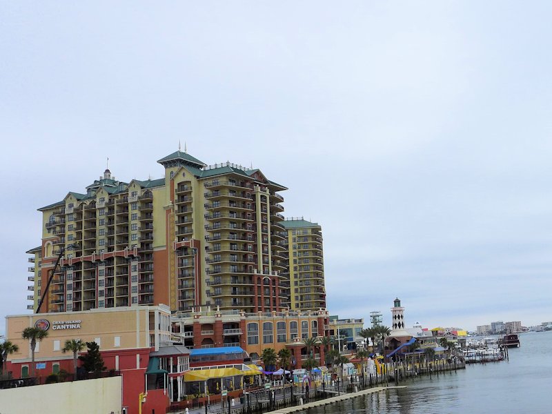
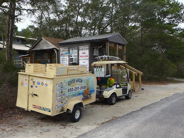
There is a small camp store with limited hours at the eastern end of the campground. But a decent sized shopping center including grocery and adult beverage stores is only about a mile from the park entrance. Also nearby is one of our favorite Pensacola Golf Courses – Perdido Bay GC and Triggers Restaurant – a great family owned seafood restaurant. A library that offers Wi-Fi is located just across the street from the park entrance. Other popular Pensacola attractions, like the fantastic Naval Air Museum, Fort Barrancas, and the Pensacola Lighthouse Museum are about 8 miles east along the Gulf Beach Highway.

What to Like or Not Like about Big Lagoon State Park and Campgrouond

Pros: The Hiking, Nature and Boardwalk Trails. Easy access from Gulf highway, convenient to shopping and many Pensacola area visitor attractions. Modest camping fees and less competition for reservations, compared to Fort Pickens and other popular State Parks.

Cons: The sandy campsites mean you track a lot of sand into your rig. And those sites along the South edge of the campground can be wet. While there are some swimming beaches, they are less attractive than those on the Gulf itself and you have to keep an eye out for Alligators.

Rosamond Johnson Beach
Rosamond Johnson Beach on the Gulf is about 3 miles from the State Park

Things to see and do in the Pensacola area

Florida Gulf Coast Scenic Drive

Pensacola Beach by Red Fish Blue Fish Restaurant

Interesting things to see and do along the Gulf Coast from Pensacola to Destin Florida.

In this article we cover the interesting towns and places to visit along the Florida portion of the Gulf Scenic Drive from Pensacola Beach to Destin. In the article we provide links to visitor worthy attractions, campground reviews and some of our more detailed articles on these places to visit and camp.

Pensacola Beach
On the beach at Fort Pickens Gulf Islands park, ranked one of the top beaches in the country.

The scenic coastal drive from Pensacola or Pensacola Beach to Destin is about 43 miles and without stops would take about an hour. If you are staying in the Pensacola area, you could easily do the trip as a day trip including a few hours stopping at destinations along the way.

Top Pensacola Attractions

Pensacola is one of the oldest cities in Florida (some claim the oldest) and it has done a great job in preserving history in the businesses in its downtown Palafox Historic District and homes in the nearby Seville neighborhood. The Naval Aviation Museum is a fantastic attraction for its wonderous exhibits of planes from the dawn of naval aviation to the present as well as the history of its role in various military and space endeavors. Fort Barrancas offers more Military History together with Fort Pickens across the bay. Top seafood restaurants abound, some decent golf courses, lots of interesting boutiques and shops, musical entertainment, and more. It is a very walkable city and we’ve never had trouble finding parking close enough to all the attractions we’ve wanted to experience.

Carmen's Lunch Box Cafe Sidewalk Dining Pensacola Florida
Sidewalk dining and socializing outside of Carmen’s Lunchbox Cafe in Pensacola.

Articles and Links to our Favorite Attractions in Pensacola Florida.

What to see and do in Pensacola Beach

While Pensacola itself has some beaches, “Going to the Beach” for Pensacola people is driving a few miles across the bridge of Pensacola Bay to Pensacola Beach on Santa Rosa Island, which offers pristine white sand beaches on the Gulf and loads of dining and entertainment attractions to supplement your day at the beach.

Pensacola Beach on Santa Rosa Island is Pensacola's Gulf playground
Pensacola Beach on Santa Rosa Island has top rated beaches on both the Gulf and Pensacola Bay.

Adjacent to Pensacola Beach is Fort Pickens National Park, more history exhibits, a large camping and RV park, many miles of uncrowded white sand beaches, and nice hiking and biking trails.

Top Things to Do and Places to see in Pensacola Beach.


Gulf Coast Drive Attractions East of Pensacola/Pensacola Beach

gulf scenic drive map
Map, with links, of the gulf scenic drive from Pensacola Beach to Grayton Beach, Florida

If you are staying on the mainland in Pensacola, you’ll follow Highway 98 across the bridge to the town of Gulf Breeze and then continue East towards Navarre Beach.

However, I think the more scenic drive is to cross the bridge into Pensacola Beach and then go East on State Highway 399 on Santa Rosa Island from to Navarre Beach. The island along this stretch of road is a narrow strip of sand dunes with Santa Rosa Sound on one side and the Gulf of Mexico on the other. After leaving the community of Pensacola Beach proper, there are no homes or buildings along the route, just dunes and water as far as the eye can see. Every few miles, however, there is a designated beach and parking area. The rest of the terrain however is a protected natural area – off limits.

Navarre Beach Village  

A smaller version of Pensacola Beach with high rise beach front condos, a compact shopping-dining-entertainment district and 1500 feet long pier that stretches out into the Gulf of Mexico. Great for fishing or just a walk far out away from shore to catch the ocean breezes. Another attraction is the Navarre Beach Marine Science Center located at the entrance to Marine Park. The Marine Park itself is designed for both snorkeling and diving, the park includes two reefs in Santa Rosa Sound and one in the Gulf of Mexico. Informational kiosks stand at the beach near each reef.

Highway 399 ends at Navarre Beach even though Santa Rosa Island continues for over twenty miles. There is a half-mile gap in the road from the Marine Park to the end of Santa Rosa Boulevard that extends out from the community of Okaloosa Island. So unless you are driving a dune buggy you are going to have to cross back to the mainland across the bridge to Highway 98 (Navarre Parkway).

icon_biggrin

It is about 16 miles to Fort Walton Beach. This stretch isn’t very scenic just typical semi-urban landscape of homes and businesses.

Fort Walton Beach

Fort Walton is located at the western end of Choctawhatche Bay and has a number of attractions for those interested in sampling what the city has to offer. These include the DeFrance Indoor Flea Market, The Bluewater Zoo, and the Heritage Park & Cultural Center.

Kite flying on the public beach of Okaloosa Island.

Most visitors or tourists however will do a drive through of Fort Walton Beach and cross the bridge back onto Santa Rosa Island to the community of Okaloosa Island, which is essentially the beach and gulf playground for residents of Fort Walton Beach. Like Pensacola Beach and Navarre Beach there are huge modern high rise condo-hotels on the beach, sugar sand parks and public beaches on both the gulf and bay sides, and an entertainment district.

Emerald Grande Hotel
The Emerald Grande luxury condo-hotel anchors Destin’s Harborwalk Village

Destin Florida

The drive from Okaloosa Island to Destin is a divided highway and normally takes about 10 minutes. Destin is a bigger and more glamorous version of Pensacola Beach with the requisite high-rise hotels and condos along the beach, a harbor boardwalk and harborwalk village (see our article with pictures and links) with lots of dining and entertainment venues, charter fishing and cruise ships, theaters, galleries, specialty shops, etc.

Destin is a big time resort community. Although less than 15,000 residents, they entertain over 4 million visitors a year.

Destin’s most famous beach is in Henderson Beach State Park  and hosts one of the top rated beaches on the Gulf of Mexico. Henderson Beach is located east of the main high rise hotel and condo section of Destin.  It has 6000 feet of beach on the Gulf and is one of the most popular state parks for campers and RV travelers  in Florida’s panhandle. Just East of Henderson Beach, you can access old highway 98, now called Scenic Highway 98, turning south on Matthew Blvd.

Destin and South WaltonTownhomes
South Walton Townhomes & Condos

Driving East of Destin

Once on Scenic 98, you’ll exchange high rise condo-hotels of Destin for low rise condo-townhouses of the community known as South Walton. Every few blocks there is a public access to the beach for visitors whose lodging isn’t directly on the beach. Beach umbrellas stretch for a few miles all along the beach to the community of Miramar Beach, where the line of umbrellas picks up again until you encounter Topsail Hill State Preserve State Park. Topsail Park has a large section of camping for RV travelers. Prior to the arriving at Topsail park, Scenic 98 actually rejoins US Highway 98 in order to go around Topsail Hill park.

While this section is called Scenic 98, unless you stop at one of the beach access parks or one of the several restaurants and pubs along the route you won’t be able see much of the Gulf or the scenic white sand beaches. It is mainly town homes and condos lining both sides of the road. But shortly the scenery improves! icon_biggrin

Gulf Beach at Grayton Beach
The “beach” at Grayton Beach is one of the finest along the gulf coast.

See the Next Section of the Scenic Gulf Drive which covers the Emerald Coast from Destin to Grayton Beach to Rosemary Beach along Scenic Highway 30A. This portion of the Gulf Drive includes unique coastal dune lakes, some of Florida’s most attractive beaches, and top campgrounds.

—See our Directory of all of our Gulf Coast Scenic Drive articles.

Links to More Articles on Places to Visit along the Florida Gulf Coast Drive

See the Google Map below for driving directions and links on this scenic drive. If you are RVing or camping, we’ve included links to 3 state parks and one national park that offer decent camping, spacious beaches, and hiking trails.


Surprisingly Available RV Campground

Buccaneer State Park RV Site

Are you a Snowbird having trouble finding an RV site along the Gulf Coast? For Snowbird’s finding a decent and affordable Winter RV campground along the Gulf of Mexico drive from Mississippi to Florida is a challenge. We’ve found having to make a reservation a year in advance is normal. That degree of advance planning … Read more

Shell Mound Campground – Cedar Key, Florida

Our rialta at shell mound campground

RV & Tent Camping: Cedar Keys National Wildlife Refuge and Shell Mound Park

Can’t find a vacancy at Cedar Key RV Campgrounds? Or you are choking on the prices. Here’s an alternative to check out.

Our favorite place to RV camp when visiting the fun and artsy Gulf Beach Town of Cedar Keys, is the Levy County Shell Mound Park. It is located about 8 miles North and East of the town of Cedar Key in Florida’s Cedar Keys Wildlife Refuge.

Shell Mound offers both RV campsites and tent campsites at prices considerably less than the fare in Cedar Key proper. There’s a pair of nice hiking/nature trails and a fishing pier nearby in the Wildlife Refuge and a boat launch for canoes and kayaks. 

Most of Shell Mound’s RV sites have both electricity and water-hookups, but some are electric only and there are a few tent sites with no utilities. There is a full-service washroom/shower building and an RV dump site. The campground also has its own boat launch and a place to park trailers.  The campground managers are on-site during the day and we found themvanc very friendly and helpful.

Beside reasonable price, another outstanding feature of Shell Mound is there are no advance reservations, site occupancy is first come, first served. There’s a 7 day maximum stay, So even during popular times of the year, you might be able to get a site there. The camping fees are reasonable, even with a recent 50% increase.

shell mound campground cedar key florida
Shell Mound Campground
google map shell mound campground
campground – google maps

Since the campground is set within the Cedar Keys Wildlife Refuge it is remote, surrounded by woods and is generally quite quiet. The only noise we heard during our stay there was when an airboat launched at the boat landing. Some of the RV sites have a decent slope to them so some leveling blocks would be necessary for these particular sites. The road that circles through the park is paved and many sites are graveled. The camping sites  generally have some shade, and offer adequate separation from neighboring sites. The sites that are electric-only (no water and lower priced) are more open and on grass vs. partially graveled.

sunset shell mound county park
A pretty sunset behind our campsite at Shell Mound County Park

Directions to Shell Mound

From the town of Cedar Key it is about an 8 mile drive to the Shell Mound campground. You go north on Highway 24 about 3 miles, then left on Highway 347 for about 3 miles, and then turn left when you get to Highway 326. The park is near the end of the road.

There’s a short trail near the boat launch that leads out to a spit of land providing a view of the bayou and islands of Suwannee Sound.

Bayou Trail, Shell Mount County Park
A trail behind our campsite led out to this spit of land
surrounded by water where we could watch the sun setting over the Gulf

Nearby Hiking Trails in the Wildlife Refuge

While technically not in the Levy County Park, within walking distance down the road are two interesting hiking/nature trails in the Cedar Key Wildlife Refuge that surrounds the county park.

Review: What to Like and Not Like About the Shell Mound County Campground

Likes

Reasonable Price.  Although the County increased the RV site rate 50% between our stay in 2018 and the recent one in 2020, it remains quite a bit more reasonable than those in or nearer the town of Cedar Key.

Convenient to the attractive Gulf Beach town of Cedar Key. It is less than a 10 mile drive to Cedar Key. Some campers with bikes will bike to town. The only portion where you might encounter any traffic is on Hwy 24 before the Cedar Key bridge. Once in town, you have slower speed limits and a bike path.

The Cedar Keys Nature Area & Hiking. The park is surrounded by the Shell Mound portion of the National Wildlife Refuge. Within walking distance down the dead end road that runs past the campground are the trail heads for two hiking/nature trails within the Refuge. There’s also small park there with boardwalk leading to an observation deck overlooking a portion of the Keys and a canoe/kayak launch area.

First Come, First Served Reservations. We like the fact the park offers no advance reservations. During the winter-spring season, it can be very difficult to get a campsite near a popular place like Cedar Key due to sites being reserved in advance. So the Shell Mound park means we have a chance to score a campsite mid-week at the last minute. During the day there is an office phone # you can call to see if the campground is full or not.

Review: What Not to Like About the Shell Mound County Campground

Airboat Noise. The boat ramp is apparently a popular launching site for locals who own flat bottomed airboats that are driven by huge aircraft propellers. While impressive to see, for those who have never seen on up close, the noise they make when taking off or arriving at the landing is deafening. You’ll most likely be treated to this experience Fridays – Sundays. The noise doesn’t last that long. Mainly it upsets people because it is such a stark contrast to what is otherwise a very peaceful and serene setting.

Sloping or Wet Campsites. Unless you get to the park early enough and/or during a non-busy period, your only site choices will be one of the very sloping campsites (so bring levelers) or parking on one of the low land, grass-covered sites that could get wet with a significant rainfall. So far, we’ve been lucky.

Old Washroom/Showers. While in general we’ve found the bathroom and showers clean, the washroom and showers fixtures are old and showing their age, and the building itself is a rustic cider block construction. But as I said it is clean and we found the hot water came quickly in the showers. 

Shell Mound Camping Rates and Reservation Information:

Shell Mound 2020 Rates

Other Cedar Keys Area RV Campgrounds

If you don’t mind paying a premium and being in a busier, more crowded campground here are your three choices:

More Good RV Campground Options Close enough to Cedar Key

A little further away (29 miles from Cedar Key) is Chiefland, Florida where the are some good RV Park & Camping options. During our previous stays in the Cedar Keys area we have also camped at the Manatee Springs State Park campground which is about 33 miles from the center of town. Manatee Springs has an excellent campground, reasonably-priced and offers other amenities we like. They do offer reservations so if you want to guarantee a camping spot for your visit to Cedar Keys, this is a good option.

Another very good RV camping option in Chiefland is Strawberry Fields RV Campground (see our review), a new facility on the East edge of town.

More Articles on Cedar Key Visitor Attractions:

Traveling The Modern Natchez Trace Parkway

A Great Road Trip

One of the most scenic and stress free road trips you can take. In the Spring you can catch the blooming Red Buds, Dogwoods, and wildflowers. In the fall beautiful colors as the leaves are changing.

The Natchez Trace Parkway begins north of the city of Natchez (see our article on Visiting historic Natchez, Mississippi), the oldest town on the Mississippi River and the southern terminus of the historic Natchez Trace. The parkway runs 444 miles, through three States, ending south of Nashville, Tennessee.

There are some interesting small towns along the route and hundreds of wayside stops with some sort of scenic or historical interest along the Parkway. Rated by Mike and Jen of RVlifestyle.com as their favorite RV road trip in the US. We agree and highlight below some of our favorite points of interest along the Trace.

The rooms in the old Mount Locust Inn, with period furnishings, are open for viewing.

Our Favorite Points of Interest Along the Natchez Trace:

Mount Locust, Milepost 15.5

Traveling north from Natchez, one of the first stops you should make along the Trace is at Mount Locust, milepost 15.5. Back in the day, this was Day 1 on the Boatman’s trip back to the Ohio Valley. The stand was originally constructed as a farm homestead in 1780. But being in the right place at the right time encouraged later owners, the William Ferguson family, to open up a crude inn to serve the growing number of travelers. Eventually an annex was constructed to better meet the need. The Inn has been restored and is open for daily tours from February through November. See link to Mt. Locust Brochure.

Sunken Trace, Milepost 41.5 – At several points along the parkway the “old Trace” intersects with or comes close to the Parkway. At mile marker 41.5 is one of many rest stops where you can walk to and through a portion of the original Trace.

Old Natchez Trace sunken trail

Rocky Springs, Milepost 54.8 – The former community of Rocky Springs is now a park, picnic site and rustic campground. A self-guided trail leads to the location of the former village and to the graveyard and old church that are all that remain of a village that once held over 2000 souls. Map of Rocky Springs Campground & Historical Site

Cypress Swamp, Milepost 122.0 – At mile marker 122 you’ll have an opportunity to stretch your legs with a half-mile loop annotated nature trail through a Cypress and Water Tupelo Swamp. We saw a baby alligator sunning itself on a little island in the swamp pond.

cypress swamp natchez trace
The nature trail begins with a boardwalk through the center of the swamp.

Holly Hill Rest Stop, Mile Marker 154.3 – One of 44 picnic areas along the Trace. There is picnic tables and accessible rest rooms.

Holly Hill Rest Stop, Natchez Trace
Holly Hill Rest Stop, Mile Marker 154.3, one of 44 picnic areas along the Natchez Trace

French Camp, Milepost 180.7 – A “stand” (inn) was established here in 1812 serving travelers along the Trace. Later in 1822 it added a school, which exists to this day. Included in the restored complex, joined by a boardwalk, are a cafe, gift shop, visitor center, log cabin, crafts center, and sorghum making center. An interesting historical stop, an opportunity to stretch your legs, and get a bite to eat.

Link to Historic French Camp Village website

French Camp, Natchez Trace
Blacksmith Shop and Barn of the French Camp
French Camp
The Drane House, an 1845 restored antebellum home is open for tours

Jeff Busby Park, Milepost 193.1 – Named for Mississippi Congressman Thomas Jefferson Busby (whose bill created the Parkway), the park has a visitor exhibit area, a nice picnic area with tables, grills, and parking, a 22 site campground, restrooms, hiking trails, and a mountain top overlook that is one of the highest points in Mississippi.

Jeff Busby Campground & Picnic Area Map – Jeff-Busby-map

Jeff Busby Overlook
The Scenic Overlook picnic area at the Jeff Busby Trace Park.

Natchez Trace Parkway Visitor Center, Tupelo, Mississippi, Milepost 266.0

The Natchez Trace Parkway Visitor Center has a twelve-minute orientation film, interpretive displays about the natural and cultural history of the Natchez Trace, as well as an Eastern National Bookstore. A park ranger is available from 8:00 am to 5:00 pm daily (except Christmas Day) to answer any questions you may have. This is also the location to get your passport stamps for the Natchez Trace Parkway, Natchez Trace National Scenic Trail, Tupelo National Battlefield, and Brices Cross Roads National Battlefield.

Visitor Center Events Calendar


Visit the Shiloh National Military Park
Exit at Mile Marker 293
Visitor Centers at Corinth &
Shiloh Battlefield


Detour – As of April 4, 2022 a section of the Trace between mile markers 293 and 321
remains closed for repairs. Here is the detour route.


Meriwether Lewis Site Milepost 385.9

This is the largest and most impressive of the 3 campground-parks actually on the Trace. It site has a campground, modern washrooms, picnic areas, some decent hiking trails, and a historical exhibit on famed explorer Meriwether Lewis, including a monument erected at the site of his burial and a replication of the Grinder House, the “Stand” where Lewis stayed over-night on his way back East and mysteriously died of gunshot wounds in the middle of the night. Exhibits tell the story of that evening, plus other significant aspects of Lewis’ history.

Merriweather Lewis Campground
Relaxing at the Meriwether Lewis Campground, Natchez Trace Parkway

While the campground has no utilities it has paved and reasonably level parking areas for RVs. Each wooded site has a picnic table, a fire pit, trash bin, and nice separation from adjacent sites. Like all the National Forest Campgrounds along the trace, it is first come, first serve for campsites so best to get there early in the afternoon or it will be full.

See more photos and info on things to do and see at Meriwether Lewis Park and Campground here.


Camping Along the Natchez Trace

The National Park maintains three improved campgrounds along the Trace (all of which were profiled above): Rocky Springs, Jeff Busby, and Meriwether Lewis. In addition there are several rustic campgrounds reserved for bikers or hikers. Within a few miles of the Trace are both private and public campgrounds with utilities for RVs. This page has links to State Parks convenient to the Trace.

Morning Fog across the Lake at Tishomingo State Park along the Natchez Trace Parkway

More Natchez Trace Links & Publications

National Parks Directory – ScenicPathways

Natchez Trace Articles on Scenic Pathways

Hot Springs Park Campground

Hot springs naitonal park campground

Review of Gulpha Gorge Campground at Hot Springs National Park, Hot Springs Arkansas

The Hot Springs National Park campground is located on the east side of Hot Springs Mountain, in a wooded setting, isolated from the urban area. The Gulpha Gorge creek runs along the edge of the campground and several camp sites overlook the creek.

The Hot Springs Campground is very tidy clean and well-maintained. The roads through the park are fully paved, There are 44 sites with full-hookups, including sewer. All sites have level or close to level paved parking pads. Each site has a concrete picnic table and elevated BBQ grill. There is adequate space between camp sites. Tall trees provide good shade for most sites.

One of the top features we like about the Gulpha Gorge campground is that sites are only available on a first-come, first-served basis. You cannot make reservations in advance. Occupancy is limited to 14 days.

The modern washrooms are well-maintained, but there are no showers. All waste disposal bins are animal proof. There is a RV dump station and fresh water fill station. Other amenities are a day use picnic area and an amphitheater with sturdy bench seating. The park staff occasionally presents programs at the theater.

hot springs campground
Gulpha Gorge Campground, Hot Springs National Park
Hot Springs Campground
Hot Springs Campground Map

Hot Springs Hiking Trails

For us a most attractive feature of the campground is the trail head at the Gulpha Gorge Campground has access to the extensive network of trails on Hot Springs Mountain. The trails vary from easy walking trails to more rugged to allow people to progress gradually to more strenuous exercise.

Leading from the campground, the Gulpha Gorge trail goes to the top of the mountain.

One of our favorite day hikes is taking the Gulpha Gorge trail that runs to top of eastern side of Hot Springs Mountain. Part way up is the intersection with the Goat Rock Trail which leads to Goat Rock, an outcropping with a panoramic view east. If you continue on the trail past the Rock, it eventually ends at the top of the Mountain where you can intersect with the Gulpha Gorge trail for your return leg of your hike. A great 90 minute exercise with a number of scenic views.

Jo about to climb the stairs to the Goat Rock overlook.
Great view from the top of Goat Rock.

Another favorite hike is taking the trail all the way to downtown Hot Springs and Bathhouse Row.

Situated in a valley in the Zig-Zag mountain range the city of Hot Springs is surrounded by hills. The Hot Springs National Park (see our article here) begins in the center of the city and encompasses the mountains to the east and west. So only minutes from downtown Hot Springs you can be in the woods several hundred feet above all the hustle and bustle of the city. Hot Springs became a center for physical therapy not only because of its abundant hot springs, but also because an extensive network of hiking trails were built in the hills surrounding the city to provide an exercise program to supplement the hot spring treatment.

Hot Springs National Park Links:

Arkansas Scenic Drives: Highway 7 Scenic Byway

–Ross

Strawberry Fields RV Park Review

strawberry fields rv campground

RV Campgrounds Chiefland, Florida – Strawberry Fields Opened in 2019, Strawberry Fields is still expanding its number of sites and amenities. It currently offers over 400 full-service pull-through sites with water, electricity, and sewage service. About 200 sites have paved pull-through pads and spot-on level; the remaining are spacious grass and gravel sites. All roads … Read more

Hot Springs National Park

Hot Springs National Park Springs

Hot Springs National Park – Camping, Hiking, and Scenic Attractions

Located near the southern end of Arkansas Scenic Highway 7, Hot Springs National Park is located in the center of the city of Hot Springs while also set in the mountains surrounding the town.

Situated in a valley in the Zig-Zag mountain range, Hot Springs is surrounded by hills. The National Park begins in the center of the city and encompasses the mountains to the east and west. So only minutes from downtown Hot Springs you can be in the woods several hundred feet above all the hustle and bustle of the city.

Hot Springs became a center for physical therapy not only because of its abundant hot springs, but also because an extensive network of hiking trails were built in the hills surrounding the city to provide an exercise program to supplement the hot springs spa treatments. The trails vary from easy walking trails to more rugged to allow people to progress gradually to more strenuous exercise.

The Promenade Walk runs above Bath House Row and overlooks downtown.

Hiking and Backpacking Trails

The primary trail network is on Hot Springs Mountain with downtown Hot Springs and Bathhouse Row anchoring the western foot of the mountain. The Gulpha Gorge park and campground anchors the eastern foot of the mountain.

The trail to the top of Hot Springs Mountain from Gulpha Gorge
Map of hiking trails hot springs national park
Hiking Trails between the Gulpha Gorge Campground and Bathhouse Row

In all there are 23 hiking trails but since many intersect with one another there are many more route options than the 23. The Hot Springs Mountain trails in turn link to other trails on adjacent mountains and hillsides: North Mountain, West Mountain, Music Mountain, and Sugarloaf Mountain.

The only campground in the park is at Gulpha Gorge so overnight backpackers would simply plan a route that would return them to Gulpha Gorge by the end of the day. Day hikers have the choice of several trail heads sprinkled throughout the park. Here’s a list of the hiking and walking trails from the Park Website.

Bath House Row

The “Hot Springs” and the spa bath houses offer both a historical  and medicinal attractions. The National Park Visitor Center is located in BathHouse Row – see our article here within one of the historic bathhouses – The Fordyce. The Fordyce Bath House has been restored to be a museum of how it was in the hay day of the Bath Houses. Free self-guided tours are available as well as narrated tours and a film on the history of the bath houses. There are a few bath houses remaining in operation and others have been restored but re-purposed for other uses.

Bathhouse Row Hot Springs National Park
Bath House Row Downtown Hot Springs

Gulpha Gorge Campground at Hot Springs National Park

When visiting Hot Springs, we generally stay at the Gulpha Gorge campground in Hot Springs National Park (see our review here). Located on the east side of Hot Springs Mountain, it is convenient to downtown Hot Springs, yet in a wooded setting, isolated from the urban area. It is an attractive campground among tall pine trees along Gulpha Creek.

Scenic Mountain Drives & Overlooks

Non-hikers can drive to the top of Hot Springs and West Mountain summits. There are several scenic lookouts along the drives as well as some picnic areas. At the top of Hot Springs Mountain is the 10 story Hot Springs Tower with an observation deck at the top. (The Tower is a commercial operation that charges a fee to visit the observation deck.)

Other Scenic Drives. Another scenic drive is south of Hot Springs to the top of Jack Mountain. West of Hot Springs is the Quachita Mountains and Lake Quachita. A nice day trip is a scenic 80 mile loop around Lake Quachita out to Mt. Ida and back to Hot Springs.

West Mountain, Hot Springs, AR
At the top of West Mountain looking towards Music Mountain, Hot Springs, AR
West Mountain, Hot Springs Tower
View from the top of West Mountain looking towards the Hot Springs Tower

Dining and Entertainment

Hot Springs National Park is quite large – 5500 acres – and almost completely surrounded by the city of Hot Springs. The centerpiece of the park – Bathhouse Row – stretches along the south side of Central Avenue. Across the street from Bathhouse Row, on the north side, is the center of the dining and entertainment district of downtown Hot Springs.

Restaurant Review: Steinhaus Keller

Down the street a little west of Bathhouse Row is one of our favorite Hot Springs restaurants and pubs. Formerly known as the Brau Haus which closed sometime in 2013, it has been re-opened at the same location as Steinhaus Keller. It is located in the lower level of a three or four story atrium in an area called Spencer’s Corner. Being below street level, it is not easily seen from the sidewalk. Above Steinhaus Keller and more prominently signed and easily noticed is Brick House Grill, known locally as offering the best burgers in town. Next time we are in town we’ll have to try them out.

Steinhaus Keller German Restaurant Hot Springs
You can dine outside in the atrium, inside at the bar overlooking the atrium, or in their intimate dining room

But on our most recent visit in late March 2014, we had our palates set for some good German food. I had their Sauerbraten and Jo had the Wienerschnitzel – both excellent meals, including our side dishes. The wait service was attentive, friendly, and professional. They offered a very good selection of beers from Germany, Austria, and eastern Europe. Jo had a black lager and I had an Oktoberfest. We noticed that the guy behind the bar was the same as when we ate there a few years ago and then it seemed he had an ownership interest in it. Don’t know the history on why the Brau Haus closed, but based on this recent visit we give the current iteration under a new name a strong recommendation.

More Hot Springs Restaurant Reviews

More Links to Hot Springs Attractions:

–Ross


Fort Pickens National Park Review

Camping and Visiting Fort Pickens & Gulf Islands National Seashore Park – Pensacola Beach, Florida

Top 10 things to do at Fort Pickens Gulf Islands Park & Campground?

  • Go beach combing, swimming, and sunbathing on sparsely populated white sand beaches on the Gulf of Mexico.
  • Tour the historic Fort Pickens and Island Gun Batteries and learn about the military history of the Fort and of Santa Rosa Island.
  • Hike the several hiking and nature trails in the park.
  • Bird-Watching. Over 280 species of birds have been identified on the gulf barrier islands.
  • Visit the Gulf Islands Discovery Center to explore exhibits on the natural environment, wildlife, and history of the Fort Pickens Area.
  • Bike the roads in the park and bike the 6 mile road between the park and the fun things to do in Pensacola Beach.
  • Camping in a tent or RV in one of the full-service campsites or in a group the more rustic backcountry sites. (See our Fort Pickens Campground Review here)
  • Like Fishing? Fort Pickens does have a fishing pier that extends out into Pensacola Bay.
  • If staying in the campground, enjoy numerous attractions in the nearby vacation community of Pensacola Beach and the larger city of Pensacola across the bay from the park. At the end of this article are several links to interesting things to see and do in the area.
  • Watch the famed Blue Angels Flight team from the Fort Pickens Pier


Slide Show Top Fort Pickens Attractions

  • Historic Fort Pickens
    The 1834 historical fort is the main visitor attraction for non-campers. The Fort along with the island's numerous gun batteries has an interesting military history from before the civil war through World War II.
  • Fort Pickens Campground
    The popular campground at Fort Pickens will accommodate larger RVs as well as smaller units and tents
  • Fort Pickens Gulf Beach
    The uncrowded pristine beaches at Fort Pickens are among Floridas top rated.
  • Fort Pickens Hiking Trails
    Hiking/biking Trail from the Fort to the Campground
  • Biking at Fort Pickens
    Bikes are useful for riding from the campground to one of the beaches within the park as well as on the hiking/biking trails in the park. Also useful to ride the 6 miles into the town of Pensacola Beach (speed limit on the park road is 25 mph and is not heavily traveled)

Pensacola Beach Santa Rosa Island
If you like the excitement of ocean resort towns, Pensacola Beach is less than
15 minutes from the Fort Pickens campground

Driving Directions to Fort Pickens Historical Site from Pensacola, Florida

To get to Fort Pickens from Pensacola on the mainland, you have to take the bridge across the bay to Gulf Breeze and then take another bridge to Pensacola Beach on Santa Rosa Island.

Touring Historic Fort Pickens

Historic Fort Pickens
The 1834 historical fort is the main visitor attraction for non-campers.
The Fort along with the island’s numerous gun batteries
has an interesting military history from before the civil war through World War II.

History buffs, particularly those interested in US military history from the War of 1812 to World War II, will also enjoy the experience of touring the old Fort Pickens and several gun batteries that exist throughout the park. Fort Pickens also has an interesting museum, featuring interactive exhibits on the natural and historic features of the Gulf Islands National Lakeshore.

The restored 1834 Fort and the assortment of many shoreline battery units added to the complex in World War II are one of the major attractions of the park. Go here to learn about the fascinating military history of this fort and its companion Fort Barrancas which is situated across the bay.


Fort Pickens Campground

Located on the remote western end of the island, Fort Pickens Recreation Area & Campground is the largest unit of the Gulf Island National Seashore. It is a great spot for people who enjoy sun and surf, relaxing by the ocean or walking the beach in an uncrowded, natural setting. The Fort Pickens campground is set about a half mile east of the old fort, nestled between the remains of several of the coastal artillery gun batteries that were constructed during World War II. It offers over 200 sites, with about 170 with utilities for RVs.

See our Review & more information on Camping at Fort Pickens here

fort pickens map
Fort Pickens map (from Google Maps)

Alternative Campground. Times when we’ve not been able to get into the park due no sites available, we often have been able to find a spot at Big Lagoon State Park at the western end of Pensacola.

Fort Pickens Park Hiking Trails

There are hiking trails from the campground to the Fort Pickens restoration and museum, from the campground to the sand beaches facing the gulf, to the beaches on Pensacola Bay, between the two major camping areas, to some of the World War II Gun Battery encampments, and to picnic pavilions in the park. And there are several miles of sand beach to hike!

fort pickens hiking trails
hiking from the campground to the old Fort

Fort Pickens Discovery Center

The Fort Pickens museum offers exhibits on the Gulf Islands eco system and the natural environment, wildlife, and history of the Fort Pickens Area.

fort pickens discovery center
Gulf Islands Seashore Museum on the grounds of the Fort Pickens encampment


Biking around Fort Pickens

Fort Pickens is a great spot for biking if you are camping at one of the Fort Pickens Campgrounds. The sand hiking trails are generally firm enough to bike on and the extensive network of roads within the park have low speed limits and are lightly traveled. Some of the beach recreation areas are far enough away from the campground that you’d want to either drive or bike to them.

When we stay at the campground, we usually make at least one bike trip into Pensacola Beach to browse around town or get a bite to eat at one of the top Pensacola Beach seafood restaurants

Biking at Fort Pickens
Bikes are useful for riding from the campground to one of the beaches within the park as well as on the hiking/biking trails in the park. Also useful to ride the 6 miles into the town of Pensacola Beach (speed limit on the park road is 25 mph and is not heavily traveled)

Fort Pickens & Gulf Island National Seashore Links:

Other Top Attractions in Pensacola and Pensacola Beach

Dauphin Island Campground | Alabama

dauphin island campground

Dauphin Island Town Campground, RV Review We spent two nights and days on Dauphin Island and RV camped at the Dauphin Island Campground on the east end of the island. We were pleasantly surprised at the quality of the facilities of the campground and the charm and attractiveness of the island community. Read on to … Read more

Ashland RV Park

Ashland Kreher RV Park

On the Lake Superior Circle Tour Scenic Drive When we are RVing around Lake Superior, one of our favorite campgrounds is the lakeside park in Ashland, Wisconsin. Kreher Park is an Ashland municipal campground offering 33 RV ONLY sites with electric and water hookups. Located on Chequamegon Bay of Lake Superior, the park also offers … Read more

Campgrounds and RV Resorts | Chiefland, Florida

southern leisure rv park

Best Campgrounds for RVs in Chiefland, Florida and Cedar Key Most RVers and campers come to Chiefland for its nearby Manatee Springs State Park or because of the attractions found in the Gulf resort community of Cedar Key (about 30 miles SW). While Cedar Key does have 4 RV parks, they are mostly filled with … Read more

Pikes Peak Campground

Pikes Peak Scenic Lookout

Our Review of Pikes Peak Iowa State Park, RV Camping & Hiking Located across the river from Prairie Du Chien, Wisconsin Pikes Peak is one of our favorite RV campgrounds along the Mississippi Great River Road (see our reviews of other best River Road RV Campsites). It is located high on a bluff above the … Read more

Welcome to RVing

winnebago motorhomes 2019

Advice & Tips for New RV Owners Our friends Rick & Sue recently took the plunge and bought an RV motorhome. Being new to RV ownership, they asked for some tips on traveling and using their new unit. After writing down some ideas and sending them an e-mail, I realized “Hey, this could be a … Read more

Davis Bayou Campground | Ocean Springs

davis bayou campground

RV Campground Review: Davis Bayous Gulf Islands National Seashore Park

Davis Bayou is one of two full service RV campgrounds that are part of the Gulf Islands National Park. The other campground is Fort Pickens on Santa Rosa Island near Pensacola Beach, Florida. The Fort Pickens Beach that stretches from the old fort east to the village of Pensacola Beach is regularly voted as Florida’s favorite beach so getting a reservation at the Fort Pickens campground can be more difficult than at Davis Bayou – which is one thing we like about Davis Bayou, we can actually get a camp site there! Another thing we like about Davis Bayou is the camp roads and the individual site parking pads are paved. The sites are also nicely spaced from one another and the mature live oaks and pine trees offer most sites at least some shade during parts of the day. All 52 sites offer water and electricity.

The Campendium camping and rv community rated Davis Bayou as one of the Top 10 Mississippi campgrounds.

davis bayous campground map
52 nicely spaced campsites, all with water and electricity.
davis bayou campground
Sturdy picnic table in excellent condition on a paved pad. First class campsites.

The Park Visitor Center has some exhibits explaining the natural features in the park and suggestions on things to see and do. There is also a fishing pier adjacent to the center for anyone who possess a Mississippi State Saltwater Fishing License. The park also has a boat launch and pier for fishing and boating in the bayous or out in the Gulf itself.

Popular activities of campers are biking, bird watching, boating, fishing, hiking nature trails, and alligator watching. The popular tourist mecca of Biloxi is about 10 miles away with its sand beaches, casinos, restaurants, museums, golfing, and other entertainments.

Nature Hiking Trails – Slide Show


davis bayou nature trailsdavis bayou nature trailalligator davis bayouGator pond davis bayou

The entrance to Davis Bayou is off of Gulf Highway 90 that runs along the Gulf from Bay St. Louis to Pascagoula. Unfortunately there is no direct connection to the Florida Gulf Coast Scenic Drive highway without going away from the Gulf through Mobile to connect with Gulf Highway 98 that runs to Pensacola. An attractive alternative that greatly reduces the highway miles is to stay along the Gulf shore and drive out to Dauphin Island where you can take a ferry to Fort Morgan and Gulf Shores and then to Pensacola. Along this route is one of our other favorite campgrounds, Big Lagoon State Park, which borders Perdido Key.

Summary of Pros & Cons of Davis Bayou RV Campground

Pro: Top Notch Campsites, Easy Access from Highway, Decent Affordable Price, Good Roads for Biking, Close to Grocery Shopping, Less Competition for Reservations.

Cons: 10+ miles to decent beach and other visitor attractions, fewer & shorter hiking trails.

Gulf Islands Visitor & Travel Attraction Links:

MIssissippi-Alabama Campgrounds & Travel Attractions

Travel Attractions: Mississippi Alabama Gulf Coast Drive

Campground Directory – Mississippi Gulf Coast Drive

Campground Directory – Alabama Gulf Coast Drive