Natchez Trace Scenic Drive

natchez trace national parkway

Natchez Trace National Parkway National Park

The Natchez Trace Parkway runs from Natchez, Mississippi to Nashville, Tennessee, about 440 miles. Traveling the Trace is an excellent way to step back in time to an era of the scenic road trip where you take the time to enjoy the trip itself. Trucks and commercial vehicles aren’t allowed on the parkway. Nor are billboards, stop lights, or commercial establishments. Along the roadsides, the human footprint is light, only a changing variety of scenery and topography provided by Mother Nature.

Along the route are numerous historical markers, restored historical sites and exhibits, rest stop parks, picnic areas, hiking trails, and public campgrounds. Within a short distance of the Trace are towns and communities with additional services and attractions, some of them with worthy scenic or historical value in of themselves.

The maximum speed along the Trace is 50 mph. The idea is a stress free, scenic, and enjoyable ride in an auto, RV, motorcycle, or road bike (there’s a special network of rustic campsites reserved for bike riders). A bonus is you can save gas by driving at a comfortable 50 mph without being hassled by drivers behind you.

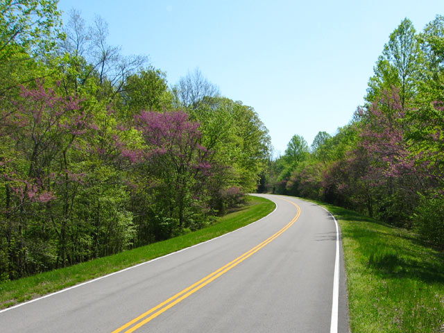
Natchez Trace Red Buds
Red Buds popping out along the Natchez Trace Parkway


History of the Old Trace

The parkway roughly follows the historic Natchez Trace, a trail whose roots goes back to the 1600s evolving from hunting trails used by the Natchez, Chickasaw, and Choctaw Indians. Around 1700 French explorers and traders established a trading post near the present day Natchez and later Fort Rosalie constructed as the European population in the area expanded. Conflicts with the native Natchez people ensued and by 1735 the Natchez Indian community in the area was essentially wiped out and the village of Natchez began to form.

For the next 50 years European influence expanded in the area between the lower Mississippi valley in Natchez and the Ohio River and Cumberland River valleys in the north.

By 1800 Nashville had become the most significant community in the Kentucky-Tennessee territory. Also by this time a defined trail had taken shape between Natchez and Nashville as an overland return route from farmers and traders who floated their crops and products down the Cumberland, Ohio, and then the Mississippi Rivers to markets in Natchez and New Orleans. With no practical way to navigate their craft back up the Mississippi River, the float boats that carried the cargo were disassembled and the lumber sold. Then the Boatmen had to walk or ride back home.

The Trace was the trail that formed from thousands of travelers following this path. Over time inns (called “stands”) and small communities grew up along this route to serve travelers along the trace. One of these inns, Mount Locust Inn & Plantation, has been restored and is open for daily tours from February through November.

By 1810 an estimated 10,000 Boatmen (called “Kaintucks”) were using the Trace and the two towns at either end (Natchez and Nashville) had become cemented as major communities.

Natchez Trace Articles


About the Natchez Trace Drive (this page)


Travelogue: Natchez Trace Parkway, Part 1


Meriwether Lewis Natchez Trace  Park


Visiting the Historic City of Natchez

natchez trace parkway
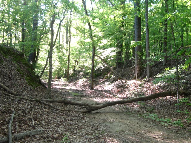
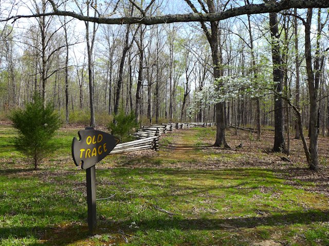
There are several pull-offs along the parkway where you can see portions of the original old trace.
Mount Locust, Natchez Trace Parkway
Mount Locust, historic inn on the Natchez Trace

Nearby Places of Interest
Historic Natchez, Mississippi
Shiloh Military Park

The Natchez Trace – Our First National Road

In 1801 President Jefferson authorized construction of a national road along the Trace as a national security measure. Army troops began clearing brush and building bridges along the trail and in a few years a good section of the trail had been improved from a winding, narrow path to a wider more comfortable road for wagons and horses and began attracting numerous travelers in addition to the Boatmen.

From 1812 to 1815 the Trace was a major route used by Andrew Jackson’s Tennessee Volunteers during the War of 1812 and the 1815 Battle of New Orleans. By 1820 the invention of the Steamboat allowed two way travel up and down the Mississippi and Ohio rivers meant the Trace began to lose its main customers. In addition a new road, called Jackson’s Military Road was being constructed. This route cut about one third of the distance between Natchez and Nashville off the original Trace. By 1900, due to improvements in river travel and the competition from more recent roadways, the Trace had reverted to a wilderness state along much of its original course.
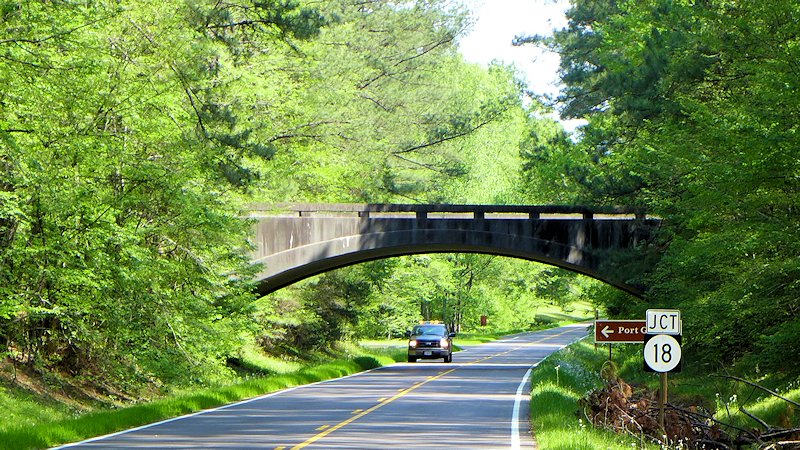
A portion of the historic Old Trace trail from Natchez to Nashville

Learn More – Natchez Trace Parkway Travelogue:

Natchez Trace National Parkway Website

Traveling The Modern Natchez Trace Parkway

A Great Road Trip

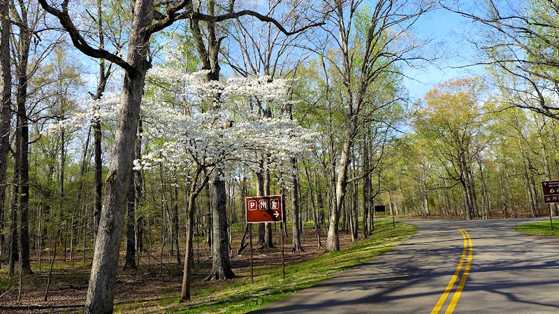
One of the most scenic and stress free road trips you can take. In the Spring you can catch the blooming Red Buds, Dogwoods, and wildflowers. In the fall beautiful colors as the leaves are changing.

The Natchez Trace Parkway begins north of the city of Natchez (see our article on Visiting historic Natchez, Mississippi), the oldest town on the Mississippi River and the southern terminus of the historic Natchez Trace. The parkway runs 444 miles, through three States, ending south of Nashville, Tennessee.

There are some interesting small towns along the route and hundreds of wayside stops with some sort of scenic or historical interest along the Parkway. Rated by Mike and Jen of RVlifestyle.com as their favorite RV road trip in the US. We agree and highlight below some of our favorite points of interest along the Trace.

The rooms in the old Mount Locust Inn, with period furnishings, are open for viewing.

Our Favorite Points of Interest Along the Natchez Trace:

Mount Locust, Milepost 15.5

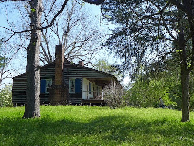
Traveling north from Natchez, one of the first stops you should make along the Trace is at Mount Locust, milepost 15.5. Back in the day, this was Day 1 on the Boatman’s trip back to the Ohio Valley. The stand was originally constructed as a farm homestead in 1780. But being in the right place at the right time encouraged later owners, the William Ferguson family, to open up a crude inn to serve the growing number of travelers. Eventually an annex was constructed to better meet the need. The Inn has been restored and is open for daily tours from February through November. See link to Mt. Locust Brochure.

Sunken Trace, Milepost 41.5 – At several points along the parkway the “old Trace” intersects with or comes close to the Parkway. At mile marker 41.5 is one of many rest stops where you can walk to and through a portion of the original Trace.

Old Natchez Trace sunken trail

Rocky Springs, Milepost 54.8 – The former community of Rocky Springs is now a park, picnic site and rustic campground. A self-guided trail leads to the location of the former village and to the graveyard and old church that are all that remain of a village that once held over 2000 souls. Map of Rocky Springs Campground & Historical Site

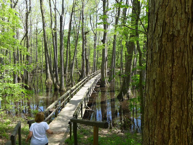
Cypress Swamp, Milepost 122.0 – At mile marker 122 you’ll have an opportunity to stretch your legs with a half-mile loop annotated nature trail through a Cypress and Water Tupelo Swamp. We saw a baby alligator sunning itself on a little island in the swamp pond.

cypress swamp natchez trace
The nature trail begins with a boardwalk through the center of the swamp.

Holly Hill Rest Stop, Mile Marker 154.3 – One of 44 picnic areas along the Trace. There is picnic tables and accessible rest rooms.

Holly Hill Rest Stop, Natchez Trace
Holly Hill Rest Stop, Mile Marker 154.3, one of 44 picnic areas along the Natchez Trace

French Camp, Milepost 180.7 – A “stand” (inn) was established here in 1812 serving travelers along the Trace. Later in 1822 it added a school, which exists to this day. Included in the restored complex, joined by a boardwalk, are a cafe, gift shop, visitor center, log cabin, crafts center, and sorghum making center. An interesting historical stop, an opportunity to stretch your legs, and get a bite to eat.

Link to Historic French Camp Village website

French Camp, Natchez Trace
Blacksmith Shop and Barn of the French Camp
French Camp
The Drane House, an 1845 restored antebellum home is open for tours

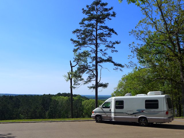
Jeff Busby Park, Milepost 193.1 – Named for Mississippi Congressman Thomas Jefferson Busby (whose bill created the Parkway), the park has a visitor exhibit area, a nice picnic area with tables, grills, and parking, a 22 site campground, restrooms, hiking trails, and a mountain top overlook that is one of the highest points in Mississippi.

Jeff Busby Campground & Picnic Area Map – Jeff-Busby-map

Jeff Busby Overlook
The Scenic Overlook picnic area at the Jeff Busby Trace Park.

Natchez Trace Parkway Visitor Center, Tupelo, Mississippi, Milepost 266.0

The Natchez Trace Parkway Visitor Center has a twelve-minute orientation film, interpretive displays about the natural and cultural history of the Natchez Trace, as well as an Eastern National Bookstore. A park ranger is available from 8:00 am to 5:00 pm daily (except Christmas Day) to answer any questions you may have. This is also the location to get your passport stamps for the Natchez Trace Parkway, Natchez Trace National Scenic Trail, Tupelo National Battlefield, and Brices Cross Roads National Battlefield.

Visitor Center Events Calendar


Visit the Shiloh National Military Park
Exit at Mile Marker 293
Visitor Centers at Corinth &
Shiloh Battlefield


Detour – As of April 4, 2022 a section of the Trace between mile markers 293 and 321
remains closed for repairs. Here is the detour route.


Meriwether Lewis Site Milepost 385.9

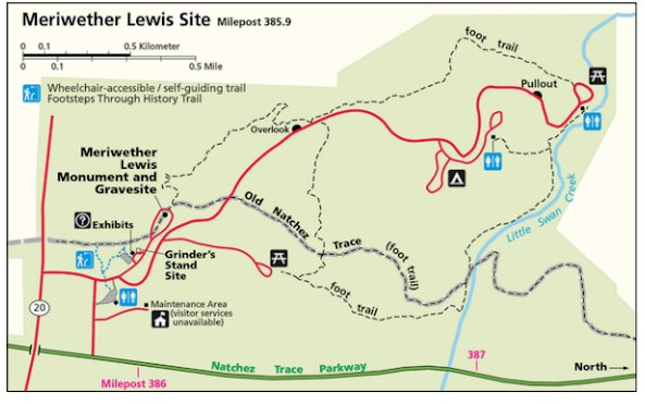
This is the largest and most impressive of the 3 campground-parks actually on the Trace. It site has a campground, modern washrooms, picnic areas, some decent hiking trails, and a historical exhibit on famed explorer Meriwether Lewis, including a monument erected at the site of his burial and a replication of the Grinder House, the “Stand” where Lewis stayed over-night on his way back East and mysteriously died of gunshot wounds in the middle of the night. Exhibits tell the story of that evening, plus other significant aspects of Lewis’ history.

Merriweather Lewis Campground
Relaxing at the Meriwether Lewis Campground, Natchez Trace Parkway

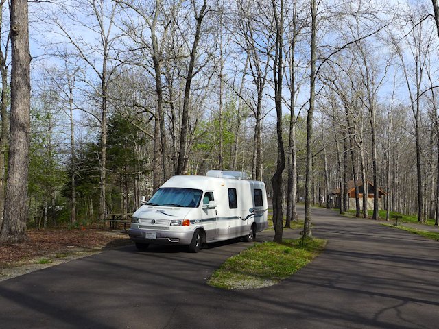
While the campground has no utilities it has paved and reasonably level parking areas for RVs. Each wooded site has a picnic table, a fire pit, trash bin, and nice separation from adjacent sites. Like all the National Forest Campgrounds along the trace, it is first come, first serve for campsites so best to get there early in the afternoon or it will be full.

See more photos and info on things to do and see at Meriwether Lewis Park and Campground here.


Camping Along the Natchez Trace

The National Park maintains three improved campgrounds along the Trace (all of which were profiled above): Rocky Springs, Jeff Busby, and Meriwether Lewis. In addition there are several rustic campgrounds reserved for bikers or hikers. Within a few miles of the Trace are both private and public campgrounds with utilities for RVs. This page has links to State Parks convenient to the Trace.

Morning Fog across the Lake at Tishomingo State Park along the Natchez Trace Parkway

More Natchez Trace Links & Publications

National Parks Directory – ScenicPathways

Natchez Trace Articles on Scenic Pathways

Meriwether Lewis Park – Natchez Trace

Meriwether Lewis Park Natchez Trace Parkway

Meriwether Lewis Park, Campground & Monument

The Merriwether Lewis Wayside Stop on the Natchez Trace is our favorite of all the significant points of interest. It is the site of Grinders Stand, made famous due to it being the place where famed explorer Meriwether Lewis died of mysterious circumstances. The Meriwether Lewis monument marks his burial site.

Another attraction of the site is being able to walk a portion of the original Old Natchez Trace that runs through the park. The old trace section also intersects with a network of other trails within this wayside stop.

A third attraction is the largest and most nicely landscaped of the 3 campgrounds that are located on the Trace itself.


Natchez Trace Articles on Scenic Pathways
History-Introduction Natchez Trace
Travelogue: Highlights along The Trace Parkway
Meriwether Lewis Natchez Trace  Park (this page)


Grinders Stand and Meriwether Lewis Last Night

On his way to Washington DC to defend himself against charges of improper expenditures, Meriwether Lewis traveled on a portion of the Trace. On October 10th he stayed overnight at Grinders Stand, a wayside inn on the Trace trail.

During the night gunshots were heard and Lewis was found dead of gunshot wounds. Some reports allege he died at his own hand; others suggest he was murdered. A sad and mysterious end to one of America’s most famous explorers.

Lewis is buried about 200 yards from the old inn and along the original Trace. In 1848 the state of Tennessee erected a monument over the grave site. Some exhibits accompany the replica of Grinders Stand built on the site of the original. Exhibits tell the story of that evening, plus other significant aspects of Lewis’ history. See MLewis-Site-Bulletin

A replica of the original Grinders Stand Inn where Lewis spent his last fateful night.
A replica of the original Grinders Stand Inn where Lewis spent his last night.
Meriwether Lewis Gravesite
Corps of Discovery explorer Meriwether Lewis is buried here along the Old Trace.

Meriwether Lewis Hiking Trails

Old Trace Trail
Old Trace Hiking Trail from the Meriwether Lewis grave site.

There is a four mile loop hiking trail that starts at the Lewis grave site and eventually runs along Little Swan Creek where it intersects with the Old Natchez Trace foot trail. A few other spur trails criss-cross this network. We found walking on the Old Trace trail fairly easy to follow from the grave site to one of the picnic grounds in the park. But based on reports I’ve read some other portions of the hiking trail are less well-traveled and more difficult to follow.

We did a loop following the Old Trace til it intersected with the spur trail to the picnic area and then returned along the road.

Meriwether Lewis Campground

Meriwether Lewis campgound
We found a nice level RV site not too far from the washrooms.

Of the three drive-in campgrounds along the Trace, Meriwether Lewis is the largest and most improved. The bathroom building is clean, heated, well lighted with sinks and toilets (not vault toilets). The campground roads and sites are fully paved and the sites are quite level. There’s also a well pump faucet for adding water to your RV. No dump site nor electric service. But otherwise a very well maintained campground with an attractive camping fee – $0.0!

During peak travel times, you may have trouble finding a vacant camping site as this is a very popular stop along the Trace. David Crockett State Park is not too far away and would be an option for those camping or RVing.

Camping Along the Natchez Trace

The National Park maintains three improved campgrounds along the Trace (all of which were profiled above): Rocky Springs, Jeff Busby, and Meriwether Lewis. In addition there are several rustic campgrounds reserved for bikers or hikers. Within a few miles of the Trace are both private and public campgrounds with utilities for RVs. This page has links to State Parks convenient to the Trace.

Natchez Trace Links & Publications


Fat Mama’s Tamales | Natchez, MS

Fat mamas tamales

Restaurant Review: Fat Mama’s Tamales

Jo reviewing the menu before placing our Fat Mama’s order.

Huge Taco Salad, Roast Beef PoBoy, and Mama’s Tamales.

Fat Mamas Tamales Natchez, Mississippi
Jo enjoying her Fat Mama’s Margarita out on the dining deck.

Fat Mama's Tamales Menu, Reviews, Photos, Location and Info - Zomato

Fat Mama’s originally opened in Natchez in 1989 and have been at their current Canal Street location since 2008. Its colorful fun atmosphere, fast and friendly service, good homemade food, and decent prices have made Fat Mama’s a favorite Natchez dining institution.

You place your order at the counter, get your beverage, leave your name and take a seat in the restaurant or out on the dining deck. A server will bring your meal when it is ready.

Jo ordered the Taco Salad, a crispy tortilla shell filled with lettuce, seasoned chicken, shredded cheese, sliced black olives, diced tomatoes and onions, but held the jalapeno peppers. Very fresh and crisp and a generous quantity of ingredients. She liked that the chicken and all the ingredients were nicely distributed throughout the salad versus being layered like you find at some eateries.

I had the huge Roast Beef & Gravy PoBoy sandwich. Served on French Bread and a generous quantity of hot thin-sliced roast beef with shredded cabbage, sliced tomatoes and pickles. Served with a side of homemade potato chips. Very filling and tasty. The chips were exceptional.

Because she had no idea what a Tamale was Jo ordered a half dozen to go with our meal. They were served hot wrapped in corn husks. Too spicy for Jo’s tastes; I found them good but could only eat one as my Roast Beef PoBoy filled my tank to the top.

Jo ordered Fat Mama’s signature Margarita and found it suitably powerful and brain-freezing chilled. I had a chilled glass of amber ale tap; one of 8 specialty beers on tap.

We give Fat Mama’s high marks for fun, comfortable, casual dining, plus great food, and good service. Zomato.com rates it in the top 5 Natchez restaurants. We had previously dined and enjoyed the food and service at The Camp restaurant, located along the river in the Natchez-Under-the-Hill neighborhood. Other top-rated Natchez dining spots on our future list of places to try are Roux 61, Mammy’s Cupboard, and the historic King’s Tavern.

Natchez Links

Shiloh Military Park

Shiloh Military Park

Shiloh National Military Park

The Shiloh Visitor Center is an important stop on your tour of Shiloh.

Travelers on the historic Natchez Trace Parkway should consider taking a 45 mile detour to visit Shiloh, a large, well preserved National Historic park and the most significant Civil War site in the Mississippi River valley.

Brief History of the Battle

The historic two day Civil War battle at Shiloh is closely tied to the town of Corinth, 22 miles south of the Shiloh Battlefield. General US Grant had encamped at Pittsburg Landing along the Tennessee River and was awaiting arrival of General Buell and the Army of Ohio to then advance on Corinth. Corinth was at the strategic rail cross roads between east-west and north-south rail lines. So Shiloh itself was not the object; it was Corinth. Capturing it from the Confederates would substantially impair their movement of troops and supplies. Confederate General Albert Johnston, commander of the Corinth region, recognized this threat and was aware of the Union Army advancing on them from the north. Rather than meet the Union forces at Corinth, he decided to seize the initiative and move his 44,000 men to attack Grant at his encampment at Pittsburg Landing and near the Shiloh Church. The battle of Shiloh began at dawn on April 6th, 1862 when a Union patrol discovered the Confederates advancing through the forest and fields near a small log church named the Shiloh Meeting House. In two days of bloody fighting (Grant’s 40,000 man army vs Johnston’s 44,000) Grant with the help of Buell’s army arriving on the second day repealed the Confederate attack. Johnston perished during the battle and was replaced by General PGT Beauregard who to save his Army was forced to retreat Corinth. In the bloody two battle, 23,746 lives were lost.

Sunken Road separating the thicket where Wallace’s line confronted Johnston’s advancing Confederate troops.

Later in April, a Union force of 100,000 troops advanced from Pittsburg Landing with the goal of capturing Corinth. Their arrival within cannon range of the Confederate encampment at Corinth and the overwhelming size of the Union forces forced Beauregard to withdraw his forces south to Tupelo, Mississippi. So Union troops occupied Corinth and the strategic railway crossroads. But that wasn’t the end of things. In October, Confederate General Earl Van Dorn launched a surprise attack on the Union Garrison in Corinth but after 3 days of fighting was forced to retreat. The three day battle of Corinth cost another 6,500 lives and marked the last Confederate Civil War offensive in Mississippi.

Corinth Civil War Interpretative Center

Corinth Military History Visitor Center

The Corinth Interpretative Center is worth a visit before touring the Shiloh Battlefield Park. It has an excellent film telling the story of Corinth and how it connects to the epic battle at Shiloh. There’s also several educational exhibits on the Civil War and some interesting artifacts. Theh center is built on the former cite of Battery Robinett. The center is conveniently located on the west side of town, with an ample parking lot, and handicap accessibility. There are a few other Civil War sites of interest in the Corinth area including the Corinth Contraband Camp. Now a park, a portion of the old camp has been set aside with a commemorative trail with bronze figures depicting the lives of residents of the camp. Navigating to visit Shiloh from the center is simple (just go north about ½ mile and turn right on Shiloh Road and follow the signs).

Shiloh Battlefield

Shiloh Map

Pittsburg Landing was the southern-most landing for river steamboats on the Tennessee River. The river afforded General Grant the opportunity to move large amount of men, supplies, and armament towards the military objective of Corinth. Above the landing was a high plateau of forest and farm land occupied by a scattering of small farmers who worshiped at a log cabin known as the Shiloh Meeting house. It was an ideal spot for Grant to encamp and use as a base of operations for the Corinth assault.

Fortunately over 4200 acres of the original battlefield have been preserved as the Shiloh Military Park. The park has an extensive network of roads throughout the park joining several key battle sites, each with a commemorative monument (cannons and other military artifacts) and plaques describing the conflict that occurred at that point or the strategic importance of the site. Visitors to the park should first stop at the Shiloh Visitor Center to pick up maps and guides to touring the park. You can take a driving tour or hike trails within the park. There are also interesting exhibits in the visitor center as well as a bookstore for more detailed accounts of the Shiloh and Corinth battles and other Civil War history. Another resource at the Visitor Center is the staff itself. They are more than just courteous hosts or park service agents; you’ll find them quite well-steeped in Shiloh history – a human interactive educational resource to complement the more high tech interactive exhibits!

Shiloh was at the time the bloodiest battle of the Civil War and the ninth overall most costly battle. If you include the casualties at Corinth, which was part of the same campaign it would rank in the top five Civil War battle sites. Visiting Shiloh Military Park is an impressive educational experience. I look forward to a return visit to Shiloh and plan to do some advance reading of Shiloh history as a guide to my next visit.

Links


Visiting Historic Natchez Mississippi

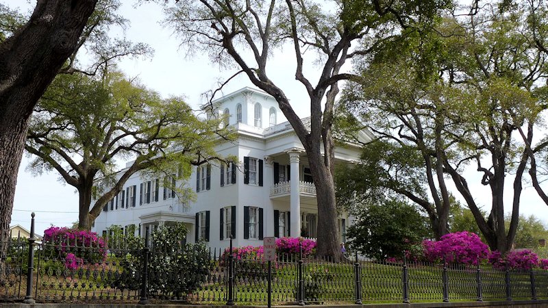
stanton hall natchez mississippi

Natchez, Mississippi celebrated its 300 year anniversary in 2016. Rich in historic preservation, Natchez is the oldest city on the Mississippi River and the southern terminus of the historic Natchez Trace, now a Scenic National Parkway which runs over 400 miles through three states.

Antebellum Homes, Historic Mansions & Structures

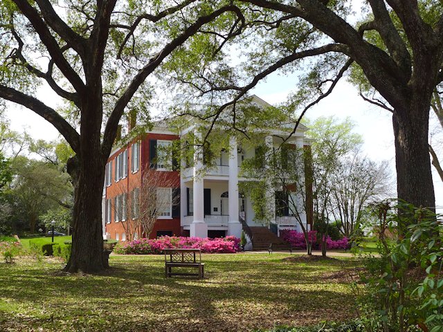
Natchez was fortunate to have a large number of its historic structures survive the great Civil War. Several Antebellum Homes are open for tours year-round and special Pilgrimage Tours are offered in the spring and fall. Maps for walking tours around town identify numerous other historic buildings, some open to the public for tours. Sprinkled among the historic buildings in the downtown historic district are arts and crafts studios, antique emporiums, specialty shops, and bars and taverns offering southern cuisine and blues music.

Rosalie Mansion
Rosalie Mansion (1832) was constructed on the former site of the French Fort Rosalie, built in 1716.

In addition to the Spring & Fall Pilgrimages of historic homes ( March and April, September & October), other annual Natchez events include a month long music festival (in May) and a Food & Wine festival in July.

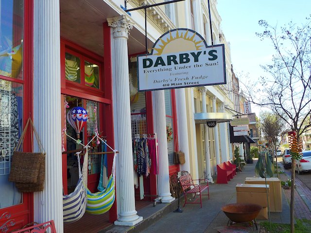
Natchez Shops
The Darby Fudge Factory is one of many interesting shops in the downtown historic district.

Natchez National Historic Park

There are two National Park facilities in Natchez. One is the William Johnson House Museum and Visitor Center. William Johnson was a barber and prosperous business man who built this house in downtown Natchez in 1840. The park service has restored the building and furnished it with pre-Civil War furnishings similar to those used by the Johnson family. There are also interactive exhibits depicting the lives of Johnson, his family, and the era that he lived, gleaned from a diary that Johnson kept from 1835 to 1851. What makes this exhibit especially interesting is that Johnson was a free black man and he himself owned several slaves.

The second Natchez National Historical Park facility is located on the edge of town. The 80 acre park includes the former Melrose Plantation estate.  The estate includes the main Mansion and numerous out-buildings including the kitchen, dairy, octagonal cistern houses, smoke house, privy, carriage house, barn, and the last remaining slave quarters in Natchez. Some think it is the most complete restoration of a southern plantation in Mississippi. Here’s an excellent article and photos of touring the Melrose Plantation.

Walking Tour City of Natchez Trails

Natchez has organized five walking trails (links lower down the page)  covering interesting natural and historic points of interest. One trail runs along the bluff park promenade with scenic views of the Mississippi River; another traces through the downtown historic district. Plaques and kiosks located along the trails give background on the history of some of the more impressive structures. Walking the trails gave us some good exercise and we saw lots of beautifully restored antebellum mansions, smaller private historic register homes and other historic structures. During our stay in Natchez, we boondocked our RV in the parking lot of the Natchez Visitor Center and each day took a different walking tour.

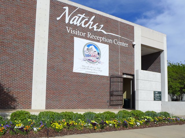
natchez ms visitor center
The Natchez Visitor Center should be your first stop on visiting Natchez.

Slide Show of the Natchez Bluff Trail 

Scenic views and historical markers along the Bluff Trail


  • Natchez Bluff Walk overlooking the Mississippi
    The upper Bluff Trail Walk offers a nice view of the Mississippi River
  • river walk gazebo natchez, ms
    The gazebo, built by the Spanish in 1790, is the centerpiece of the Bluff Parkway
  • Ealey Brothers fountain Natchez
    Thw Ealey Brothers commemorative fountain is along the Bluff walk and is also part of the Blues Trail of historic events and people
  • Bridge of Sighs Natchez MS
    The "Bridge of Sighs" is an attractive point of interest along the Bluff Top Trail
  • Bluff Trail Stairway
    A stairway from the Bluff Trail leads to another lower river front trail that runs below the bluff along the river.

Slide Show of Natchez Historic Private Homes

Just a few of the many beautiful restored historic homes in Natchez


  • historic homes natchez ms
    Myrtle Terrace was built in 1844
  • Methodist Church Parsonage Natchez Historic Homes
    The Parsonage of the Methodist Church was built in 1852
  • historic homes natchez ms
    The Dorsey House dates back to 1835
  • Cherokee House Natchez Historic Homes
    The Cherokee House was built in 1794


Best Restaurants & Places to Eat in Natchez Mississippi

The Camp Restaurant, Bowie Tavern, Fat Mama’s are some of the fun places to dine or just have a burger and beer. See our reviews of these Natchez restaurants and more here: Best Restaurants in Natchez, Mississppi

Natchez Restaurants
Best Natchez Restaurants-Pubs

Natchez Visitor Links: