Scenic Fall Color Report along Minnesota’s North Shore of Lake Superior
While this fall color travelogue was originally published a few years ago, it presents a reasonably typical experience for fall color leaf peppers during the last week in September.
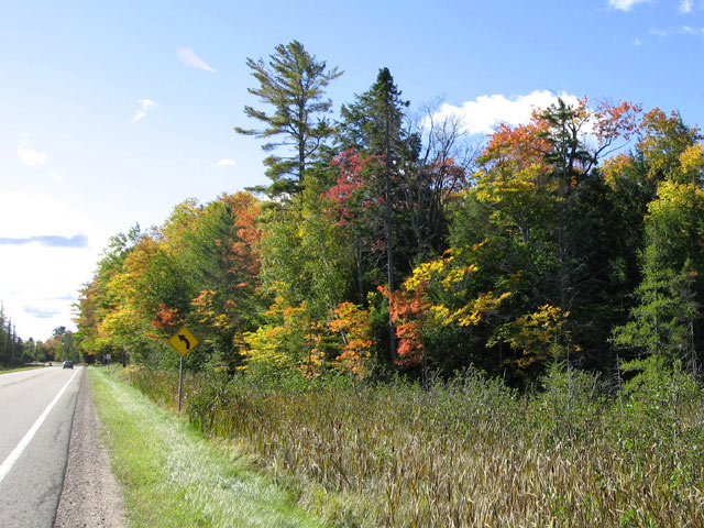
Ross here reporting from the Red Mug Coffee House in Superior, Wisconsin on Sunday, September 25th. Tomorrow we head up the North Shore along scenic highway 61 to do some hiking and check out the fall leaf color. We are trying the Seven Summits Challenge sponsored by the Superior Hiking Trail Association. Weather has been cool and overcast, but the low pressure area is forecast to move out this evening, warming the temps, clearing the sky, and we hope giving us some nice picture taking conditions.
Duluth – Hiking to Ely Peak
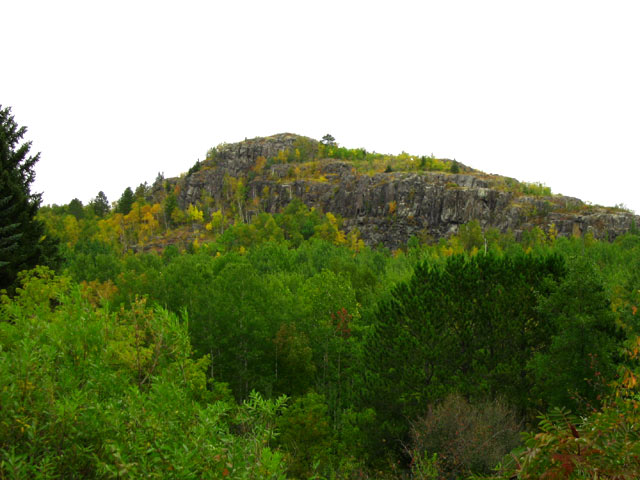
While in Duluth-Superior, Jo and I had an opportunity to hike one of the seven summits – Ely Peak, southwest of Duluth near the community of Gary. It is about a two mile round trip with parts of it steep and poor footing, but navigable for most who have done any hiking. The temperature in the high 50s turned out to be just right for climbing. Some hints of color, but should be better in a week or two.
Hiking Temperance River State Park
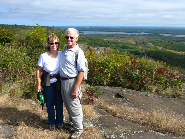
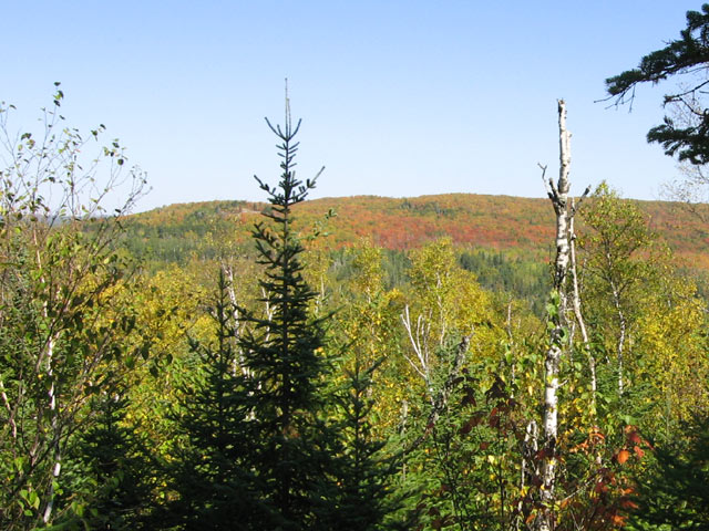
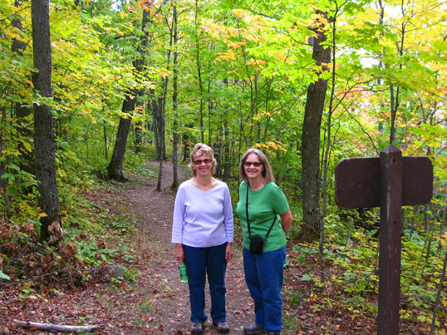
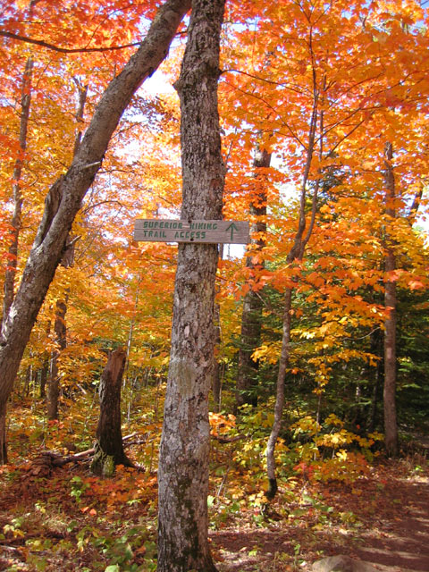
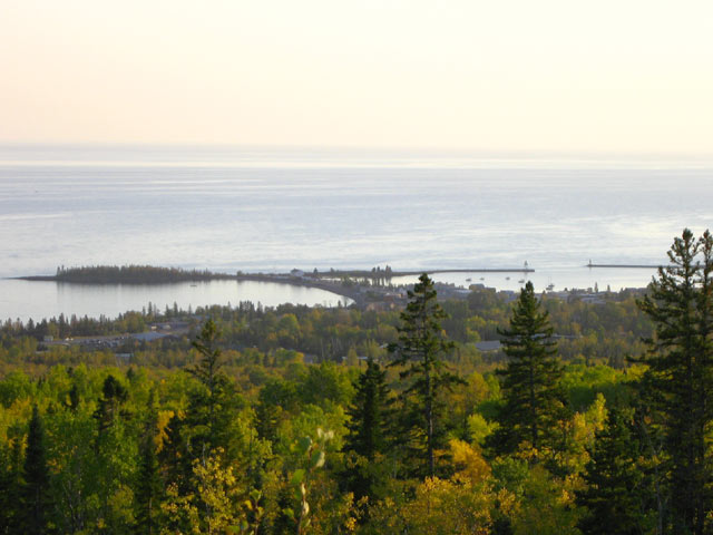
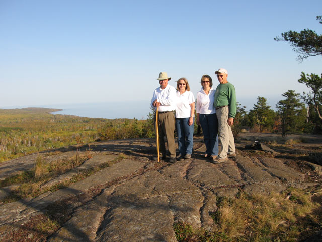
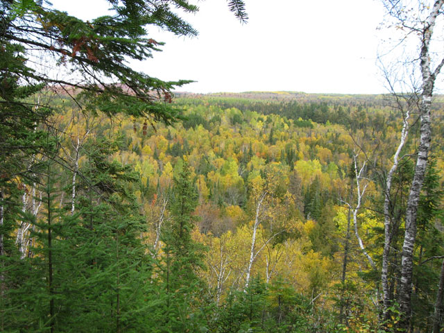
Day 2 (9/26). Jo and I met up with Jo’s sister Donna and husband Dan to tackle the next hiking peak in the Seven Summits Challenge – Carlton Peak. The hike is about 3.6 miles round trip from the Britton Peak trailhead off the Sawbill Trail. The Superior Hiking Trail Association and its volunteers have done an excellent job maintaining this trail with several boardwalks across low lying areas and raised earthen sections in other parts. A few steep and rocky sections but most average hikers should have no problem with this trail. The view from the top is about 270 degrees. On this day the views looking away from the lake showed some color but those towards the lake not so much (but great views of Lake Superior).
 50 Fabulous Day Hikes in Minnesota’s Spectacular Lake Superior Region 50 Fabulous Day Hikes in Minnesota’s Spectacular Lake Superior Region |
Hiking Oberg Mountain near Tofte, Minnesota
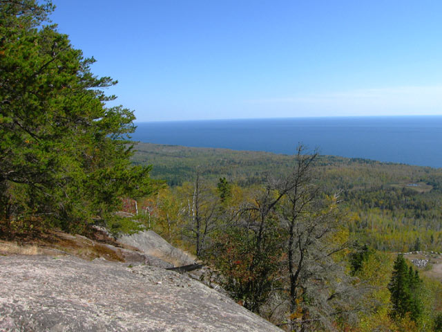
Day 3 (9/27). We saw some great color on our hike to Oberg Mountain, as well as super views from the top. The hike to and around the loop around Oberg is about 2.5 miles. It is a moderately easy hike. If you can walk in the city for a few miles you won’t have any problem with this hike and there are great rewards for the modest effort. Oberg Mountain itself is heavily populated with a few varieties of Maple; some have already turned while others are a week or two away so colors should remain vibrant for a few weeks. Looking towards Lake Superior from Oberg you see mostly aspen (poplar) and birch (mostly dead!) and they are a few weeks away from showing their best color. But looking away from the lake there are some outstanding color views. I suspect that when we complete our tour up and down the North Shore we’ll place the Oberg Mountain hike as the #1 fall color hike. We’ll see.
Hiking Moose Mountain – Lutsen
Day 4 (9/28) While Dan and I golfed Lutsen’s Superior National Golf Club, Jo and Donna rode the Gondola Tram at Lutsen Ski Area to the top of Moose Mountain where they elected to hike Superior Hiking Trail segment that runs from the top of the mountain, across the top of Mystery Mountain and then down a spur trail to the parking lot at the ski area. Their hike was 4.2 miles and while it might seem it was downhill since they started at the top of Moose Mountain. From there the trail actually went down on the north side of Moose Mountain but then went UP the south face of Mystery Mountain, at a slightly higher elevation than Moose, and then proceeded to descend again. Of all the north shore summits that Jo and Donna tackled this one was the toughest. But they were rewarded with some nice color as well as some decent exercise (see pictures).

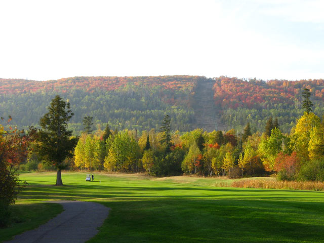
Golfing Superior National Golf Course
While the girls were working up some perspiration on the mountain, Dan and I were down below “working” the challenging golf holes on Superior National’s three golf courses: River, Canyon, and Mountain. It was great weather for golfing and Superior National’s courses are scenic and challenging. I lost a few golf balls, well maybe more than a few, but had a good time none-the-less. Dan had a couple of good rounds but found the River course unexpectedly challenging. But a few days later we golfed the course again and Dan shaved 5 strokes off his previous River course score – so he was happy. You can see a more detailed golf course review of Superior National on our SuperiorTrails Golf Course website.
Scenic Drive Grand Marais to Thunder Bay
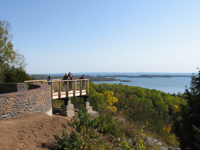
Days 5 & 6 (9/29 – 9/30). As we headed north towards Thunder Bay, Ontario we found after Cascade River State Park the colors were more muted due to a higher percentage of Aspen and Spruce and being further north. From Grand Marais to Thunder Bay when there is color change, yellows predominate. It is a pleasant drive that has some stunning overlooks of Lake Superior as you approach the border crossing at Grand Portage and the Pigeon River. We had no delays crossing the border and the 40 mile drive to Thunder Bay is pleasant and includes some panoramic views of several large glacial mounds that dot the landscape.
We came to Thunder Bay to visit Fort William Historical Park, play golf at the Whitewater Golf Club, and hoped to find some nice color at this time of the year. Like we found around Grand Marais, the color in Thunder Bay had not changed completely and what was changed was mostly yellow from Aspen and a few Birch trees. From Grand Marais going north the nature of the forest begins to change from Northern Hardwood Forest mixed with fir, spruce, and pine to what is termed a Boreal Forest. The thin soils and the shorter summers create a less diverse forest than you find in Northern Wisconsin or the Upper Peninsula. Here you find mostly spruce, tamarack, and aspen or popple in the woods. Few Maple, Oak, Hickory, Ash, Beech, or several other species that produce the range of reds, oranges, golds, as well as yellows that make the fall woods in late September so beautiful. But one advantage of this difference is that it allows a complete Lake Superior Circle Color Tour during which you can catch peak color at most places. This is because Aspen, which produces the predominate woods color from Grand Marais north into Ontario and over to Wawa, changes a week or two later than the Maples and Oaks.
See more photos and information on Things to see and do in Thunder Bay during Fall Color Season.
Driving South from Grand Marais
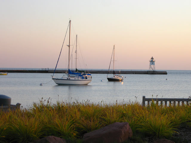
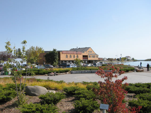
Days 7 thru 9. We returned from Thunder Bay on October 1st. Back in the states we found more color along the lake than a few days before, but still lots of green yet and what was showing was muted yellow. The weather remained fantastic: mid-sixties to mid-seventies and sunny skies. Cool nights and early mornings. Grand Marais and its harbor is one of the definite jewels around Lake Superior. In fall, with weather like we had, is hard to top, better than a summertime visit in our opinion. It seemed many other people shared our opinion because the streets of Grand Marais seemed as full as mid-summer and it wasn’t the weekend! The waiting line for dinner at the popular Angry Trout Cafe was long and it was a mid-week day.
Hiking to Pincushion Mountain
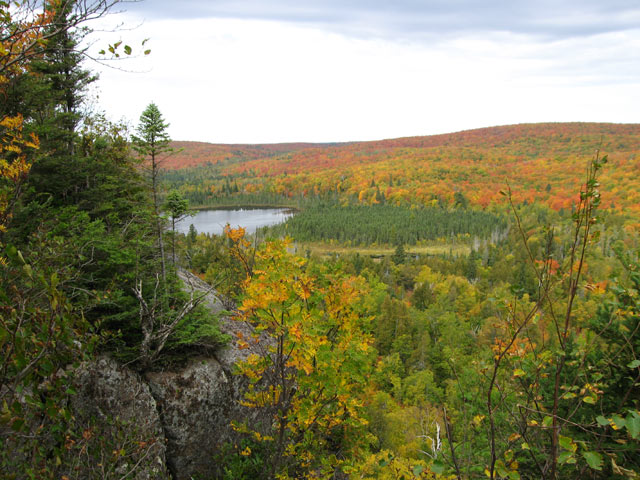
While the color in town and around the lake shore was modest, we found some nice color during our two summit hikes while we stayed in Grand Marais. We hiked to the top of Pincushion Mountain which overlooks Grand Marais. It is about 3 and half miles round trip and not very strenuous, except the last 100 feet when you have to climb the face of a large rock outcropping. You get about a 250 degree view from the top of the mountain. Looking away from the lake towards the hills to the west you see splashes of nice color. Attractive views of Lake Superior too.
Hiking Cascade River’s Lookout Mountain
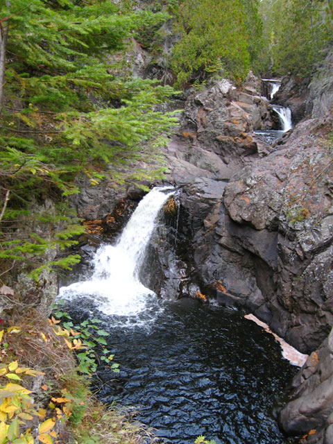
On our way South from Grand Marais we stopped at Cascade River State Park to hike to the top of Lookout Mountain. The first part of the trail runs adjacent to the Cascade River where you are treated to great views of several cascades and waterfalls on the river. Steps, 96 of them in all, make the hike along the river gorge relatively easy. The next section of the hike isn’t bad, except watch for tripping on tree roots. But the last third of the hike gets more strenuous – mainly because the ascent is steady with few breaks where it levels out. But the effort is rewarded with two scenic overlooks of inland mountains and hills, also showing nice splashes of color.
By our trips’ end Donna and Jo had hiked 6 summits along Minnesota’s North Shore plus some other trails. I had hiked 5 summits and Dan 4 (he took a day off to nurse a cold one day). We had some good healthful exercise, spectacular views, and treated to some decent fall color. Jo and Donna logged more than 35 trail and walking miles and are expecting a bonus when they return home and step on the scales!!
North Shore Fall Color Recommendations
For people traveling along Minnesota’s North Shore who don’t want to climb a mountain to see the best color (as we did) I recommend some side trips away from the lake into the hills.
Traveling along Scenic Highway 61, from Illgen City, near Tettegouche State Park, take State Highway 1 north toward Finland. Then take County Highway 7 east until Cramer Road (Cty 8 & Cty 1) going towards Schroeder where you’ll return to Scenic Highway 61.
In Tofte, you can take the Sawbill Trail north for two miles to the Britton Peak parking lot. There the trail to the Britton Peak overlook is only a five minute walk. In Grand Marais there are several color trail loops you can take into the hills above town. Check at the Visitor Center for these routes and which of them might involve gravel roads.
On our companion website, SuperiorTrails.com, you can see more pictures and notes on fall hiking along the North Shore
More Scenic Fall Color Drives
- Great River Road Fall Color
- Favorite Minnesota, Wisconsin, and Upper Peninsula Scenic Fall Color Drives
- More Fall Color Drives
Ross, your scenic travel guide
Comments are closed.