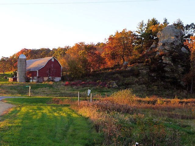
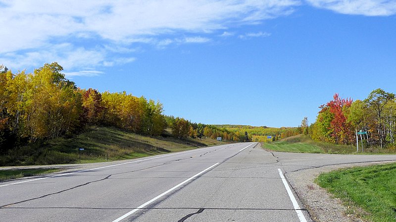
October 3, 2022. Fall color change is beginning in Wisconsin; we are starting to see the lime green peeking out among the wooded hillsides. Looks like it might be a week or two before Peak Color. But cool and dry weather is coming in a few days so that could produce some changes quickly.
The earliest fall color will occur in Northern Wisconsin from Vilas County to Hurley-Ironwood in the western Upper Peninsula. But timing your trip to catch real good color can be fickle and sometimes catching the earliest color doesn’t mean catching the best!
For your upcoming scenic fall color drive planning, I am listing lower down this page some of our earlier ScenicPathways articles on some of our favorite scenic fall color drives in Wisconsin, along the Mississippi Great River Road, and around Lake Superior.
Review of Gulpha Gorge Campground at Hot Springs National Park, Hot Springs Arkansas
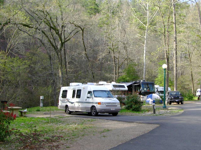
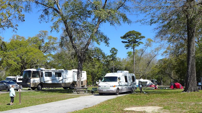
The Hot Springs National Park campground is located on the east side of Hot Springs Mountain, in a wooded setting, isolated from the urban area. The Gulpha Gorge creek runs along the edge of the campground and several camp sites overlook the creek.
The Hot Springs Campground is very tidy clean and well-maintained. The roads through the park are fully paved, There are 44 sites with full-hookups, including sewer. All sites have level or close to level paved parking pads. Each site has a concrete picnic table and elevated BBQ grill. There is adequate space between camp sites. Tall trees provide good shade for most sites.
One of the top features we like about the Gulpha Gorge campground is that sites are only available on a first-come, first-served basis. You cannot make reservations in advance. Occupancy is limited to 14 days.
The modern washrooms are well-maintained, but there are no showers. All waste disposal bins are animal proof. There is a RV dump station and fresh water fill station. Other amenities are a day use picnic area and an amphitheater with sturdy bench seating. The park staff occasionally presents programs at the theater.
Gulpha Gorge Campground, Hot Springs National Park
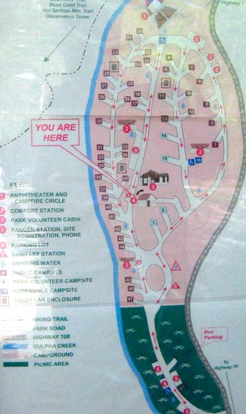
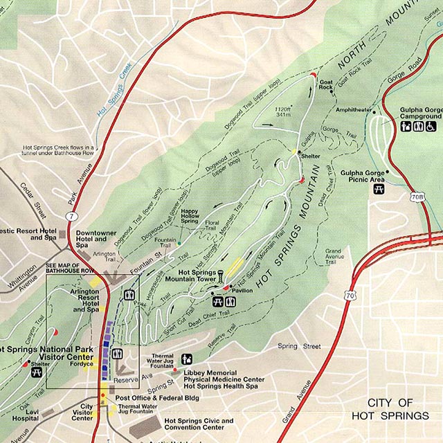
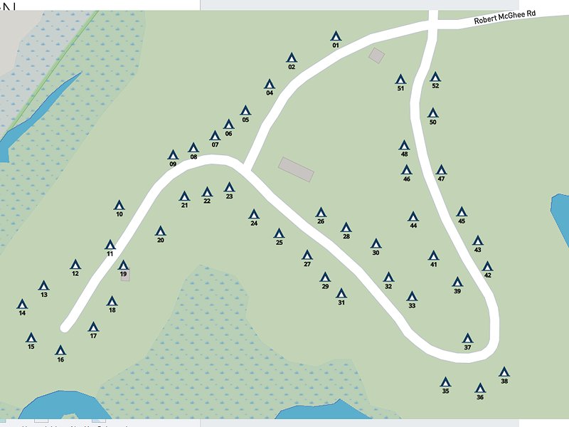
Hot Springs Campground Map
Hot Springs Hiking Trails
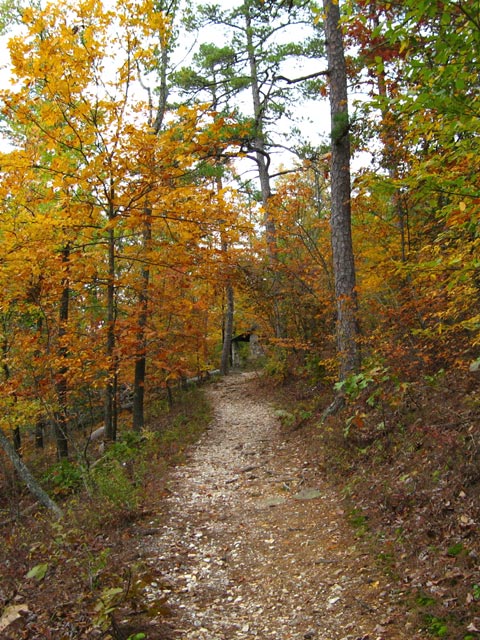
For us a most attractive feature of the campground is the trail head at the Gulpha Gorge Campground has access to the extensive network of trails on Hot Springs Mountain. The trails vary from easy walking trails to more rugged to allow people to progress gradually to more strenuous exercise.
Leading from the campground, the Gulpha Gorge trail goes to the top of the mountain.
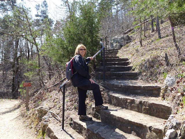
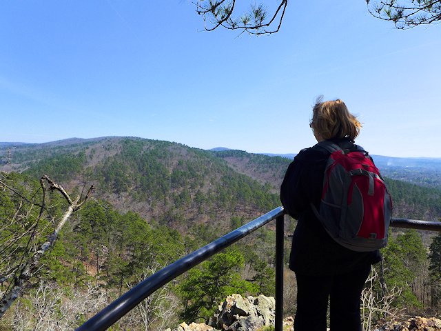
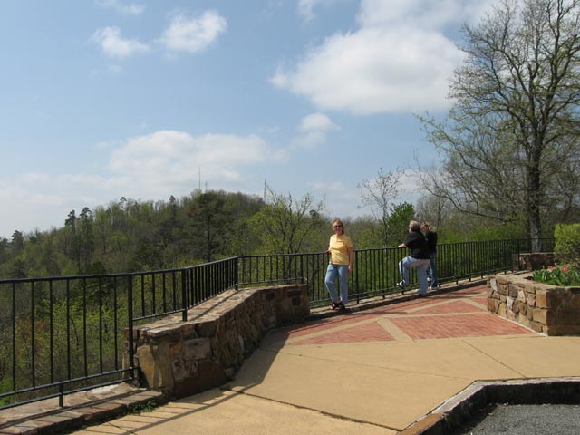
One of our favorite day hikes is taking the Gulpha Gorge trail that runs to top of eastern side of Hot Springs Mountain. Part way up is the intersection with the Goat Rock Trail which leads to Goat Rock, an outcropping with a panoramic view east. If you continue on the trail past the Rock, it eventually ends at the top of the Mountain where you can intersect with the Gulpha Gorge trail for your return leg of your hike. A great 90 minute exercise with a number of scenic views.
Jo about to climb the stairs to the Goat Rock overlook.
Situated in a valley in the Zig-Zag mountain range the city of Hot Springs is surrounded by hills. The Hot Springs National Park (see our article here) begins in the center of the city and encompasses the mountains to the east and west. So only minutes from downtown Hot Springs you can be in the woods several hundred feet above all the hustle and bustle of the city. Hot Springs became a center for physical therapy not only because of its abundant hot springs, but also because an extensive network of hiking trails were built in the hills surrounding the city to provide an exercise program to supplement the hot spring treatment.
Hot Springs National Park – Camping, Hiking, and Scenic Attractions
Located near the southern end of Arkansas Scenic Highway 7, Hot Springs National Park is located in the center of the city of Hot Springs while also set in the mountains surrounding the town.
Situated in a valley in the Zig-Zag mountain range, Hot Springs is surrounded by hills. The National Park begins in the center of the city and encompasses the mountains to the east and west. So only minutes from downtown Hot Springs you can be in the woods several hundred feet above all the hustle and bustle of the city.
Hot Springs became a center for physical therapy not only because of its abundant hot springs, but also because an extensive network of hiking trails were built in the hills surrounding the city to provide an exercise program to supplement the hot springs spa treatments. The trails vary from easy walking trails to more rugged to allow people to progress gradually to more strenuous exercise.
The Promenade Walk runs above Bath House Row and overlooks downtown.
Hiking and Backpacking Trails
The primary trail network is on Hot Springs Mountain with downtown Hot Springs and Bathhouse Row anchoring the western foot of the mountain. The Gulpha Gorge park and campground anchors the eastern foot of the mountain.
The trail to the top of Hot Springs Mountain from Gulpha Gorge
Hiking Trails between the Gulpha Gorge Campground and Bathhouse Row
In all there are 23 hiking trails but since many intersect with one another there are many more route options than the 23. The Hot Springs Mountain trails in turn link to other trails on adjacent mountains and hillsides: North Mountain, West Mountain, Music Mountain, and Sugarloaf Mountain.
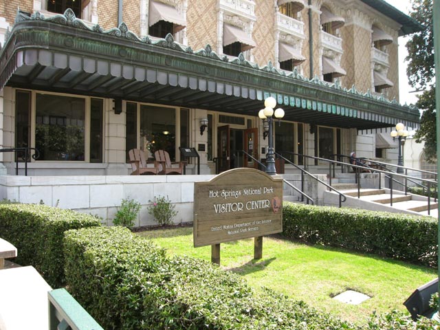
The “Hot Springs” and the spa bath houses offer both a historical and medicinal attractions. The National Park Visitor Center is located inBathHouse Row – see our article here within one of the historic bathhouses – The Fordyce. The Fordyce Bath House has been restored to be a museum of how it was in the hay day of the Bath Houses. Free self-guided tours are available as well as narrated tours and a film on the history of the bath houses. There are a few bath houses remaining in operation and others have been restored but re-purposed for other uses.
Gulpha Gorge Campground at Hot Springs National Park
When visiting Hot Springs, we generally stay at the Gulpha Gorge campground in Hot Springs National Park (see our review here). Located on the east side of Hot Springs Mountain, it is convenient to downtown Hot Springs, yet in a wooded setting, isolated from the urban area. It is an attractive campground among tall pine trees along Gulpha Creek.
Scenic Mountain Drives & Overlooks
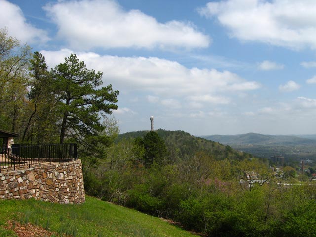
Non-hikers can drive to the top of Hot Springs and West Mountain summits. There are several scenic lookouts along the drives as well as some picnic areas. At the top of Hot Springs Mountain is the 10 story Hot Springs Tower with an observation deck at the top. (The Tower is a commercial operation that charges a fee to visit the observation deck.)
Other Scenic Drives. Another scenic drive is south of Hot Springs to the top of Jack Mountain. West of Hot Springs is the Quachita Mountains and Lake Quachita. A nice day trip is a scenic 80 mile loop around Lake Quachita out to Mt. Ida and back to Hot Springs.
At the top of West Mountain looking towards Music Mountain, Hot Springs, AR
View from the top of West Mountain looking towards the Hot Springs Tower
Dining and Entertainment
Hot Springs National Park is quite large – 5500 acres – and almost completely surrounded by the city of Hot Springs. The centerpiece of the park – Bathhouse Row – stretches along the south side of Central Avenue. Across the street from Bathhouse Row, on the north side, is the center of the dining and entertainment district of downtown Hot Springs.
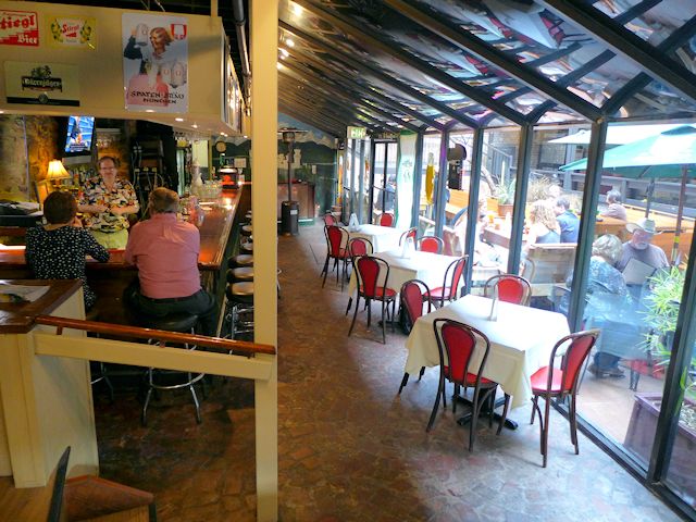
Restaurant Review: Steinhaus Keller
Down the street a little west of Bathhouse Row is one of our favorite Hot Springs restaurants and pubs. Formerly known as the Brau Haus which closed sometime in 2013, it has been re-opened at the same location as Steinhaus Keller. It is located in the lower level of a three or four story atrium in an area called Spencer’s Corner. Being below street level, it is not easily seen from the sidewalk. Above Steinhaus Keller and more prominently signed and easily noticed is Brick House Grill, known locally as offering the best burgers in town. Next time we are in town we’ll have to try them out.
You can dine outside in the atrium, inside at the bar overlooking the atrium, or in their intimate dining room
But on our most recent visit in late March 2014, we had our palates set for some good German food. I had their Sauerbraten and Jo had the Wienerschnitzel – both excellent meals, including our side dishes. The wait service was attentive, friendly, and professional. They offered a very good selection of beers from Germany, Austria, and eastern Europe. Jo had a black lager and I had an Oktoberfest. We noticed that the guy behind the bar was the same as when we ate there a few years ago and then it seemed he had an ownership interest in it. Don’t know the history on why the Brau Haus closed, but based on this recent visit we give the current iteration under a new name a strong recommendation.
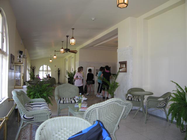
Hot Springs National Park – Visiting Historic Bathhouses Row & Attractions
Seven of the original historic Hot Springs bathhouses along Bathhouse Row remain and have been restored or in the process of restoration. Some offer classic hot springs spa experiences, others are open for tours, and some have been repurposed for other uses (like a restaurant or brew house).
The restored Fordyce Bath House serves as the visitor center for Hot Springs National Park
The historic Fordyce Bathhouse serves as the National Park Visitor Center. In addition to information on the park and activities, the various rooms and services of the original bathhouse have been preserved and restored and can be seen in a self-guided tour. Also a small theater with a 15 minute movie presentation of the bathhouse era. Touring the bathhouse facilities can take from 15 minutes to an hour depending on how much time one wants to spend with each exhibit.
Touring the Fordyce provides a fascinating look into an era and the forerunner of the todays resort spas. The facilities served a wide variety of patrons from those with quite serious maladies to the wealthy leisure class looking to be pampered and enjoying what was essentially a club-like ambience.
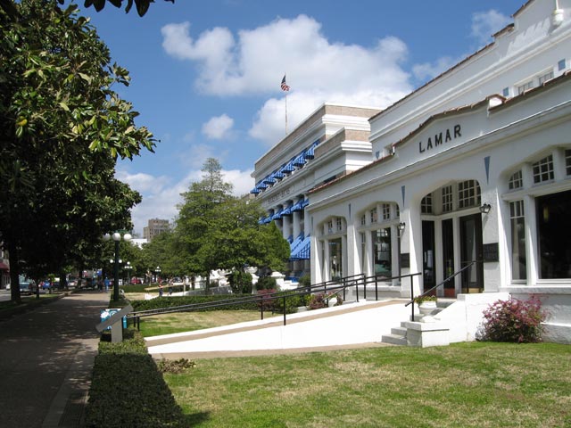
Looking North down Bathhouse Row, Lamar Bathhouse in the foreground
Open Bathhouses on Bathhouse Row
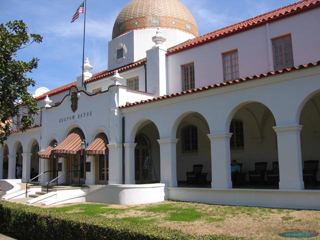
Quapaw Bath House, Bathouse Row Hot Springs National Park
Two of the bathhouses currently serve patrons. The Quapaw Bathhouse operates much as it did back years ago, offering both a large communal bathing pool as well as private bathing tubs. Their principal appeal is to those who are looking to soak in the hot, mineral rich waters. The second operating bath house, the Buckstaff Bathhouse, offers a more modern version and a complete array of spa services. In addition to soaking in a tub, they offer loafa scrubbing sponges and massages.
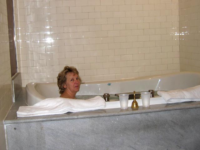
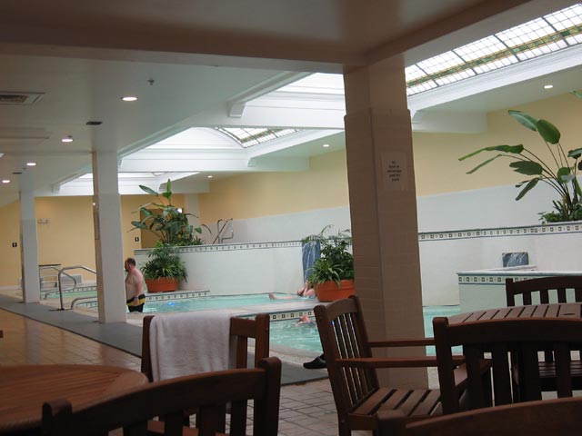
We decided to try out one of Bathhouses. We chose Quapaw because it had a package that fit our needs -a private spa for two. While the large public spa pools are refurbished versions of the pools from the 1920s our private spa room was somewhat newer and more modern – basically a Jacuzzi for two. So we didn’t step back 90 years to sample a replica of what had been in the heyday of Quapaw. But none-the-less the spa was soothing – you could feel something different in the water – it wasn’t the same as our hot tub at home. But afterword Jo and I decided next time we’d have a go at the public pool because you could move around more and get a little water aerobic exercise. And the public spa is a from the original bath house.
Jo enjoying the private spa at the Quapaw Bath House
The Public Bath at Quapaw Bath House
Other bathhouses are being converted to other uses. The Ozark Bathhouse is the home of the Hot Springs Museum of Contemporary Art. The Hale Bathhouse offers a café and bookstore and now offers Hotel accommodations. The Superior Bathhouse is now the only Brewery in a National Park and the only brewery in the world to utilize thermal spring water in their beer. The Lamar Bathhouse serves as the parks official gift shop, bookstore, and souvenir shop.
The Hot Springs National Park’s website offers some interesting tidbits on the history of Bathhouse Row plus links to learning more about each of the current bathhouses.
Jo and I enjoyed a cup of coffee and scones in the relaxing lobby of the Hale Bathhouse
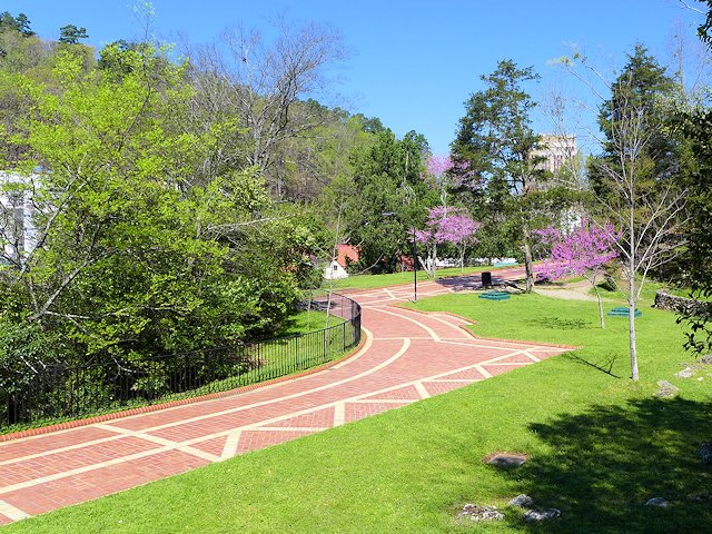
The Promenade walk & Hot Springs
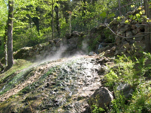
The bathhouses are set in an attractive landscaped park against the base of Hot Springs Mountain where up to 20 springs perculate out of the ground. The street in front of the bathhouses originally was Hot Springs creek, formed from the numerous springs eminating from the mountain. The creek still exists but now it runs in a tunnel underneath Central Avenue.
One of the hot springs flowing out of Hot Springs Mountain
A few of the springs have been left untouched, flowing out of the rock and cascading into pools of water, so visitors can see how they looked years ago. However 44 of the springs are now routed to reservoirs. Some of these provide the water sources for the bathhouses. Three fountains are located in the bathhouse row park, each of them with several spigots for filling up water jugs. The minerals in the water are believed by many to be healthful to drink as well as for bathing and soaking. The water is uncontaminated as it boils up from deep within the earth, estimated to be 4000 feet below the surface. Scientists estimate that the water being drunk today originally fell as rainwater over 3000 years ago!
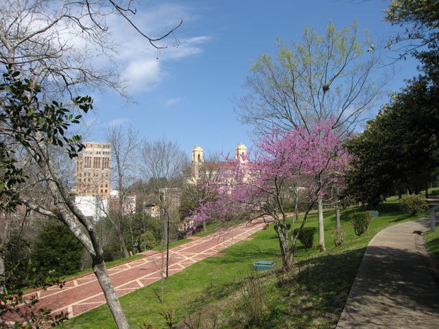
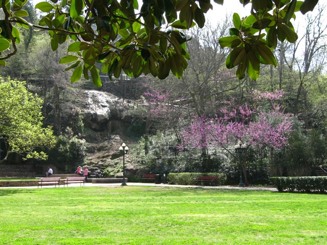
The Grand Promenade runs above Bathhouse Row. In the right foreground is a portion of the Tufa Trail, one of many graduated difficulty walking and hiking paths along the scenic Hot Springs Mountain
The Promenade is a tiled and landscaped walkway that runs along the hillside behind and above the bathhouses. At several points along the walkway one can view the active springs coming out of the ground. Numerous walking and hiking trails intersect with or cross the Promenade. These trails and walkways were constructed as part of the therapy plan of the spas. They cover a wide range of difficulty. The Promenade is the most gentle walkway and is handicapped accessible. Other trails go up the mountain or across the side hills of the mountain. Some are paved and have staircases, others are graveled and several are well-worn dirt trails through dense woods. In the 1920s Dr. Max Oertel designed the original network to provide spa patients an increasing level of difficulty. They could start out on short and relatively level paths and as their endurance and strength increased progress to steeper and more lengthy trails.
Red Buds in bloom near a hot springs pool in the Arlington Lawn of Hot Springs National Park
Tufa Terrace Trail, Hot Springs National Park
Gulpha Gorge Campground & Hiking Trails – The extensive network of hiking trails also connects downtown to the park’s Gulpha Gorge Campground which is on the other end of Hot Springs Mountain.
Interesting places and attractions along the Coastal Scenic Drive from Bay St. Louis, MS to Gulf Shores, Alabama This portion of the scenic gulf coast drive starts at the Mississippi-Louisiana line on US Hwy 90 and heads east towards Mobile and Pensacola. Just over the Mississippi-Alabama line, the most scenic and interesting alternative is to … Read more
RV Campground Review: Davis Bayous Gulf Islands National Seashore Park
Davis Bayou is one of two full service RV campgrounds that are part of the Gulf Islands National Park. The other campground is Fort Pickens on Santa Rosa Island near Pensacola Beach, Florida. The Fort Pickens Beach that stretches from the old fort east to the village of Pensacola Beach is regularly voted as Florida’s favorite beach so getting a reservation at the Fort Pickens campground can be more difficult than at Davis Bayou – which is one thing we like about Davis Bayou, we can actually get a camp site there! Another thing we like about Davis Bayou is the camp roads and the individual site parking pads are paved. The sites are also nicely spaced from one another and the mature live oaks and pine trees offer most sites at least some shade during parts of the day. All 52 sites offer water and electricity.
The Campendium camping and rv community rated Davis Bayou as one of the Top 10 Mississippi campgrounds.
52 nicely spaced campsites, all with water and electricity.
Sturdy picnic table in excellent condition on a paved pad. First class campsites.
The Park Visitor Center has some exhibits explaining the natural features in the park and suggestions on things to see and do. There is also a fishing pier adjacent to the center for anyone who possess a Mississippi State Saltwater Fishing License. The park also has a boat launch and pier for fishing and boating in the bayous or out in the Gulf itself.
Popular activities of campers are biking, bird watching, boating, fishing, hiking nature trails, and alligator watching. The popular tourist mecca of Biloxi is about 10 miles away with its sand beaches, casinos, restaurants, museums, golfing, and other entertainments.
Nature Hiking Trails – Slide Show
The entrance to Davis Bayou is off of Gulf Highway 90 that runs along the Gulf from Bay St. Louis to Pascagoula. Unfortunately there is no direct connection to the Florida Gulf Coast Scenic Drive highway without going away from the Gulf through Mobile to connect with Gulf Highway 98 that runs to Pensacola. An attractive alternative that greatly reduces the highway miles is to stay along the Gulf shore and drive out to Dauphin Island where you can take a ferry to Fort Morgan and Gulf Shores and then to Pensacola. Along this route is one of our other favorite campgrounds, Big Lagoon State Park, which borders Perdido Key.
Summary of Pros & Cons of Davis Bayou RV Campground
Pro: Top Notch Campsites, Easy Access from Highway, Decent Affordable Price, Good Roads for Biking, Close to Grocery Shopping, Less Competition for Reservations.
Cons: 10+ miles to decent beach and other visitor attractions, fewer & shorter hiking trails.
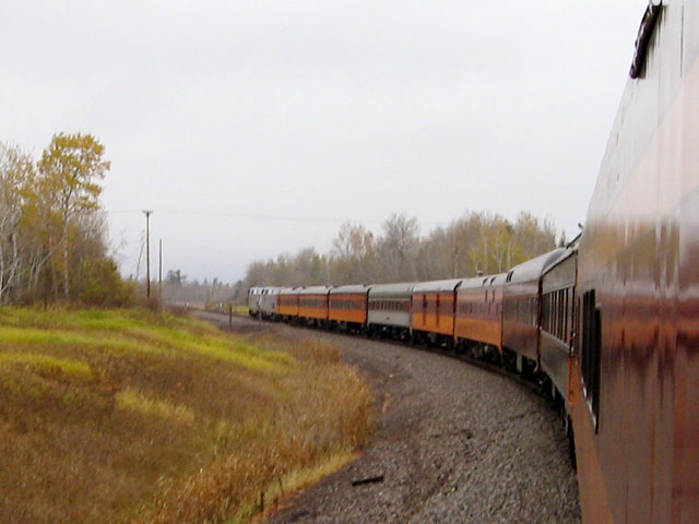
Friends of 261 Fall Train Ride The group of volunteers (members of the non-profit Railroading Heritage of Midwest Ameria), who support the Milwaukee Road Steam Locomotive #261 and classic railroading, operate a number of train excursions throughout the year. Included among these are a fall color train operating out of Minneapolis offering two trips on … Read more