Cedar Key, Florida Fun Gulf Beach Town

Cedar Key Beach

Affordable Vacation Beach Town

Whether RVing or Vacationing, are you looking to escape to get away from the madness of South Florida? Consider Scenic Cedar Key. It is a slow-pace Gulf Beach Town Gem along the Hidden Coast, with lots of fun and interesting things to do and places to see. Read On.


Although impacted by Hurricane Idalia, Cedar Key is quickly returning and open for business. With the help of hundreds of volunteers, the majority of the shops and restaurants have re-opened.


Top Ten Small Town Culture & Affordable Gulf Vacation Beach Town

Located on what is known as Florida’s Hidden Gulf Coast, the island city of Cedar Key has managed to retain its small town feel while providing a very hospitable vacation experience for visitors. USA Today ranks it in the best Top Ten Small Town culture scenes, # 6 in the nation and #1 in Florida. And UpGradedPoints rates Cedar Keys as the USA least expensive Vacation Beach Town.

Cedar Key has lots of neat shops and galleries, some great restaurants serving up some great seafood, top notch kayaking and paddle-boarding, island tours boat trips, charter fishing, sunning and swimming at the spacious Cedar Key Beach & city park, some interesting hiking trails, and just plain fun hanging out in a friendly island community.

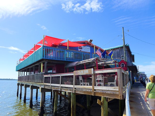
Cedar Key Florida Waterfront Restaurants
The restaurants and shops along Dock Street hangout over the water.

RVers Note: There are several RV campgrounds in and near Cedar Key and several choices in nearby Chiefland, Florida. We profile these camping options lower down this page, with descriptions and links.


Top Things to Do and See in Cedar Key, Florida

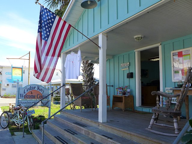
Cedar Key Florida Welcome Center
Stop at the Welcome Center for info on neat things to see and do.

See our list of Top 10 Things to Do, Places to see in Cedar Key, Florida

Kayaks, Swimming, Sunbathing, Picnicing at the City Beach and Park

cedar key public beach
Picnic, Swim or just relax and enjoy the breezes and sunshine at the city Beach and Park.

There is a decent city swimming and sunbathing beach adjacent to the city park that has picnic tables, a playground area, a pavilion, and a bath house. Nearby, within walking distance of the beach are several good restaurants and raw bars offering fresh seafood, some of which is locally caught.

Cedar Key Florida Beach & Kayaking
Kayaks are popular because the many bays and channels among the islands provide protection from big waves.

Cedar Key Dining and Entertaining

cedar key dockside restaurants
Many of the top restaurants and bars are located along dock street.

Most of the bars, restaurants, and boutiques are located along Dock Street which runs down the center of a narrow hook-shaped peninsula that juts out into the Gulf and Suwanee Sound. The buildings on the Gulf side of the street are built on stilts and actually sit out in the water.

See our reviews of Best Restaurants and Places to Eat in Cedar Key

Walking Around Downtown Cedar Key

Cedar Key Florida Artists Gallery
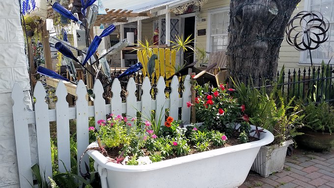
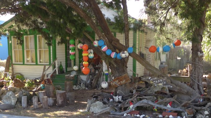
Cedar Key has its share of artists and artisans, including some with a sense of humor.

Cedar Key Emporium
Humorous artistic touches all around town
Cedar Key Cottages
One of several “unique” cottages in Cedar Key
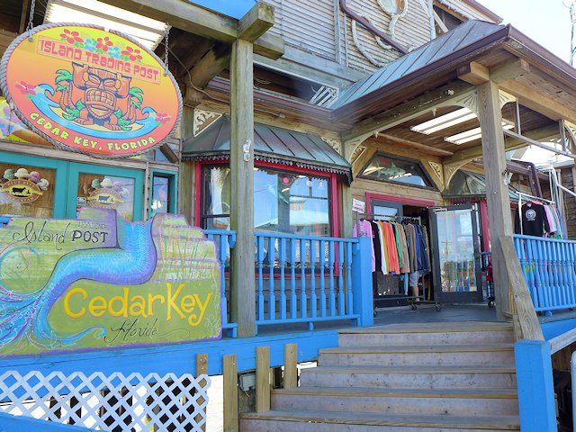
Cedar Key Florida Gift Shops Boutiques
Wouldn’t be a beach community without some gift shops and boutiques.

Away from downtown, there are some interesting walks along the Cemetery Point Trail and the Trestle Nature Trail (see them here)

While the town of Cedar Key is situated on about 6 islands, the Cedar Keys Wildlife Refuge that surrounds the town of Cedar Key has thirteen named islands, plus perhaps hundred more islands too small to have a name encircle the town. The many islands of the Cedar Keys Wildlife Refuge provide great shelter for kayaking and canoeing and also a chance to see dolphins, birds, and other wildlife or do some fishing.

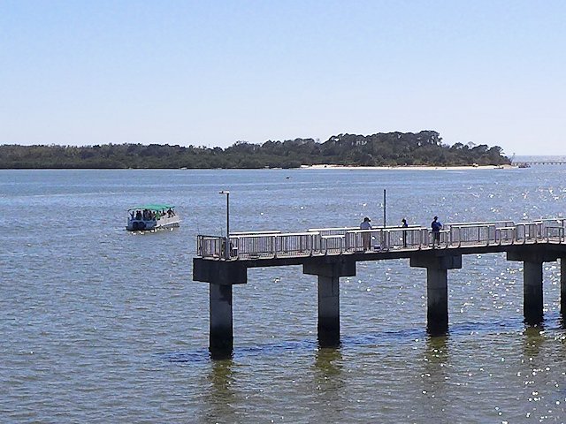
Cedar Key Fishing Pier
Cedar Key’s Fishing Pier, Swimming Beach of Atsena Otie Key in the background

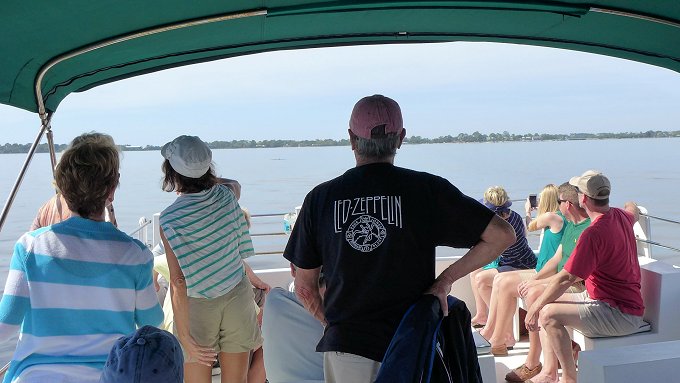
The Island Tours Boat Rides offers an interesting narrated tour of a few of the islands in the Keys. Seeing some dolphins is just about a guarantee as they seem to be attracted to the boat, as if they were hired performers!

Island Tour Boat Ride
Watching the Dolphins perform on the Island Tour Boat.

See our list of Top 10 Things to Do, Places to see in Cedar Key, Florida

Lodging in Cedar Keys

The town has a very hospitable beach resort community that is more laid-back and has far less commercial glitz than you’d find in Destin or Panama City Beach. There’s no high-rise resort buildings or huge apartment complexes. There are a few medium-size ocean-side condos and hotels, but a good deal of the lodging for visitors is provided in quaint cottages and mom & pop style motels.

Camping, Campgrounds, RV Parks Cedar Key, Florida

There are three private RV parks/campgrounds located within Cedar Key or within 5 miles of the center of town. As you might expect, you pay a premium to be located in or close to town. We drove through two of these three parks and found the sites too cramped together for our tastes.

Our favorite Cedar Keys RV Campground is a few miles out of town at the North end of the Keys Wildlife Refuge, Shell Mound County Park. The park offers both RV and Tent Camping and the nearby nature trails provide some interesting hiking and bird-watching.

**Shell Mound County Park Campground (see our review and article)

The nearby Cedar Keys Nature area offers a boardwalk, a fishing pier and a canoe/kayak landing. We camped at the County RV park and found the camp hosts very friendly and helpful. The RV sites offer water and electricity; the bath houses have running water and showers; and the campsite fees were quite reasonable. The campground is first come, first served – no reservations.

Can’t Find Campground Vacancies in or near Cedar Keys?

If you are willing to drive about 30 miles, there are several good RV camping options in Chiefland (see our reviews). One that we like is Manatee Springs State Park. The state park offers very nice RV sites, good spacing, nice shading, 8 miles of hiking trails, kayaking, biking, and swimming/snorkeling in the spring pool. And the rates are quite a bit less than the private parks nearer to town.

Another decent RV campground for visiting Cedar Keys area is Strawberry Fields RV Campground

Beside being able to get a reasonable campsite somewhat near Cedar Key, another reason we like to RV camp in Chiefland is the Chiefland Golf Course, only about a mile from Manatee Springs. We found it a nicely, maintained 18 hole golf course, with a friendly staff, and modestly priced green fees. It is also a very walk-able course.

More Places to Visit and Things to around Cedar Keys:

Have you been to Cedar Key Florida? If so tell us how you liked it in the comments below.

Your Scenic Travel Guide: Ross Reinhold

Reviewing the Airstream Bambi and its competitors

airstream bambi travel trailer

Is Airstream the Best Compact Tow Behind RV? What else comes close? The Airstream Travel Trailer is the benchmark in quality and luxury among RV campers. But before you buy there are 7 other brands and models you should consider before buying an Airstream. In this article, I review the 20 foot Airstream Bambi and … Read more

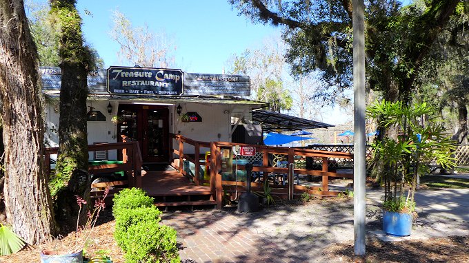
Treasure Camp Restaurant On the Suwannee

Treasure Camp on the Suwannee River

Best Seafood Restaurant Chiefland, Florida Great Seafood and Outdoor Dining on the Shores of the Suwannee River. In our opinion it is the best place to eat outside near Chiefland, FL. The Treasure Camp Restaurant & Resort is located along the famous historic Suwannee River about 14 miles South of Chiefland in the tiny village … Read more

Surprisingly Available RV Campground

Buccaneer State Park RV Site

Are you a Snowbird having trouble finding an RV site along the Gulf Coast? For Snowbird’s finding a decent and affordable Winter RV campground along the Gulf of Mexico drive from Mississippi to Florida is a challenge. We’ve found having to make a reservation a year in advance is normal. That degree of advance planning … Read more

Bay St. Louis

Downtown Old Bay St. Louis

Fun things to see and do in our Second Favorite Small Gulf Coast Town Bay St. Louis recently made USA Today’s list of 10 Top Coastal Small Towns (coming in at number 2) offering “unpretentious and affordable seaside fun without the crowds.” We agree. We first discovered Bay St. Louis and its’ historic Old Town … Read more

Shell Mound Campground – Cedar Key, Florida

Our rialta at shell mound campground

RV & Tent Camping: Cedar Keys National Wildlife Refuge and Shell Mound Park

Can’t find a vacancy at Cedar Key RV Campgrounds? Or you are choking on the prices. Here’s an alternative to check out.

Our favorite place to RV camp when visiting the fun and artsy Gulf Beach Town of Cedar Keys, is the Levy County Shell Mound Park. It is located about 8 miles North and East of the town of Cedar Key in Florida’s Cedar Keys Wildlife Refuge.

Shell Mound offers both RV campsites and tent campsites at prices considerably less than the fare in Cedar Key proper. There’s a pair of nice hiking/nature trails and a fishing pier nearby in the Wildlife Refuge and a boat launch for canoes and kayaks. 

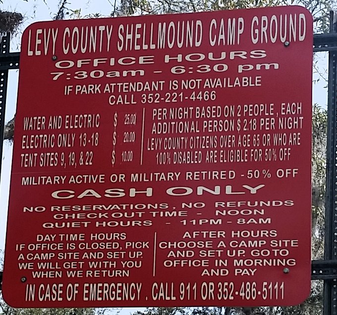
Most of Shell Mound’s RV sites have both electricity and water-hookups, but some are electric only and there are a few tent sites with no utilities. There is a full-service washroom/shower building and an RV dump site. The campground also has its own boat launch and a place to park trailers.  The campground managers are on-site during the day and we found themvanc very friendly and helpful.

Beside reasonable price, another outstanding feature of Shell Mound is there are no advance reservations, site occupancy is first come, first served. There’s a 7 day maximum stay, So even during popular times of the year, you might be able to get a site there. The camping fees are reasonable, even with a recent 50% increase.

shell mound campground cedar key florida
Shell Mound Campground
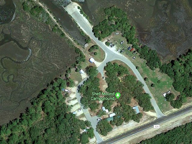
google map shell mound campground
campground – google maps

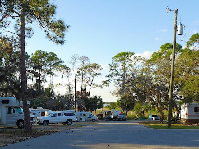
Since the campground is set within the Cedar Keys Wildlife Refuge it is remote, surrounded by woods and is generally quite quiet. The only noise we heard during our stay there was when an airboat launched at the boat landing. Some of the RV sites have a decent slope to them so some leveling blocks would be necessary for these particular sites. The road that circles through the park is paved and many sites are graveled. The camping sites  generally have some shade, and offer adequate separation from neighboring sites. The sites that are electric-only (no water and lower priced) are more open and on grass vs. partially graveled.

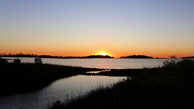
sunset shell mound county park
A pretty sunset behind our campsite at Shell Mound County Park

Directions to Shell Mound

From the town of Cedar Key it is about an 8 mile drive to the Shell Mound campground. You go north on Highway 24 about 3 miles, then left on Highway 347 for about 3 miles, and then turn left when you get to Highway 326. The park is near the end of the road.

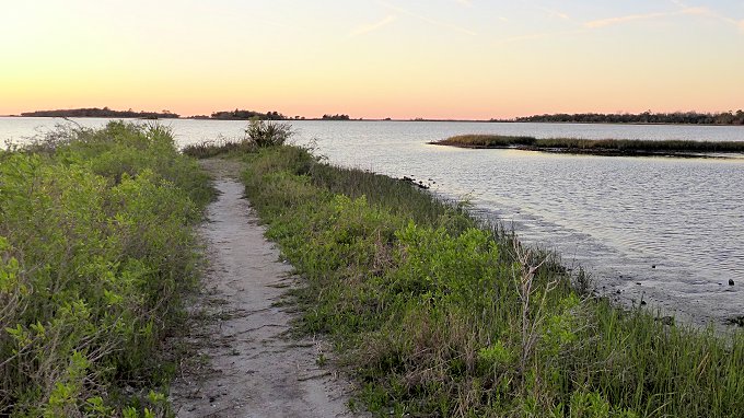
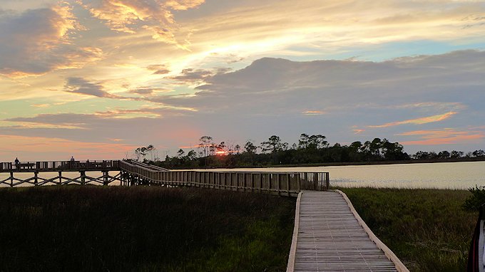
There’s a short trail near the boat launch that leads out to a spit of land providing a view of the bayou and islands of Suwannee Sound.

Bayou Trail, Shell Mount County Park
A trail behind our campsite led out to this spit of land
surrounded by water where we could watch the sun setting over the Gulf

Nearby Hiking Trails in the Wildlife Refuge

While technically not in the Levy County Park, within walking distance down the road are two interesting hiking/nature trails in the Cedar Key Wildlife Refuge that surrounds the county park.

Review: What to Like and Not Like About the Shell Mound County Campground

Likes

Reasonable Price.  Although the County increased the RV site rate 50% between our stay in 2018 and the recent one in 2020, it remains quite a bit more reasonable than those in or nearer the town of Cedar Key.

Convenient to the attractive Gulf Beach town of Cedar Key. It is less than a 10 mile drive to Cedar Key. Some campers with bikes will bike to town. The only portion where you might encounter any traffic is on Hwy 24 before the Cedar Key bridge. Once in town, you have slower speed limits and a bike path.

The Cedar Keys Nature Area & Hiking. The park is surrounded by the Shell Mound portion of the National Wildlife Refuge. Within walking distance down the dead end road that runs past the campground are the trail heads for two hiking/nature trails within the Refuge. There’s also small park there with boardwalk leading to an observation deck overlooking a portion of the Keys and a canoe/kayak launch area.

First Come, First Served Reservations. We like the fact the park offers no advance reservations. During the winter-spring season, it can be very difficult to get a campsite near a popular place like Cedar Key due to sites being reserved in advance. So the Shell Mound park means we have a chance to score a campsite mid-week at the last minute. During the day there is an office phone # you can call to see if the campground is full or not.

Review: What Not to Like About the Shell Mound County Campground

Airboat Noise. The boat ramp is apparently a popular launching site for locals who own flat bottomed airboats that are driven by huge aircraft propellers. While impressive to see, for those who have never seen on up close, the noise they make when taking off or arriving at the landing is deafening. You’ll most likely be treated to this experience Fridays – Sundays. The noise doesn’t last that long. Mainly it upsets people because it is such a stark contrast to what is otherwise a very peaceful and serene setting.

Sloping or Wet Campsites. Unless you get to the park early enough and/or during a non-busy period, your only site choices will be one of the very sloping campsites (so bring levelers) or parking on one of the low land, grass-covered sites that could get wet with a significant rainfall. So far, we’ve been lucky.

Old Washroom/Showers. While in general we’ve found the bathroom and showers clean, the washroom and showers fixtures are old and showing their age, and the building itself is a rustic cider block construction. But as I said it is clean and we found the hot water came quickly in the showers. 

Shell Mound Camping Rates and Reservation Information:

Shell Mound 2020 Rates

Other Cedar Keys Area RV Campgrounds

If you don’t mind paying a premium and being in a busier, more crowded campground here are your three choices:

More Good RV Campground Options Close enough to Cedar Key

A little further away (29 miles from Cedar Key) is Chiefland, Florida where the are some good RV Park & Camping options. During our previous stays in the Cedar Keys area we have also camped at the Manatee Springs State Park campground which is about 33 miles from the center of town. Manatee Springs has an excellent campground, reasonably-priced and offers other amenities we like. They do offer reservations so if you want to guarantee a camping spot for your visit to Cedar Keys, this is a good option.

Another very good RV camping option in Chiefland is Strawberry Fields RV Campground (see our review), a new facility on the East edge of town.

More Articles on Cedar Key Visitor Attractions:

Walking, Nature & Hiking Trails | Cedar Keys

Boardwalk Shell Mound

In addition to walking around artsy downtown and the cottages in the nearby historic district, Cedar Keys also offers some worthwhile and interesting nature trails within the town. You’d enjoy a nice walk on the Cemetery Point Trail and the Railroad Trestle Trail. Cedar Key Railroad Trestle Nature Trail This is an easy walk (2/3 … Read more

Reviews – Best Cedar Keys Restaurants

Duncans Gulf View Restaurant Cedar Key Florida

One of the fun things about Cedar Key is their collection of interesting and unique restaurants, pubs, and cafes. Great seafood, neat ambiance, comfortable breezes off the Gulf. Lots of entertainment choices in Cedar Key, Florida . . . one of our favorite Florida Gulf Coast towns. Below is our list of the Best places … Read more

Natchez Trace Scenic Drive

natchez trace national parkway

Natchez Trace National Parkway National Park

The Natchez Trace Parkway runs from Natchez, Mississippi to Nashville, Tennessee, about 440 miles. Traveling the Trace is an excellent way to step back in time to an era of the scenic road trip where you take the time to enjoy the trip itself. Trucks and commercial vehicles aren’t allowed on the parkway. Nor are billboards, stop lights, or commercial establishments. Along the roadsides, the human footprint is light, only a changing variety of scenery and topography provided by Mother Nature.

Along the route are numerous historical markers, restored historical sites and exhibits, rest stop parks, picnic areas, hiking trails, and public campgrounds. Within a short distance of the Trace are towns and communities with additional services and attractions, some of them with worthy scenic or historical value in of themselves.

The maximum speed along the Trace is 50 mph. The idea is a stress free, scenic, and enjoyable ride in an auto, RV, motorcycle, or road bike (there’s a special network of rustic campsites reserved for bike riders). A bonus is you can save gas by driving at a comfortable 50 mph without being hassled by drivers behind you.

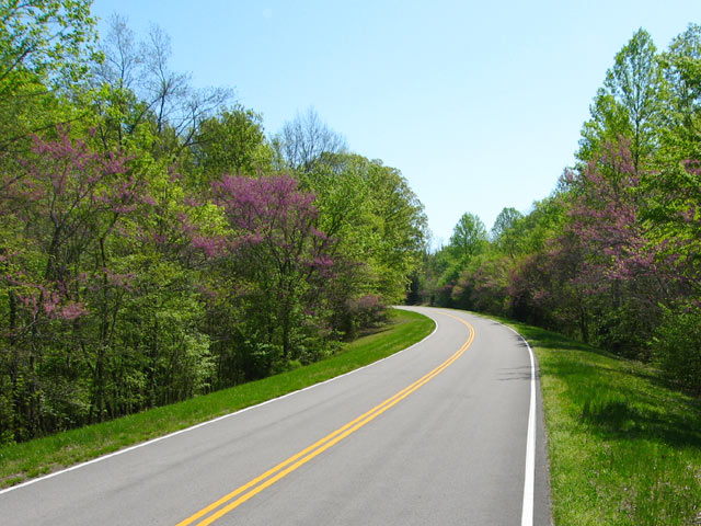
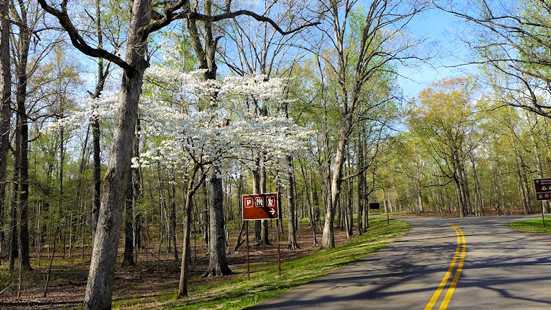
Natchez Trace Red Buds
Red Buds popping out along the Natchez Trace Parkway


History of the Old Trace

The parkway roughly follows the historic Natchez Trace, a trail whose roots goes back to the 1600s evolving from hunting trails used by the Natchez, Chickasaw, and Choctaw Indians. Around 1700 French explorers and traders established a trading post near the present day Natchez and later Fort Rosalie constructed as the European population in the area expanded. Conflicts with the native Natchez people ensued and by 1735 the Natchez Indian community in the area was essentially wiped out and the village of Natchez began to form.

For the next 50 years European influence expanded in the area between the lower Mississippi valley in Natchez and the Ohio River and Cumberland River valleys in the north.

By 1800 Nashville had become the most significant community in the Kentucky-Tennessee territory. Also by this time a defined trail had taken shape between Natchez and Nashville as an overland return route from farmers and traders who floated their crops and products down the Cumberland, Ohio, and then the Mississippi Rivers to markets in Natchez and New Orleans. With no practical way to navigate their craft back up the Mississippi River, the float boats that carried the cargo were disassembled and the lumber sold. Then the Boatmen had to walk or ride back home.

The Trace was the trail that formed from thousands of travelers following this path. Over time inns (called “stands”) and small communities grew up along this route to serve travelers along the trace. One of these inns, Mount Locust Inn & Plantation, has been restored and is open for daily tours from February through November.

By 1810 an estimated 10,000 Boatmen (called “Kaintucks”) were using the Trace and the two towns at either end (Natchez and Nashville) had become cemented as major communities.

Natchez Trace Articles


About the Natchez Trace Drive (this page)


Travelogue: Natchez Trace Parkway, Part 1


Meriwether Lewis Natchez Trace  Park


Visiting the Historic City of Natchez

natchez trace parkway
There are several pull-offs along the parkway where you can see portions of the original old trace.
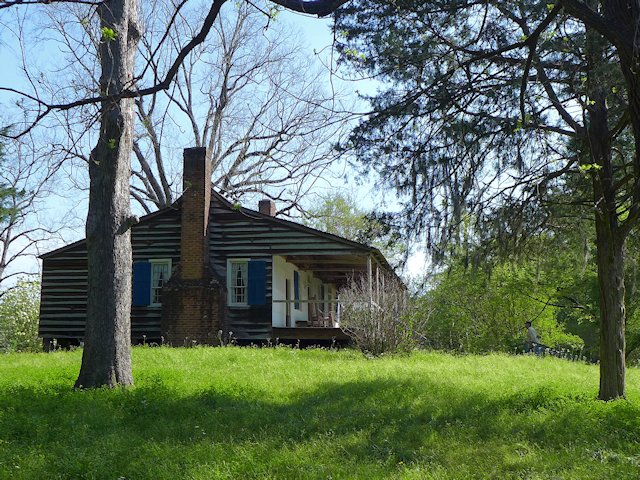
Mount Locust, Natchez Trace Parkway
Mount Locust, historic inn on the Natchez Trace

Nearby Places of Interest
Historic Natchez, Mississippi
Shiloh Military Park

The Natchez Trace – Our First National Road

In 1801 President Jefferson authorized construction of a national road along the Trace as a national security measure. Army troops began clearing brush and building bridges along the trail and in a few years a good section of the trail had been improved from a winding, narrow path to a wider more comfortable road for wagons and horses and began attracting numerous travelers in addition to the Boatmen.

From 1812 to 1815 the Trace was a major route used by Andrew Jackson’s Tennessee Volunteers during the War of 1812 and the 1815 Battle of New Orleans. By 1820 the invention of the Steamboat allowed two way travel up and down the Mississippi and Ohio rivers meant the Trace began to lose its main customers. In addition a new road, called Jackson’s Military Road was being constructed. This route cut about one third of the distance between Natchez and Nashville off the original Trace. By 1900, due to improvements in river travel and the competition from more recent roadways, the Trace had reverted to a wilderness state along much of its original course.

A portion of the historic Old Trace trail from Natchez to Nashville

Learn More – Natchez Trace Parkway Travelogue:

Natchez Trace National Parkway Website

Best Compact RV Motorhomes from Winnebago

Winnebago Grand National Rally

Review of top small Class C and Class B Winnebago motorhomes for 2022 The 2021 Winnebago Grand National Rally in Forest City, Iowa provided my wife Jo and I an opportunity to personally inspect the 2022 offerings from Winnebago in the compact motorhome and camper van market segment. I not only wanted informative content for … Read more

Best Camper Vans

Interior of Winnebago Solis

Camper Vans Reviews in this article: Winnebago Solis & Solis PX, Solis Pocket, PleasureWay Tofino, and Thor Tollaro In an earlier article on featuring Modular Conversion Camper Vans, I commented that major RV manufacturers need to create what is essentially a successor to the venerable VW Bus-Camper Van, an affordable camper van that doesn’t require … Read more

Best Like New Compact RV Motorhomes

Thor Compass RV

This is an older article reviewing the best of small motorhomes. I am republishing it for the benefit of RVers who are looking for a good used or pre-owned compact motorhome. Ross Reinhold, editor and publisher For new smaller, compact motorhomes see our 2021-22 Update to our Best Compact RV Motorhomes – so check it … Read more

Traveling The Modern Natchez Trace Parkway

A Great Road Trip

One of the most scenic and stress free road trips you can take. In the Spring you can catch the blooming Red Buds, Dogwoods, and wildflowers. In the fall beautiful colors as the leaves are changing.

The Natchez Trace Parkway begins north of the city of Natchez (see our article on Visiting historic Natchez, Mississippi), the oldest town on the Mississippi River and the southern terminus of the historic Natchez Trace. The parkway runs 444 miles, through three States, ending south of Nashville, Tennessee.

There are some interesting small towns along the route and hundreds of wayside stops with some sort of scenic or historical interest along the Parkway. Rated by Mike and Jen of RVlifestyle.com as their favorite RV road trip in the US. We agree and highlight below some of our favorite points of interest along the Trace.

The rooms in the old Mount Locust Inn, with period furnishings, are open for viewing.

Our Favorite Points of Interest Along the Natchez Trace:

Mount Locust, Milepost 15.5

Traveling north from Natchez, one of the first stops you should make along the Trace is at Mount Locust, milepost 15.5. Back in the day, this was Day 1 on the Boatman’s trip back to the Ohio Valley. The stand was originally constructed as a farm homestead in 1780. But being in the right place at the right time encouraged later owners, the William Ferguson family, to open up a crude inn to serve the growing number of travelers. Eventually an annex was constructed to better meet the need. The Inn has been restored and is open for daily tours from February through November. See link to Mt. Locust Brochure.

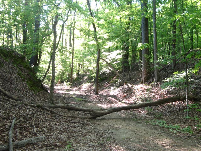
Sunken Trace, Milepost 41.5 – At several points along the parkway the “old Trace” intersects with or comes close to the Parkway. At mile marker 41.5 is one of many rest stops where you can walk to and through a portion of the original Trace.

Old Natchez Trace sunken trail

Rocky Springs, Milepost 54.8 – The former community of Rocky Springs is now a park, picnic site and rustic campground. A self-guided trail leads to the location of the former village and to the graveyard and old church that are all that remain of a village that once held over 2000 souls. Map of Rocky Springs Campground & Historical Site

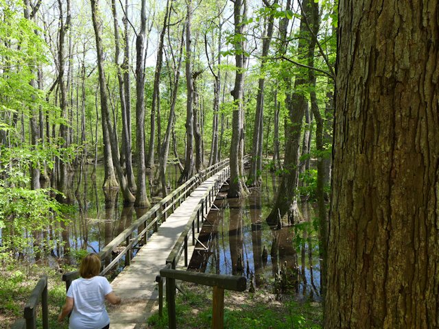
Cypress Swamp, Milepost 122.0 – At mile marker 122 you’ll have an opportunity to stretch your legs with a half-mile loop annotated nature trail through a Cypress and Water Tupelo Swamp. We saw a baby alligator sunning itself on a little island in the swamp pond.

cypress swamp natchez trace
The nature trail begins with a boardwalk through the center of the swamp.

Holly Hill Rest Stop, Mile Marker 154.3 – One of 44 picnic areas along the Trace. There is picnic tables and accessible rest rooms.

Holly Hill Rest Stop, Natchez Trace
Holly Hill Rest Stop, Mile Marker 154.3, one of 44 picnic areas along the Natchez Trace

French Camp, Milepost 180.7 – A “stand” (inn) was established here in 1812 serving travelers along the Trace. Later in 1822 it added a school, which exists to this day. Included in the restored complex, joined by a boardwalk, are a cafe, gift shop, visitor center, log cabin, crafts center, and sorghum making center. An interesting historical stop, an opportunity to stretch your legs, and get a bite to eat.

Link to Historic French Camp Village website

French Camp, Natchez Trace
Blacksmith Shop and Barn of the French Camp
French Camp
The Drane House, an 1845 restored antebellum home is open for tours

Jeff Busby Park, Milepost 193.1 – Named for Mississippi Congressman Thomas Jefferson Busby (whose bill created the Parkway), the park has a visitor exhibit area, a nice picnic area with tables, grills, and parking, a 22 site campground, restrooms, hiking trails, and a mountain top overlook that is one of the highest points in Mississippi.

Jeff Busby Campground & Picnic Area Map – Jeff-Busby-map

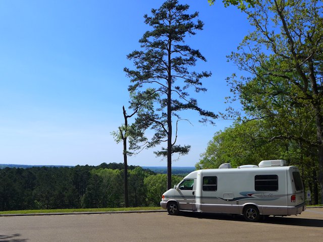
Jeff Busby Overlook
The Scenic Overlook picnic area at the Jeff Busby Trace Park.

Natchez Trace Parkway Visitor Center, Tupelo, Mississippi, Milepost 266.0

The Natchez Trace Parkway Visitor Center has a twelve-minute orientation film, interpretive displays about the natural and cultural history of the Natchez Trace, as well as an Eastern National Bookstore. A park ranger is available from 8:00 am to 5:00 pm daily (except Christmas Day) to answer any questions you may have. This is also the location to get your passport stamps for the Natchez Trace Parkway, Natchez Trace National Scenic Trail, Tupelo National Battlefield, and Brices Cross Roads National Battlefield.

Visitor Center Events Calendar


Visit the Shiloh National Military Park
Exit at Mile Marker 293
Visitor Centers at Corinth &
Shiloh Battlefield


Detour – As of April 4, 2022 a section of the Trace between mile markers 293 and 321
remains closed for repairs. Here is the detour route.


Meriwether Lewis Site Milepost 385.9

This is the largest and most impressive of the 3 campground-parks actually on the Trace. It site has a campground, modern washrooms, picnic areas, some decent hiking trails, and a historical exhibit on famed explorer Meriwether Lewis, including a monument erected at the site of his burial and a replication of the Grinder House, the “Stand” where Lewis stayed over-night on his way back East and mysteriously died of gunshot wounds in the middle of the night. Exhibits tell the story of that evening, plus other significant aspects of Lewis’ history.

Merriweather Lewis Campground
Relaxing at the Meriwether Lewis Campground, Natchez Trace Parkway

While the campground has no utilities it has paved and reasonably level parking areas for RVs. Each wooded site has a picnic table, a fire pit, trash bin, and nice separation from adjacent sites. Like all the National Forest Campgrounds along the trace, it is first come, first serve for campsites so best to get there early in the afternoon or it will be full.

See more photos and info on things to do and see at Meriwether Lewis Park and Campground here.


Camping Along the Natchez Trace

The National Park maintains three improved campgrounds along the Trace (all of which were profiled above): Rocky Springs, Jeff Busby, and Meriwether Lewis. In addition there are several rustic campgrounds reserved for bikers or hikers. Within a few miles of the Trace are both private and public campgrounds with utilities for RVs. This page has links to State Parks convenient to the Trace.

Morning Fog across the Lake at Tishomingo State Park along the Natchez Trace Parkway

More Natchez Trace Links & Publications

National Parks Directory – ScenicPathways

Natchez Trace Articles on Scenic Pathways

Meriwether Lewis Park – Natchez Trace

Meriwether Lewis Park Natchez Trace Parkway

Meriwether Lewis Park, Campground & Monument

The Merriwether Lewis Wayside Stop on the Natchez Trace is our favorite of all the significant points of interest. It is the site of Grinders Stand, made famous due to it being the place where famed explorer Meriwether Lewis died of mysterious circumstances. The Meriwether Lewis monument marks his burial site.

Another attraction of the site is being able to walk a portion of the original Old Natchez Trace that runs through the park. The old trace section also intersects with a network of other trails within this wayside stop.

A third attraction is the largest and most nicely landscaped of the 3 campgrounds that are located on the Trace itself.


Natchez Trace Articles on Scenic Pathways
History-Introduction Natchez Trace
Travelogue: Highlights along The Trace Parkway
Meriwether Lewis Natchez Trace  Park (this page)


Grinders Stand and Meriwether Lewis Last Night

On his way to Washington DC to defend himself against charges of improper expenditures, Meriwether Lewis traveled on a portion of the Trace. On October 10th he stayed overnight at Grinders Stand, a wayside inn on the Trace trail.

During the night gunshots were heard and Lewis was found dead of gunshot wounds. Some reports allege he died at his own hand; others suggest he was murdered. A sad and mysterious end to one of America’s most famous explorers.

Lewis is buried about 200 yards from the old inn and along the original Trace. In 1848 the state of Tennessee erected a monument over the grave site. Some exhibits accompany the replica of Grinders Stand built on the site of the original. Exhibits tell the story of that evening, plus other significant aspects of Lewis’ history. See MLewis-Site-Bulletin

A replica of the original Grinders Stand Inn where Lewis spent his last fateful night.
A replica of the original Grinders Stand Inn where Lewis spent his last night.
Meriwether Lewis Gravesite
Corps of Discovery explorer Meriwether Lewis is buried here along the Old Trace.

Meriwether Lewis Hiking Trails

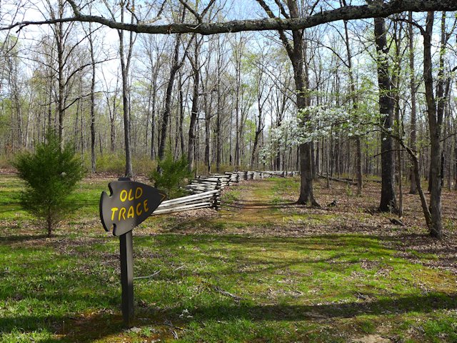
Old Trace Trail
Old Trace Hiking Trail from the Meriwether Lewis grave site.

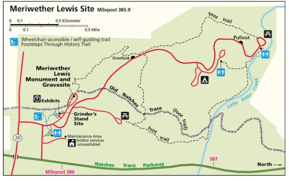
There is a four mile loop hiking trail that starts at the Lewis grave site and eventually runs along Little Swan Creek where it intersects with the Old Natchez Trace foot trail. A few other spur trails criss-cross this network. We found walking on the Old Trace trail fairly easy to follow from the grave site to one of the picnic grounds in the park. But based on reports I’ve read some other portions of the hiking trail are less well-traveled and more difficult to follow.

We did a loop following the Old Trace til it intersected with the spur trail to the picnic area and then returned along the road.

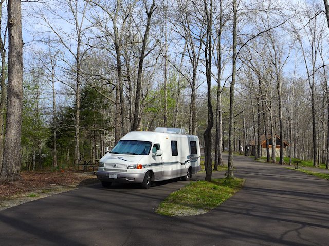
Meriwether Lewis Campground

Meriwether Lewis campgound
We found a nice level RV site not too far from the washrooms.

Of the three drive-in campgrounds along the Trace, Meriwether Lewis is the largest and most improved. The bathroom building is clean, heated, well lighted with sinks and toilets (not vault toilets). The campground roads and sites are fully paved and the sites are quite level. There’s also a well pump faucet for adding water to your RV. No dump site nor electric service. But otherwise a very well maintained campground with an attractive camping fee – $0.0!

During peak travel times, you may have trouble finding a vacant camping site as this is a very popular stop along the Trace. David Crockett State Park is not too far away and would be an option for those camping or RVing.

Camping Along the Natchez Trace

The National Park maintains three improved campgrounds along the Trace (all of which were profiled above): Rocky Springs, Jeff Busby, and Meriwether Lewis. In addition there are several rustic campgrounds reserved for bikers or hikers. Within a few miles of the Trace are both private and public campgrounds with utilities for RVs. This page has links to State Parks convenient to the Trace.

Natchez Trace Links & Publications