Traveling The Modern Natchez Trace Parkway

A Great Road Trip

One of the most scenic and stress free road trips you can take. In the Spring you can catch the blooming Red Buds, Dogwoods, and wildflowers. In the fall beautiful colors as the leaves are changing.

The Natchez Trace Parkway begins north of the city of Natchez (see our article on Visiting historic Natchez, Mississippi), the oldest town on the Mississippi River and the southern terminus of the historic Natchez Trace. The parkway runs 444 miles, through three States, ending south of Nashville, Tennessee.

There are some interesting small towns along the route and hundreds of wayside stops with some sort of scenic or historical interest along the Parkway. Rated by Mike and Jen of RVlifestyle.com as their favorite RV road trip in the US. We agree and highlight below some of our favorite points of interest along the Trace.

The rooms in the old Mount Locust Inn, with period furnishings, are open for viewing.

Our Favorite Points of Interest Along the Natchez Trace:

Mount Locust, Milepost 15.5

Traveling north from Natchez, one of the first stops you should make along the Trace is at Mount Locust, milepost 15.5. Back in the day, this was Day 1 on the Boatman’s trip back to the Ohio Valley. The stand was originally constructed as a farm homestead in 1780. But being in the right place at the right time encouraged later owners, the William Ferguson family, to open up a crude inn to serve the growing number of travelers. Eventually an annex was constructed to better meet the need. The Inn has been restored and is open for daily tours from February through November. See link to Mt. Locust Brochure.

Sunken Trace, Milepost 41.5 – At several points along the parkway the “old Trace” intersects with or comes close to the Parkway. At mile marker 41.5 is one of many rest stops where you can walk to and through a portion of the original Trace.

Old Natchez Trace sunken trail

Rocky Springs, Milepost 54.8 – The former community of Rocky Springs is now a park, picnic site and rustic campground. A self-guided trail leads to the location of the former village and to the graveyard and old church that are all that remain of a village that once held over 2000 souls. Map of Rocky Springs Campground & Historical Site

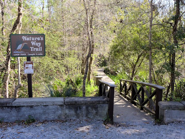
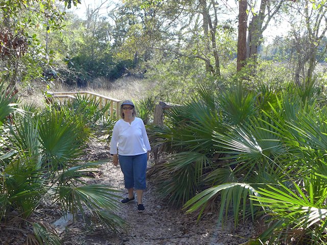
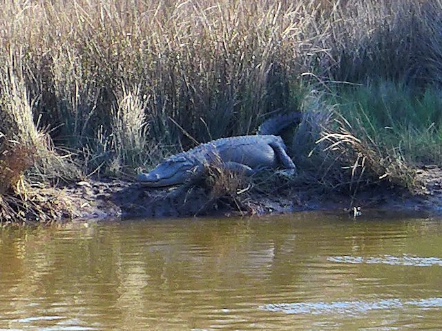
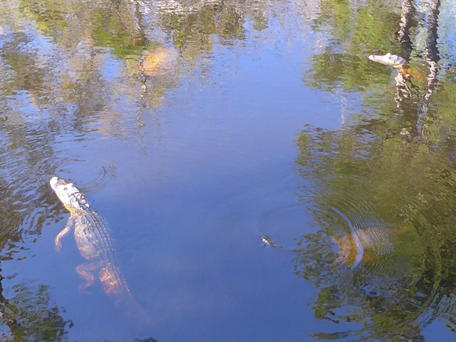
Cypress Swamp, Milepost 122.0 – At mile marker 122 you’ll have an opportunity to stretch your legs with a half-mile loop annotated nature trail through a Cypress and Water Tupelo Swamp. We saw a baby alligator sunning itself on a little island in the swamp pond.

cypress swamp natchez trace
The nature trail begins with a boardwalk through the center of the swamp.

Holly Hill Rest Stop, Mile Marker 154.3 – One of 44 picnic areas along the Trace. There is picnic tables and accessible rest rooms.

Holly Hill Rest Stop, Natchez Trace
Holly Hill Rest Stop, Mile Marker 154.3, one of 44 picnic areas along the Natchez Trace

French Camp, Milepost 180.7 – A “stand” (inn) was established here in 1812 serving travelers along the Trace. Later in 1822 it added a school, which exists to this day. Included in the restored complex, joined by a boardwalk, are a cafe, gift shop, visitor center, log cabin, crafts center, and sorghum making center. An interesting historical stop, an opportunity to stretch your legs, and get a bite to eat.

Link to Historic French Camp Village website

French Camp, Natchez Trace
Blacksmith Shop and Barn of the French Camp
French Camp
The Drane House, an 1845 restored antebellum home is open for tours

Jeff Busby Park, Milepost 193.1 – Named for Mississippi Congressman Thomas Jefferson Busby (whose bill created the Parkway), the park has a visitor exhibit area, a nice picnic area with tables, grills, and parking, a 22 site campground, restrooms, hiking trails, and a mountain top overlook that is one of the highest points in Mississippi.

Jeff Busby Campground & Picnic Area Map – Jeff-Busby-map

Jeff Busby Overlook
The Scenic Overlook picnic area at the Jeff Busby Trace Park.

Natchez Trace Parkway Visitor Center, Tupelo, Mississippi, Milepost 266.0

The Natchez Trace Parkway Visitor Center has a twelve-minute orientation film, interpretive displays about the natural and cultural history of the Natchez Trace, as well as an Eastern National Bookstore. A park ranger is available from 8:00 am to 5:00 pm daily (except Christmas Day) to answer any questions you may have. This is also the location to get your passport stamps for the Natchez Trace Parkway, Natchez Trace National Scenic Trail, Tupelo National Battlefield, and Brices Cross Roads National Battlefield.

Visitor Center Events Calendar


Visit the Shiloh National Military Park
Exit at Mile Marker 293
Visitor Centers at Corinth &
Shiloh Battlefield


Detour – As of April 4, 2022 a section of the Trace between mile markers 293 and 321
remains closed for repairs. Here is the detour route.


Meriwether Lewis Site Milepost 385.9

This is the largest and most impressive of the 3 campground-parks actually on the Trace. It site has a campground, modern washrooms, picnic areas, some decent hiking trails, and a historical exhibit on famed explorer Meriwether Lewis, including a monument erected at the site of his burial and a replication of the Grinder House, the “Stand” where Lewis stayed over-night on his way back East and mysteriously died of gunshot wounds in the middle of the night. Exhibits tell the story of that evening, plus other significant aspects of Lewis’ history.

Merriweather Lewis Campground
Relaxing at the Meriwether Lewis Campground, Natchez Trace Parkway

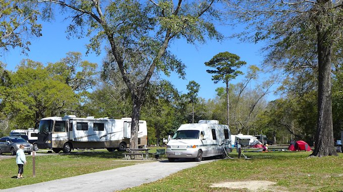
While the campground has no utilities it has paved and reasonably level parking areas for RVs. Each wooded site has a picnic table, a fire pit, trash bin, and nice separation from adjacent sites. Like all the National Forest Campgrounds along the trace, it is first come, first serve for campsites so best to get there early in the afternoon or it will be full.

See more photos and info on things to do and see at Meriwether Lewis Park and Campground here.


Camping Along the Natchez Trace

The National Park maintains three improved campgrounds along the Trace (all of which were profiled above): Rocky Springs, Jeff Busby, and Meriwether Lewis. In addition there are several rustic campgrounds reserved for bikers or hikers. Within a few miles of the Trace are both private and public campgrounds with utilities for RVs. This page has links to State Parks convenient to the Trace.

Morning Fog across the Lake at Tishomingo State Park along the Natchez Trace Parkway

More Natchez Trace Links & Publications

National Parks Directory – ScenicPathways

Natchez Trace Articles on Scenic Pathways

Meriwether Lewis Park – Natchez Trace

Meriwether Lewis Park Natchez Trace Parkway

Meriwether Lewis Park, Campground & Monument

The Merriwether Lewis Wayside Stop on the Natchez Trace is our favorite of all the significant points of interest. It is the site of Grinders Stand, made famous due to it being the place where famed explorer Meriwether Lewis died of mysterious circumstances. The Meriwether Lewis monument marks his burial site.

Another attraction of the site is being able to walk a portion of the original Old Natchez Trace that runs through the park. The old trace section also intersects with a network of other trails within this wayside stop.

A third attraction is the largest and most nicely landscaped of the 3 campgrounds that are located on the Trace itself.


Natchez Trace Articles on Scenic Pathways
History-Introduction Natchez Trace
Travelogue: Highlights along The Trace Parkway
Meriwether Lewis Natchez Trace  Park (this page)


Grinders Stand and Meriwether Lewis Last Night

On his way to Washington DC to defend himself against charges of improper expenditures, Meriwether Lewis traveled on a portion of the Trace. On October 10th he stayed overnight at Grinders Stand, a wayside inn on the Trace trail.

During the night gunshots were heard and Lewis was found dead of gunshot wounds. Some reports allege he died at his own hand; others suggest he was murdered. A sad and mysterious end to one of America’s most famous explorers.

Lewis is buried about 200 yards from the old inn and along the original Trace. In 1848 the state of Tennessee erected a monument over the grave site. Some exhibits accompany the replica of Grinders Stand built on the site of the original. Exhibits tell the story of that evening, plus other significant aspects of Lewis’ history. See MLewis-Site-Bulletin

A replica of the original Grinders Stand Inn where Lewis spent his last fateful night.
A replica of the original Grinders Stand Inn where Lewis spent his last night.
Meriwether Lewis Gravesite
Corps of Discovery explorer Meriwether Lewis is buried here along the Old Trace.

Meriwether Lewis Hiking Trails

Old Trace Trail
Old Trace Hiking Trail from the Meriwether Lewis grave site.

There is a four mile loop hiking trail that starts at the Lewis grave site and eventually runs along Little Swan Creek where it intersects with the Old Natchez Trace foot trail. A few other spur trails criss-cross this network. We found walking on the Old Trace trail fairly easy to follow from the grave site to one of the picnic grounds in the park. But based on reports I’ve read some other portions of the hiking trail are less well-traveled and more difficult to follow.

We did a loop following the Old Trace til it intersected with the spur trail to the picnic area and then returned along the road.

Meriwether Lewis Campground

Meriwether Lewis campgound
We found a nice level RV site not too far from the washrooms.

Of the three drive-in campgrounds along the Trace, Meriwether Lewis is the largest and most improved. The bathroom building is clean, heated, well lighted with sinks and toilets (not vault toilets). The campground roads and sites are fully paved and the sites are quite level. There’s also a well pump faucet for adding water to your RV. No dump site nor electric service. But otherwise a very well maintained campground with an attractive camping fee – $0.0!

During peak travel times, you may have trouble finding a vacant camping site as this is a very popular stop along the Trace. David Crockett State Park is not too far away and would be an option for those camping or RVing.

Camping Along the Natchez Trace

The National Park maintains three improved campgrounds along the Trace (all of which were profiled above): Rocky Springs, Jeff Busby, and Meriwether Lewis. In addition there are several rustic campgrounds reserved for bikers or hikers. Within a few miles of the Trace are both private and public campgrounds with utilities for RVs. This page has links to State Parks convenient to the Trace.

Natchez Trace Links & Publications


Hot Springs Park Campground

Hot springs naitonal park campground

Review of Gulpha Gorge Campground at Hot Springs National Park, Hot Springs Arkansas

The Hot Springs National Park campground is located on the east side of Hot Springs Mountain, in a wooded setting, isolated from the urban area. The Gulpha Gorge creek runs along the edge of the campground and several camp sites overlook the creek.

The Hot Springs Campground is very tidy clean and well-maintained. The roads through the park are fully paved, There are 44 sites with full-hookups, including sewer. All sites have level or close to level paved parking pads. Each site has a concrete picnic table and elevated BBQ grill. There is adequate space between camp sites. Tall trees provide good shade for most sites.

One of the top features we like about the Gulpha Gorge campground is that sites are only available on a first-come, first-served basis. You cannot make reservations in advance. Occupancy is limited to 14 days.

The modern washrooms are well-maintained, but there are no showers. All waste disposal bins are animal proof. There is a RV dump station and fresh water fill station. Other amenities are a day use picnic area and an amphitheater with sturdy bench seating. The park staff occasionally presents programs at the theater.

hot springs campground
Gulpha Gorge Campground, Hot Springs National Park
Hot Springs Campground
Hot Springs Campground Map

Hot Springs Hiking Trails

For us a most attractive feature of the campground is the trail head at the Gulpha Gorge Campground has access to the extensive network of trails on Hot Springs Mountain. The trails vary from easy walking trails to more rugged to allow people to progress gradually to more strenuous exercise.
Leading from the campground, the Gulpha Gorge trail goes to the top of the mountain.

One of our favorite day hikes is taking the Gulpha Gorge trail that runs to top of eastern side of Hot Springs Mountain. Part way up is the intersection with the Goat Rock Trail which leads to Goat Rock, an outcropping with a panoramic view east. If you continue on the trail past the Rock, it eventually ends at the top of the Mountain where you can intersect with the Gulpha Gorge trail for your return leg of your hike. A great 90 minute exercise with a number of scenic views.

Jo about to climb the stairs to the Goat Rock overlook.
Great view from the top of Goat Rock.

Another favorite hike is taking the trail all the way to downtown Hot Springs and Bathhouse Row.

Situated in a valley in the Zig-Zag mountain range the city of Hot Springs is surrounded by hills. The Hot Springs National Park (see our article here) begins in the center of the city and encompasses the mountains to the east and west. So only minutes from downtown Hot Springs you can be in the woods several hundred feet above all the hustle and bustle of the city. Hot Springs became a center for physical therapy not only because of its abundant hot springs, but also because an extensive network of hiking trails were built in the hills surrounding the city to provide an exercise program to supplement the hot spring treatment.

Hot Springs National Park Links:

Arkansas Scenic Drives: Highway 7 Scenic Byway

–Ross

Hot Springs National Park

Hot Springs National Park Springs

Hot Springs National Park – Camping, Hiking, and Scenic Attractions

Located near the southern end of Arkansas Scenic Highway 7, Hot Springs National Park is located in the center of the city of Hot Springs while also set in the mountains surrounding the town.

Situated in a valley in the Zig-Zag mountain range, Hot Springs is surrounded by hills. The National Park begins in the center of the city and encompasses the mountains to the east and west. So only minutes from downtown Hot Springs you can be in the woods several hundred feet above all the hustle and bustle of the city.

Hot Springs became a center for physical therapy not only because of its abundant hot springs, but also because an extensive network of hiking trails were built in the hills surrounding the city to provide an exercise program to supplement the hot springs spa treatments. The trails vary from easy walking trails to more rugged to allow people to progress gradually to more strenuous exercise.

The Promenade Walk runs above Bath House Row and overlooks downtown.

Hiking and Backpacking Trails

The primary trail network is on Hot Springs Mountain with downtown Hot Springs and Bathhouse Row anchoring the western foot of the mountain. The Gulpha Gorge park and campground anchors the eastern foot of the mountain.
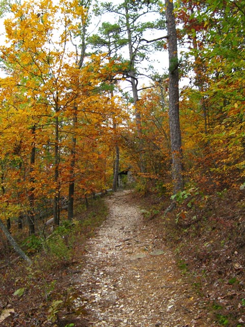
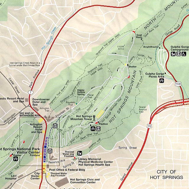
The trail to the top of Hot Springs Mountain from Gulpha Gorge
Map of hiking trails hot springs national park
Hiking Trails between the Gulpha Gorge Campground and Bathhouse Row

In all there are 23 hiking trails but since many intersect with one another there are many more route options than the 23. The Hot Springs Mountain trails in turn link to other trails on adjacent mountains and hillsides: North Mountain, West Mountain, Music Mountain, and Sugarloaf Mountain.

The only campground in the park is at Gulpha Gorge so overnight backpackers would simply plan a route that would return them to Gulpha Gorge by the end of the day. Day hikers have the choice of several trail heads sprinkled throughout the park. Here’s a list of the hiking and walking trails from the Park Website.

Bath House Row

The “Hot Springs” and the spa bath houses offer both a historical  and medicinal attractions. The National Park Visitor Center is located in BathHouse Row – see our article here within one of the historic bathhouses – The Fordyce. The Fordyce Bath House has been restored to be a museum of how it was in the hay day of the Bath Houses. Free self-guided tours are available as well as narrated tours and a film on the history of the bath houses. There are a few bath houses remaining in operation and others have been restored but re-purposed for other uses.

Bathhouse Row Hot Springs National Park
Bath House Row Downtown Hot Springs

Gulpha Gorge Campground at Hot Springs National Park

When visiting Hot Springs, we generally stay at the Gulpha Gorge campground in Hot Springs National Park (see our review here). Located on the east side of Hot Springs Mountain, it is convenient to downtown Hot Springs, yet in a wooded setting, isolated from the urban area. It is an attractive campground among tall pine trees along Gulpha Creek.

Scenic Mountain Drives & Overlooks

Non-hikers can drive to the top of Hot Springs and West Mountain summits. There are several scenic lookouts along the drives as well as some picnic areas. At the top of Hot Springs Mountain is the 10 story Hot Springs Tower with an observation deck at the top. (The Tower is a commercial operation that charges a fee to visit the observation deck.)

Other Scenic Drives. Another scenic drive is south of Hot Springs to the top of Jack Mountain. West of Hot Springs is the Quachita Mountains and Lake Quachita. A nice day trip is a scenic 80 mile loop around Lake Quachita out to Mt. Ida and back to Hot Springs.
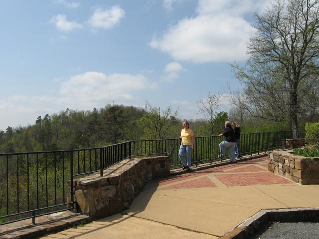
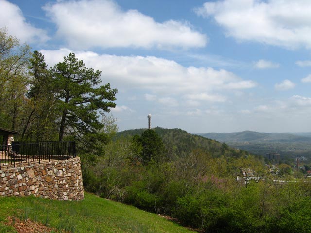
West Mountain, Hot Springs, AR
At the top of West Mountain looking towards Music Mountain, Hot Springs, AR
West Mountain, Hot Springs Tower
View from the top of West Mountain looking towards the Hot Springs Tower

Dining and Entertainment

Hot Springs National Park is quite large – 5500 acres – and almost completely surrounded by the city of Hot Springs. The centerpiece of the park – Bathhouse Row – stretches along the south side of Central Avenue. Across the street from Bathhouse Row, on the north side, is the center of the dining and entertainment district of downtown Hot Springs.

Restaurant Review: Steinhaus Keller

Down the street a little west of Bathhouse Row is one of our favorite Hot Springs restaurants and pubs. Formerly known as the Brau Haus which closed sometime in 2013, it has been re-opened at the same location as Steinhaus Keller. It is located in the lower level of a three or four story atrium in an area called Spencer’s Corner. Being below street level, it is not easily seen from the sidewalk. Above Steinhaus Keller and more prominently signed and easily noticed is Brick House Grill, known locally as offering the best burgers in town. Next time we are in town we’ll have to try them out.
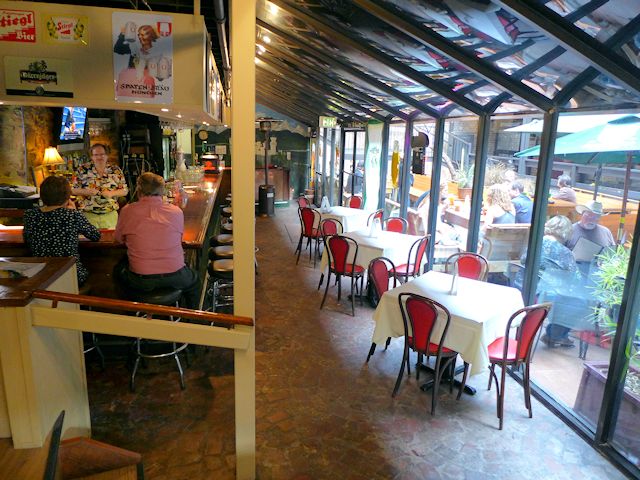
Steinhaus Keller German Restaurant Hot Springs
You can dine outside in the atrium, inside at the bar overlooking the atrium, or in their intimate dining room

But on our most recent visit in late March 2014, we had our palates set for some good German food. I had their Sauerbraten and Jo had the Wienerschnitzel – both excellent meals, including our side dishes. The wait service was attentive, friendly, and professional. They offered a very good selection of beers from Germany, Austria, and eastern Europe. Jo had a black lager and I had an Oktoberfest. We noticed that the guy behind the bar was the same as when we ate there a few years ago and then it seemed he had an ownership interest in it. Don’t know the history on why the Brau Haus closed, but based on this recent visit we give the current iteration under a new name a strong recommendation.

More Hot Springs Restaurant Reviews

More Links to Hot Springs Attractions:

–Ross


Fort Pickens National Park Review

Camping and Visiting Fort Pickens & Gulf Islands National Seashore Park – Pensacola Beach, Florida

Top 10 things to do at Fort Pickens Gulf Islands Park & Campground?

  • Go beach combing, swimming, and sunbathing on sparsely populated white sand beaches on the Gulf of Mexico.
  • Tour the historic Fort Pickens and Island Gun Batteries and learn about the military history of the Fort and of Santa Rosa Island.
  • Hike the several hiking and nature trails in the park.
  • Bird-Watching. Over 280 species of birds have been identified on the gulf barrier islands.
  • Visit the Gulf Islands Discovery Center to explore exhibits on the natural environment, wildlife, and history of the Fort Pickens Area.
  • Bike the roads in the park and bike the 6 mile road between the park and the fun things to do in Pensacola Beach.
  • Camping in a tent or RV in one of the full-service campsites or in a group the more rustic backcountry sites. (See our Fort Pickens Campground Review here)
  • Like Fishing? Fort Pickens does have a fishing pier that extends out into Pensacola Bay.
  • If staying in the campground, enjoy numerous attractions in the nearby vacation community of Pensacola Beach and the larger city of Pensacola across the bay from the park. At the end of this article are several links to interesting things to see and do in the area.
  • Watch the famed Blue Angels Flight team from the Fort Pickens Pier


Slide Show Top Fort Pickens Attractions

  • Historic Fort Pickens
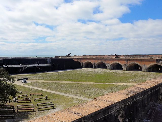
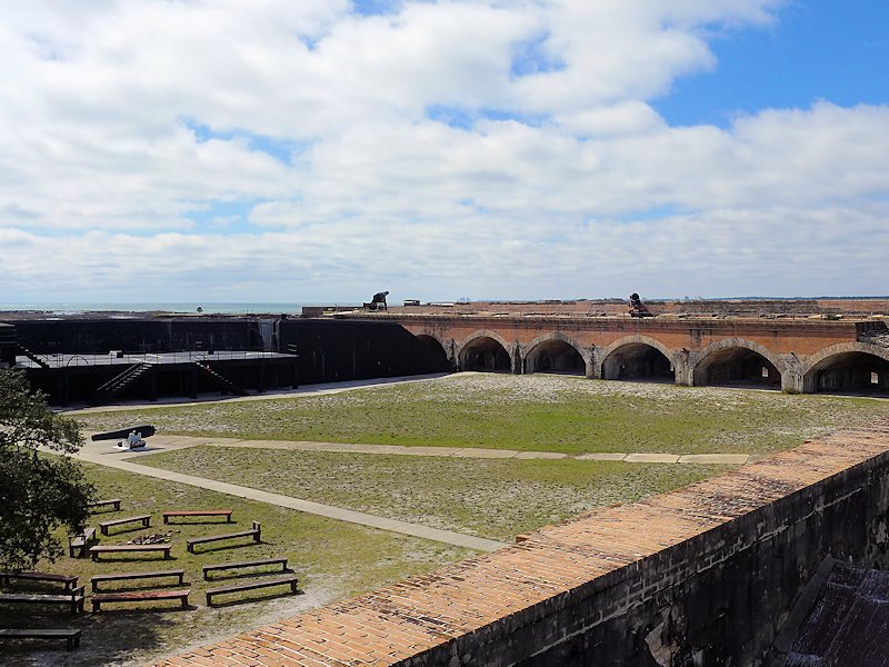
    The 1834 historical fort is the main visitor attraction for non-campers. The Fort along with the island's numerous gun batteries has an interesting military history from before the civil war through World War II.
  • Fort Pickens Campground
    The popular campground at Fort Pickens will accommodate larger RVs as well as smaller units and tents
  • Fort Pickens Gulf Beach
    The uncrowded pristine beaches at Fort Pickens are among Floridas top rated.
  • Fort Pickens Hiking Trails
    Hiking/biking Trail from the Fort to the Campground
  • Biking at Fort Pickens
    Bikes are useful for riding from the campground to one of the beaches within the park as well as on the hiking/biking trails in the park. Also useful to ride the 6 miles into the town of Pensacola Beach (speed limit on the park road is 25 mph and is not heavily traveled)

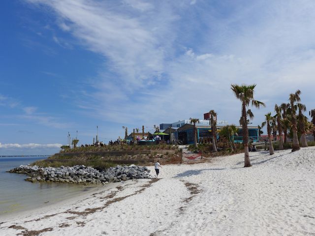
Pensacola Beach Santa Rosa Island
If you like the excitement of ocean resort towns, Pensacola Beach is less than
15 minutes from the Fort Pickens campground

Driving Directions to Fort Pickens Historical Site from Pensacola, Florida

To get to Fort Pickens from Pensacola on the mainland, you have to take the bridge across the bay to Gulf Breeze and then take another bridge to Pensacola Beach on Santa Rosa Island.

Touring Historic Fort Pickens

Historic Fort Pickens
The 1834 historical fort is the main visitor attraction for non-campers.
The Fort along with the island’s numerous gun batteries
has an interesting military history from before the civil war through World War II.

History buffs, particularly those interested in US military history from the War of 1812 to World War II, will also enjoy the experience of touring the old Fort Pickens and several gun batteries that exist throughout the park. Fort Pickens also has an interesting museum, featuring interactive exhibits on the natural and historic features of the Gulf Islands National Lakeshore.

The restored 1834 Fort and the assortment of many shoreline battery units added to the complex in World War II are one of the major attractions of the park. Go here to learn about the fascinating military history of this fort and its companion Fort Barrancas which is situated across the bay.


Fort Pickens Campground

Located on the remote western end of the island, Fort Pickens Recreation Area & Campground is the largest unit of the Gulf Island National Seashore. It is a great spot for people who enjoy sun and surf, relaxing by the ocean or walking the beach in an uncrowded, natural setting. The Fort Pickens campground is set about a half mile east of the old fort, nestled between the remains of several of the coastal artillery gun batteries that were constructed during World War II. It offers over 200 sites, with about 170 with utilities for RVs.

See our Review & more information on Camping at Fort Pickens here

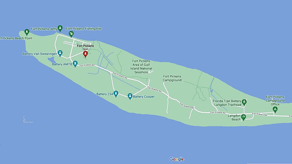
fort pickens map
Fort Pickens map (from Google Maps)

Alternative Campground. Times when we’ve not been able to get into the park due no sites available, we often have been able to find a spot at Big Lagoon State Park at the western end of Pensacola.

Fort Pickens Park Hiking Trails

There are hiking trails from the campground to the Fort Pickens restoration and museum, from the campground to the sand beaches facing the gulf, to the beaches on Pensacola Bay, between the two major camping areas, to some of the World War II Gun Battery encampments, and to picnic pavilions in the park. And there are several miles of sand beach to hike!

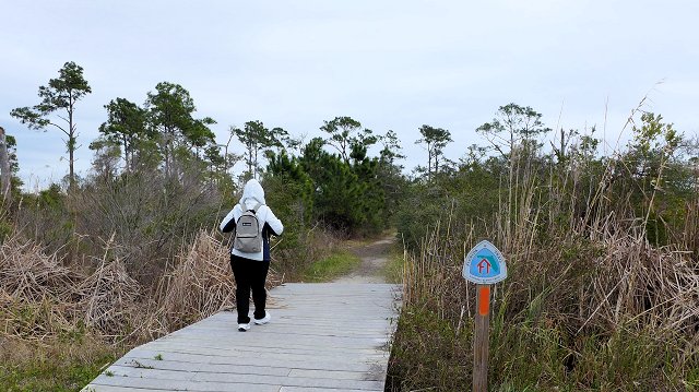
fort pickens hiking trails
hiking from the campground to the old Fort

Fort Pickens Discovery Center

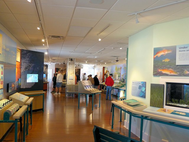
The Fort Pickens museum offers exhibits on the Gulf Islands eco system and the natural environment, wildlife, and history of the Fort Pickens Area.

fort pickens discovery center
Gulf Islands Seashore Museum on the grounds of the Fort Pickens encampment


Biking around Fort Pickens

Fort Pickens is a great spot for biking if you are camping at one of the Fort Pickens Campgrounds. The sand hiking trails are generally firm enough to bike on and the extensive network of roads within the park have low speed limits and are lightly traveled. Some of the beach recreation areas are far enough away from the campground that you’d want to either drive or bike to them.

When we stay at the campground, we usually make at least one bike trip into Pensacola Beach to browse around town or get a bite to eat at one of the top Pensacola Beach seafood restaurants

Biking at Fort Pickens
Bikes are useful for riding from the campground to one of the beaches within the park as well as on the hiking/biking trails in the park. Also useful to ride the 6 miles into the town of Pensacola Beach (speed limit on the park road is 25 mph and is not heavily traveled)

Fort Pickens & Gulf Island National Seashore Links:

Other Top Attractions in Pensacola and Pensacola Beach

Bathhouse Row – Hot Springs National Park

hot springs national park bath houses

Hot Springs National Park – Visiting Historic Bathhouses Row & Attractions

Seven of the original historic Hot Springs bathhouses along Bathhouse Row remain and have been restored or in the process of restoration. Some offer classic hot springs spa experiences, others are open for tours, and some have been repurposed for other uses (like a restaurant or brew house).

Hot Springs Fordyce Bathhouse
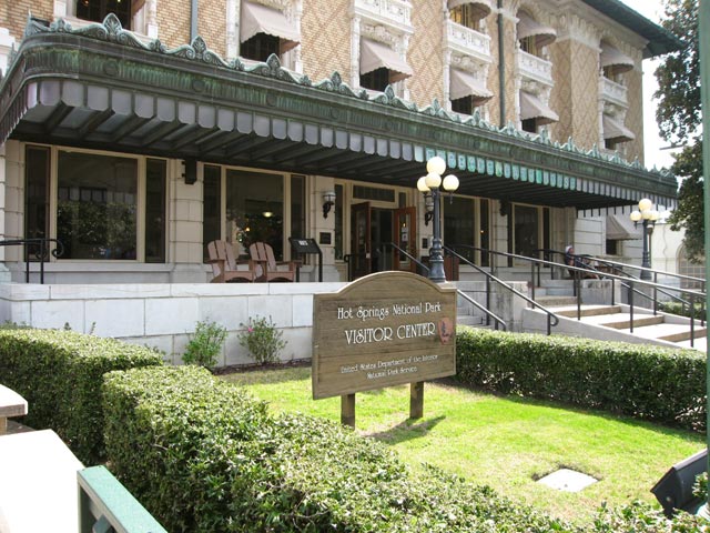
The restored Fordyce Bath House serves as the visitor center for Hot Springs National Park

The historic Fordyce Bathhouse serves as the National Park Visitor Center. In addition to information on the park and activities, the various rooms and services of the original bathhouse have been preserved and restored and can be seen in a self-guided tour. Also a small theater with a 15 minute movie presentation of the bathhouse era. Touring the bathhouse facilities can take from 15 minutes to an hour depending on how much time one wants to spend with each exhibit.

Touring the Fordyce provides a fascinating look into an era and the forerunner of the todays resort spas. The facilities served a wide variety of patrons from those with quite serious maladies to the wealthy leisure class looking to be pampered and enjoying what was essentially a club-like ambience.

bATHHOUSE rOW hOT SPRINGS
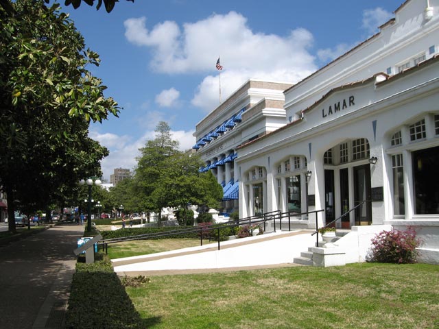
Looking North down Bathhouse Row, Lamar Bathhouse in the foreground

Open Bathhouses on Bathhouse Row

Quapaw Bath House Hot Springs
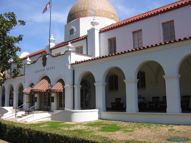
Quapaw Bath House, Bathouse Row Hot Springs National Park

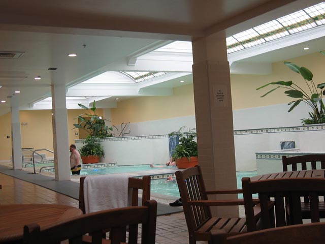
Two of the bathhouses currently serve patrons. The Quapaw Bathhouse operates much as it did back years ago, offering both a large communal bathing pool as well as private bathing tubs. Their principal appeal is to those who are looking to soak in the hot, mineral rich waters. The second operating bath house, the Buckstaff Bathhouse, offers a more modern version and a complete array of spa services. In addition to soaking in a tub, they offer loafa scrubbing sponges and massages.

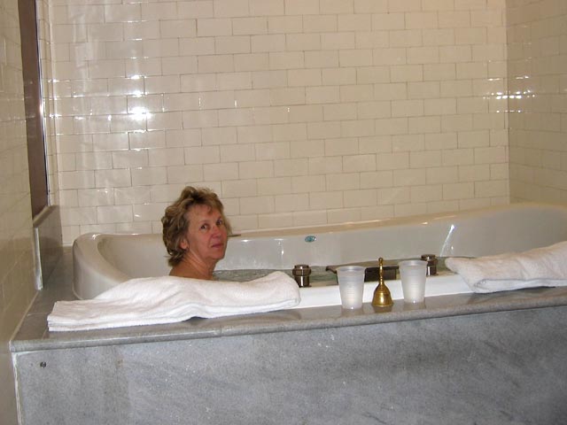
We decided to try out one of Bathhouses. We chose Quapaw because it had a package that fit our needs -a private spa for two. While the large public spa pools are refurbished versions of the pools from the 1920s our private spa room was somewhat newer and more modern – basically a Jacuzzi for two. So we didn’t step back 90 years to sample a replica of what had been in the heyday of Quapaw. But none-the-less the spa was soothing – you could feel something different in the water – it wasn’t the same as our hot tub at home. But afterword Jo and I decided next time we’d have a go at the public pool because you could move around more and get a little water aerobic exercise. And the public spa is a from the original bath house.

Private Spa Quapaw Bath House
Jo enjoying the private spa at the Quapaw Bath House
Quapaw Bath House Hot Springs
The Public Bath at Quapaw Bath House

Other bathhouses are being converted to other uses. The Ozark Bathhouse is the home of the Hot Springs Museum of Contemporary Art. The Hale Bathhouse offers a café and bookstore and now offers Hotel accommodations. The Superior Bathhouse is now the only Brewery in a National Park and the only brewery in the world to utilize thermal spring water in their beer.  The Lamar Bathhouse serves as the parks official gift shop, bookstore, and souvenir shop.

The Hot Springs National Park’s website offers some interesting tidbits on the history of Bathhouse Row plus links to learning more about each of the current bathhouses.

HALE bATHHOUSE
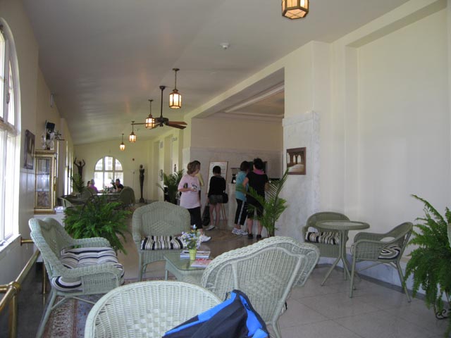
Jo and I enjoyed a cup of coffee and scones in the relaxing lobby of the Hale Bathhouse

The Promenade walk &  Hot Springs

The bathhouses are set in an attractive landscaped park against the base of Hot Springs Mountain where up to 20 springs perculate out of the ground. The street in front of the bathhouses originally was Hot Springs creek, formed from the numerous springs eminating from the mountain. The creek still exists but now it runs in a tunnel underneath Central Avenue.

Hot Springs of Hot Springs Mountain
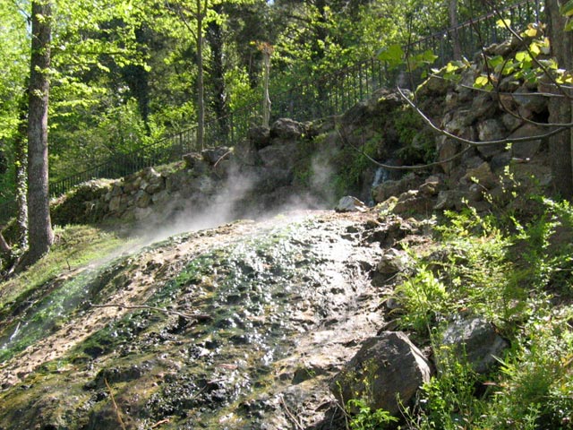
One of the hot springs flowing out of Hot Springs Mountain

A few of the springs have been left untouched, flowing out of the rock and cascading into pools of water, so visitors can see how they looked years ago. However 44 of the springs are now routed to reservoirs. Some of these provide the water sources for the bathhouses. Three fountains are located in the bathhouse row park, each of them with several spigots for filling up water jugs. The minerals in the water are believed by many to be healthful to drink as well as for bathing and soaking. The water is uncontaminated as it boils up from deep within the earth, estimated to be 4000 feet below the surface. Scientists estimate that the water being drunk today originally fell as rainwater over 3000 years ago!

Hot Springs Grand Promenade
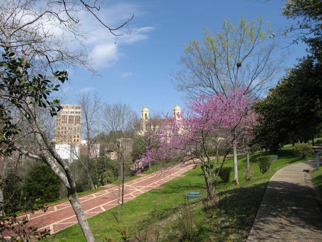
The Grand Promenade runs above Bathhouse Row. In the right foreground is a portion of the Tufa Trail, one of many graduated difficulty walking and hiking paths along the scenic Hot Springs Mountain

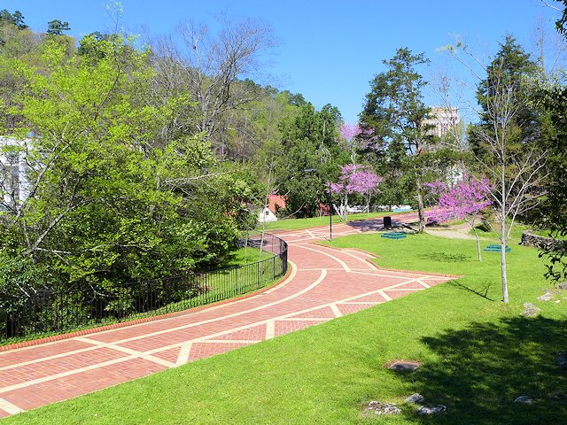
The Promenade is a tiled and landscaped walkway that runs along the hillside behind and above the bathhouses. At several points along the walkway one can view the active springs coming out of the ground. Numerous walking and hiking trails intersect with or cross the Promenade. These trails and walkways were constructed as part of the therapy plan of the spas. They cover a wide range of difficulty. The Promenade is the most gentle walkway and is handicapped accessible. Other trails go up the mountain or across the side hills of the mountain. Some are paved and have staircases, others are graveled and several are well-worn dirt trails through dense woods. In the 1920s Dr. Max Oertel designed the original network to provide spa patients an increasing level of difficulty. They could start out on short and relatively level paths and as their endurance and strength increased progress to steeper and more lengthy trails.

Arlington Lawn at Hot springs National Park
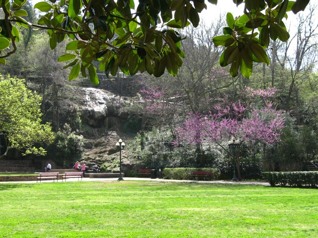
Red Buds in bloom near a hot springs pool in the Arlington Lawn of Hot Springs National Park
Tufa Terrace Trail, Hot Springs National Park

Gulpha Gorge Campground & Hiking Trails – The extensive network of hiking trails also connects downtown to the park’s Gulpha Gorge Campground which is on the other end of Hot Springs Mountain.

Other Attractions & Things to See and Do in Hot Springs National Park – Scenic Drives, Restaurants, Hiking and Nature Trails, etc.

More Hot Springs Travel and Attractions Links:

101 Things to see and do in Arkansas

–Ross [email protected]
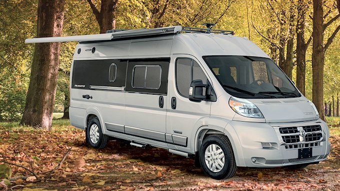
Winnebago Travato | Best Class B RVs

winnebago travato class B RV

Review: Winnebago Travato Class B Motorhome – Update

See our article on Best Class B RV MotorHomes

See our article on Top Small Motorhomes from Winnebago


The Travato is a compact 21 feet long and on the Dodge Ram ProMaster Chassis with the 3.6 liter 24 valve V6 engine, same as the Hymer Aktiv 2.0. Also like the Aktiv it will tow up to 3500 lbs. But it doesn’t have the same engine generator system as the Aktiv; the Travato comes with a separate 2,800-watt Cummins Onan gas generator.

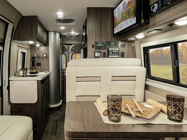
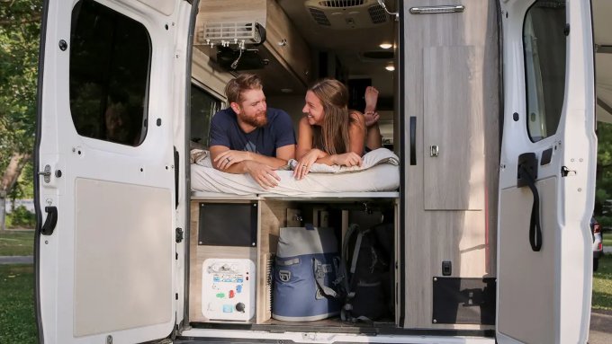
We most like the 59G floor plan. The dinette is in the front of the coach sharing space with the cab seating. While similar in layout to the Aktiv it appears to have a little more width in the bench seat. The Travato 59G comes with a murphy-bed layout but when in the bed position it is more narrow than the traditional double bed, only 49 inches wide at its widest point. However, the mattress is thick and it sets upon the Froli sleep system, a high tech substitute for box springs.

travato
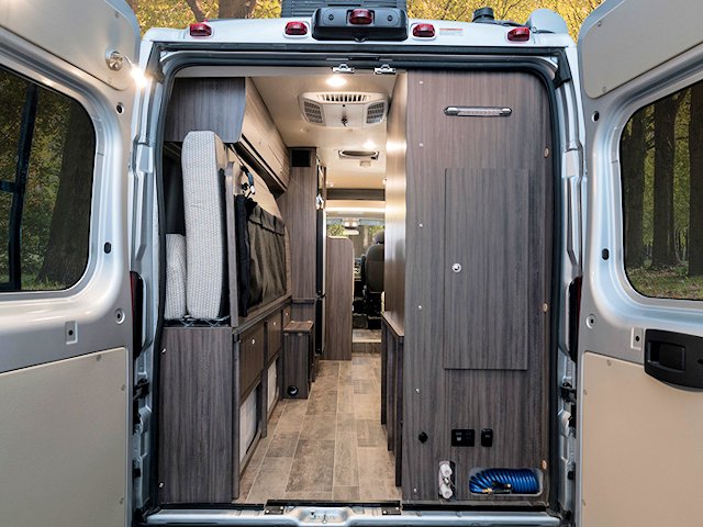
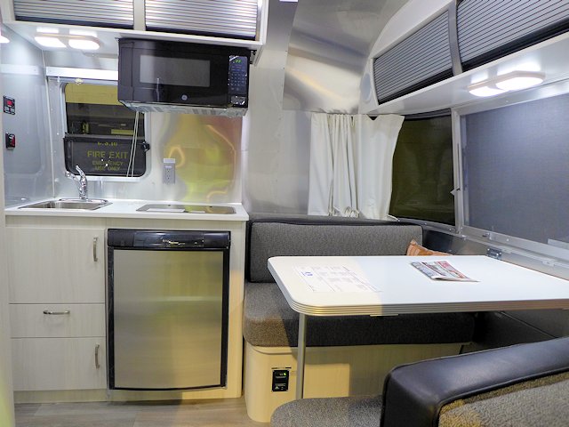
Like the Aktiv 2.0 the Travato’s Murphy Bed folds up to allow carrying bikes, golf bags, and other toys plus access to additional storage.
travato class b dinette
The Travato dinette will easily serve two people. An extension unit slides out to almost double the space shown here.
Winnebago Travato 59G bed
For 2021 the 59G Bed is 3 inches wider

The 59 G closet or pantry is narrow like the Hymer Aktiv 2.0 but has a little more vertical storage than the Aktiv. The kitchen counter has an folding extension to add counter space, a nice feature. The refrigerator in the 59G layout is quite large and is a two door model with a separate freezer.

Twin Bed Option

There is an alternate twin bed layout (59K & KL) if the 49 inch double bed width is too narrow for two. The twin-bed floor plan has the bathroom in the rear by the double doors. This allows a much larger wardrobe closet with more hanging room than the 59G, plus 3 storage drawers.

2021 update. The twin-beds can now be converted to one large Queen/King sized bed.

Lithium Battery Electrical System (GL and KL models)

The Travato has it’s own brand of lithium ion battery management system, called the Pure 3, similar to what is offered by RoadTrek and Hymer. The system also comes with 215 watt solar panels and is a standard feature, not an option. The L models (GL and KL) also come with a second under-hood alternator (that replaces the standard Onan Generator) powered by the chassis engine and an energy pack heating system. The Lithium system allows all the appliances, including the AC, to be powered off the batteries. Combined with the solar panels these two models are well-suited for off-the-grid living and camping.

Comparing Travato G and Travato K Models

The G and GL models offer a standard Murphy Bed with room for lots of storage underneath the bed (including large items like golf club bags). You also get a dedicated dinette area that also allows you to transport 2 additional passengers. What you “lose” compared to the K and KL models is a wardrobe closet and beds that are easier to get in or out of.

The K and KL models come standard with twin beds that allow the beds to remain “made” during the day and a decent size wardrobe closet, including some drawers. There is a double bed conversion feature but it blocks easy access to the bathroom when it is setup (have to crawl over the double bed setup to get to the bath). Two flip up counter-tops allow either passenger seat to have a laptop console or modest eating setup. The K and KL models are setup to legally only carry two passengers (driver and one rider).

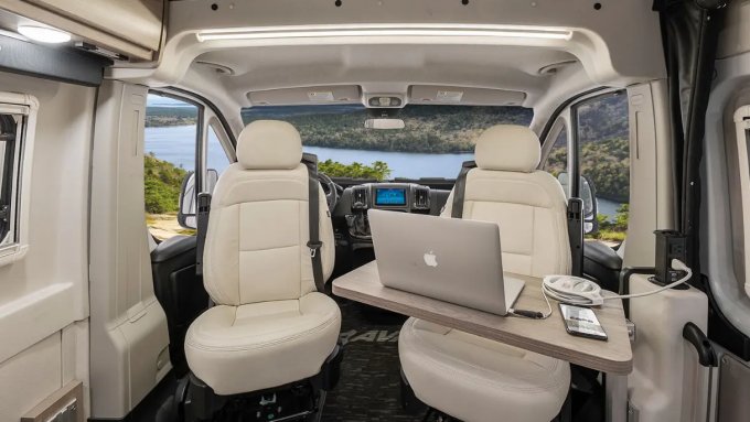
Winnebago Travato Lounge table
The new flip up passenger side table is an improved design, plus has usb and electrical outlets.
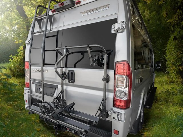
Travato Bike Rack
The Bike Rack and the Movable Ladder a popular options

New Winnebago Travato 2021-22 Features

  • Sumo Air Springs are standard
  • Deluxe FROLI® Sleep System
  • Truma Combi® Eco Plus Heating System (hot water and furnace)
  • Coleman-Mach 10 NDQ AC, quiet and energy efficient
  • Flex Bed kit (59K, 59KL) – converts twin bed model to double bed
  • 2 deep-cycle Group 31 AGM batteries (59G, 59K)
  • Optional Bike Rack, Luggage Rack, Movable Ladder, and heated drainage system

Winnebago Travato 2021 Floor Plans

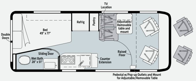
Winnebago Travato 59 G & GL Floor Plan

Winnebago Travato 2021 G and GL Floor plans
Slightly larger bed and an additional passenger side table for 2021

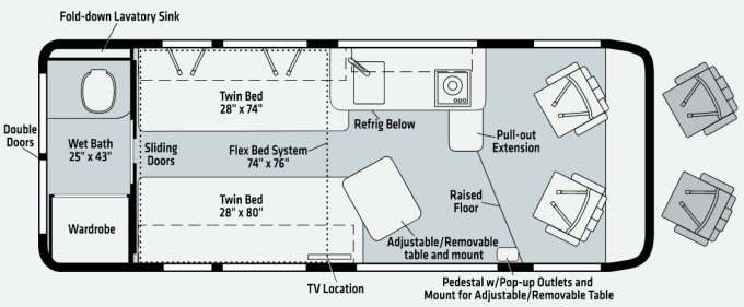
Winnebago Travato 59 K & KL Floor Plan

Winnebago Travato 2021 K and KL Floor plans.
For 2021, an additional galley table and improved passenger side lounge table

Winnebago Travato Website MSRP $130,056 (2021 base price)

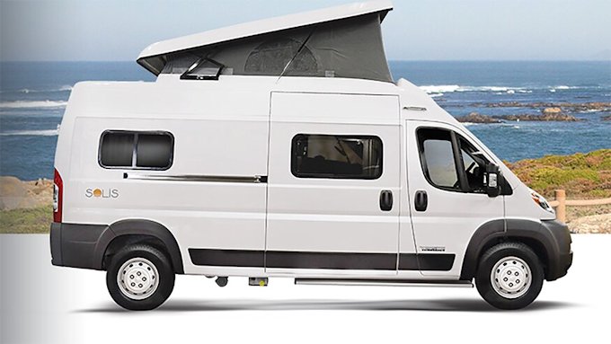
Concluding Comment. In 2019 the Travato G Model did the best job of Class B units in meeting our compact motorhome criteria (see them here). My main reservations are for an “old guy” climbing into the bed from the end is a handicap and my wife in particular will miss having a hanging clothes closet area. For 2021, there are some “new” Class B options that make the K model as possible better fit for our comfort criteria. But I am even more enthused by the possibilities of the new Winnebago Solis PX.

See the New Competitor within the Winnebago Family: Solis 59PX

red-line

Ross Reinhold for ScenicPathways, December 2022

RV & RV Review Links

Rock On Agate Festival

7th Annual Rock On! With Lake Superior Agates Festival . . . and Lake Superior Rock Hound convention.

Muskallonge Park Beach
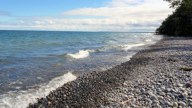
Beach rocks covering Muskallonge State Park’s Lake Superior beach

While the weather was cooler than normal and overcast at night, shortly after the opening bell of the show at 10 am each day, the sunshine appeared. Two rows of campsites were filled with exhibitors and vendors for the two day show. Most had agates, gemstones, and unusual Lake Superior rocks on display. Many of the vendors offered artisan creations using agates, gemstones, and polished rocks as part of their art or product. As before a nice backdrop to touring the show were the pleasant tunes provided by musicians and singers Gordon Fergin and the Sunshine Band (Edwin and Augusta Birdsley).

Oiled Lake Superior Agates
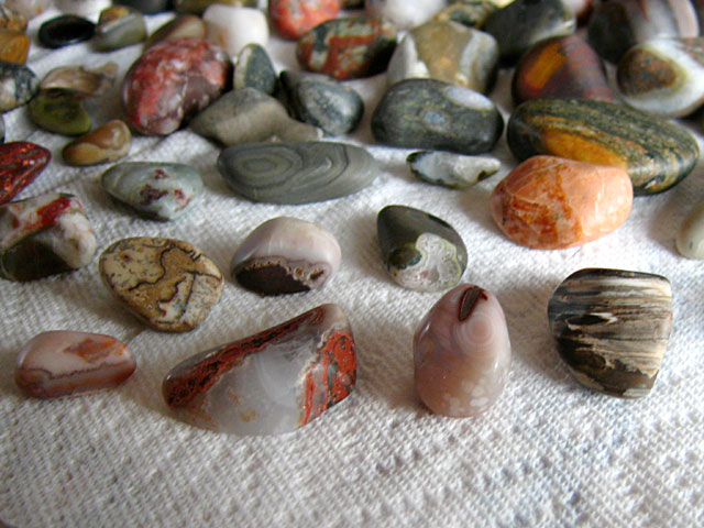
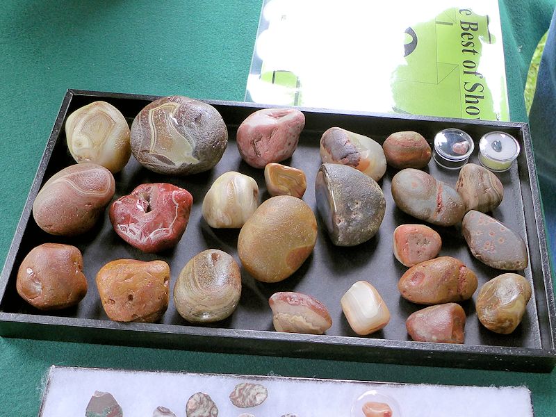
Jeff King’s collection. Note for aspiring agate hunters. Some of the rocks in the photo don’t look like much. That’s because they are upside down hiding their agate features. Jeff did this as a show & tell for agate hunting newbies.

Another part of the show involves festival attendees casting a ballot for “Best of Show” among the vendors who were exhibiting their collections. A friend of mine, exhibitor Jeff King, displayed some of his biggest specimens all of which were collected on Lake Superior beaches between Grand Marais, MI and Whitefish Point. These guys aren’t as shiny as some because they are not polished – just oiled. (see picture to the right)

Rock and Agate Hunting on the beach wasn’t as productive as last year. Jo found two, for sure Agate specimens, and a few more that are “maybes” but last year she found five Lake Superior Agates. However, even when we don’t find much in the way of agates or unusual stones for polishing, we still enjoy walking along the Lake Superior’s beaches scanning the water and shoreline for that elusive find. The crisp Lake Superior breeze, the lapping of the waves on the shoreline, and the exercise is therapy for the soul. We always come back with something to add to our collection, but even if not, the “hunt” itself is reward enough.

Because we always spend some time on the beach agate and rock hunting, we never get to attend all the talks, presentations, and demonstrations so we are glad some were repeated from last year. One of the presentations I always enjoy is by Agate Lady Karen Brzys of the Grand Marais Agate Museum. She has a new DVD out on “How to Find Agates” that we’ll be getting. Karen believes you can train your eye and your mind to be much more effective and efficient in finding agates along the lakeshore. We shall see if it works as I do need help!

Information on Attending the Agate Festival

If you plan on attending a future Rock On Agate Festival, here’s a few things to know to help your planning.

Lodging. While earlier shows were at Muskallonge State Park, more recently the event has moved to Grand Marais, Michigan. The Woodland Park campground has about 150 campsites. About 120 sites are set up with utilities for RVs (Tents are OK too) and about 25 tent-only sites. While Woodland Park offers some advance reservations, the majority of the sites are offered on a first come, first served basis. If you haven’t grabbed one of the early reservation sites, we recommend you arrive a day or two earlier to better ensure you get a site. If you can’t get in there, and you need electric hookups, try the Seney Township park 25 miles South of Grand Marais.

If you are not in an RV, go here for lodging in the Grand Marais area.

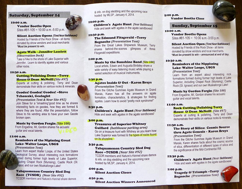
Daily Schedule. Saturday has the most presentations and is the busiest of the two days. Some of Saturday’s presentations are repeated on Sunday and a few presentations are only on Sunday. If you aren’t staying in the park, the less crowded day for parking would be Sunday, but there will be more things going on on Saturday. We found many of the demonstrations, presentations and talks were repeats of the previous year’s show so looking at the 2013-14 Schedule of Events will give you a good idea of what to expect.

Rock On Agate Festival Events
Presentations, Events, and Demonstrations at the Rock On Festival

Agate Festival Pictures

Here’s a slide show of pictures from an earlier Rock On Agate event to give you a taste of the show.


  • Best of Show Agates
    A number of vendors competed for the “best of show” award for their agate collections as well as had collections for sale.
  • Agates for sale
    Lots of unpolished Agates for sale from 50 cents on up. Hundreds, perhaps thousands to choose from . . . offered by several vendors.
  • Agate Jewelry
    Jo admiring Jennifer Lasslett’s custom jewelry fashioned with Lake Superior Agates. You can see more of her stuff at: www.etsy.com/shop/SuperiorPendantsPlus
  • Karen Brzyz, the Agate Lady
    The display booth of Karen Brzyz, the Agate Lady from the Grand Marais Agate Museum. She also gave a presentation on training your eye and mind to be a successful agate hunter.
  • Grinding and Polishing Agates
    Rock On Fest volunteer Terry House offered demonstrations on and complimentary polishing of rocks and minerals.
  • Learning About Geodes
    Steve Tchozeski gave an excellent talk and demonstration on the formation and identification of Geodes
  • Fish Management & Biology
    Not everything at the Fest is about Agates and Rocks. Here Cory Kovacs and Carl Christiansen gave an interesting talk and demonstration on fish biology and fish management.

Agate Hunting, Polishing, Rock Hound Links:

Here’s a few pages on beach rock, agate collecting and rock polishing from our Rock Hound pages on SuperiorTrails.com

Ross

Fall Color Minnesota North Shore

Scenic Fall Color Report along Minnesota’s North Shore of Lake Superior While this fall color travelogue was originally published a few years ago, it presents a reasonably typical experience for fall color leaf peppers during the last week in September. Ross here reporting from the Red Mug Coffee House in Superior, Wisconsin on Sunday, September … Read more

Lake Superior Rocks & Agates

Finding Lake Superior Agates on the beach

Lake Superior Agate and Rock Picking Beaches

Agate Hunting and Rock Picking Black River Harbor beach

Walking Lake Superior beaches searching for the treasured Lake Superior Agate is a favorite past time of many people vacationing around the big lake. Veteran rock pickers and agate hunters have their favorite beaches, some of which are kept secret. Among my favorites are Little Girls Point and Black River Harbor in Michigan’s Upper Peninsula near the border with Wisconsin. Black River Harbor’s beach is where I found my first agate (see above picture) and Little Girl’s Point has I believe the largest variety of rocks and gemstones anywhere around Lake Superior. If you aren’t lucky enough to find an agate at LGP, you will for sure find some attractive rocks for polishing.

Little Girls Point is a Gogebic County park that has camping, including electric hookups, and picnicing facilities. Its beach is miles long and unpopulated. The water’s edge of the beach is shallow enough for swimming and there are sandy sections amongst the rocks for people who just want to sun bathe or do a picnic on the beach. But I’d say the major activity of day users and campers is rock picking because there must be millions of rocks along the shoreline and in the water adjacent to the beach. Every time there is a storm or high winds, new rocks get washed up on the beach. So yesterday you might have thought you thoroughly searched a section of beach, but today wind and surf have made it a “new” beach with fresh rocks.

Little Girls Point Beach
Picking rocks and looking for a Lake Superior Agate along the beach at Little Girls Point County Park near Ironwood, Michigan

How you find Agates on the Beach

Some rock pickers, me among them, like to walk the edge of the water looking for agates and potential gemstones. I get some good exercise from the walk and in bending over often to inspect specimens I get some stretching exercise as well. The Lake Superior breeze is cool and crisp, as is the water. I’ll bring a mesh or plastic bag for my specimens and generally walk until I am getting tired, then I begin the return trip. In general walking with the sun at your back allows you to see the rocks a little better. Going over the same territory, out and back, you get a different view of the rocks because of the sun and sometimes I find a good specimen that I missed on the way out. I’ll also focus more on the rocks in shallow water on the way out and then more on the rocks in the sand at the water’s edge on the way back (or visa-versa).

Agates and Rocks from Lake Superior
Some agates (foreground) and other rocks picked from Lake Superior and polished

Another type of rock pickers are excavators. They find a spot on the beach that looks like a good place to find agates or other rare stones and plop themselves down with a bucket and small sand shovel and start digging. At Little Girls Point I think you could dig down at least two feet and still be excavating rocks. This method is less tiring and easier on your back. And it can be quite effective, particularly if you’ve learned to spot rock characteristics that favor the appearance of agates.

Recently I’ve tried a combination of the above methods with some success. As I said I really enjoy the stroll along the beach so that will continue to be my primary rock hunting style. However now when I come across an area with a number of quartz or quartzite rocks, I’ll stop and spend some time excavating and examining the rocks more closely. The two agatized rocks pictured above were found by this method.

Here’s a Google Map showing the location of Little Girls Point Beach and two other nearby excellent Lake Superior rock picking beaches.

3 Great Rock Picking Beaches

View Rock Picking Beaches – Ironwood Michigan in a larger map

Interested in learning more about rock picking along Lake Superior? Go to my SuperiorTrails website for agate & rock picking books and links and learn more about identifying Lake Superior beach rocks and agates

Lake Superior Agate Festival

See our post on the Lake Superior Agate Festival Rock On with Lake Superior Agates.

Raspberry Island Lighthouse

Raspberry Island Lighthouse Apostle Islands

Raspberry Island Lighthouse Tour – Apostle Islands The Raspberry Island Lighthouse is one of six lighthouses in the Apostle Islands. Three of them are open to the public for guided tours; we elected to tour the one at Raspberry Island offered by Apostle Islands Cruise Service in conjunction with the Apostle Islands National Park Service. … Read more

Ashland RV Park

Ashland Kreher RV Park

On the Lake Superior Circle Tour Scenic Drive When we are RVing around Lake Superior, one of our favorite campgrounds is the lakeside park in Ashland, Wisconsin. Kreher Park is an Ashland municipal campground offering 33 RV ONLY sites with electric and water hookups. Located on Chequamegon Bay of Lake Superior, the park also offers … Read more

Holiday Winter Events Duluth North Shore

bentleyville christmas lights show

Holiday, Winter Events and Travel Attractions in Duluth and Minnesota Lake Superior North Shore

We’ve just posted in SuperiorTrails.com our calendar of interesting events and attractions along the North Shore for the Holiday and upcoming Winter.

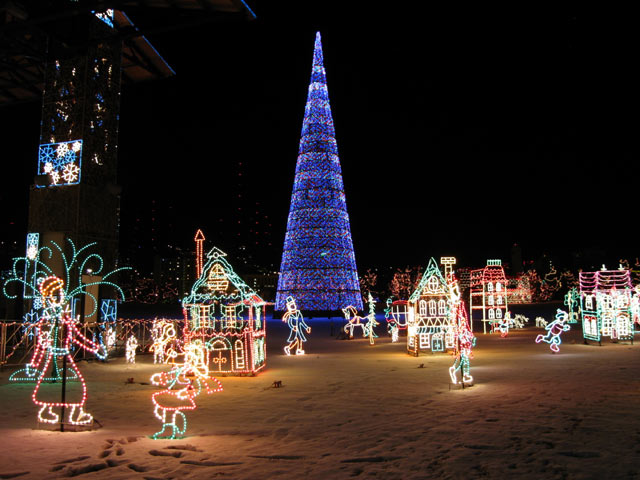
BentleyVille Christmas Lights Duluth, MN
A fantastic winter holiday wonderland in lights – Bentleyville Christmas Lights Village

Among the top Holiday Events in Duluth, the premier Christmas and Holiday event is the BentleyVille Tour of Lights Christmas Lights Village. It is a terrific holiday activity for families and people of all ages.  Duluth changes its Bayfront Park into a Christmas and Holiday Village with a gazzilion scenes artistically created with steel and colored lights (over 3 million lights). At the center of the village is a 12 story Christmas Tree (see picture). There is no admission charge (although donations are accepted) and there is free hot chocolate and other Christmas goodies offered. But this year it is a drive-through event vs. walking. The village is open from November 21st to December 27th.

On the weekends, an event that is especially popular with the kids is the North Shore Scenic Railway’s Christmas City Express (ala Polar Express) train between the Duluth Depot (decorated as the North Pole) and Fitgers Brewhouse complex. The Depot is just across the expressway from Bentleyville so you can park near Fitgers to do some shopping or dining and then ride the train to Bentleyville and return later. Another treat for kids is Santa arrives on the Christmas City Express to set up shop in the Fitgers Inn Mall to meet the kids and find out their Christmas wishes. (see the video below)

Duluth Christmas City Express Video


Another popular Duluth Holiday attraction is the Glensheen Mansion Christmas Tours where you step back in time in a re-creation of how all the rooms in the mansion were opulently decorated for the holidays. The weekend tours start November 17th and run through January 6th. Glensheen also hosts a special Holiday Bazaar the first weekend in December creating an outdoor village on the grounds of the estate with over 40 artisans & merchants setting up shop.

The first year we attended the Bentleyville Show there was snow on the ground so we also took in some snowshoe hiking at one of Duluth’s parks. If you are a winter sports enthusiast, there are several good hiking, cross-country skiing and snowshoe trails within the city of Duluth. There are also two city run ski hills (Spirit Mountain and Chester Bowl) for downhill skiing and snowboarding. See our Winter Events & Links page for more info.

John Beargrease Sled Dog Race
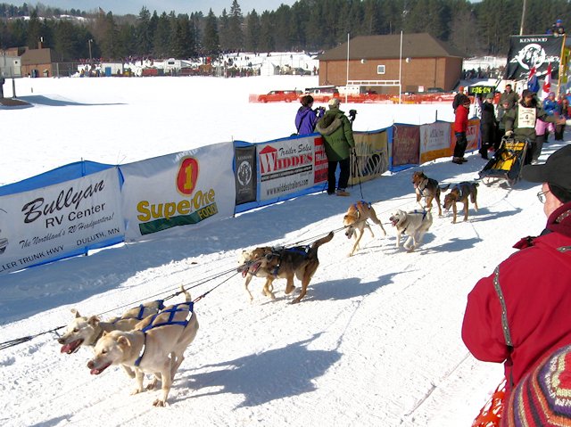
Tim Calhoun of Tomahawk, WI was an early leader in this John Beargrease race and was a winner of the UP200, Michigan’s largest sled dog race.

Another popular winter event in Duluth (and in fact along the entire Minnesota North Shore of Lake Superior) is the annual John Beargrease Sled Dog Race, which is the longest Sled Dog Race in the lower 48 states (around 400 miles from Duluth to the Canadian border and back). For some of the racers this is a warm-up for the famous Alaskan Iditarod Sled Race. Other racers are working their way up to some day compete in the Iditarod. You can watch the race from several intersections and check-in points along the route. Most popular are the starting and finishing lines but you will often get an even closer look at the racers at one of the viewing points along the route. The race runs over four days and runs 24 hours a day, although racers are required to take a minimum # of hours of rest stops. When we attended the race we also brought our snowshoes along and did some of the several great snowshoe and cross-country trails that dot the North Shore.

We’ve listed other recommended events at our North Shore Winter Events Calendar. You can also check out the Duluth Chamber Events Calendar for other travel attractions.

Happy Trails,

Roscoe

Apalachicola, Florida

Apalachicola Florida Oyster Capital of Florida

Apalachicola – Gem along the Forgotten Gulf Coast (While Apalachicola sustained some damage from the October 2018 Hurricane Michael the town recovered quite quickly and is now fully open for business and entertainment) Apalachicola has a rich history, established in 1831, at one time it was the third largest port on the Gulf of Mexico. … Read more

Gulf Scenic Drive – Highway 98

Apalachicola Sunrise

Road Trip – Gulf Coast Scenic Drive from Rosemary Beach to Apalachicola

Previous Road Trip Article: Scenic Highway 30A Destin to Rosemary Beach

Directory to the Florida Gulf Coast Drive Maps and Articles

Interesting things to see and do from Rosemary Beach to Panama City Beach

After Rosemary Beach Scenic Highway 30A rejoins highway 98 and the average speed of traffic accelerates. On your way toward Panama City Beach, highway 30 splits off and runs along the Gulf shoreline. Before arriving at Panama City, you go through a few suburban beach communities like Hollywood Beach, Sunnyside and Laguna Beach. The beach front along this stretch is largely public with lots of parking along the road. Unlike Destin and the beach communities of South Walton along 30A, very few structures are built on the beach itself. Most of the resorts, townhomes, cottages, and condos are on the other side of the highway.

These communities west of Panama City have the look of more affordable beach vacation destinations and or an affordable retirement community. Not at all sparkly and upscale like Seaside and Rosemary Beach.

Panama City & Panama City Beach

Panama City Beach
Panama City Beach beach drive. High rise resort condos on beach side of the road, bars & amusements on the other side.

As you get closer and closer to Panama City Beach, things get bigger, denser, and high rise resorts begin to dominate the landscape. Once in the thick of Panama City Beach there is an unbroken chain of huge resorts along the beach. These resort hotels are flanked by various beach resort entertainment venues – usually on the other side of the street from the beach front.

While there were a fair amount of people on the street and the traffic was heavy, compared to the large crowds of people milling around in the three South Walton beach communities we saw relatively few people along the road. Most people staying in these huge resort complexes must be at the beach or inside enjoying whatever amenities are in these luxury facilities.

A personal viewpoint. Panama City Beach seems to be a more urban setting compared to other beach communities along the Panhandle Gulf Drive. Doesn’t look like the kind of place where you could turn your kids loose like you could at the resort communities of Seaside or Rosemary Beach. But with so many mega-resorts per mile there has to be a sizable demographic that finds Panama City Beach appealing. For us, one trip was enough for lifetime. On our return trip we stuck to Highway 98 that ran away from the beach and then through Panama City itself.

Caveat. However if you are lucky enough to get a reservation at St. Andrews State Park you can escape the maddening crowds of commercial Panama City Beach and enjoy a top-rated beach, hiking trails, kayaking, water sports, and more. The park has three camp stores for provisions and vacation needs so there is no need to leave the park during your stay.

(By the way, although parts of Panama City got hit real hard from Hurricane Michael, Panama City Beach itself managed to escape with minimal damage . . . so various tourism and beach destinations are intact and operating normally)

Panama City Links

Panama City to Apalachicola

Mexico Beach

About 10 miles east of Panama City, along highway 98 you arrive at the small community of Mexico Beach where the pace of life slows down quite a bit. There’s an extensive public beach area with lots of free parking. The collection of cottages, vacation homes, and condos are all on the non-beach side of the highway. There is an assortment of restaurants, pubs, charter fishing, a fishing pier and beach related enterprises to give vacationers a variety of things to do. If you like being at the beach, aren’t attracted to the urban beach resorts like Destin and Panama City Beach, or can’t afford a Seaside or Rosemary Beach vacation, Mexico Beach could be the place for you.

(unfortunately the 2018 Hurricane Michael did a great amount of damage to the town. Mexico Beach’s lodging providers and tourism have been working hard to restore and reopen. Several lodging places to stay are now available with more coming soon!)

Port St. Joe

The next town Port St. Joe is less a vacation community and seems to have a more industrial or commercial base but it does have a nice downtown waterfront and park area. Port St. Joe looks out across an expansive lagoon to the St. Joseph Peninsula so technically it is not on the Gulf. The lagoon forms the St. Joseph’s Bay Aquatic Preserve. Near the tip of the Peninsula is St. Joseph Peninsula State Park that offers camping, hiking, and an extensive beach fronting on the Gulf. (Port St. Joe was another casualty of Hurricane Michael so camping here in 2019 may be dicey. Likewise camping is at the State Park on the St. Jo Peninsula is suspended because the park is now only accessible by water.)

Indian Pass

On your way south of St. Joe, Highway 98 and Highway 30A part company again. 30A is more scenic and runs along the Gulf past the entrance to St. Joseph Peninsula and past Indian Pass, a smaller peninsula that is primarily a vacation home community, but has a nice secluded RV and Tent Campground-Indian Pass at the tip (The campground survived Hurricane Michael with minimal damage).  Another noteworthy spot along this route is St. Joe Bay Golf Course (see our review).

Indian Pass Campground Beach
Indian Pass Campground Beach – see our review with pictures and information

When you turn East on Hwy 30A by the entrance to St. Joe’s Peninsula and head towards Indian Pass, you leave the Emerald Coast and travel along what is known at the “Forgotten Coast.” Along this route there is a string of barrier islands: St. Vincent, Cape St. George, and St. George Island. The first town along the Forgotten Coast is Apalachicola.

Historic Apalachicola

Apalachicola
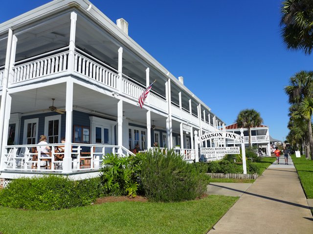
The 1907 Gibson Inn is one of many lovingly restored structures in Apalachicola

Apalachicola, is one of our favorite places along the Panhandle Gulf Coast. Unfortunately because it is protected by those barrier islands, Apalachicola doesn’t have those glamorous white sand beaches. You’ll have to drive out to St. George’s Island to get your “Gulf Beach Fix.” But for many other kinds of vacation entertainment we like Apalachicola a lot. It has several quaint restaurants and bars – see our reviews, even a brew pub, lots of neat little shops and galleries, some interesting parks, museums, a large number of historic register homes and structures, and some attractively restored B&Bs.

Oyster City Brewing
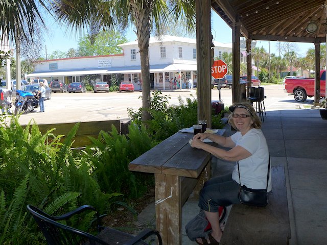
Jo and I enjoyed some Oyster City Brewing nut brown ale out on the Brewery patio.
st. george island lighthouse
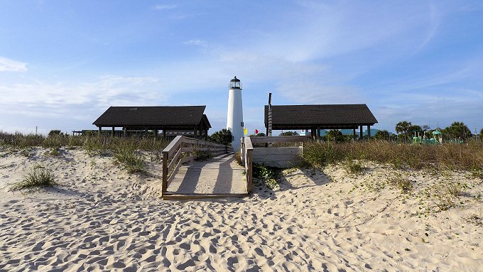
Along the Forgotten Coast – St. George Island Lighthouse and Public Beach

See our Road Trip article on travel attractions along the Gulf drive from Apalachicola to Cedar Key.

(Below. Gulf Scenic Drive, Destin to Apalachicola Road Map. if viewing on mobile use two fingers to move map around)

Travel and Visitor Links:

The portion of the Gulf Coast from the St. Joe’s Peninsula and east to Apalachicola and beyond calls itself the Forgotten Coast. So far what we’ve seen of it, we like it. The Gulf Coast Drive continues east and north past the communities of Carrabelle, SopChoppy, Panacea, Shell Point and St. Marks.

Previous Article: Scenic Highway 30A Destin to Rosemary Beach

Ross Reinhold