Touring the ice sculptures of the Bayfield Lake Superior Ice Caves was easily the most popular 2014 & 2015 winter event around Lake Superior. In 2016 and since that time, the Lake Superior Ice was not safe enough to allow travel to the Ice Caves and Formations.
Ty Daniels tool this shot in 2014 from the inside of one of the ice caves
Jo in front of one of the many ice cave sculptures done by Mother Nature
In 2014, For the first time in 5 years the ice on Lake Superior around the Bayfield Peninsula and the Apostle Islands was thick enough for people to safely hike out to the unique ice sculptures that form in the caves formed in lake shore bluffs the Apostle Islands National Park mainland. See some photos and directions to the Ice Caves from our last visit – Wisconsin Lake Superior Ice Caves.
Tips on Visiting the Ice Caves
If you go up to Bayfield to see this display of Mother Nature sculptures, here’s a few tips for you.
While at times snowshoes would be helpful to travel to the caves, it is likely when you go thousands of people have already trekked out across the ice and snow to the see the caves. So expect the trail to be quite tamped down. (However if it snows heavily just before you go, this may change.) So if you have ice cleats that clamp on your boots, bring them along. Or wear whatever boots you have that will give you decent traction on ice or snow. If you’ve got some ski poles or hiking sticks, bring them.
Also pack a beverage and some energy or granola bars. I figure the hike across the ice to the caves is about a mile and the hike along the caves could be almost a mile. So figure at least four miles round trip and extra time to explore the caves means you’ll be out there a few hours. And this amount of time also means a bathroom break prior to your trek wouldn’t hurt either (Because of the high bluffs the caves are formed in, you can’t sneak off into the woods for a pottie stop!).
Directions to the Ice Caves
The Ice Caves are accessed from the Meyers Beach unit of the Apostle Islands National Park. The road to the beach is off Highway 13 four miles east of Cornucopia, Wisconsin or 17 miles Northwest of Bayfield, Wisconsin. There are places to eat and get grocery items at both locations. Here is a link to our Lake Superior Region Snow & Weather Reports page for information on traveling.
Lodging. You’ll want to Google for motel accommodations in Bayfield, Washburn, and Ashland as your best bets for finding a place to stay. If all what is available is booked, it is feasible to get lodging in Superior, Wisconsin as via Hwy 13 it is about 60 miles to the Ice Caves from Superior. There are spots between Ashland and Superior that are closer – like Iron River and Brule – but my guess is if Ashland – Bayfield motels are filled for your desired dates, these would be filled as well. Make your reservations as early as you can.
We hope to see the caves again this year. Maybe we’ll see you there.
Whether RVing or Vacationing, are you looking to escape to get away from the madness of South Florida? Consider Scenic Cedar Key. It is a slow-pace Gulf Beach Town Gem along the Hidden Coast, with lots of fun and interesting things to do and places to see. Read On.
Cedar Key Voted Top Ten Small Town Culture & Affordable Gulf Vacation Beach Town
Located on what is known as Florida’s Hidden Gulf Coast, the island city of Cedar Key has managed to retain its small town feel while providing a very hospitable vacation experience for visitors. USA Today ranks it in the best Top Ten Small Town culture scenes, # 6 in the nation and #1 in Florida. And UpGradedPoints rates Cedar Keys as the USA least expensive Vacation Beach Town.
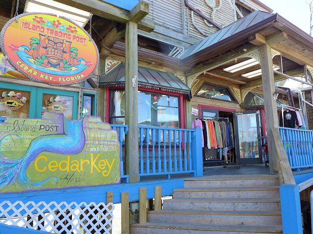
Cedar Key has lots of neat shops and galleries, some great restaurants serving up some great seafood, top notch kayaking and paddle-boarding, island tours boat trips, charter fishing, sunning and swimming at the spacious Cedar Key Beach & city park, some interesting hiking trails, and just plain fun hanging out in a friendly island community.
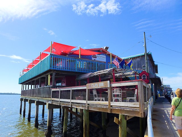
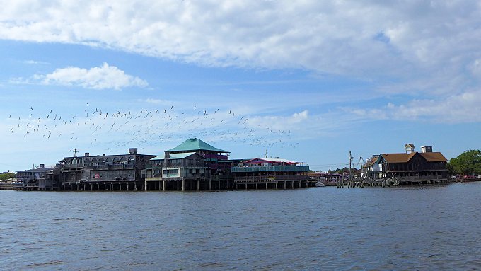
The restaurants and shops along Dock Street hangout over the water.
RVers Note:There are several RV campgrounds in and near Cedar Key and several choices in nearby Chiefland, Florida. We profile these camping options lower down this page, with descriptions and links.
Top Things to Do and See in Cedar Key, Florida
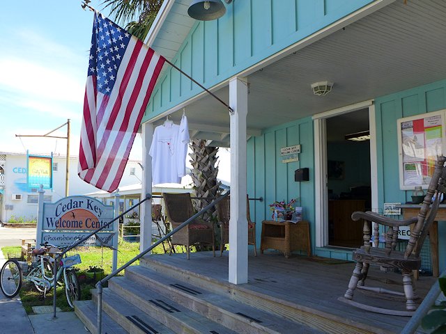
Stop at the Welcome Center for info on neat things to see and do.
Kayaks, Swimming, Sunbathing, Picnicing at the City Beach and Park
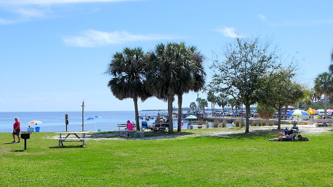
Picnic, Swim or just relax and enjoy the breezes and sunshine at the city Beach and Park.
There is a decent city swimming and sunbathing beach adjacent to the city park that has picnic tables, a playground area, a pavilion, and a bath house. Nearby, within walking distance of the beach are several good restaurants and raw bars offering fresh seafood, some of which is locally caught.
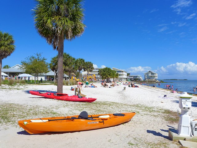
Kayaks are popular because the many bays and channels among the islands provide protection from big waves.
Cedar Key Dining and Entertaining
Many of the top restaurants and bars are located along dock street.
Most of the bars, restaurants, and boutiques are located along Dock Street which runs down the center of a narrow hook-shaped peninsula that juts out into the Gulf and Suwanee Sound. The buildings on the Gulf side of the street are built on stilts and actually sit out in the water.
While the town of Cedar Key is situated on about 6 islands, the Cedar Keys Wildlife Refuge that surrounds the town of Cedar Key has thirteen named islands, plus perhaps hundred more islands too small to have a name encircle the town. The many islands of the Cedar Keys Wildlife Refuge provide great shelter for kayaking and canoeing and also a chance to see dolphins, birds, and other wildlife or do some fishing.
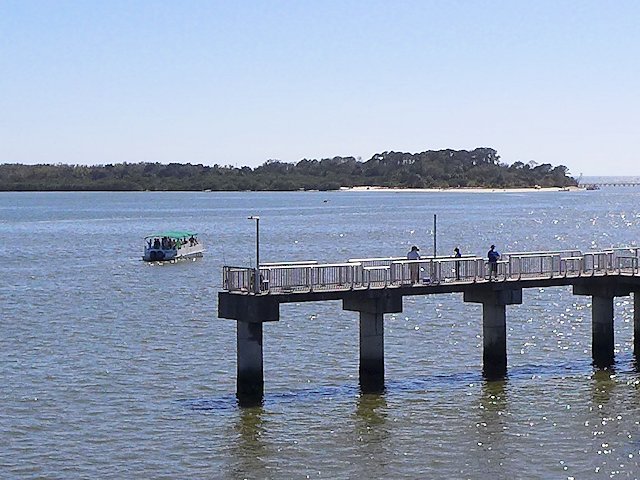
Cedar Key’s Fishing Pier, Swimming Beach of Atsena Otie Key in the background
The Island Tours Boat Rides offers an interesting narrated tour of a few of the islands in the Keys. Seeing some dolphins is just about a guarantee as they seem to be attracted to the boat, as if they were hired performers!
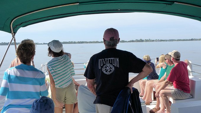
Watching the Dolphins perform on the Island Tour Boat.
The town has a very hospitable beach resort community that is more laid-back and has far less commercial glitz than you’d find in Destin or Panama City Beach. There’s no high-rise resort buildings or huge apartment complexes. There are a few medium-size ocean-side condos and hotels, but a good deal of the lodging for visitors is provided in quaint cottages and mom & pop style motels.
Camping,Campgrounds, RV Parks Cedar Key, Florida
There are three private RV parks/campgrounds located within Cedar Key or within 5 miles of the center of town. As you might expect, you pay a premium to be located in or close to town. We drove through two of these three parks and found the sites too cramped together for our tastes.
Our favorite Cedar Keys RV Campground is a few miles out of town at the North end of the Keys Wildlife Refuge, Shell Mound County Park. The park offers both RV and Tent Camping and the nearby nature trails provide some interesting hiking and bird-watching.
The nearby Cedar Keys Nature area offers a boardwalk, a fishing pier and a canoe/kayak landing. We camped at the County RV park and found the camp hosts very friendly and helpful. The RV sites offer water and electricity; the bath houses have running water and showers; and the campsite fees were quite reasonable. The campground is first come, first served – no reservations.
Can’t Find Campground Vacancies in or near Cedar Keys?
If you are willing to drive about 30 miles, there are several good RV camping options in Chiefland (see our reviews). One that we like is Manatee Springs State Park. The state park offers very nice RV sites, good spacing, nice shading, 8 miles of hiking trails, kayaking, biking, and swimming/snorkeling in the spring pool. And the rates are quite a bit less than the private parks nearer to town.
Beside being able to get a reasonable campsite somewhat near Cedar Key, another reason we like to RV camp in Chiefland is the Chiefland Golf Course, only about a mile from Manatee Springs. We found it a nicely, maintained 18 hole golf course, with a friendly staff, and modestly priced green fees. It is also a very walk-able course.
More Places to Visit and Things to around Cedar Keys:
Visitor Attractions Pensacola Beach on Santa Rosa Island Pensacola Beach is a beach community located near the western end of Santa Rosa Island, a thirty mile long, narrow barrier island strip of dunes and grass lands that protects Pensacola Florida from the hurricanes and storms that roll across the Gulf of Mexico. To the east … Read more
However if you are in market for a pre-owned compact motorhome, the following reviews can be helpful. PS. Two of the units we previously liked are no longer being produced.
In an earlier post (top compact European motorhomes – see article) I discussed some criteria my wife and I have should we elect to replace our aging Winnebago Rialta motorhome. Class C Motorhomes made in the USA and Canada lack many of the features we now enjoy. On the other hand several European motor home manufacturers offer a number of compact full-featured motorhomes (see our article) that we would consider as viable replacements.
In this article I review the Best USA/Canadian motorhomes that come the closest to having the features that made the Rialta so desirable to many RV buyers who want a compact but full-featured motor home.
These Rialta features are:
Low profile, aerodynamic and attractive body style
Short length (21 feet) enables parking in a conventional automobile parking space
Driving and maneuvering it is as easy as a pickup truck
Doubles as a deluxe passenger van with seating for up to 5 passengers
Large coach windows, with natural light lending an open feeling to the interior
Large rear-facing picture window with view from the driver’s seat
Good gas mileage: 17 – 19 highway
Has the same coach accessories/conveniences of much bigger units.
Here’s our reviews of best small class C motorhomes under 25 feet.
Editor Note: Since the original publication of this article, some models have been discontinued. However for those looking for a Good Used Compact Motorhomes, these are some good choices.
–List Prices in the article are from a few years ago – –
Winnebago Trend
At 24′ 4″ long the Trend is close to being too long for ease of parking and fitting into compact campsites. The 23L floorplan is the most viable for us. It has a defined bedroom with a 49″ wide bed that can remain made-up and a dinette seating that will handle 3 people (maybe a 4th in a pinch). It has seat belts for five people. So two positive gains over the Rialta: the daily bed making chores will be reduced and the Dodge Promaster Chassis and engine which will be easier to find good service than we now experience. Negatives are: 1) we lose some gas mileage 2) we lose our beautiful expansive rear picture window 3) less natural interior light, 4) the truncated corner bed is slightly smaller than a conventional double bed, 5) somewhat boxy appearance, and 6) the list price is above $100,000 (but you should be able to find one for under $85,000).
PS The Trend was later replaced by the Winnebago Fuse, which uses a Ford Transit chassis.
Looking for a Roomy but compact Travel Trailer? See our article on the Airstream Bambi and other top rated compact travel trailers
Thor Compass
Thor Compass Motorhome
Pictured at the top of this page, at 23′ 6″ long the Thor Compass fits within our specs for maximum length. The 23TK model has a comfortable 4 person dinette and a dedicated bedroom with a 49″ wide corner bed setup similar to the Winnebago Trend. (The 23TB model gives you a flip-up queen size bed but the dining area becomes only a two person pedestal table (which I find too small) in front of a couch.) It has a large European style “garage” external storage compartment which I like. The chassis and engine are Ford Transit which should give even better service options than the Dodge Promaster. The Ford is also a diesel which should offer a bit more miles per gallon than the Dodge gas engine. Negative: List price is above 100,000 but you may be able to find one for around $75,000.
At 24′ 5″ long the model 5245 pushes our limit on vehicle length. Likewise at 10′ 6″ high it is on upper end. But it has a separate queen bed and a four person dinette, and overall an attractive floor plan and amenities. Its Ford E350 Engine and Chassis will be easy to service. It doesn’t have the more aerodynamic and newer Ford Trend chassis and I’d expect less MPG than the Trend chassis but the E350 is well established and easy to service. It’s retail price is under $100,000 and I’ve seen advertised prices under $80,000. A decent value.
Leisure Travel Wonder
The Leisure Travel Wonder has a low profile, sleek appearance. It is just under 10 feet high but is 24′ 9″ long, barely under our 25 feet maximum. It is very spacious with lots of storage inside and out. The kitchen is well laid out with good counter space and the bath has a separate roomy shower. Roomy exterior storage space will easily hold our two golf bags. The murphy bed model is a unique feature. It allows you to keep a made up bed, yet not have the bed taking up all that useable floor space during the day. A skylight and larger windows give it an airy feeling inside. Besides it being a little on the long side, the only downside feature is the dining area is limited to two persons. This also limits it seating for day travel to 4 persons. It’s built on a Ford Transit Chassis with a 3.2 liter Turbo Diesel. List price is above $100,000 ($108 to 115K) but you may be able to find a deal for under $100,000.
Phoenix Cruiser
The Phoenix 2100 is the most compact full-featured Canadian or American-made Class C we’ve found. In terms of providing useable space and conveniences in a modest-size footprint it is the most space efficient USA motorhome we’ve come across. It’s a compact 21′ 7″ long and under 10′ in height including the AC unit. It has a four person dinette and a full dry bath with a separate shower. Adequate size kitchen with a counter top extension. The slide-out contains a full-size walk around bed that in the daytime folds up into a sofa.
The Phoenix provides seat belts and seating for 6 people so it works as Van alternative for comfortable day trips. In comparison to the Rialta, we’d lose our nice big rear picture window and quite a bit in MPG. I’m also unsure about exterior storage; a must-have for us is the ability to carry two golf bags. The Chassis is the Ford E350 with the 6.8 Liter V-10 gas engine (gas mpg?). Comes factory direct with a nice selection of premium convenience options for under $100,000.
The 2100 offers a lot of features in a small space
Pleasure-Way Plateau . . . really Sharp, but expensive, compact Class C RV
After I wrote this original version of this article I saw a video of the Pleasure-Way Plateau XLTS (see my review) and saw some nice features that would challenge the top Compact Class Cs featured in this post. Except that MSRP is $145,000 plus! But if you’ve got the cash and desire a full-featured compact Class C, it might be the unit for you.
Another new 2018 compact motorhome I am anxious to see up close is the North American Hymer Aktiv 2.0. It is a Class B, but from the pictures I’ve seen it seems more spacious and airy inside than the usual Class B. See our report here on Best Class B RVs or Van Campers
Concluding Remarks. The Phoenix Cruiser and the Thor Compass come closer than other US-Canadian RV makers to the European standard of right-sizing RVs, but not good enough in our opinion. Guess we’ll have to wait for the US-Canadian RV market to change before we can seriously consider replacing our Rialta. We are looking for a model under 23 feet, under $100,000 price, external storage for at least two golf bags, with all the usual RV accessories and comforts, and most of the the criteria we listed at the beginning of this article as plus-features of the Rialta. Know of any model that comes close? Write me in the comments.
Cedar Key a hidden gem of the Gulf Coast. See our article on camping, hiking, and interesting things to see and do in and around this unique Florida Gulf Coast community.
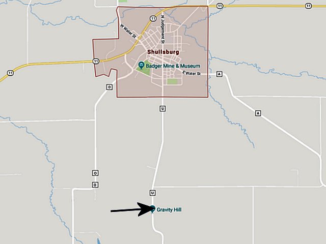
About a mile south of historic Shullsburg, Wisconsin is an interesting and fun phenomenon that must be seen and experienced to believe. Some would say there are mystic forces involved. Others will go with the scientific explanation that it is a trick of perception – your eyes deceive you, what you “see” is not “what you get.”
Driving South of Shullsburg on County Road U there is a point in the road where you are going downhill. However if you stop your vehicle at a certain point and put your transmission in neutral, take your foot off the brake, you will find yourself coasting backwards uphill!
See our video of this amazing experience.
How to get to Gravity Hill.
In downtown Shullsburg go to the intersection of Water Street and Judgement Street. Turn south on Judgement Street and take it out of town (where it is now known as County U).
Once clearly out of town, look for a paved road on your left (Rennick Road). Continue past that intersection about 600 feet and look for a GH and a line painted on the road. That is where you stop to try your coasting uphill experiment. Put your flashers on and beware of oncoming traffic.
If prior to your Gravity Hill experience you haven’t stopped and spent time in Shullsburg, do it. Things to do include: visiting the Shullsburg Creamery Cheese Shop, stopping in some interesting shops and boutiques, browse antique and collectable items, dine at some neat pubs and restaurants, visit the mining museum, and do a walking tour around town looking at the historic buildings that have been restored.
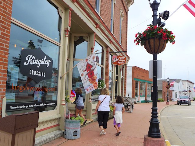
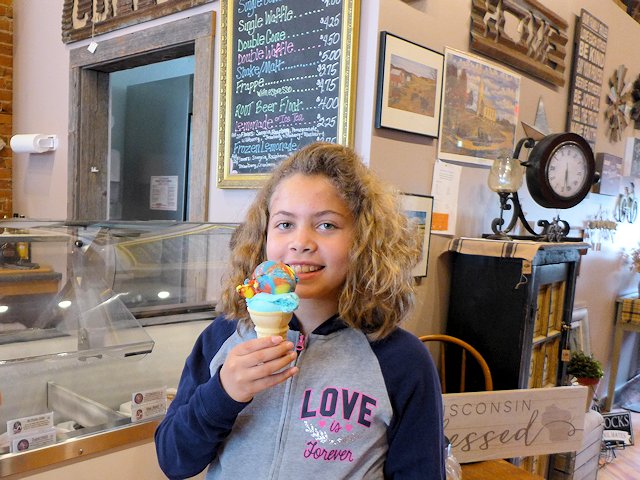
After our Gravity Hill experience, we stopped in Kingsley Crossing where Jo and the girls got some ice cream cones.
Keena about to enjoy a “Superman” flavor ice cream cone.
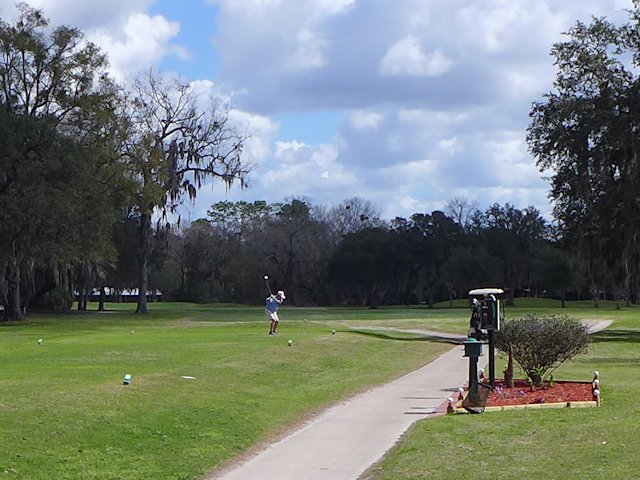
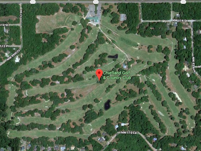
Chiefland Golf and Country Club, an 18 hole course located 4 miles west of Chiefland, Florida and about 1 mile east of Manatee Springs State Park. Its location close to the state park is ideal for RVers and campers who also like to golf and is one reason we chose the Manatee Campground.
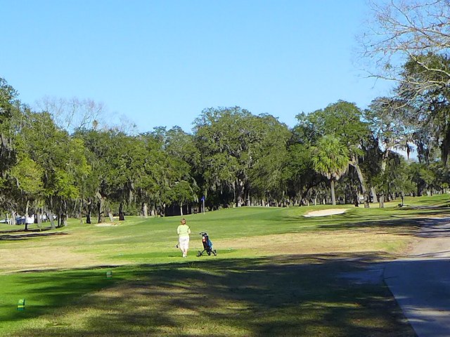
Teeing off on the #1 hole
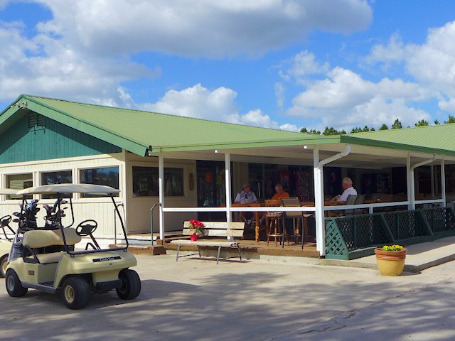
Can have a brew or sandwich outside or inside at the clubhouse.
What to Like about the Chiefland Golf Course
We golfed there in late February and were pleasantly surprised how much “green” was in the fairways and greens themselves compared to other courses we’ve played in Northern Florida and the Panhandle. We later found out it was because of the Rye grass mix they use compared to Bermuda grass commonly used throughout Florida. Bermuda is great for withstanding hot and dry weather but it dies back in the winter and is slow to come back in the spring.
Another feature we liked about the course were the five sets of tee boxes, a tee for every level of golfer. And my wife particularly liked that the ladies Red Tees come in at under 5000 yards (4843). Too often we see the ladies tees set up for around 5400 yards, which can be too long for the average lady golfer. As my wife Jo is a fairly new golfer she appreciated having a chance of reaching most greens with only one more shot above regulation. But if you are a lower handicap player, the Blue Tees run out over 6500 yards and there are three more choices between the extremes of the Red and the Blue tees.
I also liked that mature trees line most of the fairways – providing good definition of each hole, particularly helpful if you a new to the course. As during our stay we experienced unseasonably warm weather, the shade the trees provided was also a plus.
The tee boxes were in good shape and the sand in the bunkers was firm but it wasn’t caked up like we’ve found at some of the places we’ve played.
The green and cart fees are very reasonable and the pro shop staff (as well as members) were very hospitable. We loved the course and the people and look forward to spending more time there in the future. Note to Rvers, nearby Manatee Springs State Park (see our review) has decent campsites: level with nice trees and shrub screening and/or spacing between the sites.
Rough Texture of the Greens. It is not the smooth bentgrass or bermuda grass carpet you may be used to playing on. But I found them adequate for the time of the year.
Modest Course Challenge (a negative for some, but for others this is a positive). There isn’t much elevation change over the course nor many water hazards. Most of the fairways are wide enough to give you some latitude on your drives. Except for the perimeter around the course itself, the “rough” adjacent to the fairways were light cover; we didn’t lose many balls that missed the fairway.
The driving range is quite basic, a large open field with no targets. The condition of the range balls is poor to average.
Bottom Line
Chiefland Country Club is an attractive and friendly golf course for mid to high handicap golfers. It is also a very walkable course. The layout of the holes provided easy navigation from the green to the tees for the next hole.
Interesting things to see and do along the Gulf Coast from Pensacola to Destin Florida.
In this article we cover the interesting towns and places to visit along the Florida portion of the Gulf Scenic Drive from Pensacola Beach to Destin. In the article we provide links to visitor worthy attractions, campground reviews and some of our more detailed articles on these places to visit and camp.
The scenic coastal drive from Pensacola or Pensacola Beach to Destin is about 43 miles and without stops would take about an hour. If you are staying in the Pensacola area, you could easily do the trip as a day trip including a few hours stopping at destinations along the way.
Pensacola is one of the oldest cities in Florida (some claim the oldest) and it has done a great job in preserving history in the businesses in its downtown Palafox Historic District and homes in the nearby Seville neighborhood. The Naval Aviation Museum is a fantastic attraction for its wonderous exhibits of planes from the dawn of naval aviation to the present as well as the history of its role in various military and space endeavors. Fort Barrancas offers more Military History together with Fort Pickens across the bay. Top seafood restaurants abound, some decent golf courses, lots of interesting boutiques and shops, musical entertainment, and more. It is a very walkable city and we’ve never had trouble finding parking close enough to all the attractions we’ve wanted to experience.
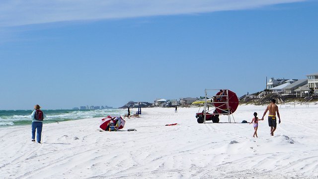
While Pensacola itself has some beaches, “Going to the Beach” for Pensacola people is driving a few miles across the bridge of Pensacola Bay to Pensacola Beach on Santa Rosa Island, which offers pristine white sand beaches on the Gulf and loads of dining and entertainment attractions to supplement your day at the beach.
Pensacola Beach on Santa Rosa Island has top rated beaches on both the Gulf and Pensacola Bay.
Adjacent to Pensacola Beach is Fort Pickens National Park, more history exhibits, a large camping and RV park, many miles of uncrowded white sand beaches, and nice hiking and biking trails.
Gulf Coast Drive Attractions East of Pensacola/Pensacola Beach
Map, with links, of the gulf scenic drive from Pensacola Beach to Grayton Beach, Florida
If you are staying on the mainland in Pensacola, you’ll follow Highway 98 across the bridge to the town of Gulf Breeze and then continue East towards Navarre Beach.
However, I think the more scenic drive is to cross the bridge into Pensacola Beach and then go East on State Highway 399 on Santa Rosa Island from to Navarre Beach. The island along this stretch of road is a narrow strip of sand dunes with Santa Rosa Sound on one side and the Gulf of Mexico on the other. After leaving the community of Pensacola Beach proper, there are no homes or buildings along the route, just dunes and water as far as the eye can see. Every few miles, however, there is a designated beach and parking area. The rest of the terrain however is a protected natural area – off limits.
A smaller version of Pensacola Beach with high rise beach front condos, a compact shopping-dining-entertainment district and 1500 feet long pier that stretches out into the Gulf of Mexico. Great for fishing or just a walk far out away from shore to catch the ocean breezes. Another attraction is the Navarre Beach Marine Science Center located at the entrance to Marine Park. The Marine Park itself is designed for both snorkeling and diving, the park includes two reefs in Santa Rosa Sound and one in the Gulf of Mexico. Informational kiosks stand at the beach near each reef.
Highway 399 ends at Navarre Beach even though Santa Rosa Island continues for over twenty miles. There is a half-mile gap in the road from the Marine Park to the end of Santa Rosa Boulevard that extends out from the community of Okaloosa Island. So unless you are driving a dune buggy you are going to have to cross back to the mainland across the bridge to Highway 98 (Navarre Parkway).
It is about 16 miles to Fort Walton Beach. This stretch isn’t very scenic just typical semi-urban landscape of homes and businesses.
Fort Walton is located at the western end of Choctawhatche Bay and has a number of attractions for those interested in sampling what the city has to offer. These include the DeFrance Indoor Flea Market, The Bluewater Zoo, and the Heritage Park & Cultural Center.
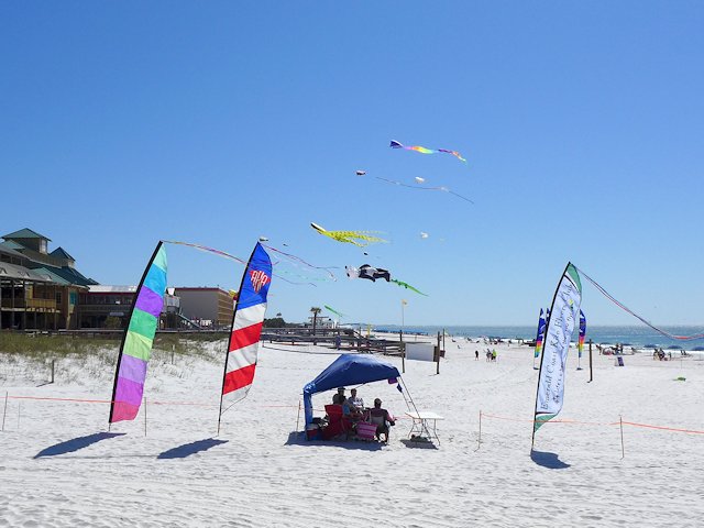
Kite flying on the public beach of Okaloosa Island.
Most visitors or tourists however will do a drive through of Fort Walton Beach and cross the bridge back onto Santa Rosa Island to the community of Okaloosa Island, which is essentially the beach and gulf playground for residents of Fort Walton Beach. Like Pensacola Beach and Navarre Beach there are huge modern high rise condo-hotels on the beach, sugar sand parks and public beaches on both the gulf and bay sides, and an entertainment district.
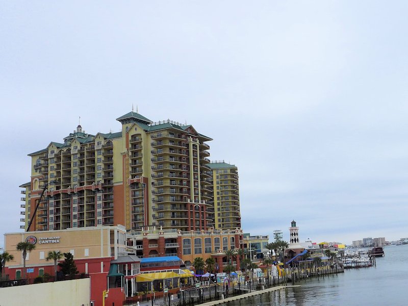
The Emerald Grande luxury condo-hotel anchors Destin’s Harborwalk Village
The drive from Okaloosa Island to Destin is a divided highway and normally takes about 10 minutes. Destin is a bigger and more glamorous version of Pensacola Beach with the requisite high-rise hotels and condos along the beach, a harbor boardwalk and harborwalk village (see our article with pictures and links)with lots of dining and entertainment venues, charter fishing and cruise ships, theaters, galleries, specialty shops, etc.
Destin is a big time resort community. Although less than 15,000 residents, they entertain over 4 million visitors a year.
Destin’s most famous beach is in Henderson Beach State Park and hosts one of the top rated beaches on the Gulf of Mexico. Henderson Beach is located east of the main high rise hotel and condo section of Destin. It has 6000 feet of beach on the Gulf and is one of the most popular state parks for campers and RV travelers in Florida’s panhandle. Just East of Henderson Beach, you can access old highway 98, now called Scenic Highway 98, turning south on Matthew Blvd.
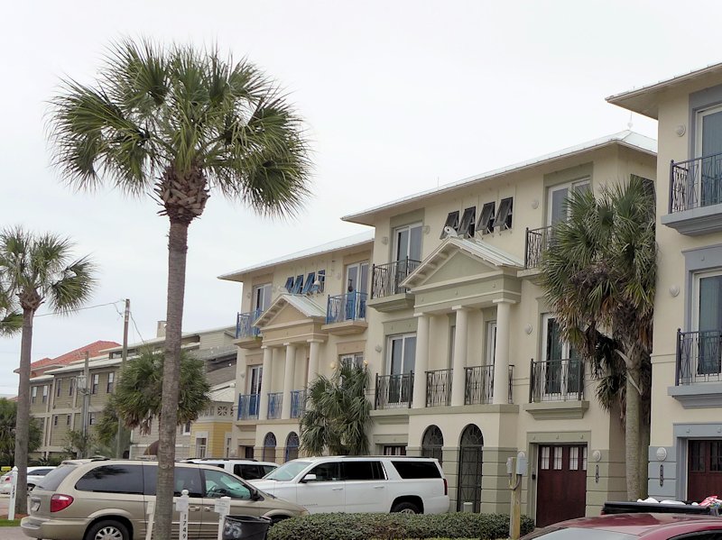
South Walton Townhomes & Condos
Driving East of Destin
Once on Scenic 98, you’ll exchange high rise condo-hotels of Destin for low rise condo-townhouses of the community known as South Walton. Every few blocks there is a public access to the beach for visitors whose lodging isn’t directly on the beach. Beach umbrellas stretch for a few miles all along the beach to the community of Miramar Beach, where the line of umbrellas picks up again until you encounter Topsail Hill State Preserve State Park. Topsail Park has a large section of camping for RV travelers. Prior to the arriving at Topsail park, Scenic 98 actually rejoins US Highway 98 in order to go around Topsail Hill park.
While this section is called Scenic 98, unless you stop at one of the beach access parks or one of the several restaurants and pubs along the route you won’t be able see much of the Gulf or the scenic white sand beaches. It is mainly town homes and condos lining both sides of the road. But shortly the scenery improves!
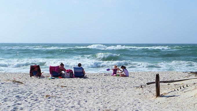
The “beach” at Grayton Beach is one of the finest along the gulf coast.
See the Google Map below for driving directions and links on this scenic drive. If you are RVing or camping, we’ve included links to 3 state parks and one national park that offer decent camping, spacious beaches, and hiking trails.
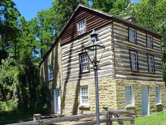
Settled in 1827, Mineral Point was prominent in the creation of the Wisconsin Territory, serving as the host town for the July 4, 1836 inauguration of the first territorial governor, Henry Dodge. As the center of the evolving lead mining industry, Mineral Point grew quickly and drew immigrants from Cornwall England an area with a rich mining history. By 1850 the majority of the residents of Mineral Point had Cornish ancestry. The Pendarvis Settlement, a Wisconsin Historic Site, preserves some of the early structures and relates the history of Cornish settlements and mining in Mineral Point. Many other Mineral Point buildings from its early history have been restored and are found along Commerce Street, High Street, and ShakeRag Street.
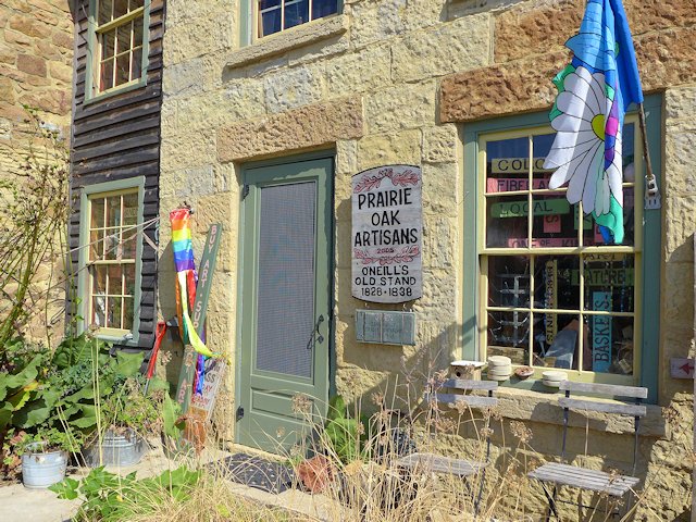
Today Mineral Point is a center of artists, artisans, unique restaurants, galleries and boutiques. There is about 25 galleries and studios of sculptors, fiber arts artisans, woodworkers, potters, glass workers, painters, etc. The town hosts several annual events including a 4th of July Festival (always held on the actual 4th), the Mineral Point Car Show, the Fall Art Tour, and the annual Cornish Festival. Mineral Point is also home to Hooks Cheese, producers of over 50 varieties of award-winning cheese.
A few highlights around Mineral Point
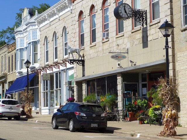
The Gray Dog Deli is one of Mineral Point’s favorite cafes.
Shake Rag Alley
In addition to preserving several historic buildings that was the heart of early Mineral Point, Shake Rag Alley is an arts education center offering workshops and classes are offered in a wide variety of arts and crafts. In the summer they offer day camps and programs especially for young people.
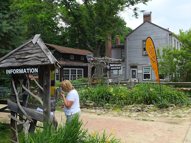
Jo checks out the information booth at the entrance to Shake Rag Alley
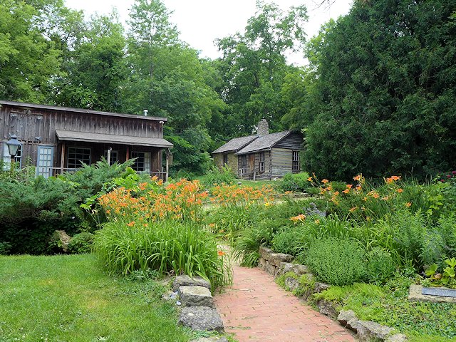
Taking a walk through the gardens and “village” of Shake Rag Alley
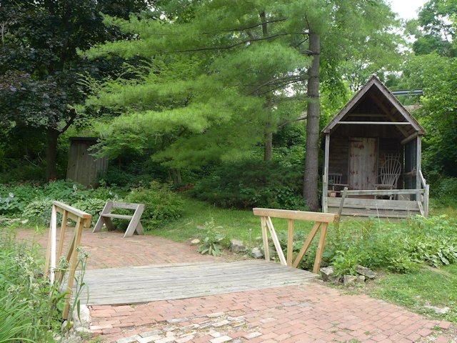
This pioneer cabin is one of 9 historic buildings in the Shake Rag village.
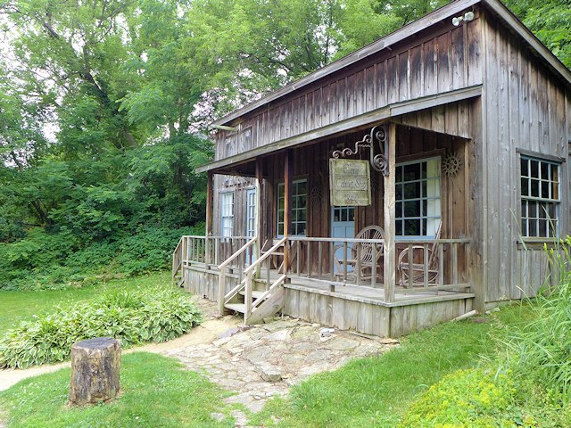
Many of the historic buildings in the Shake Rag village are used as classrooms and workshops.
Pendarvis Historic Site
The Wisconsin Historic Society offers narrated tours, with costumed interpreters, of the buildings, artifacts and gardens of the 5 acre historic site. Pendarvis is open Thursday through Sunday, June 1 to October 15th. Guided tours are available 4 times a day or at other times you can do a self-guided tour.
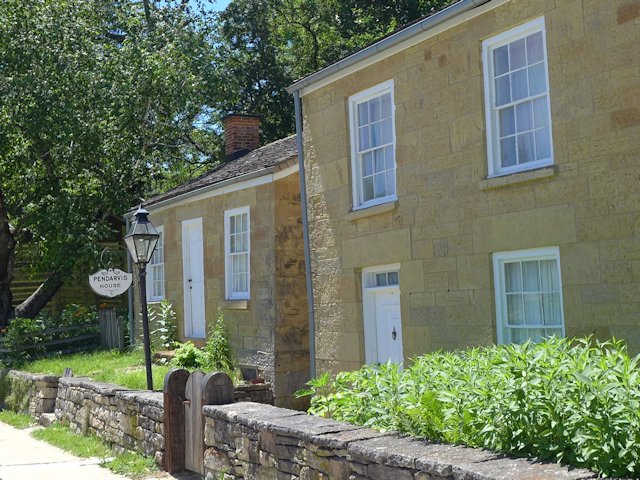
The original Pendarvis and Telawny Miners homes. on Shake Rag Street.
The Pendarvis House Restaurant operated for 35 years until 1970
Fourth of July Celebration
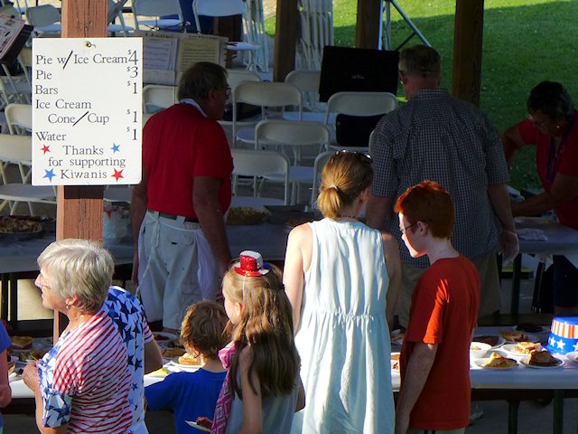
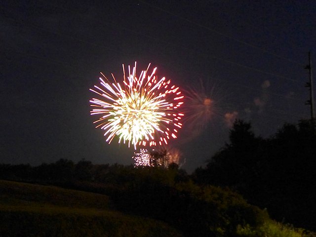
A rarity these days, the annual Independence Day celebration is always held on the 4th itself. It is an “old school” day-long and evening celebration featuring a Parade, an Ice Cream & Pie Social, a Community Band Concert, a Softball Tournament, and Fireworks.
Young and old alike line up for ice cream and pie before the concert at the Soldiers Park pavilion.
Fireworks are on Christmas Mine Hill next to Soldiers Memorial Park.
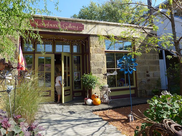
The Longbranch Gallery features rustic, folk, and fine art, the works of over 60 local, regional and national artists
Mineral Point Restaurants & Pubs
One of Mineral Point’s most popular places to eat, according to Zomato Reviews, is Brewery Creek Pub (see our review here) on south Commerce Street near the old Depot.
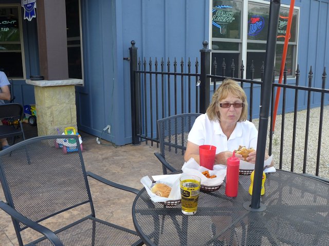
Jo enjoying her burger and fries at Tony’s Tap outdoor patio.
Other highly rated places to eat and drink are Tequila Point and the Gray Dog Deli both on High Street. We’ve eaten a few times at Tony’s Tap Bar & Grill also near the Depot and although nothing fancy about the menu, the food and prices were decent and they gave us attentive, friendly service. Nice outdoor patio too.
Located on the Iowa side of the Upper Mississippi Great River Road Scenic Drive, Dubuque holds claim to Iowa’s oldest city. Named after French-Canadian fur trader Julien Dubuque, who arrived in the area in 1785 and set up a trading post on the Mississippi River. Learning of the existence of lead deposits in the area he began mining operations cooperating with the Mesquakie Indians who had lived in the area for years. The mining community he established was known as the Mines of Spain. This later spawned the settlement of the city of Dubuque, which was chartered in 1837.
While lead mining and trade as a key port on the Mississippi were key to its early development, it later added other industries like button making, boat building, logging, mill working, meat packing, and other heavy industries. After experiencing a downturn in its local economy in the 1970s through the 1990s, the city initiated an economic revival that had “. . . five anchor components: the Mississippi Riverwalk, the National Mississippi River Museum and Aquarium, the Grand River Center, the Grand Harbor Resort, and the Star Brewery.”
Dubuque River Walk and Art on the River
In addition to offering these visitor and tourist attractions, Dubuque has become a major retail, medical, education and employment center for the tri-state area.
Top Dubuque Visitor Attractions
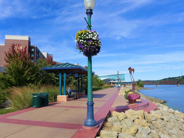
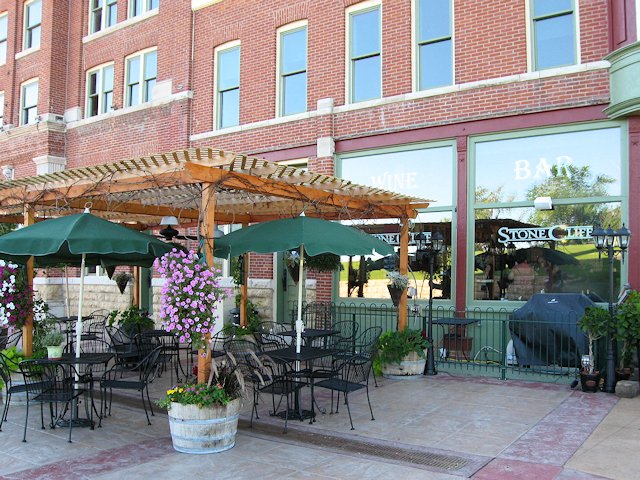
Whenever we visit Dubuque, we always find time to take in the Riverwalk with its panoramic views of the Mississippi River, isolation from the hustle and bustle of the city, and its interesting artistic sculptures sprinkled along the walk. The Grand River Center, a unique architectural creation, is a prominent center-piece along the Riverwalk. At the end of the Riverwalk is the restored historic Star Brewery building which now houses a mini-brewery museum, a fine restaurant, and the tasting room of the Stone Cliff Winery, among other attractions.
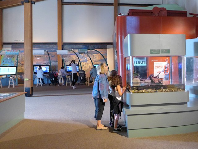
Another favorite Dubuque attraction is the National Mississippi River Museum and Aquarium. It anchors the other end of the Riverwalk built along the lagoon called the Ice Harbor. Filled with interactive exhibits and educational displays, it is easy to spend several hours exploring all that it has to offer. In fact the admission ticket is good for two consecutive days as for some people they would need two days to see everything.
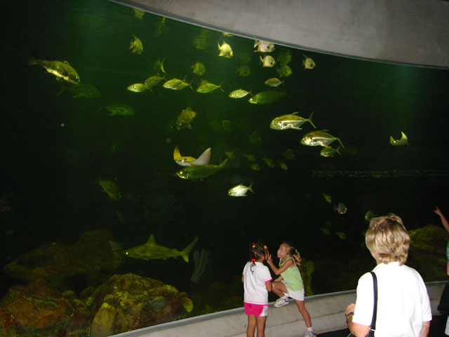
Gulf of Mexico tank at the National Mississippi River Aquarium
And still another regular part of visiting Dubuque is taking a walk downtown past the historic Julien Dubuque Hotel, past the Bell Tower, and a stroll along Bluff Street to Cable Car Square visiting boutiques and specialty shops.
Once at Cable Car Square, taking a ride up the hill on the Fenlon Place Elevator is a must for any Dubuque visitor (see our slide show below). Originally built in 1882 by a downtown banker who lived on the top of the bluffs in order to save an hour buggy ride round trip to work and back. Years later the Fenlon Place Elevator Company was formed and the cable car served all the neighbors who lived on top of the bluff.
The incline railway takes you up to the top of the Bluff where the station deck offers terrific views of downtown Dubuque and the Mississippi River. We usually take the bluff trail walk down from the top of the bluff for the exercise, but if you buy a round trip ticket you can take the incline railway back to the Square and avoid the walk.
Slide Show: Riding the Fenlon Place Incline Railway
Here is where passengers board the incline railway to the top of the hill
Jo and the kids getting excited for the ride up the hill.
The Cable Car goes both directions, you can ride up or ride down.
The kids enjoying the view from the bluff-top station deck.
Scenic Overlooks
You get a great view of the downtown and river from the top of Fenlon Place. Another great view of the river and the Dubuque River Front is from the top of Eagle Point Park.
Campgrounds
Another park, Miller Riverview park, is located adjacent to the river and offers a picnic area and RV and tent camping. More RV camping is offered at the Dubuque Yacht basin. Both of these RV campgrounds can be difficult to snag a site at so we more often camp across the river at the Grant River Corps parknear Potosi.
Golfing.
The city has a municipal golf course, Bunker Hill, which offers 18 holes suitable for beginning through intermediate golfers. Across the river, Lacoma Golf Course offers 36 holes of regulation and championship golf plus a nice little par 3 course. It is one of our favorite golfing spots in the area. (See our reviews of Dubuque Golf Courses)
Gaming and Cruises
Other Dubuque recreational attractions include two Casinos, a Greyhound Race Track, and Riverboat Cruises.
When we are staying in the Dubuque area there are two other places we try to include on our visit. One is dining at the historic Breitbach Country Tavern in little Balltown, Iowa about 16 miles north of Dubuque on Iowa’s highest bluff overlooking the Mississippi River. Breitbach is Iowa’s oldest continually operating tavern and restaurant, being run by the Breitbach family for six generations. The other significant attraction is across the river in the little river town of Potosi: The historic Potosi Brewery and Brewery Museum. Fascinating tour of the brewing facilities, the outstanding artifacts and memorabilia in the Brewery Museum, and excellent food and fresh brewed beer in the brewpub tap room.
RV & Tent Camping: Cedar Keys National Wildlife Refuge and Shell Mound Park
Can’t find a vacancy at Cedar Key RV Campgrounds? Or you are choking on the prices. Here’s an alternative to check out.
Our favorite place to RV camp when visiting the fun and artsy Gulf Beach Town of Cedar Keys, is the Levy County Shell Mound Park. It is located about 8 miles North and East of the town of Cedar Key in Florida’s Cedar Keys Wildlife Refuge.
Shell Mound offers both RV campsites and tent campsites at prices considerably less than the fare in Cedar Key proper. There’s a pair of nice hiking/nature trails and a fishing pier nearby in the Wildlife Refuge and a boat launch for canoes and kayaks.
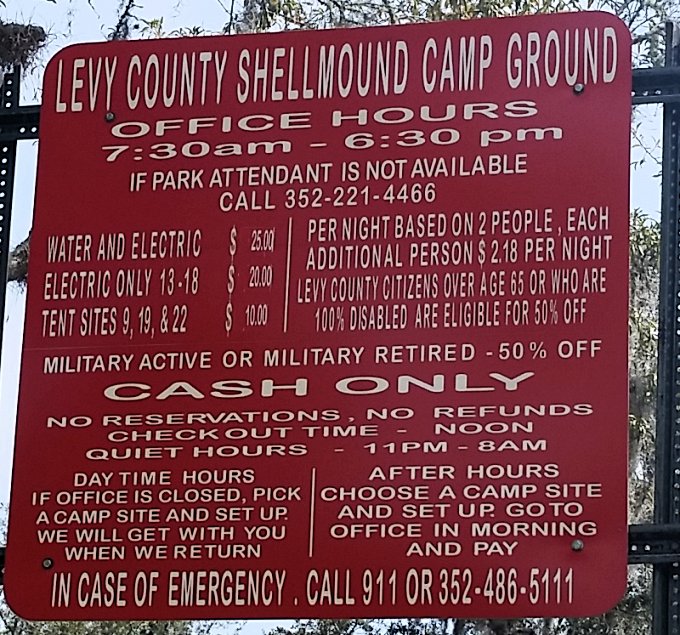
Most of Shell Mound’s RV sites have both electricity and water-hookups, but some are electric only and there are a few tent sites with no utilities. There is a full-service washroom/shower building and an RV dump site. The campground also has its own boat launch and a place to park trailers. The campground managers are on-site during the day and we found themvanc very friendly and helpful.
Beside reasonable price, another outstanding feature of Shell Mound is there are no advance reservations, site occupancy is first come, first served. There’s a 7 day maximum stay, So even during popular times of the year, you might be able to get a site there. The camping fees are reasonable, even with a recent 50% increase.
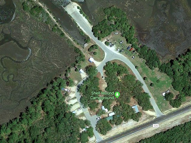
Shell Mound Campground
campground – google maps
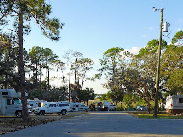
Since the campground is set within the Cedar Keys Wildlife Refuge it is remote, surrounded by woods and is generally quite quiet. The only noise we heard during our stay there was when an airboat launched at the boat landing. Some of the RV sites have a decent slope to them so some leveling blocks would be necessary for these particular sites. The road that circles through the park is paved and many sites are graveled. The camping sites generally have some shade, and offer adequate separation from neighboring sites. The sites that are electric-only (no water and lower priced) are more open and on grass vs. partially graveled.
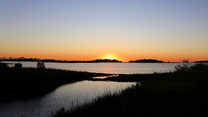
A pretty sunset behind our campsite at Shell Mound County Park
Directions to Shell Mound
From the town of Cedar Key it is about an 8 mile drive to the Shell Mound campground. You go north on Highway 24 about 3 miles, then left on Highway 347 for about 3 miles, and then turn left when you get to Highway 326. The park is near the end of the road.
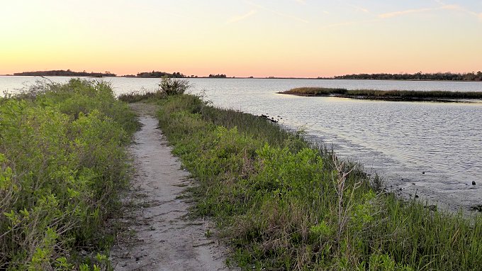
There’s a short trail near the boat launch that leads out to a spit of land providing a view of the bayou and islands of Suwannee Sound.
A trail behind our campsite led out to this spit of land surrounded by water where we could watch the sun setting over the Gulf
Review: What to Like and Not Like About the Shell Mound County Campground
Likes
Reasonable Price. Although the County increased the RV site rate 50% between our stay in 2018 and the recent one in 2020, it remains quite a bit more reasonable than those in or nearer the town of Cedar Key.
Convenient to the attractive Gulf Beach town of Cedar Key. It is less than a 10 mile drive to Cedar Key. Some campers with bikes will bike to town. The only portion where you might encounter any traffic is on Hwy 24 before the Cedar Key bridge. Once in town, you have slower speed limits and a bike path.
The Cedar Keys Nature Area & Hiking. The park is surrounded by the Shell Mound portion of the National Wildlife Refuge. Within walking distance down the dead end road that runs past the campground are the trail heads for two hiking/nature trails within the Refuge. There’s also small park there with boardwalk leading to an observation deck overlooking a portion of the Keys and a canoe/kayak launch area.
First Come, First Served Reservations. We like the fact the park offers no advance reservations. During the winter-spring season, it can be very difficult to get a campsite near a popular place like Cedar Key due to sites being reserved in advance. So the Shell Mound park means we have a chance to score a campsite mid-week at the last minute. During the day there is an office phone # you can call to see if the campground is full or not.
Review: What Not to Like About the Shell Mound County Campground
Airboat Noise. The boat ramp is apparently a popular launching site for locals who own flat bottomed airboats that are driven by huge aircraft propellers. While impressive to see, for those who have never seen on up close, the noise they make when taking off or arriving at the landing is deafening. You’ll most likely be treated to this experience Fridays – Sundays. The noise doesn’t last that long. Mainly it upsets people because it is such a stark contrast to what is otherwise a very peaceful and serene setting.
Sloping or Wet Campsites. Unless you get to the park early enough and/or during a non-busy period, your only site choices will be one of the very sloping campsites (so bring levelers) or parking on one of the low land, grass-covered sites that could get wet with a significant rainfall. So far, we’ve been lucky.
Old Washroom/Showers. While in general we’ve found the bathroom and showers clean, the washroom and showers fixtures are old and showing their age, and the building itself is a rustic cider block construction. But as I said it is clean and we found the hot water came quickly in the showers.
Shell Mound Camping Rates and Reservation Information:
Other Cedar Keys Area RV Campgrounds
If you don’t mind paying a premium and being in a busier, more crowded campground here are your three choices:
More Good RV Campground Options Close enough to Cedar Key
A little further away (29 miles from Cedar Key) is Chiefland, Florida where the are some good RV Park & Camping options. During our previous stays in the Cedar Keys area we have also camped at the Manatee Springs State Park campground which is about 33 miles from the center of town. Manatee Springs has an excellent campground, reasonably-priced and offers other amenities we like. They do offer reservations so if you want to guarantee a camping spot for your visit to Cedar Keys, this is a good option.
October 3, 2022. Fall color change is beginning in Wisconsin; we are starting to see the lime green peeking out among the wooded hillsides. Looks like it might be a week or two before Peak Color. But cool and dry weather is coming in a few days so that could produce some changes quickly.
The earliest fall color will occur in Northern Wisconsin from Vilas County to Hurley-Ironwood in the western Upper Peninsula. But timing your trip to catch real good color can be fickle and sometimes catching the earliest color doesn’t mean catching the best!
For your upcoming scenic fall color drive planning, I am listing lower down this page some of our earlier ScenicPathways articles on some of our favorite scenic fall color drives in Wisconsin, along the Mississippi Great River Road, and around Lake Superior.
One year in mid June, Jo and I decided to take a trip around the north shore of Lake Superior. One benefit of taking a late spring trip around Gitche Gumme, is due to the rain the upper Midwest typcially experiences in May and early June. The rivers emptying into Lake Superior are typically at high water levels . . . making for terrific waterfalls.
Our trip started in Duluth, Minnesota where we found a nice waterfall along Chester Creek in Chester Park. The Dan Proctor Hiking Trail runs adjacent to the creek on the east side as it tumbles down the hillside towards Lake Superior. On the west side of the creek is the Superior Hiking Trail that connects to the Duluth Lakewalk at the Rose Garden in Leif Erickson Park. Going the other direction the SHT goes to Hawk Ridge and then leaves Duluth heading toward Two Harbors, Minnesota. The Superior Hiking Trail runs the entire length of the Minnesota North shore.
The normally mild Chester Creek was pretty wild in mid-June
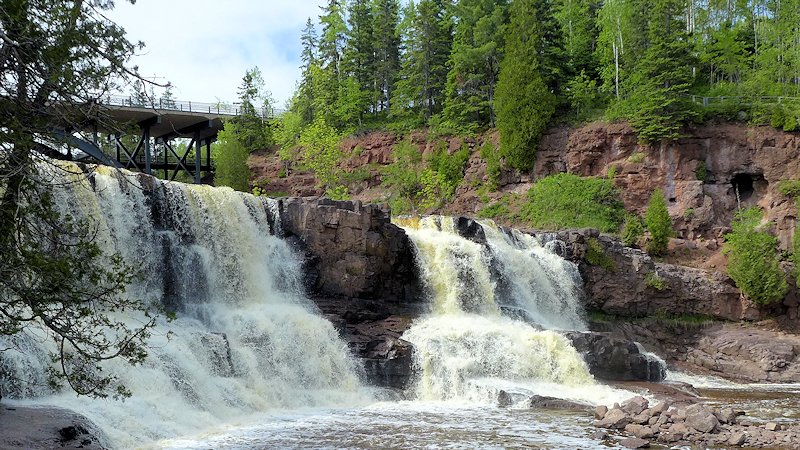
The next day we headed towards Grand Marais finding several impressive waterfalls along the route: Gooseberry Falls, Cross River Falls, the High Falls on the Baptism River. Gooseberry State Park is a must-see stop along the Minnesota North Shore for its extensive network of stairs and walking trails completely encircling Gooseberry Falls. You can see these waterfalls and others along the Minnesota North Shore in the following slide show (click on any image to see a larger view)
Slide Show North Shore Waterfalls
130 foot High Falls on the Pigeon River at the Minnesota-Ontario border
Manitou Falls
Devils Kettle Falls in Judge Magney Park
Upper Gooseberry Falls
middle gooseberry falls
Naniboujou Lodge – Historic Dining and Lodging
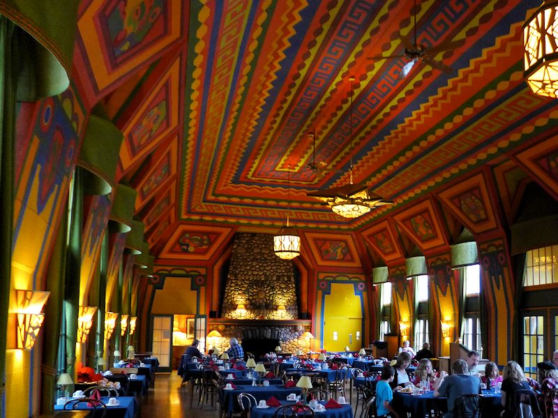
On our recent trip we made time to stop in the Naniboujou Lodge on the shores of Lake Superior near the entrance to Judge Magney State Park. We’ve probably passed their sign dozens of times on the way to Grand Portage or Canada. It is worth a stop for the architecture, the ambiance, and the food.
The Great Hall of Naniboujou Lodge is like a Northwoods Sistine Chapel and a spacious and welcoming place for dining.
It is a step back in time to the elegance of a 1929 northwoods gentlemen’s club. Babe Ruth, Jack Dempsey and Ring Lardner were among the notables who were charter members. The original estate was over 3000 acres and was to include a wide range of sporting facilities (tennis, golf, bathhouse, etc.) and up to 150 guest rooms. The 1929 stock market crash and resulting depression curtailed plans to expand the estate and its membership and eventually required the club to sell its properties. The original lodge, great hall, and 24 guest rooms have been preserved and operate today as a restaurant and inn. The most impressive feature of the lodge is the great hall which serves as the main dining room. The walls and twenty foot high ceiling are a mural of Cree Indian designs created by a French artist. The huge fireplace at one end of the lodge is the largest native stone fireplace in Minnesota. All the furnishings are suitably aged and fit the image of a 1930s era clubhouse and north woods inn. The menu offers a reasonable variety of choices, all with a creative twist in the recipe. The food was top quality and the price reasonable enough for a family on a budget. There is also a kids menu and pricing. The wait service was courteous and efficient – well-trained. The inn and restaurant is open from mid-May to mid-October and an abbreviated winter schedule – weekends from late December to mid-March.
Highest Lake Superior Waterfall
Further down Scenic Highway 61 is Grand Portage State Park. Be sure to stop at the Grand Portage State Park visitor center and take a short hike to High Falls, one of two waterfalls competing for the title of highest waterfall around Lake Superior. The trail to the falls is an easy half mile walk and is handicap accessible.
Magnificent sailing ships competing in the Tall Ships Challenge Race have been the occasion for a every other year Tall Ships Festival in Duluth, Minnesota. In 2022 the festival moved to Two Harbors due to construction in the Duluth Harbor. Below is an earlier article which will give you an idea of what the festival is all about. ~~~Ross
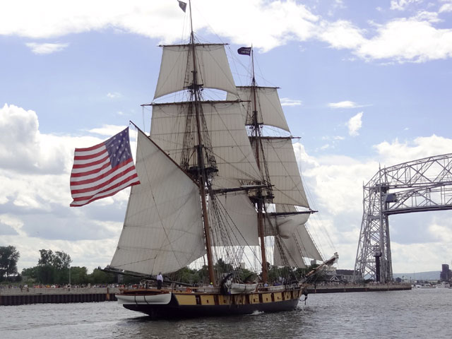
The US Brig Niagara sails into the Duluth Harbor during the Tall Ships Festival’s Parade of Sails
Duluth Tall Ships Festival, 2013
On July 25th Duluth, Minnesota again welcomed sailing ships participating in the 2013 Tall Ships Challenge Race. Nine Tall Ships sailed into the Duluth Shipping Canal to the inner harbor they would make as their temporary port for the four days of the Tall Ships Festival. Thursday’s Parade of Sails was followed by opportunities to tour several of the ships docked along the inner harbor lake walk. Several people had advance sale tickets for day sails out into the Duluth bay on some of the other ships.
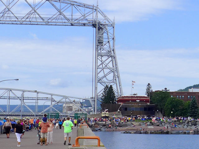
A crowd in excess of 100,000 assembled along the pier and throughout Canal Park waiting for the Parade of Sails to begin
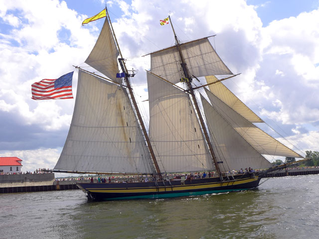
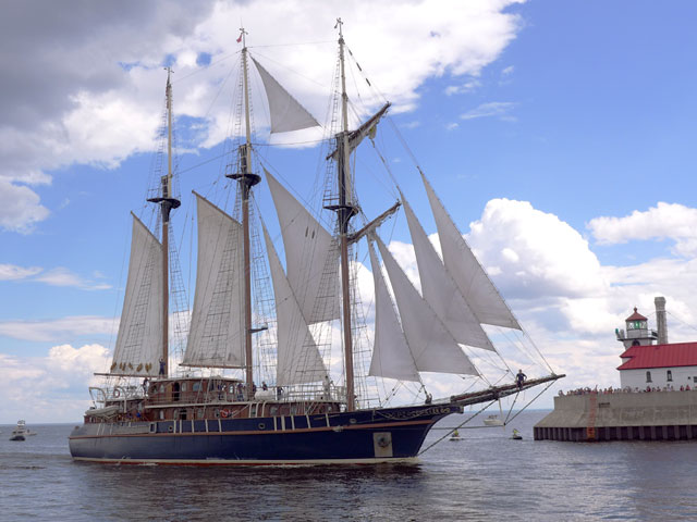
The Pride of Baltimore II is a replica of Commander Perry’s vessel that fought in the War of 1812
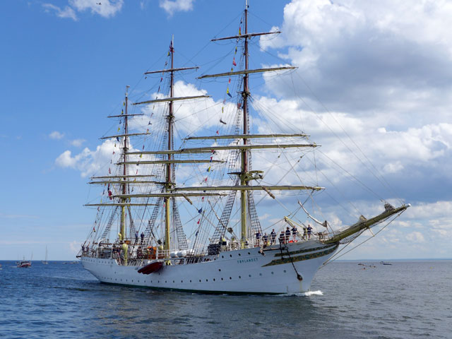
The Norwegian sailing vessel Sorlandet was the largest Tall Ship in Duluth’s Tall Ships Festival
Here’s a picture of the Sorlandet under full sail from a blog entry from Erin in the Tall Ships Challenge Blog
Some of the Tall Ships, like the US Brig Niagara, the Pride of Baltimore, and the Privateer Lynx are replicas of ships from the earlier 1800s – in particular the War of 1812. So in the addition to the innate beauty of a large sailing ship passing within a stone’s throw of us, when we were able to tour US Brig Niagara, we were treated to a living naval history lesson of a time early in our nation’s history. The lines for dockside tours of these ships were strung out in waits up to two or more hours so seeing more than two ships would have involved more standing around than our legs could handle so we only did the Niagara and the Peacemaker. The most popular ship for dockside tours was the magnificent SS Sorlandet, a 1925 Norwegian vessel that is the oldest full-rigged ship in the world still in operation.
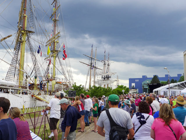
Crowds gathered dockside to see the Tall Ships up close
The Peacemaker was the most unique Tall Ship in the festival
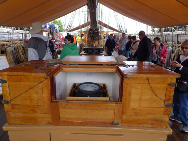
The captain’s station on the US Brig Niagara is spartan befitting a replica of an 1812 era sailing ship
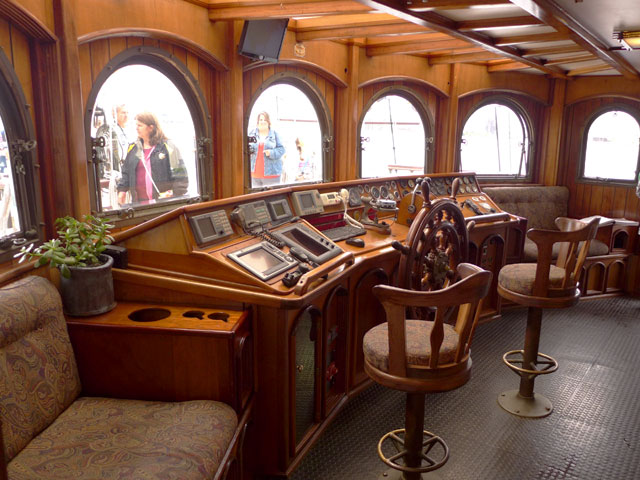
The Peacemaker’s pilot house is full of electronic gear and comfort befitting its previous life as yacht of a wealthy industrialist
The two ships we toured offered some interesting contrasts. The Brig Niagara allowed us to experience a taste of life of a sailing ship crew member 200 years ago. The captain’s console had a compass and a place to roll out navigational maps and was immediately ahead of the massive hand-operated tiller. Crew members slept on hammocks below deck where only a 4 foot high person would stand up straight. Massive ropes were coiled everywhere and 24 foot oars stored in the sidewalls. In contrast to the Niagara, the Peacemaker’s Pilot house was a modern assembly of the latest electronic navigation and communications gear with comfortable swivel chairs and upholstered couches.
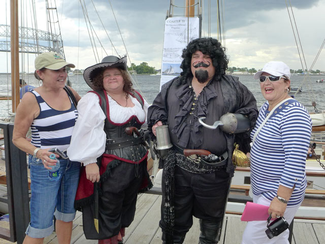
The 1812 theme was continued by a group of re-enactors who have been following the Challenge Race tour ships as they visit various Great Lakes ports. They had old fashioned tents set up in Bayfront Park with exhibits of 1800s era cooking, iron working, weapons, and other artifacts from the War of 1812. Some of the re-enactors also mixed in amongst the crowd of festival tourists (see below).
A Captain Hook-like character ventures out from the rendezvous camp to have fun with the crowd watching the ships
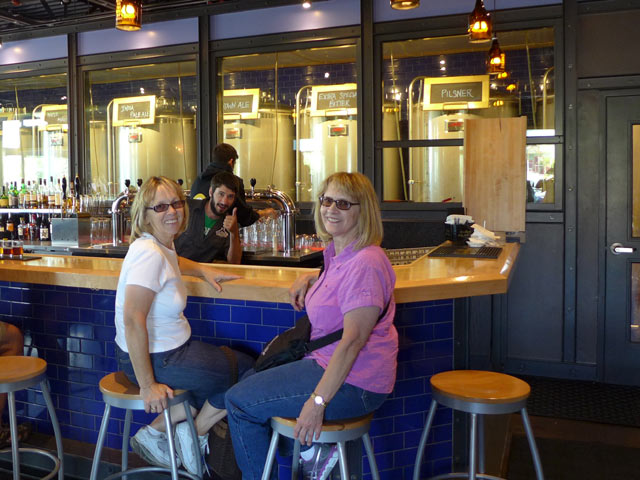
We arrived a day early of the festival and enjoyed near ideal weather walking around Canal Park, the Lakewalk, visiting shops, and sampling the brews of the new Canal Park Brewery. The next day, when the crowds of onlookers flooded the Lake Walk and Canal Park area, even buying a hot dog from a street vendor required waiting in line for 30 minutes!
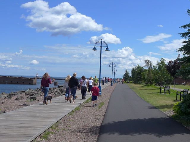
The Duluth Lakewalk on the day before the festival began
See Erin’s blog entries from her sailing and racing experiences with the Great Lakes Tall Ships Challenge Races.
The Tall Ships will be visiting other US and Canadian Ports later this month and in September. Go here for the schedule
It was a fun trip even though we got rained on the second day of the festival. We return again to Duluth in September for the KIA Duluth Drag Race and Car Show.
The Duluth Drag Race and Car Show features the Nations only legalized 1/8 mile drag race on a public street. The event usually takes place every summer on Duluth’s Garfield Ave. Unfortunately due to ongoing construction of the Twin Ports Interchange (TPI) Project, the event had to be cancelled in 2021 and 22. Organizers hope to return the event in 2023. Below is an an article from an earlier race which will give you an idea of what this fun event is all about.
Kia Duluth Drag Race and Car Show
Jo and I had a chance to catch the second day of the KIA Duluth Street Drag Race classic on Sept 8, 2013. The car show portion of the event seemed at least twice as large as last year. I’ll bet there were at least 50 cars on display. And given that almost all of the 100 street racers in attendance were custom and restored cars, it was a true smorgasbord for car lovers.
Ross & Jo at the Drag Race
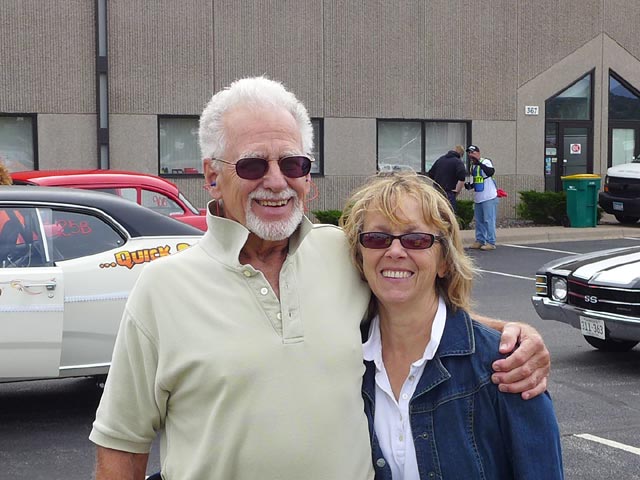
The races themselves were exciting as well as loud! Ear plugs were a hot selling item. If you click on the picture to see and larger version and then look closely at my ears in the picture of Jo and me, you’ll see them sticking out of my ears.
Here’s a few photos from the event, followed by a video of the race.
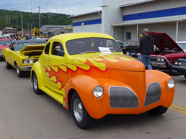
Despite the roaring flames this customized 1940 Studebaker Coupe wasn’t in the race but was a strong contestant in the car show. Owned by Steve Carlton of Duluth
But this 1969 Chevelle piloted by Ryan Humes of Superior, Wisconsin was in the race and recorded two wins before being eliminated
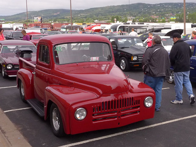
This sharp customized 1951 International Pickup is owned by Matt Johnson of Duluth. This baby can really scoot, finishing under 7 seconds. But unfortunately Matt got eliminated in the first round.
This chopped 1930 Model A Coupe is owned and raced by David Karcher of Taylor Falls, MN. Dave was a semi-final winner in his class
Here’s a video I put together. Keep your finger on the volume control because it is loud!
We have some more photos and links to the drag race website on our Duluth Drag Race page on our SuperiorTrails.com website. So go there for more info.
If you want to go to this race and car show event next year check back on our SuperiorTrails Drag Race page. We’ll post race info there when we get it.
The Natchez Trace Parkway runs from Natchez, Mississippi to Nashville, Tennessee, about 440 miles. Traveling the Trace is an excellent way to step back in time to an era of the scenic road trip where you take the time to enjoy the trip itself. Trucks and commercial vehicles aren’t allowed on the parkway. Nor are billboards, stop lights, or commercial establishments. Along the roadsides, the human footprint is light, only a changing variety of scenery and topography provided by Mother Nature.
Along the route are numerous historical markers, restored historical sites and exhibits, rest stop parks, picnic areas, hiking trails, and public campgrounds. Within a short distance of the Trace are towns and communities with additional services and attractions, some of them with worthy scenic or historical value in of themselves.
The maximum speed along the Trace is 50 mph. The idea is a stress free, scenic, and enjoyable ride in an auto, RV, motorcycle, or road bike (there’s a special network of rustic campsites reserved for bike riders). A bonus is you can save gas by driving at a comfortable 50 mph without being hassled by drivers behind you.
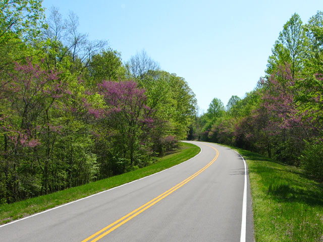
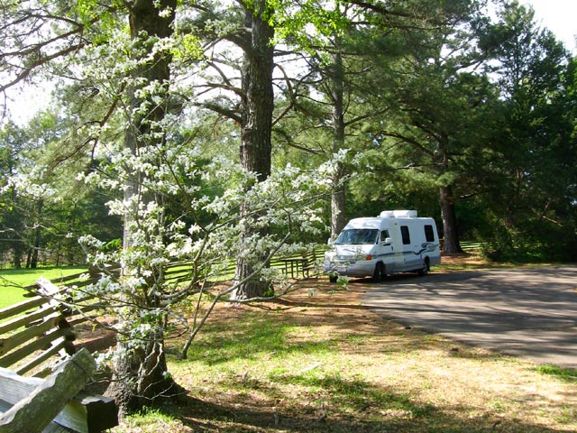
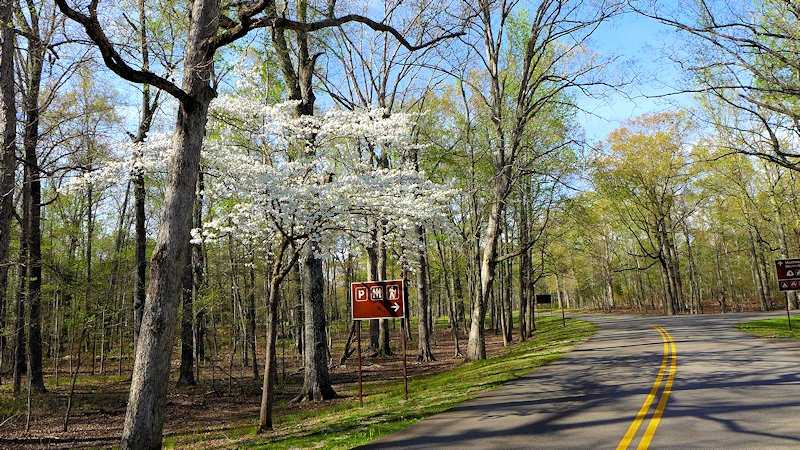
Red Buds popping out along the Natchez Trace Parkway
History of the Old Trace
The parkway roughly follows the historic Natchez Trace, a trail whose roots goes back to the 1600s evolving from hunting trails used by the Natchez, Chickasaw, and Choctaw Indians. Around 1700 French explorers and traders established a trading post near the present day Natchez and later Fort Rosalie constructed as the European population in the area expanded. Conflicts with the native Natchez people ensued and by 1735 the Natchez Indian community in the area was essentially wiped out and the village of Natchez began to form.
For the next 50 years European influence expanded in the area between the lower Mississippi valley in Natchez and the Ohio River and Cumberland River valleys in the north.
By 1800 Nashville had become the most significant community in the Kentucky-Tennessee territory. Also by this time a defined trail had taken shape between Natchez and Nashville as an overland return route from farmers and traders who floated their crops and products down the Cumberland, Ohio, and then the Mississippi Rivers to markets in Natchez and New Orleans. With no practical way to navigate their craft back up the Mississippi River, the float boats that carried the cargo were disassembled and the lumber sold. Then the Boatmen had to walk or ride back home.
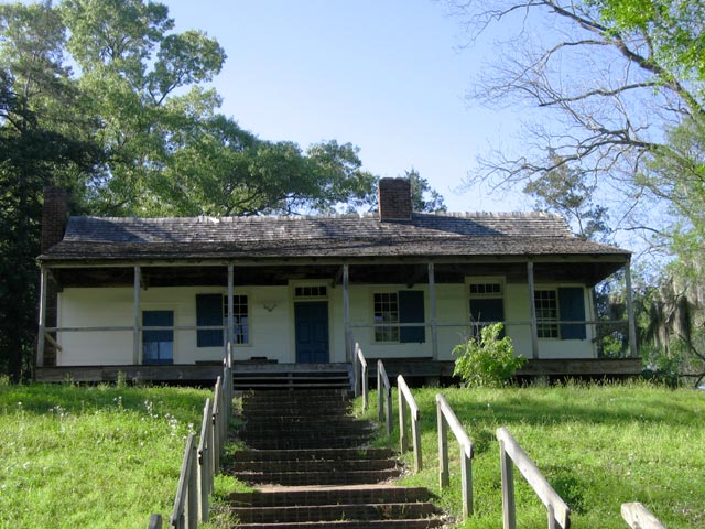
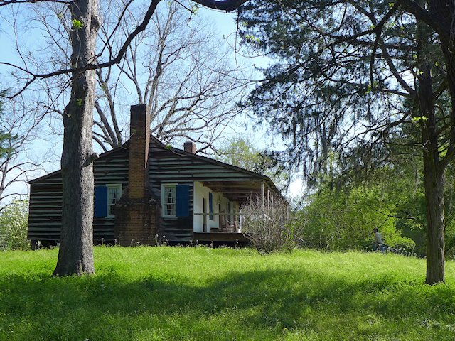
The Trace was the trail that formed from thousands of travelers following this path. Over time inns (called “stands”) and small communities grew up along this route to serve travelers along the trace. One of these inns, Mount Locust Inn & Plantation, has been restored and is open for daily tours from February through November.
By 1810 an estimated 10,000 Boatmen (called “Kaintucks”) were using the Trace and the two towns at either end (Natchez and Nashville) had become cemented as major communities.
In 1801 President Jefferson authorized construction of a national road along the Trace as a national security measure. Army troops began clearing brush and building bridges along the trail and in a few years a good section of the trail had been improved from a winding, narrow path to a wider more comfortable road for wagons and horses and began attracting numerous travelers in addition to the Boatmen.
From 1812 to 1815 the Trace was a major route used by Andrew Jackson’s Tennessee Volunteers during the War of 1812 and the 1815 Battle of New Orleans. By 1820 the invention of the Steamboat allowed two way travel up and down the Mississippi and Ohio rivers meant the Trace began to lose its main customers. In addition a new road, called Jackson’s Military Road was being constructed. This route cut about one third of the distance between Natchez and Nashville off the original Trace. By 1900, due to improvements in river travel and the competition from more recent roadways, the Trace had reverted to a wilderness state along much of its original course.
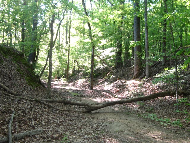
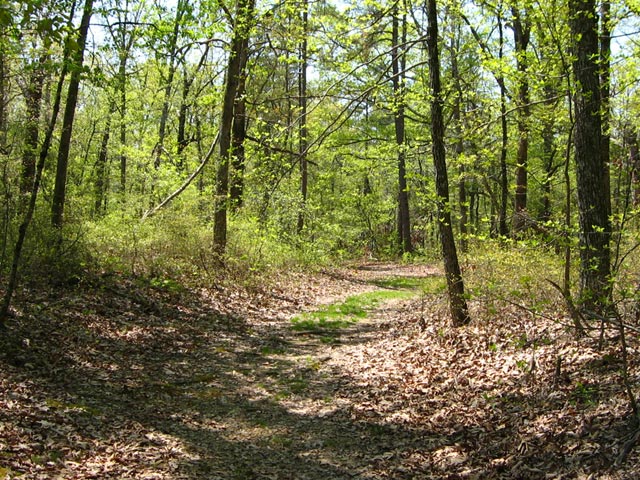
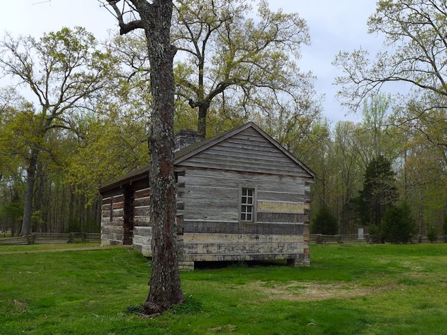
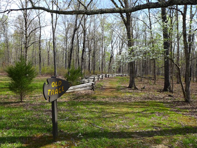
A portion of the historic Old Trace trail from Natchez to Nashville