Camping at Fort Pickens National Park

Fort Pickens Beach Sunset

Fort Pickens Campground RV Park Review, Pensacola Beach Florida Pros & Cons, What to like and not like about camping at Fort Pickens. See campground maps, pictures, information and links below. The Fort Pickens Gulf Islands National Park RV park and campground is set about a half mile east of the old fort, nestled between … Read more

Natchez Trace Scenic Drive

natchez trace national parkway

Natchez Trace National Parkway National Park

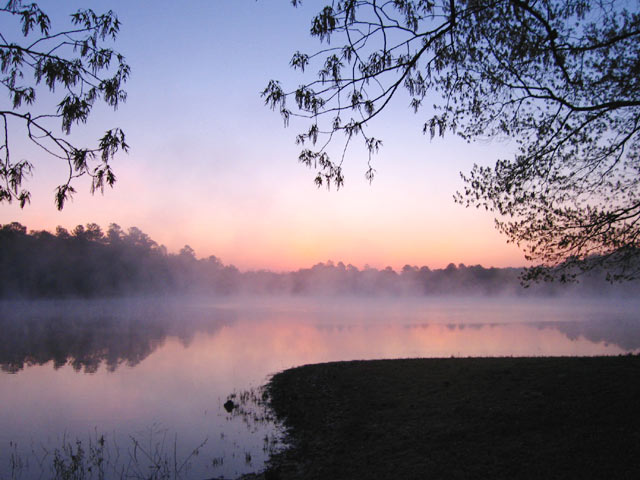
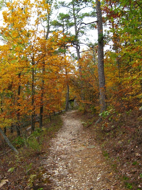
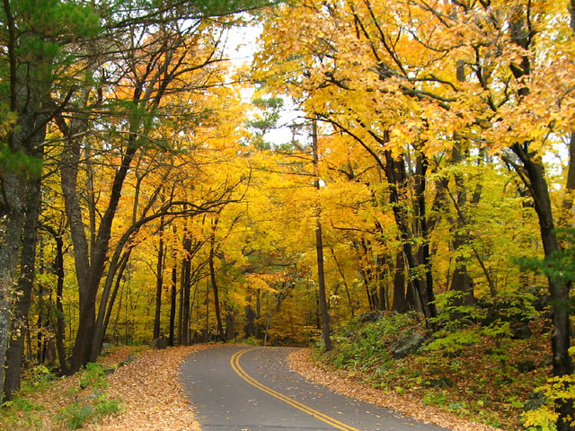
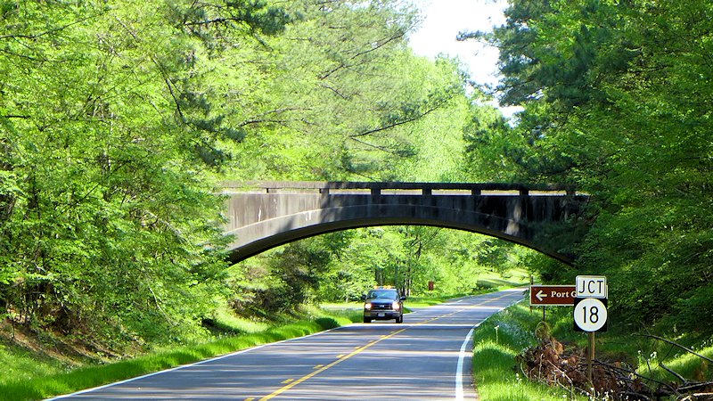
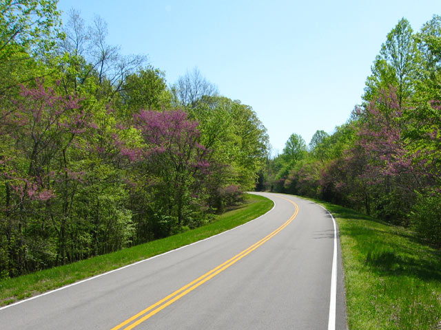
The Natchez Trace Parkway runs from Natchez, Mississippi to Nashville, Tennessee, about 440 miles. Traveling the Trace is an excellent way to step back in time to an era of the scenic road trip where you take the time to enjoy the trip itself. Trucks and commercial vehicles aren’t allowed on the parkway. Nor are billboards, stop lights, or commercial establishments. Along the roadsides, the human footprint is light, only a changing variety of scenery and topography provided by Mother Nature.

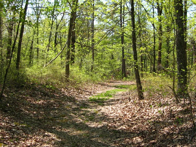
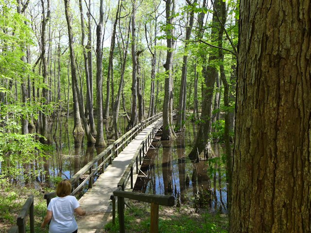
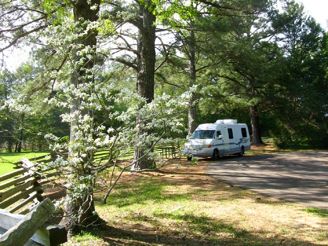
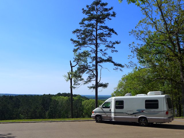
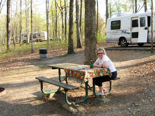
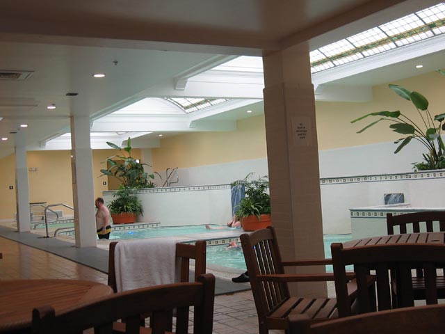
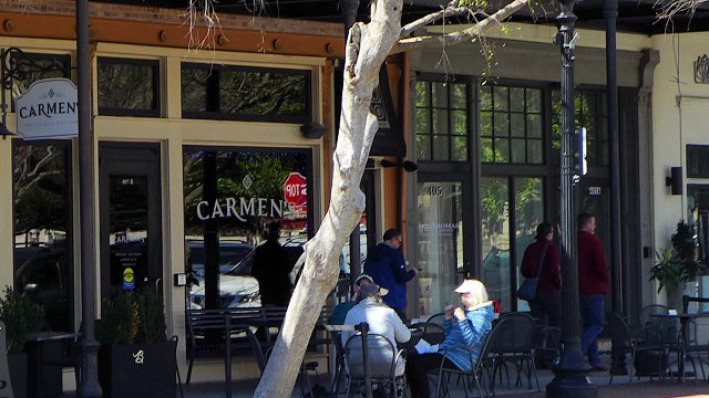
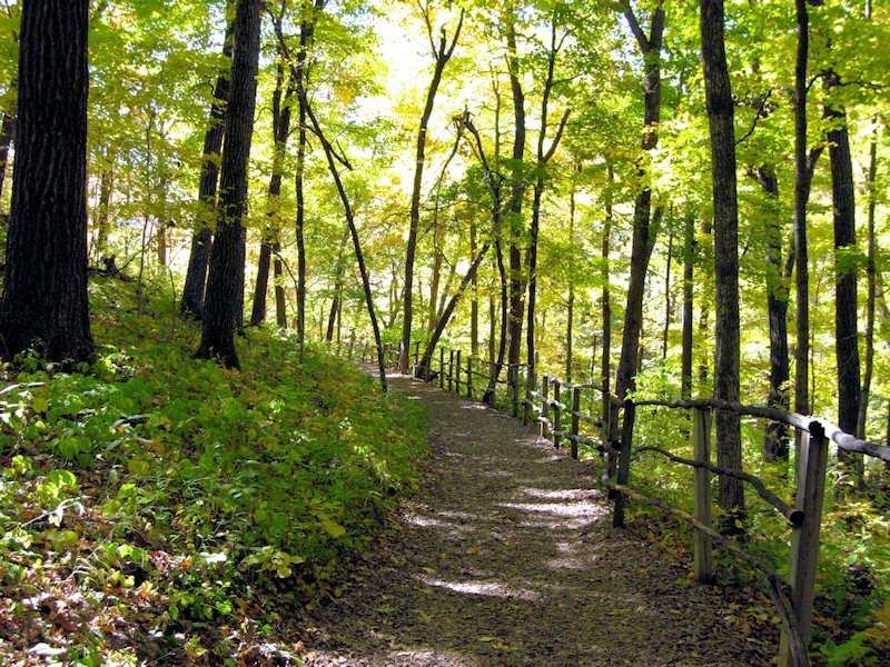
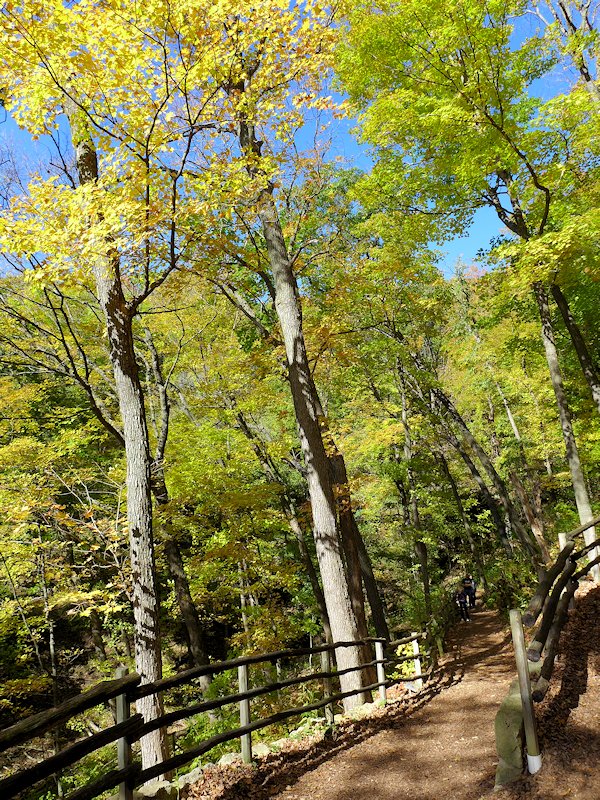
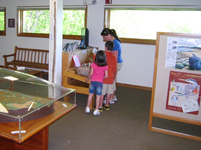
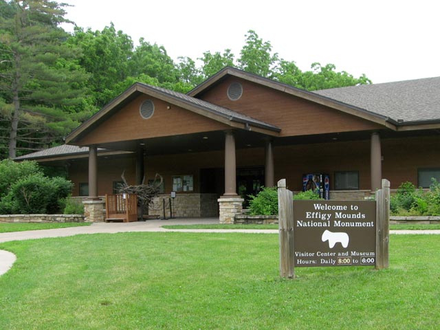
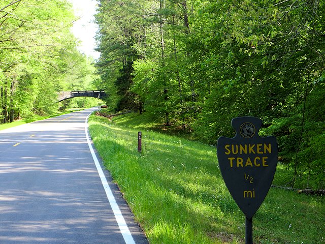
Along the route are numerous historical markers, restored historical sites and exhibits, rest stop parks, picnic areas, hiking trails, and public campgrounds. Within a short distance of the Trace are towns and communities with additional services and attractions, some of them with worthy scenic or historical value in of themselves.

The maximum speed along the Trace is 50 mph. The idea is a stress free, scenic, and enjoyable ride in an auto, RV, motorcycle, or road bike (there’s a special network of rustic campsites reserved for bike riders). A bonus is you can save gas by driving at a comfortable 50 mph without being hassled by drivers behind you.

Natchez Trace Red Buds
Red Buds popping out along the Natchez Trace Parkway


History of the Old Trace

The parkway roughly follows the historic Natchez Trace, a trail whose roots goes back to the 1600s evolving from hunting trails used by the Natchez, Chickasaw, and Choctaw Indians. Around 1700 French explorers and traders established a trading post near the present day Natchez and later Fort Rosalie constructed as the European population in the area expanded. Conflicts with the native Natchez people ensued and by 1735 the Natchez Indian community in the area was essentially wiped out and the village of Natchez began to form.

For the next 50 years European influence expanded in the area between the lower Mississippi valley in Natchez and the Ohio River and Cumberland River valleys in the north.

By 1800 Nashville had become the most significant community in the Kentucky-Tennessee territory. Also by this time a defined trail had taken shape between Natchez and Nashville as an overland return route from farmers and traders who floated their crops and products down the Cumberland, Ohio, and then the Mississippi Rivers to markets in Natchez and New Orleans. With no practical way to navigate their craft back up the Mississippi River, the float boats that carried the cargo were disassembled and the lumber sold. Then the Boatmen had to walk or ride back home.

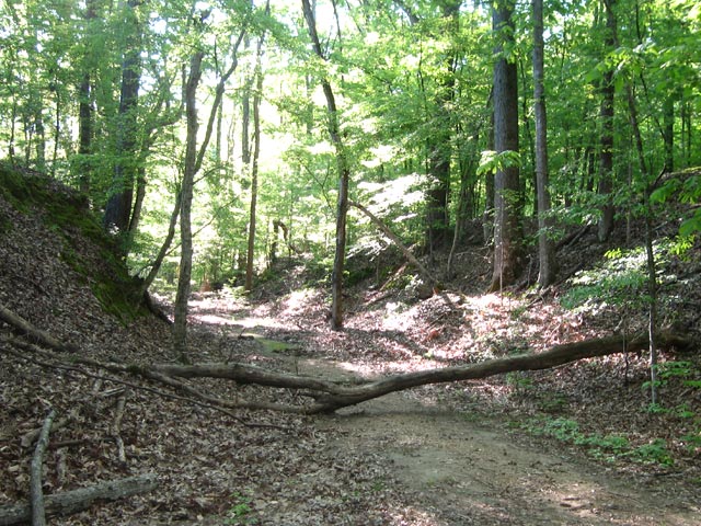
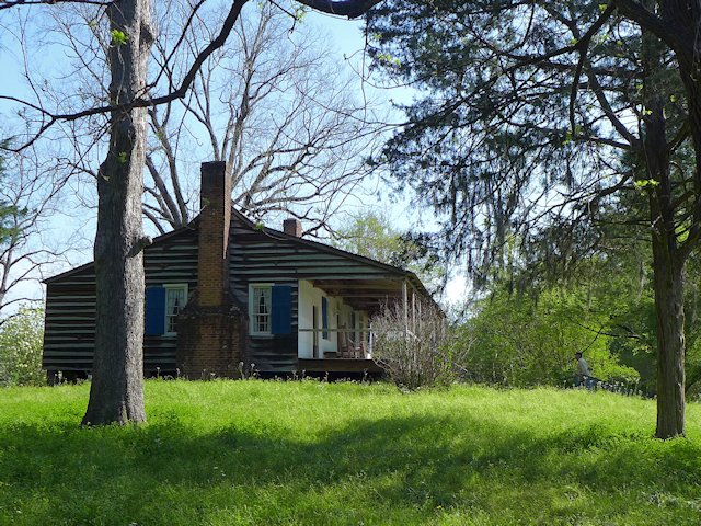
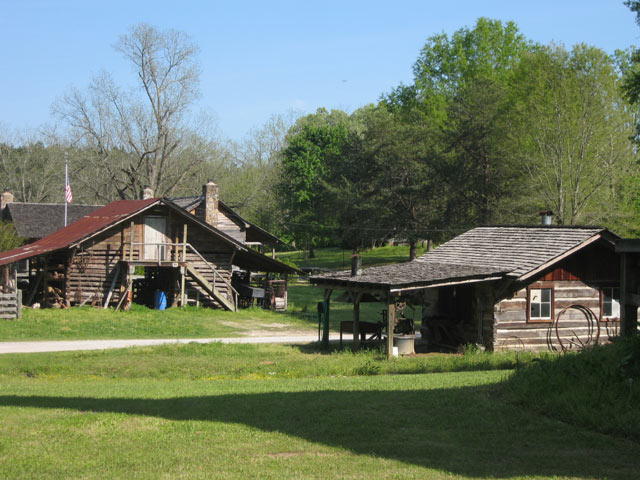
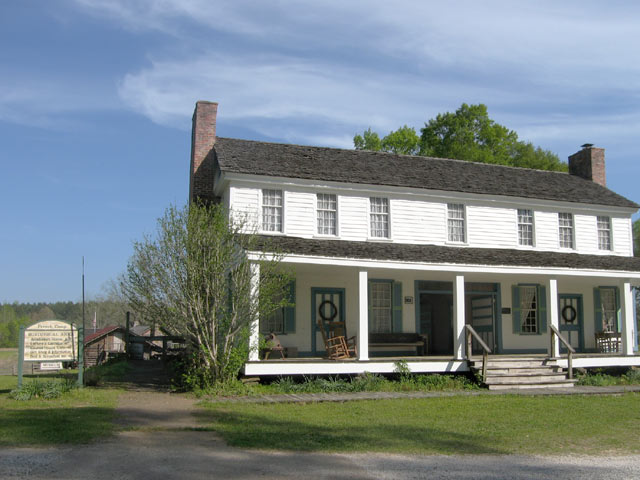
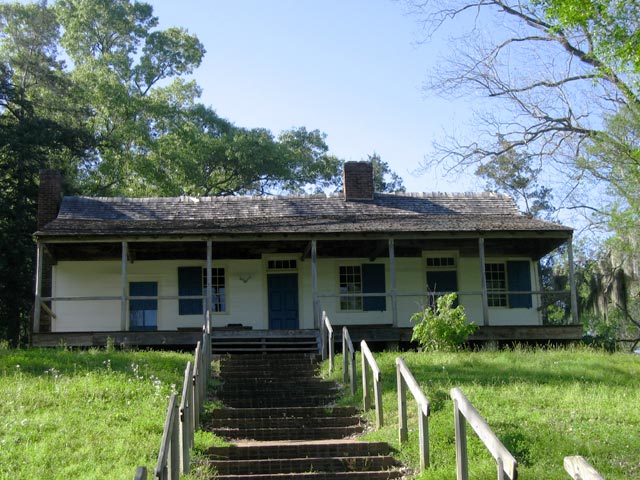
The Trace was the trail that formed from thousands of travelers following this path. Over time inns (called “stands”) and small communities grew up along this route to serve travelers along the trace. One of these inns, Mount Locust Inn & Plantation, has been restored and is open for daily tours from February through November.

By 1810 an estimated 10,000 Boatmen (called “Kaintucks”) were using the Trace and the two towns at either end (Natchez and Nashville) had become cemented as major communities.

Natchez Trace Articles


About the Natchez Trace Drive (this page)


Travelogue: Natchez Trace Parkway, Part 1


Meriwether Lewis Natchez Trace  Park


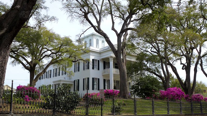
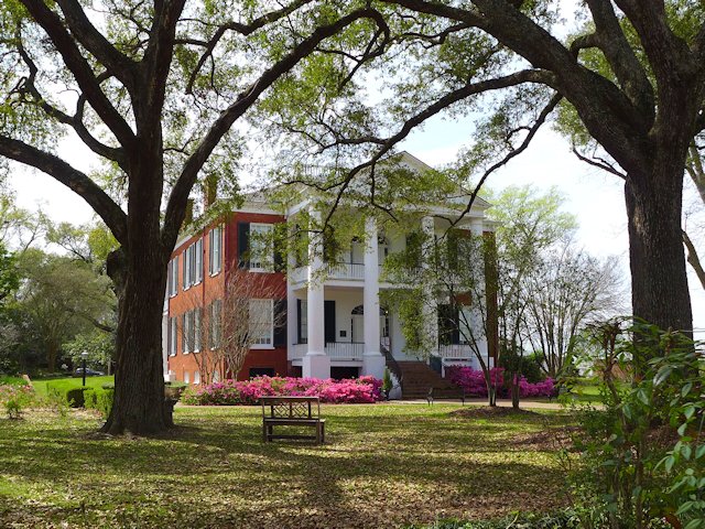
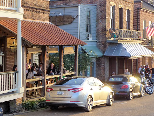
Visiting the Historic City of Natchez

natchez trace parkway
There are several pull-offs along the parkway where you can see portions of the original old trace.
Mount Locust, Natchez Trace Parkway
Mount Locust, historic inn on the Natchez Trace

Nearby Places of Interest
Historic Natchez, Mississippi
Shiloh Military Park

The Natchez Trace – Our First National Road

In 1801 President Jefferson authorized construction of a national road along the Trace as a national security measure. Army troops began clearing brush and building bridges along the trail and in a few years a good section of the trail had been improved from a winding, narrow path to a wider more comfortable road for wagons and horses and began attracting numerous travelers in addition to the Boatmen.

From 1812 to 1815 the Trace was a major route used by Andrew Jackson’s Tennessee Volunteers during the War of 1812 and the 1815 Battle of New Orleans. By 1820 the invention of the Steamboat allowed two way travel up and down the Mississippi and Ohio rivers meant the Trace began to lose its main customers. In addition a new road, called Jackson’s Military Road was being constructed. This route cut about one third of the distance between Natchez and Nashville off the original Trace. By 1900, due to improvements in river travel and the competition from more recent roadways, the Trace had reverted to a wilderness state along much of its original course.

A portion of the historic Old Trace trail from Natchez to Nashville

Learn More – Natchez Trace Parkway Travelogue:

Natchez Trace National Parkway Website

Traveling The Modern Natchez Trace Parkway

A Great Road Trip

One of the most scenic and stress free road trips you can take. In the Spring you can catch the blooming Red Buds, Dogwoods, and wildflowers. In the fall beautiful colors as the leaves are changing.

The Natchez Trace Parkway begins north of the city of Natchez (see our article on Visiting historic Natchez, Mississippi), the oldest town on the Mississippi River and the southern terminus of the historic Natchez Trace. The parkway runs 444 miles, through three States, ending south of Nashville, Tennessee.

There are some interesting small towns along the route and hundreds of wayside stops with some sort of scenic or historical interest along the Parkway. Rated by Mike and Jen of RVlifestyle.com as their favorite RV road trip in the US. We agree and highlight below some of our favorite points of interest along the Trace.

The rooms in the old Mount Locust Inn, with period furnishings, are open for viewing.

Our Favorite Points of Interest Along the Natchez Trace:

Mount Locust, Milepost 15.5

Traveling north from Natchez, one of the first stops you should make along the Trace is at Mount Locust, milepost 15.5. Back in the day, this was Day 1 on the Boatman’s trip back to the Ohio Valley. The stand was originally constructed as a farm homestead in 1780. But being in the right place at the right time encouraged later owners, the William Ferguson family, to open up a crude inn to serve the growing number of travelers. Eventually an annex was constructed to better meet the need. The Inn has been restored and is open for daily tours from February through November. See link to Mt. Locust Brochure.

Sunken Trace, Milepost 41.5 – At several points along the parkway the “old Trace” intersects with or comes close to the Parkway. At mile marker 41.5 is one of many rest stops where you can walk to and through a portion of the original Trace.

Old Natchez Trace sunken trail

Rocky Springs, Milepost 54.8 – The former community of Rocky Springs is now a park, picnic site and rustic campground. A self-guided trail leads to the location of the former village and to the graveyard and old church that are all that remain of a village that once held over 2000 souls. Map of Rocky Springs Campground & Historical Site

Cypress Swamp, Milepost 122.0 – At mile marker 122 you’ll have an opportunity to stretch your legs with a half-mile loop annotated nature trail through a Cypress and Water Tupelo Swamp. We saw a baby alligator sunning itself on a little island in the swamp pond.

cypress swamp natchez trace
The nature trail begins with a boardwalk through the center of the swamp.

Holly Hill Rest Stop, Mile Marker 154.3 – One of 44 picnic areas along the Trace. There is picnic tables and accessible rest rooms.

Holly Hill Rest Stop, Natchez Trace
Holly Hill Rest Stop, Mile Marker 154.3, one of 44 picnic areas along the Natchez Trace

French Camp, Milepost 180.7 – A “stand” (inn) was established here in 1812 serving travelers along the Trace. Later in 1822 it added a school, which exists to this day. Included in the restored complex, joined by a boardwalk, are a cafe, gift shop, visitor center, log cabin, crafts center, and sorghum making center. An interesting historical stop, an opportunity to stretch your legs, and get a bite to eat.

Link to Historic French Camp Village website

French Camp, Natchez Trace
Blacksmith Shop and Barn of the French Camp
French Camp
The Drane House, an 1845 restored antebellum home is open for tours

Jeff Busby Park, Milepost 193.1 – Named for Mississippi Congressman Thomas Jefferson Busby (whose bill created the Parkway), the park has a visitor exhibit area, a nice picnic area with tables, grills, and parking, a 22 site campground, restrooms, hiking trails, and a mountain top overlook that is one of the highest points in Mississippi.

Jeff Busby Campground & Picnic Area Map – Jeff-Busby-map

Jeff Busby Overlook
The Scenic Overlook picnic area at the Jeff Busby Trace Park.

Natchez Trace Parkway Visitor Center, Tupelo, Mississippi, Milepost 266.0

The Natchez Trace Parkway Visitor Center has a twelve-minute orientation film, interpretive displays about the natural and cultural history of the Natchez Trace, as well as an Eastern National Bookstore. A park ranger is available from 8:00 am to 5:00 pm daily (except Christmas Day) to answer any questions you may have. This is also the location to get your passport stamps for the Natchez Trace Parkway, Natchez Trace National Scenic Trail, Tupelo National Battlefield, and Brices Cross Roads National Battlefield.

Visitor Center Events Calendar


Visit the Shiloh National Military Park
Exit at Mile Marker 293
Visitor Centers at Corinth &
Shiloh Battlefield


Detour – As of April 4, 2022 a section of the Trace between mile markers 293 and 321
remains closed for repairs. Here is the detour route.


Meriwether Lewis Site Milepost 385.9

This is the largest and most impressive of the 3 campground-parks actually on the Trace. It site has a campground, modern washrooms, picnic areas, some decent hiking trails, and a historical exhibit on famed explorer Meriwether Lewis, including a monument erected at the site of his burial and a replication of the Grinder House, the “Stand” where Lewis stayed over-night on his way back East and mysteriously died of gunshot wounds in the middle of the night. Exhibits tell the story of that evening, plus other significant aspects of Lewis’ history.

Merriweather Lewis Campground
Relaxing at the Meriwether Lewis Campground, Natchez Trace Parkway

While the campground has no utilities it has paved and reasonably level parking areas for RVs. Each wooded site has a picnic table, a fire pit, trash bin, and nice separation from adjacent sites. Like all the National Forest Campgrounds along the trace, it is first come, first serve for campsites so best to get there early in the afternoon or it will be full.

See more photos and info on things to do and see at Meriwether Lewis Park and Campground here.


Camping Along the Natchez Trace

The National Park maintains three improved campgrounds along the Trace (all of which were profiled above): Rocky Springs, Jeff Busby, and Meriwether Lewis. In addition there are several rustic campgrounds reserved for bikers or hikers. Within a few miles of the Trace are both private and public campgrounds with utilities for RVs. This page has links to State Parks convenient to the Trace.

Morning Fog across the Lake at Tishomingo State Park along the Natchez Trace Parkway

More Natchez Trace Links & Publications

National Parks Directory – ScenicPathways

Natchez Trace Articles on Scenic Pathways

Hot Springs National Park

Hot Springs National Park Springs

Hot Springs National Park – Camping, Hiking, and Scenic Attractions

Located near the southern end of Arkansas Scenic Highway 7, Hot Springs National Park is located in the center of the city of Hot Springs while also set in the mountains surrounding the town.

Situated in a valley in the Zig-Zag mountain range, Hot Springs is surrounded by hills. The National Park begins in the center of the city and encompasses the mountains to the east and west. So only minutes from downtown Hot Springs you can be in the woods several hundred feet above all the hustle and bustle of the city.

Hot Springs became a center for physical therapy not only because of its abundant hot springs, but also because an extensive network of hiking trails were built in the hills surrounding the city to provide an exercise program to supplement the hot springs spa treatments. The trails vary from easy walking trails to more rugged to allow people to progress gradually to more strenuous exercise.

The Promenade Walk runs above Bath House Row and overlooks downtown.

Hiking and Backpacking Trails

The primary trail network is on Hot Springs Mountain with downtown Hot Springs and Bathhouse Row anchoring the western foot of the mountain. The Gulpha Gorge park and campground anchors the eastern foot of the mountain.

The trail to the top of Hot Springs Mountain from Gulpha Gorge
Map of hiking trails hot springs national park
Hiking Trails between the Gulpha Gorge Campground and Bathhouse Row

In all there are 23 hiking trails but since many intersect with one another there are many more route options than the 23. The Hot Springs Mountain trails in turn link to other trails on adjacent mountains and hillsides: North Mountain, West Mountain, Music Mountain, and Sugarloaf Mountain.

The only campground in the park is at Gulpha Gorge so overnight backpackers would simply plan a route that would return them to Gulpha Gorge by the end of the day. Day hikers have the choice of several trail heads sprinkled throughout the park. Here’s a list of the hiking and walking trails from the Park Website.

Bath House Row

The “Hot Springs” and the spa bath houses offer both a historical  and medicinal attractions. The National Park Visitor Center is located in BathHouse Row – see our article here within one of the historic bathhouses – The Fordyce. The Fordyce Bath House has been restored to be a museum of how it was in the hay day of the Bath Houses. Free self-guided tours are available as well as narrated tours and a film on the history of the bath houses. There are a few bath houses remaining in operation and others have been restored but re-purposed for other uses.

Bathhouse Row Hot Springs National Park
Bath House Row Downtown Hot Springs

Gulpha Gorge Campground at Hot Springs National Park

When visiting Hot Springs, we generally stay at the Gulpha Gorge campground in Hot Springs National Park (see our review here). Located on the east side of Hot Springs Mountain, it is convenient to downtown Hot Springs, yet in a wooded setting, isolated from the urban area. It is an attractive campground among tall pine trees along Gulpha Creek.

Scenic Mountain Drives & Overlooks

Non-hikers can drive to the top of Hot Springs and West Mountain summits. There are several scenic lookouts along the drives as well as some picnic areas. At the top of Hot Springs Mountain is the 10 story Hot Springs Tower with an observation deck at the top. (The Tower is a commercial operation that charges a fee to visit the observation deck.)

Other Scenic Drives. Another scenic drive is south of Hot Springs to the top of Jack Mountain. West of Hot Springs is the Quachita Mountains and Lake Quachita. A nice day trip is a scenic 80 mile loop around Lake Quachita out to Mt. Ida and back to Hot Springs.

West Mountain, Hot Springs, AR
At the top of West Mountain looking towards Music Mountain, Hot Springs, AR
West Mountain, Hot Springs Tower
View from the top of West Mountain looking towards the Hot Springs Tower

Dining and Entertainment

Hot Springs National Park is quite large – 5500 acres – and almost completely surrounded by the city of Hot Springs. The centerpiece of the park – Bathhouse Row – stretches along the south side of Central Avenue. Across the street from Bathhouse Row, on the north side, is the center of the dining and entertainment district of downtown Hot Springs.

Restaurant Review: Steinhaus Keller

Down the street a little west of Bathhouse Row is one of our favorite Hot Springs restaurants and pubs. Formerly known as the Brau Haus which closed sometime in 2013, it has been re-opened at the same location as Steinhaus Keller. It is located in the lower level of a three or four story atrium in an area called Spencer’s Corner. Being below street level, it is not easily seen from the sidewalk. Above Steinhaus Keller and more prominently signed and easily noticed is Brick House Grill, known locally as offering the best burgers in town. Next time we are in town we’ll have to try them out.

Steinhaus Keller German Restaurant Hot Springs
You can dine outside in the atrium, inside at the bar overlooking the atrium, or in their intimate dining room

But on our most recent visit in late March 2014, we had our palates set for some good German food. I had their Sauerbraten and Jo had the Wienerschnitzel – both excellent meals, including our side dishes. The wait service was attentive, friendly, and professional. They offered a very good selection of beers from Germany, Austria, and eastern Europe. Jo had a black lager and I had an Oktoberfest. We noticed that the guy behind the bar was the same as when we ate there a few years ago and then it seemed he had an ownership interest in it. Don’t know the history on why the Brau Haus closed, but based on this recent visit we give the current iteration under a new name a strong recommendation.

More Hot Springs Restaurant Reviews

More Links to Hot Springs Attractions:

–Ross


Fort Pickens National Park Review

Camping and Visiting Fort Pickens & Gulf Islands National Seashore Park – Pensacola Beach, Florida

Top 10 things to do at Fort Pickens Gulf Islands Park & Campground?

  • Go beach combing, swimming, and sunbathing on sparsely populated white sand beaches on the Gulf of Mexico.
  • Tour the historic Fort Pickens and Island Gun Batteries and learn about the military history of the Fort and of Santa Rosa Island.
  • Hike the several hiking and nature trails in the park.
  • Bird-Watching. Over 280 species of birds have been identified on the gulf barrier islands.
  • Visit the Gulf Islands Discovery Center to explore exhibits on the natural environment, wildlife, and history of the Fort Pickens Area.
  • Bike the roads in the park and bike the 6 mile road between the park and the fun things to do in Pensacola Beach.
  • Camping in a tent or RV in one of the full-service campsites or in a group the more rustic backcountry sites. (See our Fort Pickens Campground Review here)
  • Like Fishing? Fort Pickens does have a fishing pier that extends out into Pensacola Bay.
  • If staying in the campground, enjoy numerous attractions in the nearby vacation community of Pensacola Beach and the larger city of Pensacola across the bay from the park. At the end of this article are several links to interesting things to see and do in the area.
  • Watch the famed Blue Angels Flight team from the Fort Pickens Pier


Slide Show Top Fort Pickens Attractions

  • Historic Fort Pickens
    The 1834 historical fort is the main visitor attraction for non-campers. The Fort along with the island's numerous gun batteries has an interesting military history from before the civil war through World War II.
  • Fort Pickens Campground
    The popular campground at Fort Pickens will accommodate larger RVs as well as smaller units and tents
  • Fort Pickens Gulf Beach
    The uncrowded pristine beaches at Fort Pickens are among Floridas top rated.
  • Fort Pickens Hiking Trails
    Hiking/biking Trail from the Fort to the Campground
  • Biking at Fort Pickens
    Bikes are useful for riding from the campground to one of the beaches within the park as well as on the hiking/biking trails in the park. Also useful to ride the 6 miles into the town of Pensacola Beach (speed limit on the park road is 25 mph and is not heavily traveled)

Pensacola Beach Santa Rosa Island
If you like the excitement of ocean resort towns, Pensacola Beach is less than
15 minutes from the Fort Pickens campground

Driving Directions to Fort Pickens Historical Site from Pensacola, Florida

To get to Fort Pickens from Pensacola on the mainland, you have to take the bridge across the bay to Gulf Breeze and then take another bridge to Pensacola Beach on Santa Rosa Island.

Touring Historic Fort Pickens

Historic Fort Pickens
The 1834 historical fort is the main visitor attraction for non-campers.
The Fort along with the island’s numerous gun batteries
has an interesting military history from before the civil war through World War II.

History buffs, particularly those interested in US military history from the War of 1812 to World War II, will also enjoy the experience of touring the old Fort Pickens and several gun batteries that exist throughout the park. Fort Pickens also has an interesting museum, featuring interactive exhibits on the natural and historic features of the Gulf Islands National Lakeshore.

The restored 1834 Fort and the assortment of many shoreline battery units added to the complex in World War II are one of the major attractions of the park. Go here to learn about the fascinating military history of this fort and its companion Fort Barrancas which is situated across the bay.


Fort Pickens Campground

Located on the remote western end of the island, Fort Pickens Recreation Area & Campground is the largest unit of the Gulf Island National Seashore. It is a great spot for people who enjoy sun and surf, relaxing by the ocean or walking the beach in an uncrowded, natural setting. The Fort Pickens campground is set about a half mile east of the old fort, nestled between the remains of several of the coastal artillery gun batteries that were constructed during World War II. It offers over 200 sites, with about 170 with utilities for RVs.

See our Review & more information on Camping at Fort Pickens here

fort pickens map
Fort Pickens map (from Google Maps)

Alternative Campground. Times when we’ve not been able to get into the park due no sites available, we often have been able to find a spot at Big Lagoon State Park at the western end of Pensacola.

Fort Pickens Park Hiking Trails

There are hiking trails from the campground to the Fort Pickens restoration and museum, from the campground to the sand beaches facing the gulf, to the beaches on Pensacola Bay, between the two major camping areas, to some of the World War II Gun Battery encampments, and to picnic pavilions in the park. And there are several miles of sand beach to hike!

fort pickens hiking trails
hiking from the campground to the old Fort

Fort Pickens Discovery Center

The Fort Pickens museum offers exhibits on the Gulf Islands eco system and the natural environment, wildlife, and history of the Fort Pickens Area.

fort pickens discovery center
Gulf Islands Seashore Museum on the grounds of the Fort Pickens encampment


Biking around Fort Pickens

Fort Pickens is a great spot for biking if you are camping at one of the Fort Pickens Campgrounds. The sand hiking trails are generally firm enough to bike on and the extensive network of roads within the park have low speed limits and are lightly traveled. Some of the beach recreation areas are far enough away from the campground that you’d want to either drive or bike to them.

When we stay at the campground, we usually make at least one bike trip into Pensacola Beach to browse around town or get a bite to eat at one of the top Pensacola Beach seafood restaurants

Biking at Fort Pickens
Bikes are useful for riding from the campground to one of the beaches within the park as well as on the hiking/biking trails in the park. Also useful to ride the 6 miles into the town of Pensacola Beach (speed limit on the park road is 25 mph and is not heavily traveled)

Fort Pickens & Gulf Island National Seashore Links:

Other Top Attractions in Pensacola and Pensacola Beach

Bathhouse Row – Hot Springs National Park

hot springs national park bath houses

Hot Springs National Park – Visiting Historic Bathhouses Row & Attractions

Seven of the original historic Hot Springs bathhouses along Bathhouse Row remain and have been restored or in the process of restoration. Some offer classic hot springs spa experiences, others are open for tours, and some have been repurposed for other uses (like a restaurant or brew house).

Hot Springs Fordyce Bathhouse
The restored Fordyce Bath House serves as the visitor center for Hot Springs National Park

The historic Fordyce Bathhouse serves as the National Park Visitor Center. In addition to information on the park and activities, the various rooms and services of the original bathhouse have been preserved and restored and can be seen in a self-guided tour. Also a small theater with a 15 minute movie presentation of the bathhouse era. Touring the bathhouse facilities can take from 15 minutes to an hour depending on how much time one wants to spend with each exhibit.

Touring the Fordyce provides a fascinating look into an era and the forerunner of the todays resort spas. The facilities served a wide variety of patrons from those with quite serious maladies to the wealthy leisure class looking to be pampered and enjoying what was essentially a club-like ambience.

bATHHOUSE rOW hOT SPRINGS
Looking North down Bathhouse Row, Lamar Bathhouse in the foreground

Open Bathhouses on Bathhouse Row

Quapaw Bath House Hot Springs
Quapaw Bath House, Bathouse Row Hot Springs National Park

Two of the bathhouses currently serve patrons. The Quapaw Bathhouse operates much as it did back years ago, offering both a large communal bathing pool as well as private bathing tubs. Their principal appeal is to those who are looking to soak in the hot, mineral rich waters. The second operating bath house, the Buckstaff Bathhouse, offers a more modern version and a complete array of spa services. In addition to soaking in a tub, they offer loafa scrubbing sponges and massages.

We decided to try out one of Bathhouses. We chose Quapaw because it had a package that fit our needs -a private spa for two. While the large public spa pools are refurbished versions of the pools from the 1920s our private spa room was somewhat newer and more modern – basically a Jacuzzi for two. So we didn’t step back 90 years to sample a replica of what had been in the heyday of Quapaw. But none-the-less the spa was soothing – you could feel something different in the water – it wasn’t the same as our hot tub at home. But afterword Jo and I decided next time we’d have a go at the public pool because you could move around more and get a little water aerobic exercise. And the public spa is a from the original bath house.

Private Spa Quapaw Bath House
Jo enjoying the private spa at the Quapaw Bath House
Quapaw Bath House Hot Springs
The Public Bath at Quapaw Bath House

Other bathhouses are being converted to other uses. The Ozark Bathhouse is the home of the Hot Springs Museum of Contemporary Art. The Hale Bathhouse offers a café and bookstore and now offers Hotel accommodations. The Superior Bathhouse is now the only Brewery in a National Park and the only brewery in the world to utilize thermal spring water in their beer.  The Lamar Bathhouse serves as the parks official gift shop, bookstore, and souvenir shop.

The Hot Springs National Park’s website offers some interesting tidbits on the history of Bathhouse Row plus links to learning more about each of the current bathhouses.

HALE bATHHOUSE
Jo and I enjoyed a cup of coffee and scones in the relaxing lobby of the Hale Bathhouse

The Promenade walk &  Hot Springs

The bathhouses are set in an attractive landscaped park against the base of Hot Springs Mountain where up to 20 springs perculate out of the ground. The street in front of the bathhouses originally was Hot Springs creek, formed from the numerous springs eminating from the mountain. The creek still exists but now it runs in a tunnel underneath Central Avenue.

Hot Springs of Hot Springs Mountain
One of the hot springs flowing out of Hot Springs Mountain

A few of the springs have been left untouched, flowing out of the rock and cascading into pools of water, so visitors can see how they looked years ago. However 44 of the springs are now routed to reservoirs. Some of these provide the water sources for the bathhouses. Three fountains are located in the bathhouse row park, each of them with several spigots for filling up water jugs. The minerals in the water are believed by many to be healthful to drink as well as for bathing and soaking. The water is uncontaminated as it boils up from deep within the earth, estimated to be 4000 feet below the surface. Scientists estimate that the water being drunk today originally fell as rainwater over 3000 years ago!

Hot Springs Grand Promenade
The Grand Promenade runs above Bathhouse Row. In the right foreground is a portion of the Tufa Trail, one of many graduated difficulty walking and hiking paths along the scenic Hot Springs Mountain

The Promenade is a tiled and landscaped walkway that runs along the hillside behind and above the bathhouses. At several points along the walkway one can view the active springs coming out of the ground. Numerous walking and hiking trails intersect with or cross the Promenade. These trails and walkways were constructed as part of the therapy plan of the spas. They cover a wide range of difficulty. The Promenade is the most gentle walkway and is handicapped accessible. Other trails go up the mountain or across the side hills of the mountain. Some are paved and have staircases, others are graveled and several are well-worn dirt trails through dense woods. In the 1920s Dr. Max Oertel designed the original network to provide spa patients an increasing level of difficulty. They could start out on short and relatively level paths and as their endurance and strength increased progress to steeper and more lengthy trails.

Arlington Lawn at Hot springs National Park
Red Buds in bloom near a hot springs pool in the Arlington Lawn of Hot Springs National Park
Tufa Terrace Trail, Hot Springs National Park

Gulpha Gorge Campground & Hiking Trails – The extensive network of hiking trails also connects downtown to the park’s Gulpha Gorge Campground which is on the other end of Hot Springs Mountain.

Other Attractions & Things to See and Do in Hot Springs National Park – Scenic Drives, Restaurants, Hiking and Nature Trails, etc.

More Hot Springs Travel and Attractions Links:

101 Things to see and do in Arkansas

–Ross ross@scenicpathways.com

Raspberry Island Lighthouse

Raspberry Island Lighthouse Apostle Islands

Raspberry Island Lighthouse Tour – Apostle Islands The Raspberry Island Lighthouse is one of six lighthouses in the Apostle Islands. Three of them are open to the public for guided tours; we elected to tour the one at Raspberry Island offered by Apostle Islands Cruise Service in conjunction with the Apostle Islands National Park Service. … Read more

Hot Springs Restaurant Reviews | Ohio Club

Ohio Club Hot Springs

Restaurants & Pubs Hot Springs National Park

Some of Hot Springs most favorite restaurants are located a good distance from the National Park Bathhouse Row and downtown Hot Springs. But when we visit we are there for the camping, hiking, and history that the National Park offers so when we eat out, it is downtown near the park headquarters.

Ohio Club Hot Springs AR
Famous and Infamous people like Babe Ruth, Tony Bennett, Sammy Davis, Jr., Al Capone, Bugsy Segal and others have sat at this historic bar.

Restaurant Review – The Ohio Club

Located across the street from Bathhouse Row, the historic Ohio Club has been doing business since it opened in 1905 as a Casino and Saloon, with brief periods of closure due to fires, floods, and illegal gambling. During prohibition it disguised itself as the Ohio Cigar Store and continued to offer gambling and drinking services to those who knew the password. Over its history, the Ohio Club has served many notable figures in entertainment as well as infamous gangsters who were drawn to its casino operations and clandestine betting parlors.

Both in its exterior and inside, the Club maintains the character of 100 years ago. Its opulent back bar goes back even further than its 1905 beginning, estimated to have been made around 1880. The story is the bar was originally in a Cincinnati tavern and was purchased by the Club’s original owner and transported to Hot Springs where it became the back bar of the Ohio Club. The bar and the interior furnishings give the Club an A+ for atmosphere.

Burgers at the Ohio Club
Service Grade A, Food a B+, and the Beer a B.

The service from the wait staff was excellent and very attentive. Grade A. My water glass was refilled without having to ask, one indicator I use to gauge if the wait staff is on the ball. We had sandwiches and beers. Jo ordered her signature Mushroom & Swiss Cheese burger, topped with lettuce and tomato. I had the Portobello Mushroom Veggie Burger. Both came with a helping of thick fries and a dill spear. Adequate size portions and served on a tasty bun. Loved the fries. We rated the food a B+, decent quality for an under $10 burger basket. Our tap beers were a Porter and a Milk Chocolate Stout. OK, but I felt a bit pricey for tap beers – $6 and $7.

A fun place to stop in, soak up some neat atmosphere, and have a sandwich and beer. And if you like live music, they have it seven nights a week.
Ohio Club Menu, Reviews, Photos, Location and Info - Zomato


Other Good Restaurants in downtown Hot Springs near Bathhouse Row

Another Hot Springs Restaurant we like a lot is Steinhaus Keller. They are on Central Avenue a few blocks south of the bathhouses. They have a decent selection of brews, great German cuisine, and a unique Biergarden. We’ve dined there a couple of times and always came away very happy with the food and the service. See our earlier Restaurant Review of Steinhaus Keller here.

Another unique pub is the Superior Bathhouse Brewery, located in the actual National Park, along Bath House Row and across the street from the Ohio Club. Their beer is brewed with the same 144 degree thermal spring water that serves the other bath houses and the water fountains that are along Bathhouse Row. The Brewery also offers a selection of pub food to accompany your craft brewed beer. Two years ago, we stopped in there shortly after the Brewery first opened and the food service was limited. From reading reviews in Zomato, the menu has expanded dramatically and is getting some very favorable comments. So next time we are Hot Springs, we must eat there (as well as sample the brews).

Rolando’s Restaurante is another downtown restaurant that gets good reviews for its atmosphere and food. If you like Southwestern, Latin and Central American dishes this is the place you should try.

If you are Irish or like Irish dishes, try the Copper Penny Pub. We’ve only had a few brews there during the very crowded post-St. Patty’s Day Parade Celebration (see our video). In the reviews, some have liked the Fish & Chips and other Irish fare, but others not so enthused. So we’ve got to try them ourselves on the next visit.

Other Hot Springs Visitor Links:

Visiting Historic Natchez Mississippi

stanton hall natchez mississippi

Natchez, Mississippi celebrated its 300 year anniversary in 2016. Rich in historic preservation, Natchez is the oldest city on the Mississippi River and the southern terminus of the historic Natchez Trace, now a Scenic National Parkway which runs over 400 miles through three states.

Antebellum Homes, Historic Mansions & Structures

Natchez was fortunate to have a large number of its historic structures survive the great Civil War. Several Antebellum Homes are open for tours year-round and special Pilgrimage Tours are offered in the spring and fall. Maps for walking tours around town identify numerous other historic buildings, some open to the public for tours. Sprinkled among the historic buildings in the downtown historic district are arts and crafts studios, antique emporiums, specialty shops, and bars and taverns offering southern cuisine and blues music.

Rosalie Mansion
Rosalie Mansion (1832) was constructed on the former site of the French Fort Rosalie, built in 1716.

In addition to the Spring & Fall Pilgrimages of historic homes ( March and April, September & October), other annual Natchez events include a month long music festival (in May) and a Food & Wine festival in July.

Natchez Shops
The Darby Fudge Factory is one of many interesting shops in the downtown historic district.

Natchez National Historic Park

There are two National Park facilities in Natchez. One is the William Johnson House Museum and Visitor Center. William Johnson was a barber and prosperous business man who built this house in downtown Natchez in 1840. The park service has restored the building and furnished it with pre-Civil War furnishings similar to those used by the Johnson family. There are also interactive exhibits depicting the lives of Johnson, his family, and the era that he lived, gleaned from a diary that Johnson kept from 1835 to 1851. What makes this exhibit especially interesting is that Johnson was a free black man and he himself owned several slaves.

The second Natchez National Historical Park facility is located on the edge of town. The 80 acre park includes the former Melrose Plantation estate.  The estate includes the main Mansion and numerous out-buildings including the kitchen, dairy, octagonal cistern houses, smoke house, privy, carriage house, barn, and the last remaining slave quarters in Natchez. Some think it is the most complete restoration of a southern plantation in Mississippi. Here’s an excellent article and photos of touring the Melrose Plantation.

Walking Tour City of Natchez Trails

Natchez has organized five walking trails (links lower down the page)  covering interesting natural and historic points of interest. One trail runs along the bluff park promenade with scenic views of the Mississippi River; another traces through the downtown historic district. Plaques and kiosks located along the trails give background on the history of some of the more impressive structures. Walking the trails gave us some good exercise and we saw lots of beautifully restored antebellum mansions, smaller private historic register homes and other historic structures. During our stay in Natchez, we boondocked our RV in the parking lot of the Natchez Visitor Center and each day took a different walking tour.

natchez ms visitor center
The Natchez Visitor Center should be your first stop on visiting Natchez.

Slide Show of the Natchez Bluff Trail 

Scenic views and historical markers along the Bluff Trail


  • Natchez Bluff Walk overlooking the Mississippi
    The upper Bluff Trail Walk offers a nice view of the Mississippi River
  • river walk gazebo natchez, ms
    The gazebo, built by the Spanish in 1790, is the centerpiece of the Bluff Parkway
  • Ealey Brothers fountain Natchez
    Thw Ealey Brothers commemorative fountain is along the Bluff walk and is also part of the Blues Trail of historic events and people
  • Bridge of Sighs Natchez MS
    The "Bridge of Sighs" is an attractive point of interest along the Bluff Top Trail
  • Bluff Trail Stairway
    A stairway from the Bluff Trail leads to another lower river front trail that runs below the bluff along the river.

Slide Show of Natchez Historic Private Homes

Just a few of the many beautiful restored historic homes in Natchez


  • historic homes natchez ms
    Myrtle Terrace was built in 1844
  • Methodist Church Parsonage Natchez Historic Homes
    The Parsonage of the Methodist Church was built in 1852
  • historic homes natchez ms
    The Dorsey House dates back to 1835
  • Cherokee House Natchez Historic Homes
    The Cherokee House was built in 1794


Best Restaurants & Places to Eat in Natchez Mississippi

The Camp Restaurant, Bowie Tavern, Fat Mama’s are some of the fun places to dine or just have a burger and beer. See our reviews of these Natchez restaurants and more here: Best Restaurants in Natchez, Mississppi

Natchez Restaurants
Best Natchez Restaurants-Pubs

Natchez Visitor Links:

Wisconsin Lake Superior Ice Caves

The Bayfield Ice Caves

Touring the ice sculptures of the Bayfield Lake Superior Ice Caves was easily the most popular 2014 & 2015 winter event around Lake Superior. In 2016 and since that time, the Lake Superior Ice was not safe enough to allow travel to the Ice Caves and Formations.

But the winter Lake Superior Region Weather Forecast provides hope that travel to the Sea Cave formations will be possible, perhaps as early as Feb 1.

Bayfield Ice Caves
Ty Daniels tool this shot in 2014 from the inside of one of the ice caves
Bayfield Lake Superior Ice Caves
Jo in front of one of the many ice cave sculptures done by Mother Nature

In 2014, For the first time in 5 years the ice on Lake Superior around the Bayfield Peninsula and the Apostle Islands was thick enough for people to safely hike out to the unique ice sculptures that form in the caves formed in lake shore bluffs the Apostle Islands National Park mainland. See some photos and directions to the Ice Caves from our last visit – Wisconsin Lake Superior Ice Caves.

Tips on Visiting the Ice Caves

If you go up to Bayfield to see this display of Mother Nature sculptures, here’s a few tips for you.

While at times snowshoes would be helpful to travel to the caves, it is likely when you go thousands of people have already trekked out across the ice and snow to the see the caves. So expect the trail to be quite tamped down. (However if it snows heavily just before you go, this may change.) So if you have ice cleats that clamp on your boots, bring them along. Or wear whatever boots you have that will give you decent traction on ice or snow. If you’ve got some ski poles or hiking sticks, bring them.

Also pack a beverage and some energy or granola bars. I figure the hike across the ice to the caves is about a mile and the hike along the caves could be almost a mile. So figure at least four miles round trip and extra time to explore the caves means you’ll be out there a few hours. And this amount of time also means a bathroom break prior to your trek wouldn’t hurt either (Because of the high bluffs the caves are formed in, you can’t sneak off into the woods for a pottie stop!).

Directions to the Ice Caves

The Ice Caves are accessed from the Meyers Beach unit of the Apostle Islands National Park. The road to the beach is off Highway 13 four miles east of Cornucopia, Wisconsin or 17 miles Northwest of Bayfield, Wisconsin. There are places to eat and get grocery items at both locations. Here is a link to our  Lake Superior Region Snow & Weather Reports page for information on traveling.

Lodging. You’ll want to Google for motel accommodations in Bayfield, Washburn, and Ashland as your best bets for finding a place to stay. If all what is available is booked, it is feasible to get lodging in Superior, Wisconsin as via Hwy 13 it is about 60 miles to the Ice Caves from Superior. There are spots between Ashland and Superior that are closer – like Iron River and Brule – but my guess is if Ashland – Bayfield motels are filled for your desired dates, these would be filled as well. Make your reservations as early as you can.

We hope to see the caves again this year. Maybe we’ll see you there.

More Ice Cave Photos and Directions on Visiting the Ice Caves

Ross

Visitor Attractions Pensacola Florida

Tourist and Travel Interests in Historic Pensacola

In the early spring we like to escape the cold Wisconsin winters by traveling to Northern Florida and the Florida Panhandle.

One of our favorite places to spend some time is in Pensacola and Pensacola Beach. Since we travel by motorhome, we stay at RV parks and prefer state and national parks for their wilderness settings and hiking trails.

On our first visit to the area we stayed at the Fort Pickens Gulf Islands National Seashore Park campground on the far western end of Santa Rosa island. The island is a gulf barrier island that is mostly within the Gulf Islands National Seashore but also includes the resort town of Pensacola Beach. The Fort Pickens campground and recreation area is about 6 miles west of the busy resort town and is a quiet and low-key contrast to the resort atmosphere.

Florida State Museum Pensacola Florida
The Spanish architecture of the Florida State Museum is fitting since it is built on the site of the old Spanish fort
historic us post office pensacola
US Customs House & Post Office – 1887 – is now the Escambia County Courthouse. One of many historic government and commercial buildings in the downtown Palafox Historic District.

While Pensacola has many beaches that face Pensacola Bay and has beaches on protected lagoons, only Pensacola Beach and Santa Rosa island have beaches that are actually on the Gulf of Mexico. So when Pensacola residents say they are “going to the beach” they are talking about Santa Rosa island’s lengthy and un-crowded beaches facing the Gulf. Many of these beaches, since they are part of the Gulf Islands National Seashore Park, are quite secluded because they have no hotels or structures fronting the beaches.

Things to See and Do in Pensacola, Florida

Pensacola, home of America’s first new world settlement (1859), is known for its military and cultural history, its southern cuisine, and its sparkling sugar-sand beaches. We sampled some of the Pensacola’s military history at the National Naval Air Museum, Fort Barrancas, and at Fort Pickens on Santa Rosa island. The Naval Air Museum  (with over 150 planes on exhibit) and the Blue Angels Flying Squadron is by far the most popular Pensacola attraction. We spent several hours there on several return trips and there is  still more to see. The actual restored Fort Pickens (the “fort” itself vs the park with the same name) is also a top Pensacola attraction. In 2020 there will be a ferry service from the mainland to the fort which if you are staying in Pensacola itself will save about 50 miles round trip you would normally take by auto to visit the Fort.

Pensacola Historic District Walks

There are two historic districts in the downtown area. Closest to and technically a part of downtown is the Palafox Historic District. The center-piece of this district is Florida’s State Museum which is built on the site of the former Spanish Fort San Miquel, Pensacola’s first settlement. Palafox street itself contains many historic buildings as well as interesting pubs, restaurants and entertainment venues, many with sidewalk cafes. This area has a New Orleans Bourbon Street feel to it. Nearby downtown is the Seville residential neighborhood, also a historic district, with a number of carefully restored and cared-for homes from the 1800s and some from earlier eras.

Within the Seville neighborhood is the Pensacola Historic Village, a complex of unique museums, with restored pioneer homesteads, structures, and artifacts. There are self-guided and directed tours. During some hours the village is populated by costumed interpreters recreating artisan crafts from the 18th and 19th centuries.

See the Slide Show below of historic homes

  • St. Michaels Benevolent Society pensacola Historic Homes
    One of the many restored historic register homes in the Pensacola Palofax-Seville Park neighborhood.
  • Moreno House Pensacola Florda
    Pensacola's Moreno House 1879
  • shotgun house pensacola
    Hendrix House - 1879 - is an example of a southern style of house popular in the 1800s named for its narrow profile and alignment of one room after another without any hallways.
  • pensacola tuttle house pensacola florida
    Tuttle House - 1850 - is an example of a "double-barrel" shotgun house, two shotgun houses sharing a common wall between them.
  • Lear-rocheblave house pensacola florida
    Lear-Rocheblave House 1890 is one of the community of homes and structures in the Pensacola Historic Village museum that can be toured.

Pensacola Dining

Carmen's Lunch Bar Pensacola
Carmens Restaurant, Pensacola

Within the Pensacola historic districts are a number of interesting pubs and dining places.

Pensacola Golf Courses

Pensacola offers a nice range of golf courses from a modest-priced municipal course to meticulously groomed semi-private courses.

Pensacola Scenic Bluffs

scenic overlook
One of the observation decks along the boardwalk at Pensacola’s Bluff Park

We took a drive along the Pensacola Scenic Bluffs Highway that was advertised in a brochure we picked up. We expected to see quaint cottages, unique restaurants, secluded picnic areas, and bluff-top vistas of Escambia Bay. These bluffs are reputed to be the highest points along Florida’s entire oceon coastline. The scenic drive begins near the Pensacola Visitor & Welcome center (take 17th avenue to East Cervantes Street – also US 90) and ends 11 miles later when US 90 crosses the Escambia River. Bay Bluffs park has an interesting boardwalk trail with some good views of the bay but after that the drive offers little to be called a scenic drive. Unfortunately for us the actual experience fell short of the promotion.

Camping & RVing in Pensacola

In addition to some private parks and campgrounds, campers and RVers can chose from a Florida State Park Campground and a National Park Campground. Both offer beaches on the gulf, some decent hiking/biking trails, modern campgrounds with electric hookups, canoeing and kayaking  and in the case of Fort Pickens some impressive historical exhibits.

More Pensacola Visitor Attractions

One of your first stops in visiting Pensacola should be at the Pensacola Visitor Center, conveniently located at the mouth of the Bayou Texar and at the base of the Pensacola Bay Bridge. Convenient parking, helpful staff, lots of maps and brochures, and hot coffee or chocolate. include map on location.

Gulf Islands Scenic Drive and Scenic Highways 98 & 30A

More impressive was the drive we took down the length of Santa Rosa Island to Destin and then south along Scenic Highway 30A. Our favorite spots along this route are Grayton Beach and Apalachicola.

Scenic Drive Part 1. Pensacola Beach to Grayton Beach

Scenic Drive Part 2. Grayton Beach to Apalachicola

Look for our next gulf drive article covering Apalachicola to Cedar Keys

Happy Trails

Ross

Fall Color Effigy Mounds

Effigy Mounds Park Fall Color Scene
There were some nice splashes of fall color in mid-October at Effigy Mounds National Park

Effigy Mounds National Park – Fall Color Hikes

Located on the Iowa side of the Upper Mississippi Great River Road, Effigy Mounds is a popular fall color attraction due to its mature mixed hardwood forest, its well-maintained and annotated nature/history trails, and its elevated scenic views of the Mississippi River and surrounding bluffs. An added attraction is its founding feature: the hundreds of Indian Burial Mounds and its educational displays on the ancient Mounds culture.

We picked the second weekend in October for our visit since during the same weekend was the McGregor Arts & Crafts Festival (see our earlier post). There was more color in the foliage than the same time last year and it was a beautiful fall day. However if your aim is to catch the ultimate “peak” of color, it looks like the second half of October is the best time to catch the most vibrant colors along this part of the Mississippi River. There were also festivals going on this weekend in LaCrosse, Wisconsin and Winona, Minnesota so River Road travelers could catch several fall festivals plus some fall color on this particular weekend. If you wait til the following weekend, however, you can enjoy some fall color and Prairie Du Chien’s Oktoberfest.

Effigy Mounds at Effigy Mounds National Monument Park
Nature Trail Effigy Mounds National Park
Effigy Mounds Trail

Fall Attractions along the Wisconsin-Minnesota Great River Road

More Posts on Effigy Mounds

See hiking trail maps, more pictures, and other information on visiting Effigy Mounds at our earlier post on Effigy Mounds National Park.

And you can see still more fall pictures from a visit a few years ago here: Fall visit to Effigy Mounds on our Quilting Pathways website

Ross

St Croix Falls Interstate Park

St Croix Falls Interstate Park – Fall Color

Scenic view of Interstate Park Gorge of the St. Croix National Scenic River
View of the St. Croix River Gorge from the Summit Rock Hiking Trail. Click image for a larger view

Interstate Park, a cooperative effort of Wisconsin, Minnesota and the National Park Service, is located on the St. Croix Wild and National Scenic River which forms part of the state line dividing the northern part of Wisconsin and Minnesota south of Duluth. It is actually two parks. There is the Wisconsin Interstate Park (St. Croix, Wisconsin) on the east side of the river and the Minnesota Interstate Park (Taylor Falls, Minnesota) located on the west bank. It is located about 60 miles north, along the Great River Road extension from Prescott, Wisconsin. The best route is to cross the river at Prescott and drive along the Minnesota side of the St. Croix River to Taylor Falls.

At Prescott the St. Croix River joins the Mississippi doubling the size of the Great River. At this point the Mississippi River Road leaves the Wisconsin-Minnesota border and heads towards the St. Paul, Minnesota. If you are driving the Great River Road, we recommend continuing along the shores of the St. Croix as it is a more scenic drive and you’ll not see anything as spectacular as the St. Croix River Gorge if you stayed on the Mississippi Road and continued on to St. Paul.

Our favorite season for Interstate Park is fall. The dramatic cliffs and formations of the Dalles of the St. Croix make it an outstanding scenic area. In fall its beauty is supplemented by terrific fall color displays. The St. Croix River Valley with its mixture of oaks, maples, birch, hickory, ash and many other species typical of a northern hardwoods forest provide an abundance of hues of reds, golds, and oranges.

Some Pictures – Click on image for a larger view

Fall color drive in Wisconsin's St. Croix Interstate Park
A scenic fall drive through Wisconsin’s Interstate Park
hiking trail in St. Croix Interstate Park
Walking along a wooded hiking trail in St. Croix Interstate Park
Dalles of the St. Croix River, National Interstate Park
Looking down the Dalles of the St. Croix & the Angle Rock from the Pothole Trail
Angle Rock Bridge St. Croix National Park
A close-up of the The Angle Rock bridge on the Minnesota side of the St. Croix

Interstate Park Recreational and Camping Facilities and Attractions

The parks are open all year. In the winter on the Wisconsin side there are 12 miles of cross-country skiing/snowshoeing trails; on the Minnesota side no x-c trails but they do offer some snowshoeing trails. Other times of the year Wisconsin offers 12 hiking trails totaling about 8 miles, whereas the Minnesota side has 6 trails, some of which include very unique geological formations. The parks are most popular in the summer offering rock climbing, hiking, canoeing and kayaking, fishing, swimming, and camping.

The Wisconsin side has the largest campground sites (2 areas) and has recently added a number of RV electric hookup sitets. The Minnesota park side also offers RV hookups. RV users on the Wisconsin side who “dry camp” will have water and a dump station near the ice age center. See our links at the bottom of the page for maps and other information on recreational and educational attractions offered by the Interstate Parks.


History of St. Croix River

The unique dalles, potholes, and cliffs are the result of several earthquakes and lava flows occuring over eons combined with the thawing, about 10, 000 years ago, of Glacial Lake Duluth. When its massive ice dam (located south of the current city of Superior, Wisconsin near Solon Springs) broke the meltwaters carved out the current St. Croix River valley. Only very resistant basalts from the lava flows were able to partially withstand the torrent and the unique geological formations were the result.

The original waterfalls and rapids which were the original St. Croix Falls are now buried underneath the “lake” created by the St. Croix Hydroelectric Dam located about one half mile north of the bridge. Above the dam the river is wider, more quiet, and lake-like. Below the dam the river runs faster with some rapids.

The outstanding scenery and geological formations led to a joint effort by Wisconsin and Minnesota to preserve the area for the use of the public. Established between 1895 and 1900 it was the nations first cooperative park established by two states. Because the St. Croix River, which divides the two state parks, is part of the National Wild and Scenic River system and the park is also part of the Ice Age National Scientific Reserve recreation passes of the National Park Service are honored at Interstate Park. Also each state honors the annual and day pass stickers of the other state. Staying at the northside Wisconsin campground it is only a short hike to the bride to walk across to the nature and hiking trails on the Minnesota side or to downtown Taylor Falls for that matter. If you stay at the Minnesota campground, you may need to drive your car to visit the Wisconsin side as it is a 1.5 mile hike just to get to the bridge.


Another National Parks along the Upper Mississippi River you might enjoy visiting:

Hiking Trails, Scenic Views, Native History Effigy Mounds National Park

Firepoint Overlook, Effigy Mounds National Park
Many great views of the Mississippi River from the bluff top Effigy Mounds hiking and nature trails
visitor center exhibits Effigy Mounds National Park
Kids and Mom enjoying some hands-on exhibits in the Effigy Mounds Visitor Center

See our National Parks Resource page for more ScenicPathways National Parks profiles.

Roscoe

Fall Trip to Marquette-McGregor Iowa

Quaint Mississippi River Road Towns ARVY, our RV motor home, had not been driven in well over a month, the gas in its tank was getting old, and we needed to mix some fuel additive + gas stabilizer into the fuel mix for the winter. Having noticed that Eagles Landing Winery was having a free … Read more

Effigy Mounds National Park

Effigy Mounds – McGregor, Iowa Officially called Effigy Mounds National Monument, Effigy Mounds is located in the bluffs overlooking the Mississippi River a few miles north of Marquette and McGregor, Iowa. Visiting the park is a great opportunity to get some healthful exercise, enjoy a nature walk through a mature northern hardwood forest, experience some … Read more