Dauphin Island Alabama

dauphin island water tower

Dauphin Island, a worthy detour from the main Mississippi-Alabama Gulf Coast Scenic Drive (Hwy 90). Take a detour off the main highway to experience the unique, low key, friendly community of Dauphin Island. No Casinos, No high-rise hotels, very light traffic, but lots of interesting places to visit and things to do for anyone who … Read more

Cedar Key, Florida Fun Gulf Beach Town

Cedar Key Beach

Affordable Vacation Beach Town

Whether RVing or Vacationing, are you looking to escape to get away from the madness of South Florida? Consider Scenic Cedar Key. It is a slow-pace Gulf Beach Town Gem along the Hidden Coast, with lots of fun and interesting things to do and places to see. Read On.


Although impacted by Hurricane Idalia, Cedar Key is quickly returning and open for business. With the help of hundreds of volunteers, the majority of the shops and restaurants have re-opened.


Top Ten Small Town Culture & Affordable Gulf Vacation Beach Town

Located on what is known as Florida’s Hidden Gulf Coast, the island city of Cedar Key has managed to retain its small town feel while providing a very hospitable vacation experience for visitors. USA Today ranks it in the best Top Ten Small Town culture scenes, # 6 in the nation and #1 in Florida. And UpGradedPoints rates Cedar Keys as the USA least expensive Vacation Beach Town.

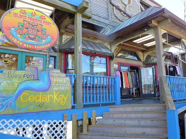
Cedar Key has lots of neat shops and galleries, some great restaurants serving up some great seafood, top notch kayaking and paddle-boarding, island tours boat trips, charter fishing, sunning and swimming at the spacious Cedar Key Beach & city park, some interesting hiking trails, and just plain fun hanging out in a friendly island community.

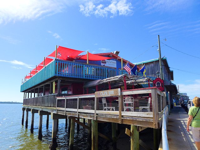
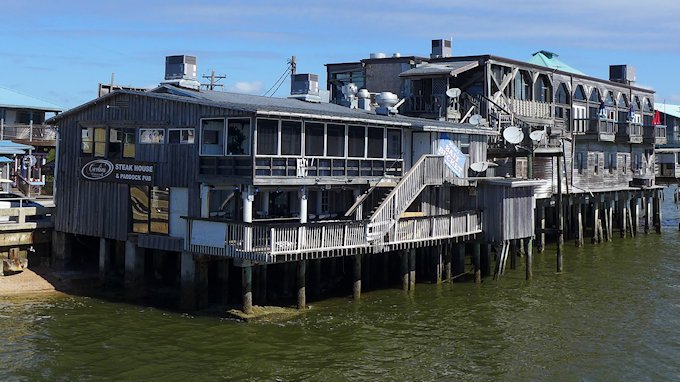
Cedar Key Florida Waterfront Restaurants
The restaurants and shops along Dock Street hangout over the water.

RVers Note: There are several RV campgrounds in and near Cedar Key and several choices in nearby Chiefland, Florida. We profile these camping options lower down this page, with descriptions and links.


Top Things to Do and See in Cedar Key, Florida

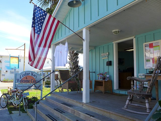
Cedar Key Florida Welcome Center
Stop at the Welcome Center for info on neat things to see and do.

See our list of Top 10 Things to Do, Places to see in Cedar Key, Florida

Kayaks, Swimming, Sunbathing, Picnicing at the City Beach and Park

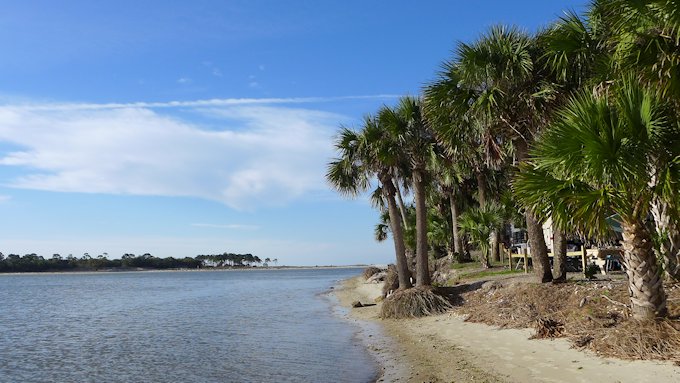
cedar key public beach
Picnic, Swim or just relax and enjoy the breezes and sunshine at the city Beach and Park.

There is a decent city swimming and sunbathing beach adjacent to the city park that has picnic tables, a playground area, a pavilion, and a bath house. Nearby, within walking distance of the beach are several good restaurants and raw bars offering fresh seafood, some of which is locally caught.

Cedar Key Florida Beach & Kayaking
Kayaks are popular because the many bays and channels among the islands provide protection from big waves.

Cedar Key Dining and Entertaining

cedar key dockside restaurants
Many of the top restaurants and bars are located along dock street.

Most of the bars, restaurants, and boutiques are located along Dock Street which runs down the center of a narrow hook-shaped peninsula that juts out into the Gulf and Suwanee Sound. The buildings on the Gulf side of the street are built on stilts and actually sit out in the water.

See our reviews of Best Restaurants and Places to Eat in Cedar Key

Walking Around Downtown Cedar Key

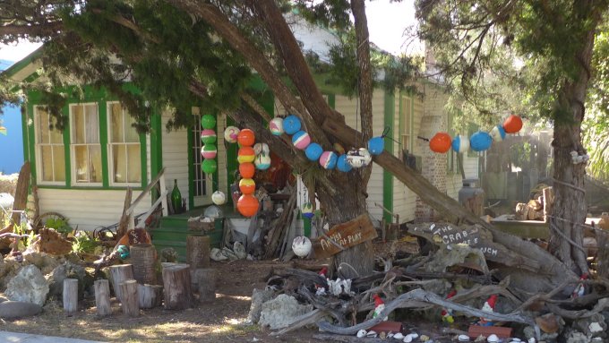
Cedar Key Florida Artists Gallery
Cedar Key has its share of artists and artisans, including some with a sense of humor.

Cedar Key Emporium
Humorous artistic touches all around town
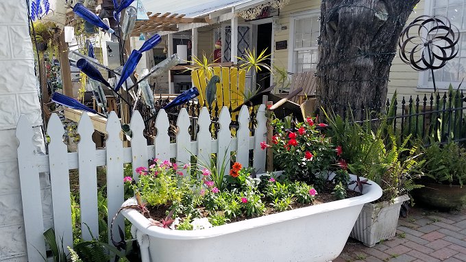
Cedar Key Cottages
One of several “unique” cottages in Cedar Key
Cedar Key Florida Gift Shops Boutiques
Wouldn’t be a beach community without some gift shops and boutiques.

Away from downtown, there are some interesting walks along the Cemetery Point Trail and the Trestle Nature Trail (see them here)

While the town of Cedar Key is situated on about 6 islands, the Cedar Keys Wildlife Refuge that surrounds the town of Cedar Key has thirteen named islands, plus perhaps hundred more islands too small to have a name encircle the town. The many islands of the Cedar Keys Wildlife Refuge provide great shelter for kayaking and canoeing and also a chance to see dolphins, birds, and other wildlife or do some fishing.

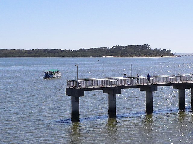
Cedar Key Fishing Pier
Cedar Key’s Fishing Pier, Swimming Beach of Atsena Otie Key in the background

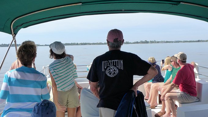
The Island Tours Boat Rides offers an interesting narrated tour of a few of the islands in the Keys. Seeing some dolphins is just about a guarantee as they seem to be attracted to the boat, as if they were hired performers!

Island Tour Boat Ride
Watching the Dolphins perform on the Island Tour Boat.

See our list of Top 10 Things to Do, Places to see in Cedar Key, Florida

Lodging in Cedar Keys

The town has a very hospitable beach resort community that is more laid-back and has far less commercial glitz than you’d find in Destin or Panama City Beach. There’s no high-rise resort buildings or huge apartment complexes. There are a few medium-size ocean-side condos and hotels, but a good deal of the lodging for visitors is provided in quaint cottages and mom & pop style motels.

Camping, Campgrounds, RV Parks Cedar Key, Florida

There are three private RV parks/campgrounds located within Cedar Key or within 5 miles of the center of town. As you might expect, you pay a premium to be located in or close to town. We drove through two of these three parks and found the sites too cramped together for our tastes.

Our favorite Cedar Keys RV Campground is a few miles out of town at the North end of the Keys Wildlife Refuge, Shell Mound County Park. The park offers both RV and Tent Camping and the nearby nature trails provide some interesting hiking and bird-watching.

**Shell Mound County Park Campground (see our review and article)

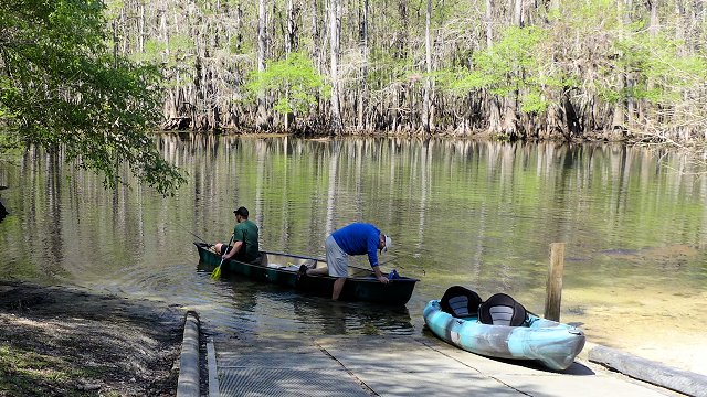
The nearby Cedar Keys Nature area offers a boardwalk, a fishing pier and a canoe/kayak landing. We camped at the County RV park and found the camp hosts very friendly and helpful. The RV sites offer water and electricity; the bath houses have running water and showers; and the campsite fees were quite reasonable. The campground is first come, first served – no reservations.

Can’t Find Campground Vacancies in or near Cedar Keys?

If you are willing to drive about 30 miles, there are several good RV camping options in Chiefland (see our reviews). One that we like is Manatee Springs State Park. The state park offers very nice RV sites, good spacing, nice shading, 8 miles of hiking trails, kayaking, biking, and swimming/snorkeling in the spring pool. And the rates are quite a bit less than the private parks nearer to town.

Another decent RV campground for visiting Cedar Keys area is Strawberry Fields RV Campground

Beside being able to get a reasonable campsite somewhat near Cedar Key, another reason we like to RV camp in Chiefland is the Chiefland Golf Course, only about a mile from Manatee Springs. We found it a nicely, maintained 18 hole golf course, with a friendly staff, and modestly priced green fees. It is also a very walk-able course.

More Places to Visit and Things to around Cedar Keys:

Have you been to Cedar Key Florida? If so tell us how you liked it in the comments below.

Your Scenic Travel Guide: Ross Reinhold

Big Lagoon State Park | Likes Dislikes

big lagoon state park boardwalk

Review: RV Camping, Hiking & Recreation Pensacola’s Big Lagoon State Park

Big Lagoon State Park is located along the Gulf Beach Highway that connects Fort Morgan and Gulf Shores at the western end to Pensacola and then east to Destin, Panama City Beach and beyond. Technically it is not on the Gulf but on the mainland side of the “big lagoon” formed by Perdido Key which forms a barrier island between it and the Gulf of Mexico. The park does offer some sand beach swimming areas on the lagoon but they don’t compare to what you find in nearby Pensacola Beach.

boardwalk big lagoon state park
A view from the park tower of one of the many boardwalks that are part of the hiking trail system at Big Lagoon State Park near Pensacola Florida

Big Lagoon Amenities and Activities

The lagoon and the interior lakes within the park offer lots of protected-water paddling territory for canoeing and kayaking. If you don’t have your own watercraft, kayak, canoe, and stand-up paddleboard rentals are available from the Ranger Station.

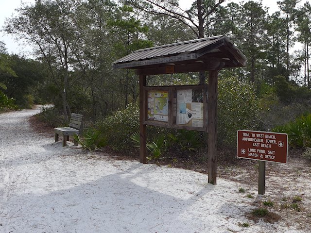
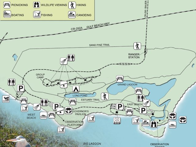
The hiking trails through the coastal forest and boardwalks along the shoreline plus a three-story observation tower provide lots of bird-watching and excellent wildlife viewing opportunities. There are over 5 miles of varied hiking and nature trails plus several boardwalks.

big lagoon state park
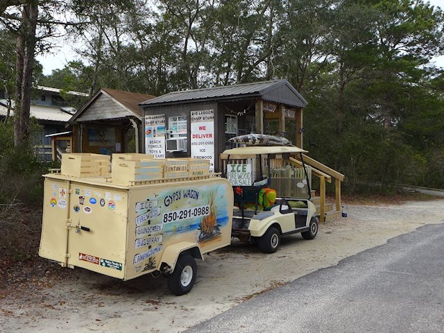
If you stand just outside the little camp store, you can get free Wi-Fi
big lagoon state park hiking
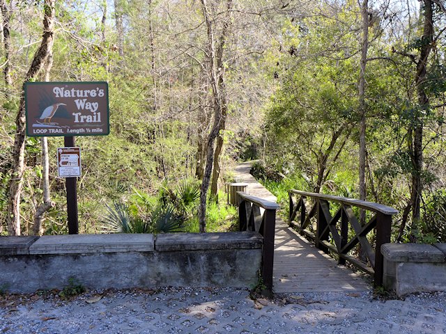
The hiking trails are wide and sandy or are wooden boardwalks.
big lagoon state park boardwalk
One of the Boardwalk/Nature Trails in the park

The park offers a full-boat launch area giving access to the lagoon and gulf for fishing and boating.

Biking is another popular recreational activity along over 3 miles of lightly traveled paved park roads. Gulf Beach Highway borders the North edge of the park. It provides additional biking opportunities as there’s a sidewalk running adjacent to the highway. That sidewal allowed us to safely bike to Shopping Plaza a mile or two West of the park entrance to do some shopping. If you are ambitious enough, you might also be able to bike across the Theo Baers Bridge all the way to Rosamond Johnson Beach along the gulf on Perdido Key. There you can enjoy a day on the outstanding several mile long white sand gulf side beach that is part of the National Gulf Island Seashore Park.

big lagoon state park
Lots of trails for biking and hiking plus several picnic areas

March 2023 Note: On our recent visit to Big Lagoon, we found, due to storm damage, the East Beach area and the central pavilion section of the park was closed. So some of the swimming, hiking, biking, and boardwalk area was off-limits. Unsure how long it will be before repairs are completed.

Review: Big Lagoon RV Campground Facilities

The campground has 75 campsites with 30 & 50 amp service and is served by 3 full-service restrooms. The main park roads are paved but the campsites themselves are sand with some gravel. Most of the sites have good plant screening providing some privacy separation. Some of the sites along the edge of marsh are subject to flooding in heavier rains. The maximum RV length is 40 feet. Several areas of the park, including the washrooms, are wheelchair accessible and there are a few designated accessible camp sites that are paved.

big lagoon state park
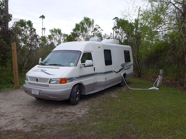
Typical Big Lagoon Campsite

There is a small camp store with limited hours at the eastern end of the campground. But a decent sized shopping center including grocery and adult beverage stores is only about a mile from the park entrance. Also nearby is one of our favorite Pensacola Golf Courses – Perdido Bay GC and Triggers Restaurant – a great family owned seafood restaurant. A library that offers Wi-Fi is located just across the street from the park entrance. Other popular Pensacola attractions, like the fantastic Naval Air Museum, Fort Barrancas, and the Pensacola Lighthouse Museum are about 8 miles east along the Gulf Beach Highway.

What to Like or Not Like about Big Lagoon State Park and Campgrouond

Pros: The Hiking, Nature and Boardwalk Trails. Easy access from Gulf highway, convenient to shopping and many Pensacola area visitor attractions. Modest camping fees and less competition for reservations, compared to Fort Pickens and other popular State Parks.

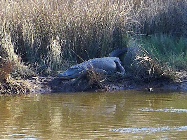
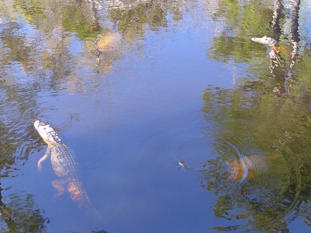
Cons: The sandy campsites mean you track a lot of sand into your rig. And those sites along the South edge of the campground can be wet. While there are some swimming beaches, they are less attractive than those on the Gulf itself and you have to keep an eye out for Alligators.

Rosamond Johnson Beach
Rosamond Johnson Beach on the Gulf is about 3 miles from the State Park

Things to see and do in the Pensacola area

Mississippi Alabama Gulf Coast Drive

Biloxi Mississippi's historic lighthouse

Interesting places and attractions along the Coastal Scenic Drive from Bay St. Louis, MS to Gulf Shores, Alabama This portion of the scenic gulf coast drive starts at the Mississippi-Louisiana line on US Hwy 90 and heads east towards Mobile and Pensacola. Just over the Mississippi-Alabama line, the most scenic and interesting alternative is to … Read more

Annies Cafe Cedar Key, Florida

annies cafe cedar key florida

See our list of Best Restaurants in Cedar Key Florida Annie’s Cafe is located along the main road, Highway 24, that leads into town and is hard to miss with their unique and artsy exterior. In addition to the Dolphin mascot that welcomes guests, a large garden surrounds the entrance to Annie’s with potted plants … Read more

Tony’s Seafood Cafe

Tony Seafood Restaurant Cedar Key Florida

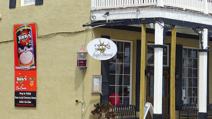
See our list of Best Restaurants in Cedar Key Florida Tony’s Cafe among the best places to eat in Cedar Key Rated by many as the Best seafood place in Cedar Key, Tony’s was on our list to try out. Located on the corner of the main intersection in downtown Cedar Key (Highway 24 and … Read more

Duncan’s On the Gulf – Our Review

duncans on the gulf cedar key

Dining Review of Duncan’s on the Gulf Formerly known as Carlin’s Steakhouse & Pub, Duncan’s has attracted good reviews online for the short time they’ve been under the current ownership. We were looking for a different place to eat with a view overlooking the Gulf of Mexico and the Cedar Keys islands. We had previously … Read more

Gulf Scenic Drive – Highway 98

Apalachicola Sunrise

Road Trip – Gulf Coast Scenic Drive from Rosemary Beach to Apalachicola

Previous Road Trip Article: Scenic Highway 30A Destin to Rosemary Beach

Directory to the Florida Gulf Coast Drive Maps and Articles

Interesting things to see and do from Rosemary Beach to Panama City Beach

After Rosemary Beach Scenic Highway 30A rejoins highway 98 and the average speed of traffic accelerates. On your way toward Panama City Beach, highway 30 splits off and runs along the Gulf shoreline. Before arriving at Panama City, you go through a few suburban beach communities like Hollywood Beach, Sunnyside and Laguna Beach. The beach front along this stretch is largely public with lots of parking along the road. Unlike Destin and the beach communities of South Walton along 30A, very few structures are built on the beach itself. Most of the resorts, townhomes, cottages, and condos are on the other side of the highway.

These communities west of Panama City have the look of more affordable beach vacation destinations and or an affordable retirement community. Not at all sparkly and upscale like Seaside and Rosemary Beach.

Panama City & Panama City Beach

Panama City Beach
Panama City Beach beach drive. High rise resort condos on beach side of the road, bars & amusements on the other side.

As you get closer and closer to Panama City Beach, things get bigger, denser, and high rise resorts begin to dominate the landscape. Once in the thick of Panama City Beach there is an unbroken chain of huge resorts along the beach. These resort hotels are flanked by various beach resort entertainment venues – usually on the other side of the street from the beach front.

While there were a fair amount of people on the street and the traffic was heavy, compared to the large crowds of people milling around in the three South Walton beach communities we saw relatively few people along the road. Most people staying in these huge resort complexes must be at the beach or inside enjoying whatever amenities are in these luxury facilities.

A personal viewpoint. Panama City Beach seems to be a more urban setting compared to other beach communities along the Panhandle Gulf Drive. Doesn’t look like the kind of place where you could turn your kids loose like you could at the resort communities of Seaside or Rosemary Beach. But with so many mega-resorts per mile there has to be a sizable demographic that finds Panama City Beach appealing. For us, one trip was enough for lifetime. On our return trip we stuck to Highway 98 that ran away from the beach and then through Panama City itself.

Caveat. However if you are lucky enough to get a reservation at St. Andrews State Park you can escape the maddening crowds of commercial Panama City Beach and enjoy a top-rated beach, hiking trails, kayaking, water sports, and more. The park has three camp stores for provisions and vacation needs so there is no need to leave the park during your stay.

(By the way, although parts of Panama City got hit real hard from Hurricane Michael, Panama City Beach itself managed to escape with minimal damage . . . so various tourism and beach destinations are intact and operating normally)

Panama City Links

Panama City to Apalachicola

Mexico Beach

About 10 miles east of Panama City, along highway 98 you arrive at the small community of Mexico Beach where the pace of life slows down quite a bit. There’s an extensive public beach area with lots of free parking. The collection of cottages, vacation homes, and condos are all on the non-beach side of the highway. There is an assortment of restaurants, pubs, charter fishing, a fishing pier and beach related enterprises to give vacationers a variety of things to do. If you like being at the beach, aren’t attracted to the urban beach resorts like Destin and Panama City Beach, or can’t afford a Seaside or Rosemary Beach vacation, Mexico Beach could be the place for you.

(unfortunately the 2018 Hurricane Michael did a great amount of damage to the town. Mexico Beach’s lodging providers and tourism have been working hard to restore and reopen. Several lodging places to stay are now available with more coming soon!)

Port St. Joe

The next town Port St. Joe is less a vacation community and seems to have a more industrial or commercial base but it does have a nice downtown waterfront and park area. Port St. Joe looks out across an expansive lagoon to the St. Joseph Peninsula so technically it is not on the Gulf. The lagoon forms the St. Joseph’s Bay Aquatic Preserve. Near the tip of the Peninsula is St. Joseph Peninsula State Park that offers camping, hiking, and an extensive beach fronting on the Gulf. (Port St. Joe was another casualty of Hurricane Michael so camping here in 2019 may be dicey. Likewise camping is at the State Park on the St. Jo Peninsula is suspended because the park is now only accessible by water.)

Indian Pass

On your way south of St. Joe, Highway 98 and Highway 30A part company again. 30A is more scenic and runs along the Gulf past the entrance to St. Joseph Peninsula and past Indian Pass, a smaller peninsula that is primarily a vacation home community, but has a nice secluded RV and Tent Campground-Indian Pass at the tip (The campground survived Hurricane Michael with minimal damage).  Another noteworthy spot along this route is St. Joe Bay Golf Course (see our review).

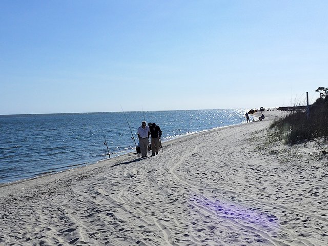
Indian Pass Campground Beach
Indian Pass Campground Beach – see our review with pictures and information

When you turn East on Hwy 30A by the entrance to St. Joe’s Peninsula and head towards Indian Pass, you leave the Emerald Coast and travel along what is known at the “Forgotten Coast.” Along this route there is a string of barrier islands: St. Vincent, Cape St. George, and St. George Island. The first town along the Forgotten Coast is Apalachicola.

Historic Apalachicola

Apalachicola
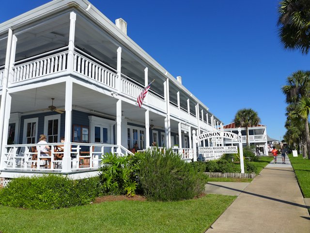
The 1907 Gibson Inn is one of many lovingly restored structures in Apalachicola

Apalachicola, is one of our favorite places along the Panhandle Gulf Coast. Unfortunately because it is protected by those barrier islands, Apalachicola doesn’t have those glamorous white sand beaches. You’ll have to drive out to St. George’s Island to get your “Gulf Beach Fix.” But for many other kinds of vacation entertainment we like Apalachicola a lot. It has several quaint restaurants and bars – see our reviews, even a brew pub, lots of neat little shops and galleries, some interesting parks, museums, a large number of historic register homes and structures, and some attractively restored B&Bs.

Oyster City Brewing
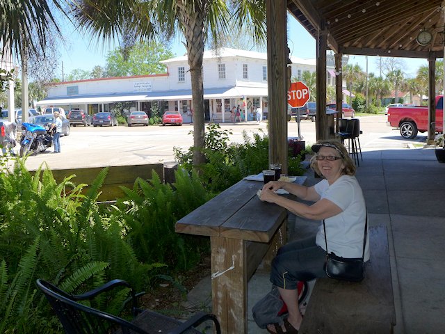
Jo and I enjoyed some Oyster City Brewing nut brown ale out on the Brewery patio.
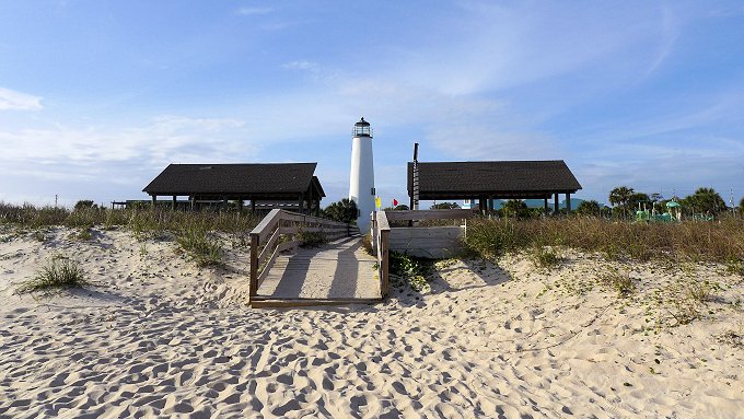
st. george island lighthouse
Along the Forgotten Coast – St. George Island Lighthouse and Public Beach

See our Road Trip article on travel attractions along the Gulf drive from Apalachicola to Cedar Key.

(Below. Gulf Scenic Drive, Destin to Apalachicola Road Map. if viewing on mobile use two fingers to move map around)

Travel and Visitor Links:

The portion of the Gulf Coast from the St. Joe’s Peninsula and east to Apalachicola and beyond calls itself the Forgotten Coast. So far what we’ve seen of it, we like it. The Gulf Coast Drive continues east and north past the communities of Carrabelle, SopChoppy, Panacea, Shell Point and St. Marks.

Previous Article: Scenic Highway 30A Destin to Rosemary Beach

Ross Reinhold
Scenic Highway 30A Travel

Grayton Beach Florida


Scenic Gulf Drive – Destin to South Walton to Rosemary Beach

Directory of Articles & Maps: Traveling the Gulf Coast Scenic Drive

Previous Article: Gulf Drive Pensacola Beach to Destin

Going East of Destin on Gulf Highway 98 you connect with Scenic Highway 30A just past Topsail Hill State Park. This will give you an opportunity to return to driving along with a view of the gulf and through the South Walton beach communities along the Emerald Coast. While there still are condos and town homes along this stretch, they aren’t as tightly packed on top of one another like in Destin and along the route you begin to see some actual single family homes with larger yards.

You’ll also pass several ponds that are called coastal dune lakes, freshwater lakes that drain into the Gulf, providing a unique ecosystem due to the exchange of salt and fresh water. Some of these coastal lakes have preserved, natural shoreline – no homes or condos and therefore indeed offer some natural scenery to justify calling this a scenic drive. About a mile before you get to the community of Grayton Beach you are actually driving through Point Washington State Forest.

coastal dune lake
A portion of Draper Lake, one of several unique coastal dune lakes along this section of Scenic Highway 30A

While the drive doesn’t offer an abundance of notable scenery, it is a more pleasant and slower paced drive than traveling on busy highway 98. But about halfway along the 24 mile route there is a genuine scenic and unique  destination: the historic beach town of Grayton Beach (see article) and it’s popular neighbor Grayton Beach State Park – see our article here.

Grayton Beach, Florida

The tiny village of Grayton Beach traces its founding back 125 years when vacationers used to travel by horse and buggy to enjoy its white sand beaches and small town character. As you walk through the town you can see many examples of old cottages lovingly restored and some with a humorous and artistic twist.

Grayton Beach Cottages
One of the many artfully landscaped cottages in Grayton Beach

The town is largely surrounded by Grayton Beach State Park (see our review) which has served to limit the expansion of the village and probably played a role in preserving its unique character. The State Park’s gulf beach extends on both side of the village providing more than a mile of relatively uncrowded pristine beach terrain. The park also encompasses a 100 acre coastal dune lake providing opportunities for canoeing, kayaking, paddle-boarding and fishing. There’s a 59 unit campground and 30 cabins in the park and biking and hiking trails. Make your reservations early as this is a popular park.

Grayton Beach and the State Park are located along the paved Walton County hike/bike path that runs adjacent to Scenic Highway 30A. Biking is one of the best ways to get around town as well as the three nearby towns east of Grayton Beach . . . as there isn’t a lot of public parking space.


Seaside Florida
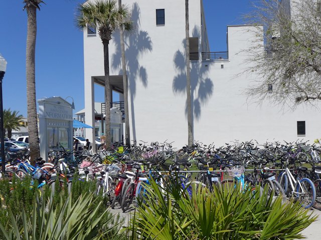
Hundreds of bikes in the town of Seaside, every where you look bikes.

Seaside to Rosemary Beach

Going east of Grayton Beach on 30A you quickly arrive at the very upscale community of Seaside with an extensive collection of modern condo units and a popular town square that hosts entertainment, beach-related enterprises, festivals and outdoor food carts. We drove through this town in late March during spring break time and were in awe of seeing what seemed like a thousand kids on bikes running back and forth along the bike path adjacent to the road and droves of teens crowding around the food and entertainment in the town square plus walking to and fro. I wonder how crowded the beaches were because there were sure lots of people walking and biking around town. Seaside is a popular place.

Seaside Town Square
The Food Court at the Seaside Town Square is a favorite gathering place.

Further east of Seaside is the community of Seagrove (more beach condos) and then at the end of Scenic Highway 30A the community of Rosemary Beach essentially a replication of Seaside with condos, beach resort venues, a very busy town square and people walking and biking everywhere. These three villages east of Grayton Beach seem to be very popular, especially with families. If you rent a house, cottage or book lodging at a condo many types of entertaiment, in addition to the beach, are within walking distance (and biking and bike rental places abound!). These villages must have a reputation as safe places because there were young kids streaming all over the place, many without any adult supervision.

Travel and Visitor Links:

Continuing on the Scenic Gulf Coast Drive: Gulf Drive Rosemary Beach to Apalachicola – – –

Davis Bayou Campground | Ocean Springs

davis bayou campground

RV Campground Review: Davis Bayous Gulf Islands National Seashore Park

Davis Bayou is one of two full service RV campgrounds that are part of the Gulf Islands National Park. The other campground is Fort Pickens on Santa Rosa Island near Pensacola Beach, Florida. The Fort Pickens Beach that stretches from the old fort east to the village of Pensacola Beach is regularly voted as Florida’s favorite beach so getting a reservation at the Fort Pickens campground can be more difficult than at Davis Bayou – which is one thing we like about Davis Bayou, we can actually get a camp site there! Another thing we like about Davis Bayou is the camp roads and the individual site parking pads are paved. The sites are also nicely spaced from one another and the mature live oaks and pine trees offer most sites at least some shade during parts of the day. All 52 sites offer water and electricity.
The Campendium camping and rv community rated Davis Bayou as one of the Top 10 Mississippi campgrounds.

davis bayous campground map
52 nicely spaced campsites, all with water and electricity.
davis bayou campground
Sturdy picnic table in excellent condition on a paved pad. First class campsites.

The Park Visitor Center has some exhibits explaining the natural features in the park and suggestions on things to see and do. There is also a fishing pier adjacent to the center for anyone who possess a Mississippi State Saltwater Fishing License. The park also has a boat launch and pier for fishing and boating in the bayous or out in the Gulf itself.

Popular activities of campers are biking, bird watching, boating, fishing, hiking nature trails, and alligator watching. The popular tourist mecca of Biloxi is about 10 miles away with its sand beaches, casinos, restaurants, museums, golfing, and other entertainments.

Nature Hiking Trails – Slide Show


davis bayou nature trailsdavis bayou nature trailalligator davis bayouGator pond davis bayou

The entrance to Davis Bayou is off of Gulf Highway 90 that runs along the Gulf from Bay St. Louis to Pascagoula. Unfortunately there is no direct connection to the Florida Gulf Coast Scenic Drive highway without going away from the Gulf through Mobile to connect with Gulf Highway 98 that runs to Pensacola. An attractive alternative that greatly reduces the highway miles is to stay along the Gulf shore and drive out to Dauphin Island where you can take a ferry to Fort Morgan and Gulf Shores and then to Pensacola. Along this route is one of our other favorite campgrounds, Big Lagoon State Park, which borders Perdido Key.

Summary of Pros & Cons of Davis Bayou RV Campground

Pro: Top Notch Campsites, Easy Access from Highway, Decent Affordable Price, Good Roads for Biking, Close to Grocery Shopping, Less Competition for Reservations.

Cons: 10+ miles to decent beach and other visitor attractions, fewer & shorter hiking trails.

Gulf Islands Visitor & Travel Attraction Links:

MIssissippi-Alabama Campgrounds & Travel Attractions

Travel Attractions: Mississippi Alabama Gulf Coast Drive

Campground Directory – Mississippi Gulf Coast Drive

Campground Directory – Alabama Gulf Coast Drive


Indian Pass RV Campground

Indian Pass Campground Beach

RV Campground Review: Indian Pass Campground, Port St. Joe, Florida

Indian Pass is a hook-shaped peninsula, about 3 miles long, jutting out into the Gulf along Scenic Highway 30A between Port St. Joe and Apalachicola.

Indian Pass Campsite
One of the pull-through RV campsites

The Indian Pass Campground is at the very tip of the peninsula adjacent to a portion of the St. Vincent Wildlife Sanctuary and the Boat Ramp and Ferry Dock. There are 34 RV sites with electric, water, and basic cable, plus a handfull of tent sites. There is a bath and shower building, a laundry area, and a modest store in the campground office. Wi-Fi is available at the office and on the porch. The lagoon formed by the peninsula and the adjacent St. Vincent Sound (bordering St. Vincent Island) make the campground popular with kayakers and canoeists. The convenient boat ramp and the protected waters are also ideal for fishermen. While the campground has its own beach, the isolated sand beach bordering the wildlife refuge is a better alternative for sunbathing and swimming.

Indian Pass Beach
The beach across the street at the wildlife refuge.

The Indian Pass community is mostly homes with a few smaller condos with few commercial establishments so there’s not much traffic and being located at the end of the road, the campground is in a very peaceful setting and the extensive beach looking out towards St. Vincent Island is uncrowded and unspoiled.

The campsites in general are well-shaded and mostly level. The sites are arranged in a somewhat crazy-quilt manner oriented around the trees and terrain. I think this adds to the general attractiveness, although it means large units will have trouble accessing some of the sites. But some will easily accommodate larger RV units and some sites are pull-through.

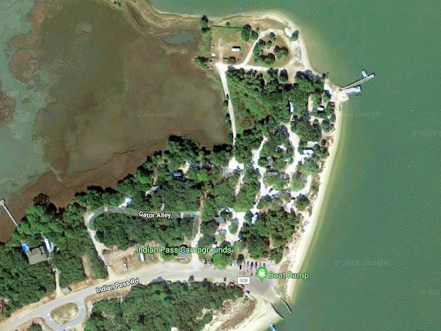
indian pass campground layout
Indian Pass CG Aerial View. Google Maps

Other Nearby Attractions. The nearest bar or restaurant is 3 miles away on Highway 30a at the entrance to Indian Pass. The closest general shopping is in Port St. Joe, 13 miles from the campground. The St. Joseph’s Bay Golf Course (see our review) is 10 miles away and for us a nice bonus as we enjoyed the course very much. Historic Apalachicola, with many notable seafood restaurants, raw bars, galleries and shopping boutiques is 21 miles from the campground.

Gulf Coast Drive Travel Links:

Grayton Beach State Park

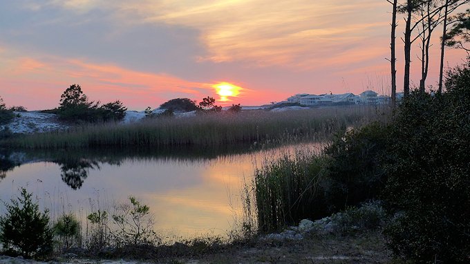
grayton beach sunset

RV Campground Review: Grayton Beach State Park With its sugar sand beach being one of the most pristine and uncluttered along the Gulf Coast, Grayton Beach State Park is a very desirable campground along the Scenic Gulf Coast Highway. It is hard to top its beach for swimming, sunbathing and surf fishing. It also borders … Read more

Manatee Springs State Park

manatee springs state park

Campground Review: Manatee Springs State Park, Chiefland, Florida

Manatee Springs is located along the legendary Suwannee River about 6 miles west of Chiefland Florida. It offers swimming, snorkeling, and manatee viewing in its signature warm water spring. Other amenities include hiking/biking trails, canoeing/kayaking, and enjoying its full-service campground (see our review lower down this page)

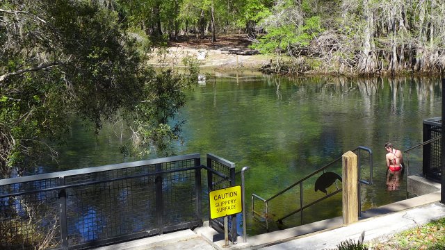
Manatee Springs
Getting ready to take a swim in the spring

The Spring pool maintains a 72 degree temperature year round which draws in Manatees from the river during the winter months when the temperatures in the river fall, thus the reason the springs are named Manatee Springs. The year round moderate temperature also provides humans swimming, scuba diving and snorkeling recreation year-round.

From the spring pool, about 100 million gallons of cool, sparkling clear, clean water are discharged into the stream that connects to the Suwannee River. The stream and the river provide excellent waters for canoeing and kayaking; both types of water craft are available for rent by the park concessionaire, Anderson’s Outdoor Adventures, who also carries a collection of camping equipment and supplies. Another service is pontoon boat tours of Suwannee River.

manatee springs state park
Boardwalk around the spring pool.
manatee springs boardwalk
Boardwalk to the fishing pier and boat dock on the Suwannee River.
manatee springs fishing
Going fishing from the canoe launch by the spring.

Camp Store & Grill

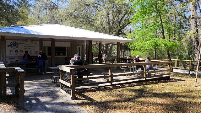
In the same building as Anderson’s Adventures is a walk-up grill and beverage stand with covered picnic tables and Free Wi-Fi service. So you can sit there have a brew or a burger while surfing the Internet!

manatee springs concession stand
Having a burger and surfing the Internet overlooking the springs

Other types of recreation popular in the park are fishing, hiking, and mountain-biking. There are 8 miles of hiking and nature trails, plus two boardwalk trails. Biking is allowed on most of the hiking trails as well as on the roads running throughout the park. Some ambitious bikers will bike to town on highway 320; we’ve found the road to town relatively less busy so reasonably safe for biking.

manatee springs state park bike trails
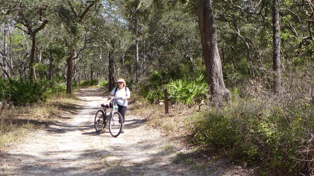
Biking on one of the many wooded biking-hiking trails

The Manatee Springs Campground

The campground offers 80 campsites in three camping areas. Most sites are reasonably level and nicely spaced away from adjacent sites. Each of the three camping areas has its own conveniently located washroom and bath house. One of the bath houses we used had heat lamps in the showers, a nice feature if you are showing on a cold morning. There is electricity and water at each campsite and a dump site near the park entrance for emptying your holding tanks. There is no Wi-Fi within the camping area, however there is free Wi-Fi at the concessionaire pavilion near the springs itself.

Cypress Trees line the spring pool and lowland areas near the river, but Oak trees are the major tree species in most of the park. Sweetgum and Ash are also found throughout the woods. The mature trees provide nice shade for the campsites and woodland plants and shrubs provide welcome privacy screening in the campground.

After each campsite is vacated, park service personnel pick up trash, sweep and rake every campsite. Sort of like a good motel has the room swept, sheets changed, bathrooms cleaned, and waste baskets cleaned between stays. We also found good maintenance of the picnic tables and fire rings and the cleaning of the washrooms excellent.

Price-wise, Camping fees at Manatee Springs is middle-level and in our opinion is a very good bargain for the services offered by the park and the high level of good maintenance.

manatee springs state park
Level campsites, electric & water, decent privacy screening.
Manatee Springs Campground Map

Nearby Visitor Attractions

In the village of Chiefland (6 miles away) you can find most every kind of shopping or dining service. Among the attractions of special interest to RVers is a propane fill-up at Wilson Gas and a mobile RV Repair Service. Another Chiefland attraction is only about a mile from the park: a friendly 18 hole golf course – Chiefland Golf & Country Club.

Gulf Coast Beach Town. An easy drive (about 30 miles) is the fun Beach Town of Cedar Key (see our post). The friendly village is built on a collection of gulf islands and offers the expected beach resort attractions such as restaurants, pubs, gift shops, T-shirts shops and the like. Yet is also offers a more homey, laid-back atmosphere than you find in most other gulf beach communities. Beach sunbathing, swimming, deep sea fishing, boat and dolphin-watching tours, shopping boutiques, and excellent sea food restaurants and pubs abound in Cedar Key.

Other Campground Options

strawberry fields rv campground
our rv site at strawberry fields
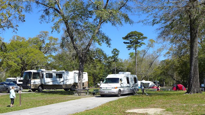
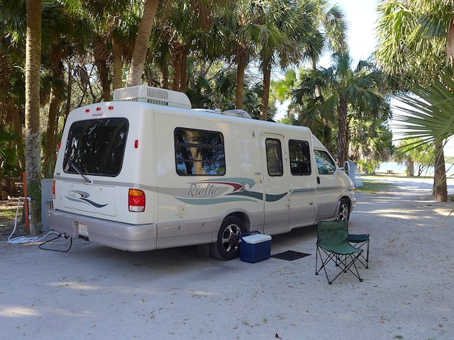
Our rialta at shell mound campground
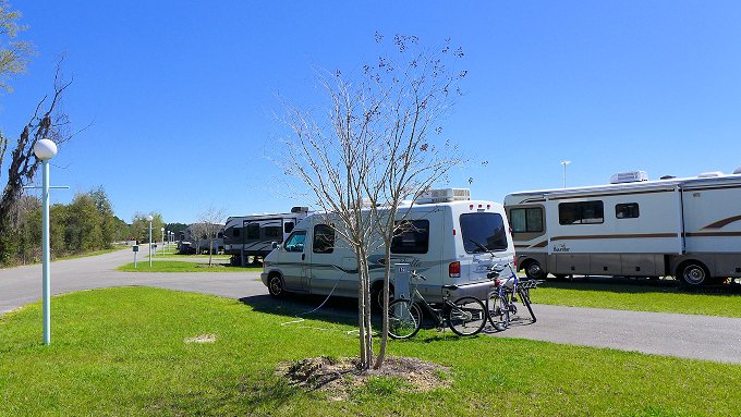
our campsite at shell mound county park

There are five other campgrounds or RV parks in the Chiefland area (see our review); our favorite is Strawberry Fields. Another campground in the area we like is the Shell Mound County Park Campground near Cedar Key.

Visitor Attraction Links:

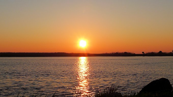
Sunset Ceder Keys Wildlife Refuge
Sunset Cedar Keys Wildlife Refuge – Shell Mound Natural Area Observation Deck

Visitor Attractions Pensacola Florida

Tourist and Travel Interests in Historic Pensacola

In the early spring we like to escape the cold Wisconsin winters by traveling to Northern Florida and the Florida Panhandle.

One of our favorite places to spend some time is in Pensacola and Pensacola Beach. Since we travel by motorhome, we stay at RV parks and prefer state and national parks for their wilderness settings and hiking trails.

On our first visit to the area we stayed at the Fort Pickens Gulf Islands National Seashore Park campground on the far western end of Santa Rosa island. The island is a gulf barrier island that is mostly within the Gulf Islands National Seashore but also includes the resort town of Pensacola Beach. The Fort Pickens campground and recreation area is about 6 miles west of the busy resort town and is a quiet and low-key contrast to the resort atmosphere.

Florida State Museum Pensacola Florida
The Spanish architecture of the Florida State Museum is fitting since it is built on the site of the old Spanish fort
historic us post office pensacola
US Customs House & Post Office – 1887 – is now the Escambia County Courthouse. One of many historic government and commercial buildings in the downtown Palafox Historic District.

While Pensacola has many beaches that face Pensacola Bay and has beaches on protected lagoons, only Pensacola Beach and Santa Rosa island have beaches that are actually on the Gulf of Mexico. So when Pensacola residents say they are “going to the beach” they are talking about Santa Rosa island’s lengthy and un-crowded beaches facing the Gulf. Many of these beaches, since they are part of the Gulf Islands National Seashore Park, are quite secluded because they have no hotels or structures fronting the beaches.

Things to See and Do in Pensacola, Florida

Pensacola, home of America’s first new world settlement (1859), is known for its military and cultural history, its southern cuisine, and its sparkling sugar-sand beaches. We sampled some of the Pensacola’s military history at the National Naval Air Museum, Fort Barrancas, and at Fort Pickens on Santa Rosa island. The Naval Air Museum  (with over 150 planes on exhibit) and the Blue Angels Flying Squadron is by far the most popular Pensacola attraction. We spent several hours there on several return trips and there is  still more to see. The actual restored Fort Pickens (the “fort” itself vs the park with the same name) is also a top Pensacola attraction. In 2020 there will be a ferry service from the mainland to the fort which if you are staying in Pensacola itself will save about 50 miles round trip you would normally take by auto to visit the Fort.

Pensacola Historic District Walks

There are two historic districts in the downtown area. Closest to and technically a part of downtown is the Palafox Historic District. The center-piece of this district is Florida’s State Museum which is built on the site of the former Spanish Fort San Miquel, Pensacola’s first settlement. Palafox street itself contains many historic buildings as well as interesting pubs, restaurants and entertainment venues, many with sidewalk cafes. This area has a New Orleans Bourbon Street feel to it. Nearby downtown is the Seville residential neighborhood, also a historic district, with a number of carefully restored and cared-for homes from the 1800s and some from earlier eras.

Within the Seville neighborhood is the Pensacola Historic Village, a complex of unique museums, with restored pioneer homesteads, structures, and artifacts. There are self-guided and directed tours. During some hours the village is populated by costumed interpreters recreating artisan crafts from the 18th and 19th centuries.

See the Slide Show below of historic homes

  • St. Michaels Benevolent Society pensacola Historic Homes
    One of the many restored historic register homes in the Pensacola Palofax-Seville Park neighborhood.
  • Moreno House Pensacola Florda
    Pensacola's Moreno House 1879
  • shotgun house pensacola
    Hendrix House - 1879 - is an example of a southern style of house popular in the 1800s named for its narrow profile and alignment of one room after another without any hallways.
  • pensacola tuttle house pensacola florida
    Tuttle House - 1850 - is an example of a "double-barrel" shotgun house, two shotgun houses sharing a common wall between them.
  • Lear-rocheblave house pensacola florida
    Lear-Rocheblave House 1890 is one of the community of homes and structures in the Pensacola Historic Village museum that can be toured.

Pensacola Dining

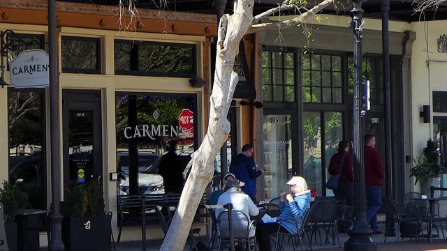
Carmen's Lunch Bar Pensacola
Carmens Restaurant, Pensacola

Within the Pensacola historic districts are a number of interesting pubs and dining places.

Pensacola Golf Courses

Pensacola offers a nice range of golf courses from a modest-priced municipal course to meticulously groomed semi-private courses.

Pensacola Scenic Bluffs

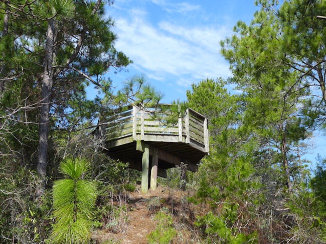
scenic overlook
One of the observation decks along the boardwalk at Pensacola’s Bluff Park

We took a drive along the Pensacola Scenic Bluffs Highway that was advertised in a brochure we picked up. We expected to see quaint cottages, unique restaurants, secluded picnic areas, and bluff-top vistas of Escambia Bay. These bluffs are reputed to be the highest points along Florida’s entire oceon coastline. The scenic drive begins near the Pensacola Visitor & Welcome center (take 17th avenue to East Cervantes Street – also US 90) and ends 11 miles later when US 90 crosses the Escambia River. Bay Bluffs park has an interesting boardwalk trail with some good views of the bay but after that the drive offers little to be called a scenic drive. Unfortunately for us the actual experience fell short of the promotion.

Camping & RVing in Pensacola

In addition to some private parks and campgrounds, campers and RVers can chose from a Florida State Park Campground and a National Park Campground. Both offer beaches on the gulf, some decent hiking/biking trails, modern campgrounds with electric hookups, canoeing and kayaking  and in the case of Fort Pickens some impressive historical exhibits.

More Pensacola Visitor Attractions

One of your first stops in visiting Pensacola should be at the Pensacola Visitor Center, conveniently located at the mouth of the Bayou Texar and at the base of the Pensacola Bay Bridge. Convenient parking, helpful staff, lots of maps and brochures, and hot coffee or chocolate. include map on location.

Gulf Islands Scenic Drive and Scenic Highways 98 & 30A

More impressive was the drive we took down the length of Santa Rosa Island to Destin and then south along Scenic Highway 30A. Our favorite spots along this route are Grayton Beach and Apalachicola.

Scenic Drive Part 1. Pensacola Beach to Grayton Beach

Scenic Drive Part 2. Grayton Beach to Apalachicola

Look for our next gulf drive article covering Apalachicola to Cedar Keys

Happy Trails

Ross